
 Explore Worlds
 Find Life
 Defend Earth


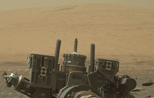
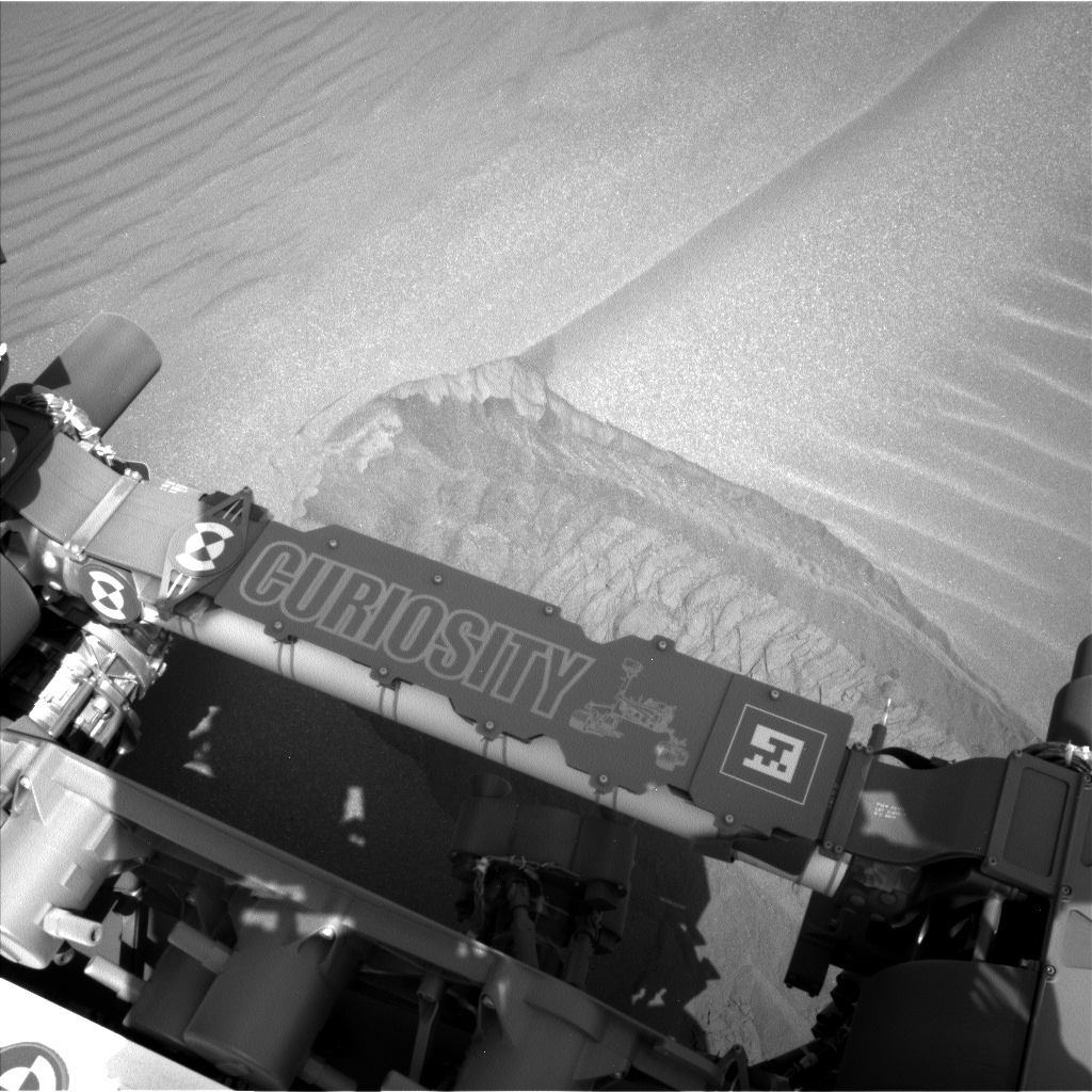
Curiosity update, sols 1726-1813: Surveying Vera Rubin Ridge from below
Written by
Emily Lakdawalla
September 13, 2017
It's hard to believe it's been three months since my last Curiosity operations update. To be fair, one of those months (sols 1758-1780) was almost entirely taken up with solar conjunction, when the rover was inactive. Other than that, it's been a period of fairly routine Martian operations for the mission. With slow and steady driving, dodging sand dunes and tipped blocks of bedrock, Curiosity traversed more than 600 meters along the base of Vera Rubin Ridge, and finally, on sol 1809, placed wheels on ridge bedrock for the first time. The view from the top of the ridge is quite nice, and the rocks look promisingly different from anything Curiosity's visited so far. Hopefully the drill will return to service before it's time for Curiosity to drive south off the ridge, a month or two from now.
Here's a map by the ever-watchful Phil Stooke of Curiosity's progress through the summer.

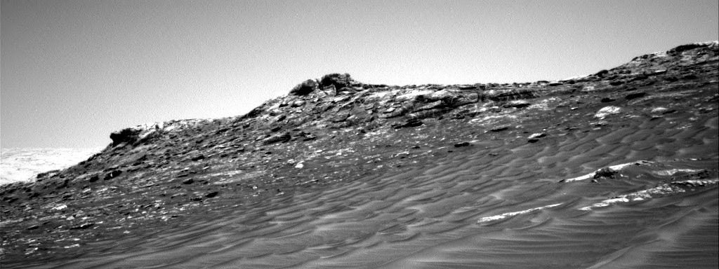
Here's the first good look the rover had at the face of the ridge. Isn't it beautiful?

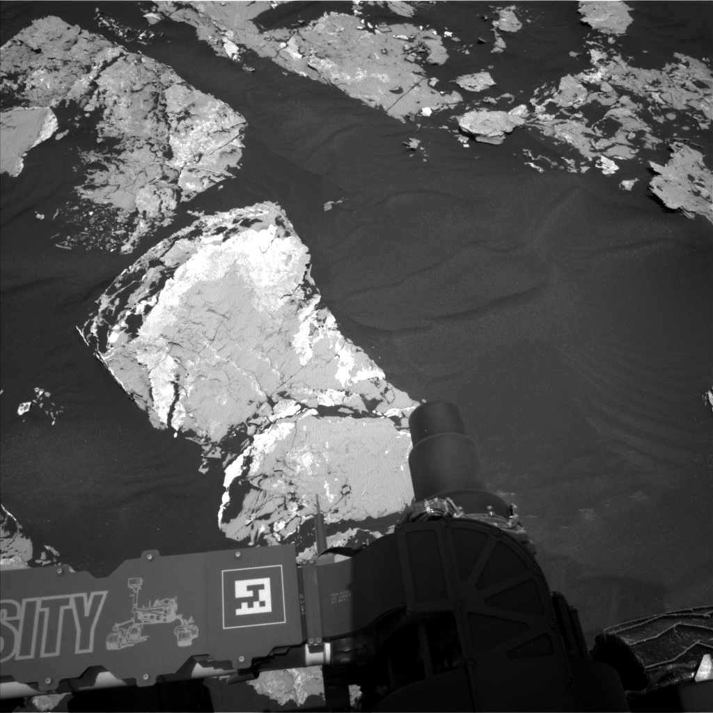
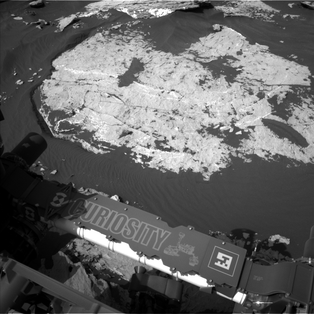
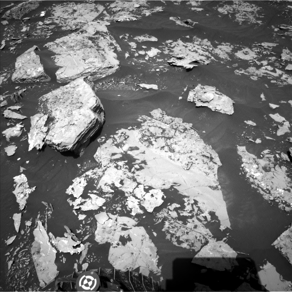
Any time there is vertical relief through a stack of rock layers, geologists are excited to survey the wall. Along Vera Rubin Ridge, the Curiosity team took lots and lots of pictures, focusing especially on 5 stops. There are several scientific questions they're asking. What's the nature of the contact between the lower-lying Murray formation and the Vera Rubin Ridge above it? Is it gradational or sharp? Above the contact, is it all one rock type or several? Does one type grade into another? Are the beds continuous or not? Are there any peculiarities to the layers that can tell us how they formed? They have also been making heavy use of ChemCam to survey composition, looking for variations and trends. On the ground in front of them, they use MAHLI and APXS to photograph and measure the composition of the uppermost layers of Murray mudstone. The mudstone continues to show fantastic eroded shapes. Here's a 3D view:

With only minor hiccups, it's been a remarkably routine summer of driving and data acquisition. (Summer, that is, on Earth; it's fall in Gale crater, so the rover is a little more power-limited than it was earlier in the year.) Without the drill, Curiosity operates much more like one of the Mars Exploration Rovers. The rover drives at almost every opportunity. If a drive places bedrock within reach of the arm, the rover typically reaches out and performs "touch and go" measurements in the morning before picking up and driving again. If there's no good bedrock target, the tactical team puts heavier emphasis on remote sensing and imaging, including gathering large mosaics with the ChemCam RMI. The Curiosity team has prioritized obtaining APXS measurements of the elemental composition of the bedrock with every 5 meters rise in the rover's elevation as it has worked along the ridge.

Curiosity's conjunction stand-down lasted from sol 1758 to sol 1780. During that time, the rover's environmental monitoring instruments continued to work and gather data on temperature, humidity, pressure, and radiation environment. Back on Earth, engineers used the time to work the drill problem, and celebrated when the drill feed was finally fully extended again on sol 1780.
Driving has been the priority, but because of the blocky terrain, it's difficult to sequence long drives. For that reason, the mission has finally re-enabled autonav, as of sol 1780, right after conjunction. Autonav has not been used since the discovery of the rapid accumulation of wheel damage in the mid-sol-400s. The primary way that the mission has decreased the rate of wheel damage is by employing the eyes of human rover drivers to avoid wheel-shredding rocks. But that limits drives to line-of-sight. Autonav enables the rover to pick its own way through terrain not seen by human drivers. The rover drivers can choose whether or not to enable autonav on any particular drive after assessing the likelihood that the unseen path ahead will contain potentially wheel-damaging rocks. They sequence as long a drive as they can accomplish in the terrain they can see, then cautiously allow Curiosity to make its own way for a little more distance.
Early on in the 5-stop survey, the science team realized that they weren't close enough to the ridge for even the highest-resolution cameras to see all the detail they needed to describe what was going on. So for the third stop they took advantage of a bare spot in the sand ripples and hooked closer to the ridge to get the best view possible. The details in these ChemCam RMI mosaics are amazing.

There's not much else to say about this phase of the mission. Cool views, cool rocks, steady driving. I'm sure there will be some interesting papers written about Vera Rubin Ridge based on the data gathered in the last three months, but it'll be a little while until we see that. In the meantime, we can just enjoy the pretty views and interesting rocks.


Now that they have completed their ascent, a Vera Rubin Ridge campaign begins. It will be one to two months of walking eastward along the ridge, stopping regularly to do in-situ science with MAHLI and APXS, before they drive on to the south. There is no way to know whether the drill will be functional again before they complete the planned work on Vera Rubin Ridge. Even if it's not fully returned to function, I hope they can, at the very least, begin testing. Any tests with the drill will scratch the surface with the drill tip, potentially giving us a look at freshly powdered material with APXS and ChemCam. Fingers crossed!

Sol 1726 update by Michael Battalio: First Look at Vera Rubin Ridge (13 Jun 2017)
After great anticipation over the last few weeks, the drive in the current plan will bring us into position for stop 1 of our close look at the northern face of the hematite-bearing Vera Rubin Ridge. Mastcam will take a wide mosaic to begin documenting the sedimentary structure of the ridge. GEO will take several observations of nearby targets before the drive. ChemCam will target "Mount Abraham" (bedrock on the top left in the above Navcam image) and "Mount Redington" (bedrock at top center), both of which are typical members of the Murray bedrock. Mastcam will image each of those targets as well, along with the target "Marsh Head," an area of exposed stratigraphy. GEO activities finish with Navcam documentation of our new position and MARDI imaging.
I was the ENV STL for this plan, and only one ENV cadence observation will be obtained. A 4-frame Navcam dust devil survey will be taken around noon to continue to document vortex activity as we climb Mt. Sharp. REMS will capture the usual top of the hour 5 minute observations, along with 9 hours of extended observations. DAN will take a 20 minute post-drive observation and just under 5 hours of passive observations.
Sol 1727 Update by Rachel Kronyak: Little bit of everything (14 Jun 2017)
After a successful drive, our parking spot included a nice patch of Murray bedrock to allow us to perform contact science (MAHLI and APXS) in today's plan. Our target for contact science is "Jones Marsh," a dark patch of the Murray that you can see just above the rightmost corner of Curiosity's mast shadow in the Navcam image. The GEO group also planned a suite of observations of Vera Rubin Ridge (VRR), which we're making great progress towards. Mastcam will perform a multispectral observation on "Freeman Ridge," a small butte just in front of VRR that shows interesting color variations. ChemCam will then take a mosaic of VRR using its Remote Micro-Imager (RMI) to complement the Mastcam mosaic we took in yesterday's plan. We will take an additional Mastcam mosaic of "Spaulding Mountain," an area of exposed Murray formation blocks along our drive path.
We will then complete a drive, do some post-drive imaging of our new location, and finish up today's plan with some environmental observations. These include tau, line-of-sight extinction, and sky survey measurements with Mastcam to assess how much dust is in the atmosphere. We will also perform our standard REMS and DAN activities.
Today I served as a PUL-1 for Mastcam. With VRR on the horizon and the fantastic Murray formation underneath our wheels, there is never a shortage of things to image!
Sol 1728 Update by Rachel Kronyak: Remote science and drive on (15 Jun 2017)
After a busy day of contact science yesterday, today's plan was dedicated towards remote science and driving. As Mastcam PUL-1 today, I was fairly busy helping put together a suite of Mastcam images for Curiosity to take. These included mosaics of "Preble Cove" and "Fernald Point", some nice blocks of the Murray formation just in front of the rover (Fernald Point is the block just in front of the rover wheel in the Navcam image above). We'll then take a few images of "Freeman Ridge" to follow up on yesterday's multispectral observation.
We also planned a series of environmental observations, including our standard REMS and DAN, as well as a ChemCam passive sky, Mastcam tau, and line-of-sight extinction. We'll then continue driving towards Vera Rubin Ridge and take some post-drive images to set ourselves up for an exciting weekend of more remote and contact science!
Sol 1729 - 1731 update by Abigail Fraeman: Roving Right Along (17 Jun 2017)
The drive on Sol 1728 was successful, and our weekend plan will be chock-full of activities. On the first sol, we will do some contact science on the rather colorful workspace that is currently in front of the rover. We will be collecting MAHLI and APXS observations of two targets, "Frazer Creek" and "Lurvey Spring." We will also collect some ChemCam observations of "Mark Island" and Frazer Creek plus the corresponding Mastcam documentation images of these targets. Finally, we will take a full multispectral filter Mastcam observation of Mark Island, as well as additional Mastcam images of targets "Big Spencer Mountain" and "Monument Cove."
Curiosity will wake up around 3 in the morning between the first and second sols of the plan to make a special observation of Mars' moon Phobos. We are going to watch Phobos as it emerges from Mars' shadow into sunlight. This will help us measure the amount and size of dust particles in Mars' upper atmosphere. After the sun rises on the second sol of the weekend plan, we'll do full MAHLI wheel imaging (or FMWI in rover-acronym speak). We take images of our wheels using MAHLI throughout a full wheel rotation every few hundred meters to track the rate of wheel damage.
On the third sol of the plan, we will drive and have a post-drive ChemCam AEGIS observation and dust devil search. The drive will place us ~35 meters closer to the second Vera Rubin Ridge approach-imaging stop. The data Curiosity collected during the first imaging stop earlier in the week have been coming down over the last few days, and they look absolutely spectacular. For example, a portion of the ChemCam RMI mosaic we took of the lower most layers of the ridge show a lot of fine-scale layers. I mapped Vera Rubin Ridge using orbital data as part of my PhD thesis five years ago, so it's been so exciting for me to see these images after staring at the area from above for so long. The fine scale details that we'll be able to collect using Curiosity's instruments will help us understand how Vera Rubin Ridge formed, and any implications for past habitable environments at Gale Crater.
Sols 1732-1733 update by Mark Salvatore: Marching Ahead towards Vera Rubin Ridge (19 Jun 2017)
As this is my first time contributing to the MSL blog, I'd like to quickly introduce myself to you all. I'm Mark, an MSL Participating Scientist and a faculty member at Northern Arizona University, trained in geochemistry, spectroscopy, and remote sensing. I'm excited to help walk you all through the daily endeavors of this wonderful rover and mission!
Curiosity continues to make progress along its planned ascent route up Mt. Sharp, and is quickly approaching the hematite-bearing Vera Rubin Ridge. As a refresher, Vera Rubin Ridge is a high-standing unit that runs parallel to and along the eastern side of the Bagnold Dunes. From orbit, Vera Rubin Ridge has been shown to exhibit signatures of hematite, an oxidized iron phase whose presence can help us to better understand the environmental conditions present when this mineral assemblage formed.
Over the weekend, Curiosity drove approximately 32 meters and parked in front of a large rocky slab (about the size of a large dining room table) with smaller rocky patches nearby, perfect for our continued documentation of the local bedrock. This slab will be extensively imaged using Mastcam. In addition to imaging, three rocky targets will be chemically analyzed by the rover. "Pierce Head" represents an unremarkable piece of the Murray formation, and will be investigated using ChemCam and APXS (and MAHLI context imaging) to fully characterize the bedrock chemistry at this location. Alternatively, "Mosely Point" and "Leland Point" appear darker in tone and exhibit slightly rougher and smoother textures, respectively, and will be investigated using only ChemCam.
Following these analyses, Curiosity will set off on another drive over rough terrain to the east, where the rover will document its surroundings using its automated ChemCam targeting capabilities and its suite of cameras. In particular, the rover will turn its cameras to Vera Rubin Ridge for another suite of high resolution color images, which will help to characterize any observed layers, fractures, or geologic contacts. These observations will help the science team to determine how Vera Rubin Ridge formed and its relationship to the other geologic units found within Gale Crater.
Another super interesting observation that will be made during this planning period is an opportunistic nighttime astronomical observation of Mars' smallest moon Deimos, which will be imaged using Mastcam. Even though Deimos is only ~8 miles in diameter, Mastcam's incredible resolution and pointing capabilities make these observations seem routine. Imaging Mars' moons allows scientists to better understand the evolution of their orbits over time.
We are currently in a phase of "restricted planning," where the offset in time between the Earth and Mars prohibits our ability to downlink data with sufficient time to plan on a daily basis. So, the science and engineering teams planned two days' worth of rover activities today. We will reconvene on Wednesday to produce a similar two-day plan, and will do so through next week. Despite this offset, the crafty and efficient science and engineering teams are able to successfully create rover plans that ensure Curiosity is busy as it continues its journey up Mt. Sharp.
Sols 1734-1735 update by Mark Salvatore: Gazing Longingly towards Vera Rubin Ridge (21 Jun 2017)
Curiosity continues to drive to the east-northeast around two small patches of dunes that are positioned just north of Vera Rubin Ridge. Once beyond this easternmost dune patch, the plan is for her to turn to the southeast and towards the location identified as the safest place for Curiosity to ascend the ridge. Currently, this ridge ascent point is approximately 370 meters away, which is less than the exterior length of Wembley Stadium in London. If only the path ahead were as smooth as a soccer pitch!
After a ~15 meter drive, Curiosity is situated in front of several small patches of rock about the size of large textbooks. This front Hazard Avoidance Camera (Hazcam) image shows today's view, with Mt. Sharp in the background and a portion of Vera Rubin Ridge in the upper-right corner. One of these rocks, a target known as "Pecks Point" exhibits some interesting variations in brightness, and so its chemistry will be analyzed using the APXS and ChemCam instruments, and it will be imaged using both MAHLI and Mastcam. The remainder of the science for this plan is focused on gazing longingly towards Vera Rubin Ridge. From this vantage point, we will be acquiring imagery of the northern exposure of the ridge (named "Northern Neck") using several techniques. First, we will use the multispectral capabilities of Mastcam (see below for more details) to investigate any possible compositional variations observed within this lower ridge material. Next, we will take a series of overlapping high-resolution images using ChemCam's remote microimager. Although these images won't cover the entirety of the exposure, they will allow scientists to interrogate the fine-scale sedimentary structures present within the ridge. Lastly, we will again turn to Mastcam to image the entirety of "Northern Neck" in true-color, similar to how your eyes would perceive the ridge if you were standing on the surface.
After this science imaging, Curiosity will again take off driving towards the east-northeast. The following day, Curiosity will image the rover deck using Mastcam, hunt for dust devils using the navigation cameras, and acquire additional chemistry data of local targets using ChemCam's automated target selection software known as AEGIS. The science and engineering teams will again reconvene on Friday to formulate the weekend's science plan.
I want to provide a little more context regarding the multispectral imaging capabilities of Mastcam. The cones in a human eye are sensitive to blue, green, and red wavelengths of light which, combined, allow us to see the full range of visible colors. Using a series of filters, Mastcam is able to finely control the wavelengths of light that enter the camera. This means that we can accurately calibrate the data to quantify how surfaces reflect specific wavelengths of light. In addition, Mastcam can record wavelengths beyond the sensitivity of the human eye in the near-infrared, and this additional information can be used to further investigate the composition of the martian surface. Just like how table salt is white and garnets are red, other geologic materials exhibit unique signatures in the infrared as well. As a result, Mastcam is an extremely useful geologic tool onboard Curiosity, as it allows us to investigate differences in the composition of distant surfaces.
One of the key compositional properties of Vera Rubin Ridge is the presence of the iron oxide phase hematite, as determined from orbital observations. Iron oxides are the primary constituents of rust on Earth, which can exhibit spectacular variations in color, and so identifying and characterizing minor color variations throughout the ridge will be important as the mission continues towards the ridge. What is the lateral and vertical distribution of these unique iron oxide phases? Do they vary significantly over the rover's traverse? These questions (and many more) will continue to be the focus of the MSL science team for months to come!
Sol 1736-1739 update by Michael Battalio and Mark Salvatore: A Roving Astronomer (23 Jun 2017)
Curiosity has presented us with another beautiful workspace following a 16.6 meter drive. The majority of this week's activities were focused on imaging Vera Rubin Ridge to observe its stratigraphic and structural relationship to the underlying Murray formation. This weekend's plan is a bit of a deviation from that, as we will be making numerous measurements of the local Murray formation. These "local" observations will be extremely valuable over the coming weeks, as Curiosity potentially transitions between two different geologic units (the Murray formation and Vera Rubin Ridge). The nature of this transition will hold important clues into the origin of the ridge and the evolution of Gale Crater as a whole.
Curiosity will first use ChemCam to probe the composition of three rocky targets, followed by acquiring high-resolution Mastcam images to document the targets. The first target, known as "Winter Harbor," is situated in front of the rover. This target is a benign, flat, and finely layered piece of the Murray formation. Next, ChemCam will target "Beaver Dam Pond," which appears to be a block of the Murray formation that may have been tilted on its side. Curiosity will then point her mast just off her back right wheel, where ChemCam will investigate "Kitteredge Brook," which is a more plate-like and fractured block that appears to have a vein running through it. Lastly, Mastcam will image one additional block of typical layered rock of the Murray formation known as "Crippens Brook." The exposed layering of this target will help determine whether this section of the Murray formation is similar or different than previously analyzed locations.
After these remote observations, Curiosity will untuck her arm and engage in contact science with the "Winter Harbor" target. First, the Dust Removal Tool will be used to brush away any surface dust. Curiosity will then deploy APXS to the target, which uses the decay of the radioactive element curium to generate alpha particles and X-rays that interact with the surface material. The energy recorded coming from the surface material as a result of these interactions holds important clues into the chemistry of the surface materials. Curiosity will leave the APXS instrument in contact with "Winter Harbor" overnight to integrate its signal and to derive a precise measurement of the material's composition.
The next sol, Curiosity will investigate the chemistry of one more target ("Blunts Point," a wavy and fractured block) using ChemCam, take two contextual Mastcam images of this target, and take an additional three Mastcam images of a separate block slightly closer to the rover known as "Blunts Pond," which appears similar in texture to "Blunts Point." Mastcam will then acquire a full multispectral image of "Winter Harbor" before departing this location to the east.
Curiosity will also take multiple environmental observations in this plan. On Sol 1738, a morning imaging suite will be taken, which will include two Navcam cloud movies - a zenith movie looking directly above the rover and a supra-horizon movie looking towards the rim of Gale Crater. Mastcam will capture tau and LOS measurements to assess the amount of dust in the atmosphere. Later on Sol 1738, Mastcam will repeat the tau and LOS pair twice to determine diurnal variability in the atmospheric opacity. The plan will also include MAHLI imaging of the REMS UV sensor to determine the amount of dust on the UV photodiodes, which is done approximately every 60 sols (for more on this periodic activity, see Sol 1674). REMS and DAN measurements will be taken according to the usual cadence.
Curiosity will be an astronomer again in this plan as Mastcam will take images of both of Mars's moons, Phobos and Deimos. Deimos imaging will assist in more accurately defining the moon's orbit, so is not constrained in timing during the night. The imaging of Phobos will capture its ingress into the shadow of Mars - a Martian lunar eclipse. This specific astronomical event occurs repeatedly at this time of year, but the timing of the imaging must be exact. Imaging before the eclipse begins and during the ingress allows for an estimation of the size and amount of dust in the upper atmosphere of Mars. This is possible because as eclipse begins, the light that is reflected off of Phobos must skim through the top of Mars's atmosphere first. This light can then be compared to imaging before eclipse begins. Repeating the Phobos observation at different times of year allows for probing of the atmosphere over different locations and at different altitudes due to the relative geometry changing.
Extra link to image of previous Phobos eclipse ingress on Sol 964 >>
Sol 1739 - 1740 update by Abigail Fraeman: More Touch and Go on the Way to Vera Rubin Ridge (26 Jun 2017)
This past weekend, Curiosity continued to journey east along the contact between the lower portion of Vera Rubin Ridge and the Murray formation with a drive that was a little over 20 m long. Today we worked on planning two sols, Sol 1739 and Sol 1740. On the first sol, we will take MAHLI and APXS observations of a target named "Rice Point" in our continuing quest to characterize the variability of typical Murray bedrock as we ascend Mt. Sharp. We will also take some remote sensing observations to document changes in texture and chemistry of the rocks in front of us, as well as some nearby sand. We have ChemCam LIBS observations of targets named "Hamilton Pond," "Whalesback," and Rice Point. We will take associated Mastcam images to provide color documentation of the ChemCam targets, as well as Mastcam observations of "Fosters Brook" and "Skillings River." After our morning science block will we continue on our way east towards the location where we can ascend Vera Rubin Ridge. Post drive, we will take a ChemCam AEGIS observation and a special stowed MAHLI observation looking back towards Aeolis Palus to document the landscape of we've traversed across. On the second sol of the plan, we will take some Navcam observations to characterize properties of the atmosphere and to search for dust devils.
All of the data from our second imaging stop back on Sol 1734 finished coming down over the weekend, and they continue to show spectacular views of vertical bedrock exposures. We are analyzing these images to understand the nature of the geologic contact between Vera Rubin Ridge and the Murray formation, as well as the environments that deposited the layers that make up the lower ridge. We have been utilizing several of Curiosity's cameras to help with this imaging campaign. We took untargeted, post-drive Mastcam left eye images the sol before the main imaging sol to get a good context and to help us refine pointing for the Mastcam right eye images, which have higher spatial resolution but smaller fields of view. We also took pictures of select sections of the area with the ChemCam Remote Micro-Imager (RMI) that have even higher spatial resolution than the Mastcam right images, but which are black and white only. The science team will use all of these data to perform our analyses.
Ridge images from Mastcam left eye >>
Ridge images from Mastcam right eye >>
Sols 1741-1743 update by Mark Salvatore: "Cat Sized Island" (28 Jun 2017)
Last evening (June 27) between 8pm and 9pm PDT, Curiosity drove approximately 34 meters to the east to position herself just north of a large field of ripples on her way closer to ascending the iron oxide-bearing Vera Rubin Ridge. As Curiosity progresses towards the east, scientists back on Earth continue to look for opportunities to both gaze ahead towards interesting locations on the ridge itself, in addition to looking at the local rocks and sediment surrounding the rover. As we approach the lower units of Vera Rubin Ridge, our measurements of the "typical" rock that surrounds the rover will be vital to helping scientists understand how and why the ridge is different than the other units that have been investigated thus far in Gale Crater. Are we going to observe a very sharp transition in the composition and textures of rocks as we cross the threshold between the underlying mudstones of the Murray formation and the lowermost units of Vera Rubin Ridge? Or, alternatively, are we going to see a very subtle transition that might have gone unnoticed if not for the methodical measurements made upon approaching the ridge? Only time will tell, but we are making sure that we have the information necessary to definitively understand the nature of this transition.
Our science plan for the next two days begins with firing the ChemCam laser at a bedrock target right in front of Curiosity known as "Cat Sized Island". The rock is almost a meter in length (more of a bobcat size than a standard house cat) and shows some interesting nodular textures that the science team wants to investigate further. Following this measurement, two different regions of Vera Rubin Ridge itself will be imaged using the ChemCam high-resolution Remote Micro-Imager (RMI). These measurements and observations will be followed up with color images collected by Mastcam for general documentation of the ridge, "Cat Sized Island," and the ChemCam target that was automatically analyzed after yesterday's drive.
Following these measurements, Curiosity will again take to the road and head further east northeast, positioning herself towards the northernmost tip of the nearby sand ripple patch. In the next few days, the plan is to turn Curiosity towards the east southeast around these ripples and towards the ideal location to begin the climb up Vera Rubin Ridge, which is still another ~275 meters distant.
The rover team is still operating under restricted planning conditions this week, which occurs when the offset in time between Earth and Mars prohibits the team from acquiring, downlinking, and analyzing the data collected by the rover with sufficient time to generate and uplink a science plan to the rover on a daily basis. In addition, with the Fourth of July holiday early next week, today's plan includes activities for three days on the Martian surface. Following Curiosity's drive, she will acquire her standard Navcam imagery surrounding the rover to allow Friday's science planning team to have a good view of the area accessible to the rover and the instruments. ChemCam will also acquire a LIBS analysis of an automatically selected target, and will also acquire passive spectra of several calibration targets onboard the deck of the rover. Lastly, MAHLI will image a tray on the rover deck that has been collecting windblown sand to help scientists better understand the properties of these particles and how the local winds are able to move materials. Curiosity will then turn in for the evening, but will wake up around 4:30am local time to image Deimos using the Mastcam instrument. The next morning, Curiosity will resume her science activities with a series of ChemCam passive observations of calibration targets on the deck of the rover, as well as Mastcam imaging of the rover deck to check on the hardware and monitor debris cover.
On the afternoon of the second day, Curiosity will acquire additional images that have become a familiar and consistent component of the rover's scientific investigation. The fixed and immovable Mars Descent Imager, or MARDI, will acquire a suite of images looking just below the rover's belly. MARDI acquired high-resolution video at four frames per second during Curiosity's descent to the Martian surface, and while its primary objective was completed the moment Curiosity landed safely on Mars, MARDI has since been used to perform surface science. MARDI routinely collects images of the ground immediately beneath the rover to characterize the physical properties of both rocks and sediment as the rover travels through Gale Crater. Because of its consistent viewing geometry and spatial resolution of approximately one millimeter per pixel, MARDI image acquisition has become a routine and integral component to our scientific investigation of the landscapes immediately surrounding Curiosity rover as she continues her journey up Mt. Sharp.
The third and final day of this observation plan will be dominated by environmental monitoring using both the Navcam and Mastcam instruments. First, Navcam will acquire several images to hunt for dust devils in Gale Crater. Then, Mastcam will acquire images of the rim of Gale Crater to investigate the amount of dust in the Martian atmosphere. Lastly, Navcam will point nearly straight up and acquire several images over several minutes to observe any possible clouds in the sky and their movement due to atmospheric winds. These observations will be used by scientists to improve our understanding of atmospheric processes on Mars and the specific atmospheric conditions present in Gale Crater.
Sol 1744 update by Christopher Edwards: Up the Vera Rubin Ridge and Around the Sand Trap (30 Jun 2017)
I was the Surface Properties Scientist, or SPS, on staff again today. After completing a successful drive, Curiosity arrived at a nice workspace to carry out the weekend plan. Today's planning activities were for a three sol plan, where the weekend activities were scheduled, including several arm activities and a drive for the last sol of the plan.
The two arm activities included the targets "Mingo" and "Jobbies", each of which were located on Murray bedrock exposures. The Mingo target was chosen for a DRT because of its relatively smooth nature, making it suitable to brush the ever-present Martian dust away. The Jobbies target seemed to have a darker, gray toned appearance that intrigued the science team on shift today. Supporting remote sensing science was planned of the scene and will be used to both give context to the contact science and help continue finding a path up the Vera Rubin Ridge.
As SPS, today I worked with rover planners to help identify a clear path up the Vera Rubin Ridge, avoiding large, steeply dipping rocks to the left of the rover and dodging a big sand trap to the right of the rover. These features can be seen in the Navcam image shown, where the rover will drive just to right of the layered rock on the upper left side of the image. It turns out the best path forward was to put the rover wheels on either side and drive right over the top of a rock that was about 33 cm in height! This lone rock can be seen on the middle left hand side of the included Navcam image. This rock is no problem for Curiosity since it has plenty of clearance and will drive smoothly over this obstacle.
Sol 1747 update by Scott Guzewich: Martian Fruit Salad (5 Jul 2017)
As is typical for Curiosity lately, today we planned a "touch-and-go" suite of activities for the rover. Today I served as the Science Operations Working Group Chair. A high level of charge in Curiosity's batteries after the long holiday weekend allowed us to prepare a bounty of science observations. The first activity was contact science, a mix of APXS and MAHLI, on a target named "Appledore" which is believed to be Murray bedrock much like we've examined before. This was followed by a Navcam survey for dust devils on the slopes of Mt. Sharp and then ChemCam targets on "Sugar_Plum" and "Whortleberry", the latter of which appears to be a dark-toned pebble mixed into the light-toned Murray bedrock. We additionally scheduled a ChemCam passive observation, i.e., one without using the laser to vaporize small bits of rock, on a promontory of Vera Rubin Ridge (the taller point near the center of the image). We also targeted some interesting layered structures with Mastcam at the "Gooseberry" target.
Following this full plate of science activities, Curiosity will drive about 10 meters toward a sand ripple that we plan to study over the coming weekend. This may be the last sand dune field Curiosity can closely examine for a long while, so we plan to make the most of it!
Sol 1748 update by Ken Herkenhoff: Bumping to a sand ripple (6 Jul 2017)
Another touch-and-go was strategically planned for today, and there is bedrock in the arm workspace, so the tactical science team selected a block named "Tupper Ledge" for contact science. After APXS measures the elemental chemistry of Tupper Ledge and MAHLI takes a full suite of images of the same target, the arm will be stowed to allow ChemCam and Right Mastcam observations of a soil target called "No Mans Land" and a bedrock target dubbed "Sugar Loaves." Navcam will search for clouds above the horizon and the Right Mastcam will snap a couple pictures of "Harris," a trough in the dark sand.
Today's drive goal is to place the crest of a sand ripple in the arm workspace, to allow contact science on the ripple this weekend. A wheel scuff of the ripple was added by the Rover Planners, which should allow the interior of the ripple to be observed. After the drive and standard post-drive imaging, Navcam will search for clouds overhead and DAN will make another active measurement of hydrogen in the near-subsurface. Once again, the tactical team did a great job, so it was an easy day for me as SOWG Chair.
Sol 1748-1752 update by Michael Battalio: Kicking up Some Sand (7 Jul 2017)
Curiosity has intentionally scuffed a nearby sand ripple, which has gifted the team with an exceptional view of the interior of these small sand deposits. The majority of the weekend's activities will consist of lots of targeted science on the scuff, as there is no nearby bedrock for Curiosity to observe. This is in contrast to the past week where quick documentation of local changes in stratigraphy of the bedrock as we drive closer to Vera Rubin Ridge was the priority.
Several targets were selected for observations around the scuff including the undisturbed ripple crest that is grayer with coarse grains, "Enchanted Island," the undisturbed ripple side that is redder and finer-grained, "Thomas Little Toes," and the wall of the scuff that cuts through the ripple, "Ile Damour." These targets will be imaged by MAHLI, with particular focus on imaging the wall of the scuff to detect any layering within the interior of the ripple that has been uncovered. APXS will perform extended integrations on Thomas Little Toes and Enchanted Island. Unfortunately, an APXS integration will not be performed on Ile Damour, and MAHLI will remain 5 cm away from this target to ensure safety of the instruments by not bringing the arm too close to the ripple at the risk of the side of the ripple collapsing. Mastcam will also image these areas for comparison of grain size, color, and composition to previously observed ripples. Finally, ChemCam will target Enchanted Island for comparison to two other ripple crest targets and Ile Damour to detect differences in grain size and composition in comparison to the targets on the ripple surface.
Two other areas along and near the crest of the un-scuffed ripple will be targeted by Mastcam and ChemCam. "Verona" is slightly away from the crest of the ripple, and "Merrymeeting Bay" is at the base of the ripple crest. These two additional targets were selected to compare differences in grain size and composition and detect changes in color across the surface of the ripple. An interesting wrinkle in planning was ordering the observations so that ChemCam activities on the wall of the scuff (the Ile Damour target) occurred after any imaging from MAHLI, in case actively shooting the fragile wall side disturbed or shifted the sand along the scuff wall.
Before the science activities with the arm, Curiosity will take a rather unusual selfie of sorts by pointing MAHLI directly into the eye of Mastcam to look at the Mastcam sunshade. This measurement is being taken to ensure that grains of sand are not interfering with Mastcam tau measurements.
Finally, Curiosity will drive away from the sand ripple to make some progress towards the next stop in the Vera Rubin Ridge imaging campaign before conjunction. Mastcam and Navcam will take standard post-drive imaging.
As ESTLK, I ensured that ENV also took a bevy of observations over the weekend. Navcam will take four observations for ENV. First, two different dust devil surveys will be taken to attempt to observe any nearby convective vortices. One of these surveys will take three consecutive images at each of three aims 120 degrees apart to capture a 360 degree field of view. A second 4-frame dust devil survey will take a pair of images at four pointings, each about 40 degrees apart. Second, a line-of-sight measurement directed towards the crater rim will be captured that is similar to the Mastcam LOS to allow for comparison between instruments. Third, a supra-horizon cloud movie will be taken, which is particularly important as we move into the time of year of the aphelion cloud belt, where high-level clouds become much more frequent. Mastcam will capture tau and LOS measurements to assess the amount of dust in the atmosphere. REMS will fit in 20 extended, hour-long blocks, including two HRIM (High Resolution Interval Mode for humid measurements) measurements, and DAN will take the usual passive and post-drive active measurements.
Sol 1752 update by Rachel Kronyak: Sand in our rear-view (10 Jul 2017)
Following a jam-packed weekend of contact and remote science on some beautiful sand deposits, the GEO group opted for mostly remote observations in today's plan. ChemCam will target "Grogg Ledge," a small patch of Murray bedrock in front of the rover. ChemCam will also use its Remote Micro-Imager (RMI) to take a long-distance mosaic of an interesting portion of Vera Rubin Ridge.
After our ChemCam activities, we'll take a suite of Mastcam mosaics to finalize our coverage of the sand deposits that we looked at over the weekend. We'll then drive, take some post-drive images, and perform a post-drive AEGIS observation. Later in the afternoon, we will conduct a SAM Electrical Baseline Test (EBT), which is designed to periodically monitor SAM's electrical functions. We also have a series of ENV activities for today, including standard REMS and DAN during the day, and an early morning suite for tomorrow that includes a Mastcam tau, line-of-sight extinction, and Navcam zenith and suprahorizon movies.
Today my job was the GEO group's Keeper of the Plan (KOP), which is a really exciting and rewarding operational role. As the KOP, I'm responsible for building the activities that GEO would like Curiosity to execute for the day. This involves assessing the terrain around the rover, searching for targets, and selecting observations that will help us achieve our scientific objectives. These tasks require input from all instrument teams and can sometimes get pretty busy!
Sol 1753 update by Mark Salvatore: Wishful Thinking (11 Jul 2017)
The activities planned for Sol 1753 revolve around a quick "touch-and-go" chemistry measurement using the Alpha Particle X-Ray Spectrometer (APXS) instrument on Curiosity's arm. After a ~10 meter drive while most Americans were asleep, Curiosity parked herself in front of another suite of beautifully fractured bedrock belonging to the Murray formation. The rover will begin her morning activities at approximately 9:30pm PDT, and about an hour later will conduct the short APXS measurement and high-resolution MAHLI imaging on a smooth block of the Murray formation known as "Foxbird." Later, the ChemCam instrument will collect chemistry information of Foxbird by ablating five small spots in the target using laser induced breakdown spectroscopy (LIBS) and recording the spectral properties of the generated plasma to determine the chemistry of the target. An additional Murray bedrock target known as "Damariscotta" will be targeted in three locations using ChemCam. The Damariscotta target exhibits beautiful thin layers along its edge, which is the target of this ChemCam investigation. Before driving further east along the nominal Mount Sharp Ascent Route (MSAR), Mastcam will be used to document both Foxbird and Damariscotta in color.
Following a planned drive lasting approximately one hour scheduled to begin at approximately 1:00am PDT, Curiosity will snap some Navcam images of her immediate surroundings before beaming them back to Earth via the Mars Reconnaissance Orbiter spacecraft. After phoning home, Curiosity will then complete her Navcam imaging, will acquire Mastcam images of nearby rock clasts and MARDI images of the terrain immediately beneath the rover, and will conduct a relatively short hunt for dust devils using Navcam.
The second ChemCam target in this plan is named for Damariscotta, Maine, a small coastal town plagued by violent conflicts and skirmishes during the 1600s and 1700s. Damariscotta is home to Whaleback Shell Midden, a huge heap of oyster shells that were discarded by the native populations well before the arrival of Europeans to the region. Digging through this midden reveals layer after layer of loosely consolidated shells that are now incorporated into the local geologic record. Might we one day find a shell midden along the margin of the ancient lake that once filled Gale Crater? Wishful thinking, methinks, but you can count on Curiosity to keep her eyes peeled.
Sol 1754 update by Abigail Fraeman: Science flowing through our veins (12 Jul 2017)
Today on Mars we planned a typical "drive sol" that involved a bit of pre-drive science followed by a drive and some post-drive untargeted observations. There were a variety of light and dark colored veins near the rover that were visible in the Navcam images, so the science team decided to spend our pre-drive science time investigating the chemistry and morphology of these features. The coordinated ChemCam and Mastcam observations we planned on light and dark veins in targets named "Hockomock Bay" and "Hells Half Acre" should get the job done. We'll also take a Mastcam-only observation of dark layers in a target named "High Sheriff."
The next major chunk of time in Sol 1754 will be spent driving towards Vera Rubin Ridge. Today I was staffed as a surface properties scientist, which means I helped advise the rover drivers on any geologic features in the terrain that could present mobility challenges. We'll be driving through a bunch of fractured bedrock and sandy areas as we head closer to our third official Vera Rubin Ridge approach imaging location. Because we've seen such spectacular sedimentary structures in our previous images of the ridge, we decided to try to get as close as possible to the vertical exposures of the lower portion of the Vera Rubin Ridge for this imaging stop - I can't wait until we get there.
After the sol's drive finishes, we'll take an automatically targeted ChemCam AEGIS observation along with standard post drive Navcam images and a clast survey. We'll also snap a quick picture with the stowed MAHLI that should give us a great view to the north back towards where we started from on Aeolis Palus almost five years ago. All in all, Sol 1754 should be a very productive day on Mars.
Image of the day:
https://mars.nasa.gov/msl/multimedia/raw/?rawid=NRB_553120980EDR_F0642442NCAM00312M_&s=1753A previous MAHLI end of drive stowed image:
https://mars.nasa.gov/msl/multimedia/raw/?rawid=1739MH0003250050700186E02_DXXX&s=1739Sol 1755 update by Roger Wiens: Getting Ready to Disappear Behind the Sun (13 Jul 2017)
Planetary scientists take their vacations when the planets align. In our case it is because communications with Mars are blacked out when the red planet goes behind the sun. It is called a solar conjunction. Afterwards, Mars will re-appear in our terrestrial skies early in the morning, just before sunrise. As the Earth chases the Red Planet, Mars will rise earlier until at opposition, when the Earth passes Mars a little over a year from now, the Red Planet will be directly overhead at midnight, e.g., directly behind Earth, relative to the sun.
For the Curiosity rover team, we will cease operations this weekend. There is one more day, tomorrow, for some instruments, while others like arm instruments and ChemCam cut out early, as we want to verify it is sun safe (its focus stage parked at a safe position) before we leave the rover on its own. The team will check on the rover on August 4 and re-start full operations on August 7. In the meantime, Curiosity might just get lonely.
Yestersol's drive was 38 meters, bringing the mission total to just over 17 km. The rover is now facing a steep 20 meter high section of the ridge. The image link shows the front Hazcam view looking straight up the ridge. We won't climb it here; there's a gentler slope to the east.
Today it was decided not to drive any further before conjunction. The rover is on a ~8 degree slope right now and the team didn't want to risk a lot of slip just before conjunction. The team planned the last ChemCams pre-conjunction, with targets "Jimmies Ledge" and "Jennys Nubble." Mastcam will take a 2-image mosaic of the top portion of the ridge and provide documentation of yestersol's ChemCam AEGIS observation. Navcam will be used to make a dust devil movie and a suprahorizon movie looking south.
Sol 1756 update by Michelle Minitti: Closing time (14 Jul 2017)
Today marked the last chance for us to reliably command Curiosity before she, and Mars, disappear behind the Sun for about three weeks. This made today's planning feel as if the Sun were setting on our normally active rover activities, akin to this Martian sunset image from 2015. MAHLI, APXS and ChemCam were already stored safely for the upcoming conjunction nap, leaving Mastcam and MARDI to collect a few last bits of science data for the GEO group. Mastcam acquired mosaics of the "Vera Rubin Ridge" above and in front of the rover, and of the workspace in front of the rover. Both mosaics not only inform us about the rocks around us, they will be used to plan activities right after we return from conjunction. Mastcam and MARDI will acquire images on sols 1757 and 1758 to look for wind-induced changes in the sands around the rover. These change detection images complement similar change detection images acquired at previous sand stops, revealing the dynamic nature of Mars. After imaging on Sol 1758, Mastcam will home her focus mechanisms and settle in for a well-deserved break.
The ENV group had a jam packed plan, acquiring three long Navcam movies seeking dust devils, and Mastcam and Navcam images monitoring the sky for clouds and dust load. The relative lack of other activities in the plan allowed these activities to be spaced out over early morning, mid-day and late afternoon times, giving the science team insight into how time of day influences atmospheric phenomena. DAN will acquire six long (at least one hour) passive observations, and RAD and REMS will continue their steady monitoring of the Gale Crater environment. DAN, RAD and REMS are the only three science instruments that will remain active over conjunction.
In addition to squeezing in science observations, Curiosity will conduct a suite of tests with the drill, another step in the efforts of the engineers to bring the drill back to full functionality. These tests will give the engineers just as much data to chew on over conjunction as the science team!
See you on the flip side, trusty rover!
Sol 1777 update by Ken Herkenhoff: Easing back into mission planning (4 Aug 2017)
As the solar conjunction stand-down comes to an end, we are easing back into operations planning, focusing on Sol 1780, which will be planned in detail on Monday. There was no SOWG meeting today, so it was a very easy day for me as SOWG Chair: We discussed plans for next week and made a few changes. The focus of the Sol 1780 plan will be more diagnostic testing of the drill and our last opportunity to examine the current arm workspace using the remote sensing instruments. Tuesday will be a "soliday," with no tactical planning. The Wednesday (Sol 1781) plan was changed to move the drive earlier, allowing return of more of the data needed for Thursday (Sol 1782) planning. This required deleting the remote science block from the Sol 1781 plan, but a touch-and-go is still planned. We received the data we need to plan contact science and discussed potential targets. So we got a good head start on Sol 1780 planning, and look forward to returning to tactical operations next week!
Sol 1780 update by Michael Battalio: Five (Earth) Years on Mars (7 Aug 2017)
Welcome back to the first full day of operations after conjunction and the fifth anniversary of landing! Curiosity remained healthy over the month long break, so without missing a beat, Curiosity is ready to resume the Vera Rubin Ridge imaging campaign and the trek up Mt. Sharp.
First in this plan, several drill feed tests will be performed and will take up the bulk of the plan's time. The GEO group resumes regular science activities by investigating a couple of targets with Mastcam to look for changes over conjunction, including "Bodge Sands" and "Machias Bay." ChemCam will target "Huckins Ledge" and "Mackerel Ledge," with Mastcam providing additional imaging of those targets. Tuesday is a "soliday" to adjust the timing of the slightly longer Mars day back to a regular Earth schedule, so there will be no tactical planning.
Waiting for conjunction to finish requires patience from everyone, but it is especially frustrating for ENV. Unlike the GEO group who can confidently know that all the science in front of them before conjunction will still be there once regular communication resumes, the weather on Mars keeps happening regardless of whether we actively direct Curiosity to observe or not. So as ESTLK, I included several cadence observations in this first plan back to ensure that the gap of environmental observations was as short as possible. Navcam will image for clouds (like the clouds in the above image from Sol 1758), scan for dust devils across the crater basin, and measure the LOS extinction of dust towards the crater rim. REMS will continue its usual five-minute, top-of-the-hour blocks along with seven hour-long extended blocks, including two HRIM (High Resolution Interval Mode) measurements. DAN will take a long passive measurement.
Sol 1781 update by Rachel Kronyak: Dusting off the wheels and hitting the road! (9 Aug 2017)
Following our month of conjunction and first full day of operations on Monday, we're finally ready to dust off the wheels and get back to driving towards Vera Rubin Ridge. Today was a pretty smooth day of planning, as we're still getting back into the swing of things.
We'll kick off today's plan with a touch and go (MAHLI imaging plus a short APXS analysis) on the target "Mackerel Ledge," which we got our first taste of with ChemCam on Monday. For reference, Mackerel Ledge is located on the small patch of Murray bedrock at the center of the Navcam image above.
We'll then complete our drive, take some standard post-drive images, and perform a SAM Electrical Baseline Test (EBT). Our ENV activities for today include standard REMS and DAN blocks as well as Mastcam tau and LOS extinction measurements.
Sol 1782 update by Rachel Kronyak: Touch and go, two days in a row! (10 Aug 2017)
Lately, one of our biggest science objectives is to conduct bedrock APXS measurements with every 5-meter climb in elevation. This allows us to systematically analyze geochemical changes in the Murray formation as we continue to climb Mount Sharp. Yesterday's drive brought us 6 meters higher in elevation, so another touch and go for today it is! We'll analyze the Murray target "Thorne" with APXS and MAHLI, followed by a short ChemCam observation on the same target. We'll also take several additional Mastcam images of "Devilled Rocks" and "Butter " which will document blocks on the slopes of the Vera Rubin Ridge (VRR).
Following our "touch" activities, we'll then "go" and complete a drive. To set ourselves up for a nice weekend plan, we'll take some post-drive images. Standard REMS and DAN blocks are also included in today's plan. We should be arriving at our next VRR imaging stop after today's drive, so stay tuned for exciting Mastcam mosaics that we'll be acquiring over the weekend!
Sols 1783-1785 update by Michelle Minitti: Taking in the view (11 Aug 2017)
For this three sol weekend plan, Curiosity sidled up to the base of the Vera Rubin Ridge (VRR), whose proximity is evidenced by the 12 degree upward tilt of the rover's parking position, for an extended suite of imaging of the ridge and its surroundings.
Curiosity will acquire a large mosaic (70 images!) with Mastcam's highest resolution camera of the beautiful bedding structures and dramatic veins seen in this portion of the VRR. She will also zoom in on two areas of particular interest - an example of parallel layering and a contact between bright and dark rocks - using ChemCam's Remote Microscopic Imager to further draw out details of the structures apparent there. These mosaics, along with others previously acquired at other imaging stops along the base of the VRR, will help the team unravel the origin of the VRR and its relationship to the Murray formation that Curiosity has spent so much time traversing over. Views of the relationship of the VRR and the Murray formation will also be afforded by the 360 degree Mastcam mosaic planned for early morning on Sol 1785.
The Murray formation will get up close and personal attention this weekend, as Curiosity will use MAHLI and APXS on two complementary Murray formation targets, "Burnt Coat" and "Pond of Tea." The former appears representative of Murray formation in this area, while the latter appears to have a greater proportion of sulfate material present within it. Burnt Coat will live up to its name, also getting shot by ChemCam's laser before it is imaged with MAHLI.
The ENV group cast Curiosity's gaze up above the VRR, acquiring ChemCam passive spectra of the sky to ascertain atmospheric chemistry, Mastcam images to measure atmospheric dustiness, and Navcam movies to search for clouds, like those captured in previous sky imaging efforts.
With all this science in the bag, Curiosity will drive east and steadily closer to the spot where we will eventually make our ridge ascent. With the ridge remaining a dramatic target to our south for many sols to come, more spectacular imaging opportunities await!
Sol 1786 update by Ken Herkenhoff: ChemCam anomaly (15 Aug 2017)
MSL drove over 32 meters last weekend, to a sandy area with a few bedrock blocks, but ChemCam suffered an anomaly and was marked sick after the acquisition of the first RMI mosaic of Vera Rubin Ridge. The instrument is in a safe state and turned off, but no other ChemCam observations were successful last weekend. The instrument team will need at least one sol to recover, so no ChemCam activities will be planned today. The team concluded that it is not essential to acquire RMI data from the previous or current position, and agreed that we should stick with the touch-and-go that was strategically planned. So GEO selected "Emery Cove" as the target for a short APXS integration and 3 MAHLI images. After the arm is stowed, the Right Mastcam will take a picture of a rock named "Hupper" that appears to show cross-bedding and acquire two mosaics of "Shooting Rock" to test techniques for improving the image resolution while the RMI is unavailable. The two mosaics will be identical except for a small pointing offset between them, which should allow them to be combined into a "super-resolution" mosaic. Navcam will search for dust devils before the drive, which is planned to be about 28 meters long. In addition to the usual post-drive imaging, Navcam will take a couple half-frames of the top of Vera Rubin Ridge to enable accurate targeting in tomorrow's plan. Mastcam will measure the amount of dust in the atmosphere, and MARDI will take the standard twilight image before the rover recharges overnight. Once we decided how to react to the ChemCam anomaly this morning, planning went very smoothly, making for an easy day for me as SOWG Chair.
Sol 1787 update by Michael Battalio: Less Driving, More Science (15 Aug 2017)
I had a busy day as the ESTLK. At the start of operations, we discovered that the drive yestersol faulted prematurely after about only 15 m, which was roughly half the expected distance. The drive halted because one of the middle wheels experienced a large up and down motion as if going over a large rock. Due to the short distance since the last contact science and the uncertain nature of the stability of the terrain at Curiosity’s position, arm activities were ruled out due to the possibility of the rover shifting during arm motion. Thus, a possible touch and go plan was scaled back to only a drive away from the faulted position. This opened up a lot of science time, particularly for ENV.
ENV planned a late afternoon supra-horizon movie (SHM) and a zenith cloud movie. The SHM is pointed just above the horizon due north so is sun-safe all day, but the zenith movie must be captured late or early in the day to allow for Navcam imaging to be sun safe, as the camera is pointed nearly vertically. Sandwiched between the cloud movies, Navcam will take a 30-minute dust devil movie to try to catch dust devils in motion. In the early morning of Sol 1788, there will be a morning imaging suite with second SHM and zenith movies from Navcam, and Mastcam will take a tau and LOS measurement.
ChemCam will be marked healthy tosol from the anomaly over the weekend plan, but in an abundance of caution, GEO will only request one ChemCam observation of "Deadman Ledge," which is an area of exposed Murray bedrock at the base of Vera Rubin Ridge. The bulk of science will be performed by Mastcam, which will image "Folly Ledge," an area of exposed fractures, "Cubby Hole," an area of sand disturbed by the drive, a mosaic of the "Hupper" target from the Sol 1786 plan (outcrop of rock near center of the above image), and a documentation image of the ChemCam target. The Rover Planners also requested a Navcam image part way through the drive to look at what rock might have triggered the drive fault.
Sol 1788 update by Christopher Edwards: Continuing up the Vera Rubin Ridge (17 Aug 2017)
I was the Surface Properties Scientist, or SPS, on staff today. After completing a successful drive back to the strategic route to continue up the Vera Rubin Ridge, we arrived at a workspace filled with sand and a lone rock outcrop dubbed "Dumplings Island" seen in the center of the included image. This rock outcrop was the focus of most of today's planned activities, including high resolution microscopic imaging with the Mars Hand Lens Imager (MAHLI) to characterize the outcrop's particle size and small scale textures. In addition Alpha Particle X-Ray Spectrometer (APXS) and ChemCam observations were planned to understand the composition of this rock outcrop, providing another important compositional data point as Curiosity traverses the Vera Rubin Ridge stratigraphy. The rover to passed its Slip Risk Assessment Process (SRAP) with flying colors, which was needed to carry out the arm-based activities in today's plan. After finishing the drive to the current location, Curiosity ended up on a relatively flat spot with its wheels in good contact with the sandy surface that likely overlies bedrock. As such, the likelihood of rover wheel slippage due to arm activities was judged to be very low.
Given the strong desire to continue to drive up the Vera Rubin Ridge, there was a tradeoff between extending the duration of science activities and extending the planned drive. As the plan was already quite busy, no additional science duration was able to be allocated and the rover only got a few more minutes of drive time. In all, there wasn't much wiggle room in today's plan! Not much additional imaging, other than that required to characterize the compositional targets, made it in to the plan either.
The path for the coming sols should follow our predefined strategic route closely as there's a lower slope gap in the steep cliffs of the Vera Rubin Ridge that makes for a safe path to the top. It should be an exciting next few days of planning with some great views once Curiosity makes it to the top of the ridge and can look out over the path that's been driven in the past 5 years of Mars surface operations.
Sol 1789 update by Mark Salvatore: Inching Closer (17 Aug 2017)
As Curiosity inches closer towards ascending Vera Rubin Ridge (VRR), the science team is continuing to be diligent in both characterizing the local surroundings while also looking ahead and imaging the ridge upon approach. Today's plan is a perfect example of these split scientific priorities. The team selected several targets near the rover to analyze using its remote sensing instruments, while also allowing time for the rover to drive approximately 15 meters ahead and get into position for tomorrow's science and this weekend's long imaging campaign of VRR.
After Curiosity awakes at about 10am local time on Mars (approximately 9pm PDT on Thursday evening), her scientific activities will begin with two active ChemCam chemistry investigations of two bedrock targets immediately in front of the rover. The first target (named "Megee," located just above the shadow of Curiosity's mast in the lower portion of the image) contains an interesting linear feature that is likely a vein of altered material that is common to the Murray formation. The second target (named "Manana," located above and to the left of "Megee") is a more "classic" and representative Murray bedrock target, which will help scientists to determine how the Murray formation changes as Curiosity moves laterally and vertically within this mudstone-dominated unit. After these measurements, Curiosity will then use the high resolution Mastcam to document these two targets, will perform routine imaging of the rover deck, and will take stereo images (to produce three-dimensional information) of a complex ripple field just off the right-front wheel of the rover (named "Leadbetter"). Sediment ripples on Mars have fascinated scientists for decades, and continue to be extensively studied using both orbital and landed spacecraft. With Mars' lower gravity and lack of vegetation, scientists can learn quite a bit about how local wind patterns interact with sediment of differing grain sizes to form ripples with different shapes and wavelengths. The science team was lucky to have such an interesting ripple target close to today's study area to further this long-duration study of Martian sedimentary processes.
After the planned ~15 meter drive to take place in the early Martian afternoon, Curiosity will perform some quick imaging of her surroundings and VRR using the Navcam cameras before sending these data up to the Mars Reconnaissance Orbiter and then back to Earth for tomorrow's science planning activities. Following this data transfer, Curiosity will complete her Navcam imaging (including a survey for nearby dust devils) and will use Mastcam to look for nearby rocks. ChemCam will also perform an automated chemistry analysis of a target of interest in the surrounding landscape using its AEGIS capabilities. Lastly, the Mars Descent Imager (MARDI) will continue its faithful tradition of imaging the terrain just below the rover's belly.
Tomorrow's plan will also include activities for Curiosity to complete over the weekend, which will include a large Mastcam mosaic of VRR from this new perspective. Within the next few weeks, Curiosity will make another turn to the south to begin her ascent up VRR. Once on top of the ridge, it will be very difficult to image and analyze any evidence of layering or spectral variations that may be observed looking at the layers leading up to the top of the ridge. To a geologist, this layering (or stratigraphy, in geologic terms) is oftentimes the most important data that one can acquire in trying to understand the origin and history of geologic features. Think about all of the information you might be able to learn from the layering exposed in the Grand Canyon - the top of the Grand Canyon is far less interesting than the layers exposed within it. Therefore, we are trying to be as diligent as possible to methodically image the ridge on our approach.
Sols 1790-1792 update by Mark Salvatore: A Science-Filled Weekend (18 Aug 2017)
Even though Curiosity did not drive the planned 15 meters yesterday evening (she only made it about 11 meters), she moved far enough down the road to get in good position to acquire a full high-resolution mosaic of Vera Rubin Ridge (VRR) over the weekend, which was the hope for yesterday's drive. In addition, Curiosity parked herself in a nice sandy location where we can continue to investigate sand ripples on our way towards the ridge. Today, the science team planned a full weekend of scientific investigations and data collection.
ChemCam will kick off this weekend's science plan by investigating the chemistry of two of the few rocky targets in front of the rover: "Zephyr Ledges," the multi-toned flaky patch of rocky material surrounded by sand ripples, and "Wallace Ledge," which is a more massive piece of rock a bit further from the rover. Following these chemistry measurements, Mastcam will be used to document these two rocky targets, including a multispectral observation of "Zephyr Ledges" and the surrounding sands. Multispectral observations collect images at more wavelengths than our eyes are accustomed to viewing, which allows us to detect "color" variations that help us to decipher the composition of these different materials. ChemCam will also collect a high-resolution image mosaic of VRR from this location before Sol 1790's first block of scientific investigations is completed. The second science block of Sol 1790 will be dedicated exclusively to collecting a twelve image mosaic of VRR using Mastcam. As mentioned in yesterday's mission update, these mosaics are essential to understand the structure of the ridge as can be seen from this perspective. Once we are up on VRR itself, we will be unable to see these subsurface layers in the same context.
Late in the afternoon on Sol 1790, Curiosity will unfurl her arm and will begin a chemistry analysis of a sand ripple named "The Shivers" using the Alpha Particle X-Ray Spectrometer (APXS) instrument. This measurement will last several hours, as the X-rays and alpha particles are generated by the slow radioactive decay of curium within the instrument. The longer the APXS is put in contact with a sample of interest, the more precise the chemical measurement will be. Following the measurement of "The Shivers," the APXS will then be moved to another sand ripple target known as "Trumpet," where it will remain overnight to collect several additional hours of chemical analyses. As has been commonly seen in Gale crater, sand ripples exhibit differences in both color and grain size, even over very short distances. These variations provide really valuable information about wind patterns, the size of particles that can be moved by the wind, and whether there is any difference in composition between sediments of different grain sizes. Both "The Shivers" and "Trumpet" exhibit such differences in color and grain size, which is why they are targets of investigation for this weekend's science plan.
On Sol 1791, Curiosity will focus on monitoring the local environment in Gale crater. Standard measurements of the local weather and radiation environment will be made, as well as passive sky observations using ChemCam. Mastcam will be employed to image the distant rim of Gale crater, as a means of determining how dusty the martian atmosphere is on this day. These measurements are extremely valuable for several reasons, including understanding whether the martian atmosphere will hinder our ability to study the surface both from the ground and from orbit. As a brief demonstration of just how big of an influence dust in Mars' atmosphere can have on imaging at long distances, consider these two images, one from May of 2016 and the other from November of 2016. Both of these images are looking at the same location on the rim of Gale crater, and they highlight just how variable the Martian atmosphere can be. This is why constant dust monitoring is an important aspect of the Curiosity mission. Before Curiosity eventually stows her arm from the previous evening's APXS measurements, the Mars Hand Lens Imager (MAHLI) will be used to collect very high resolution images of these targets for documentation purposes and to further investigate grain size variations.
On Sol 1792, Curiosity will head off on a planned 40 meter drive to the east-southeast along the planned VRR ascent route. After the drive, she will acquire Navcam and Mascam images of her immediate surroundings for the science team to use in their planning efforts on Monday morning. As always, the Mars Descent Imager (MARDI) will also acquire an image from below the rover.
Thinking back to the two rocky targets being investigated on the first day of this weekend plan, "Zephyr Ledges" and "Wallace Ledge," I can't help but think of how perfect these names are at this stage of the mission. On Earth, these two names correspond to shallow sand bars off the east coast of Maine, in the shallow ocean near more prominent islands that rise above the water. As Curiosity is starting to make preparations to ascend VRR, you can imagine the shallow sand sea that Curiosity is currently exploring and looking up towards the more prominent ridge just to the south. Take away the mighty Atlantic Ocean, and I wouldn't be surprised if the hike from one of these shallow sand bars up to a nearby island doesn't feel similar to Curiosity's upcoming ascent from the lower Murray formation up into Vera Rubin Ridge.
Sol 1793 update by Abigail Fraeman: It's Always Sunny in Gale Crater (21 Aug 2017)
Not to be overshadowed by other goings on in the solar system today, we planned a full day of activities for Curiosity. Unfortunately, some of the arm activities and the drive we planned over the weekend didn't execute because Mars was slightly colder than we expected, and we didn't heat the actuators in the arm for quite long enough. Tosol we're therefore planning to recoup the contact science observations we had planned on sandy ripples in front of the rover. We will be taking MAHLI images of targets "The Shivers," "Trumpet," and "Hosmer," and also an APXS observation of Trumpet. Following the contact science activities, we'll go for a drive that continues along the strategically planned route towards the area Curiosity will ascend Vera Rubin Ridge. Between the many arm activities and drive, we didn't have time to get targeted remote sensing science in the plan, but we did plan a post-drive Mastcam clast survey, some deck monitoring, a MARDI, standard DAN and REMS activities, and a ChemCam LIBS observation of the calibration target onboard the rover.
Back on Earth, the tactical team built a 15-minute eclipse delay into the middle of planning so that the team could go outside to observe the solar eclipse that occurred in the skies over Los Angeles and much of North America. While JPL was located substantially south of the path of totality, the partial eclipse still dimmed the Sun to a level that was approximately equivalent to what Curiosity would see on the surface of Mars. (On a clear day, Mars receives less solar insolation than Earth because it's farther from the Sun.) Science team member Fred Calef also got particularly creative in his Curiosity themed pinhole viewer.
Solar eclipses happen on Mars too, although the Martian moons Phobos and Deimos are too small to completely cover the Sun like on Earth. Curiosity has had the opportunity to observe several of these awesome celestial events throughout the mission, including one back in 2013 when even the rover couldn't help but take a pause in the middle of a drive to look skyward. Fortunately, with special solar filters already built into the rover's cameras, Curiosity didn't need to worry about ordering eclipse glasses last minute in order to capture these spectacular images.
Sol 1794 update by Ryan Anderson: A Simple Plan (22 Aug 2017)
After the excitement of a mid-planning solar eclipse yesterday, today was pretty uneventful! We had a nice long pre-drive science block which we stuffed with 2 ChemCam observations to measure the chemistry of targets "Boiler" and "Biljim" as well as a ChemCam image mosaic of the Vera Rubin Ridge. Mastcam will take pictures of each of the ChemCam targets, as well as of a knob of rock dubbed "Bombazine." Once those observations are finished, Curiosity will drive about 23 meters to place a nice patch of outcrop in the work area to be analyzed tomorrow. After the drive, we will do some post-drive imaging for targeting tomorrow, as well as a ChemCam auto-targeted observation, a dust devil survey, and an observation to watch for clouds.
Sol 1795 update by Lauren Edgar: Skirting around Vera Rubin Ridge (23 Aug 2017)
Curiosity is now tantalizingly close to climbing up Vera Rubin Ridge. For the past several weeks we have been skirting around the ridge, documenting sedimentary structures and bedrock composition along the way as we work toward our intended ascent route. Today's plan provided another opportunity for touch-and-go contact science, followed by a ~31 m drive. I'll be on duty later this week to help with planning the Vera Rubin Ridge campaign and acting as SOWG chair, so it was helpful to dial in to planning to prepare for my upcoming shifts.
The plan starts with MAHLI and APXS observations of the target "Agamenticus" to characterize a typical block of bedrock. ChemCam and Mastcam will also document the target, and then we'll acquire a long distance ChemCam RMI mosaic of a contact between bright and dark rocks in part of the ridge. We'll also take a Mastcam super-resolution mosaic to test its ability to bring out more detail. Mastcam will also acquire images of "Medrick Rock" and "Bibb Rock" to assess stratification and color variations. Then Curiosity will drive, and acquire post-drive imaging. The real challenge today was the limited downlink available, so the team had to think carefully about the priorities of post-drive imaging in order to prepare for tomorrow's plan. In the afternoon Curiosity will also acquire a ChemCam AEGIS target, a Mastcam tau, and a Navcam zenith movie. I'm looking forward to my upcoming shifts and the last imaging stop before we start making our way up the ridge!
Sol 1796 update by Roger Wiens: Elevation -4220 Meters (24 Aug 2017)
Curiosity completed a 30.3 meter drive yestersol, climbing another 2.4 meters in elevation. The rover is still in a soil-dominated region near the base of "Vera Rubin Ridge." The planned route takes Curiosity to the gentlest slope up the ridge. As part of that route, the rover has already climbed more than 15 meters from the elevation of the base of the ridge a little farther to the west, where the rover first approached the ridge. The highest portion of the ridge is still towering some 30 meters above the rover. Curiosity's current elevation is -4220 meters.
The SOWG meeting started with some beautiful poetry by ChemCam Science Payload Uplink Lead (sPUL) Raymond Francis about how (excitedly) distracting the recent Earth-Moon eclipse was for Mars operators, some of whom ended up doing operations remotely from eclipse sites earlier in the week. The last verse of the poem concludes:
The eclipse is no longer an imagined abstraction;
Its image remains a persistent distraction.
To see it oneself provoked wondrous reaction
That can hold us still rapt, when it's time for Mars action.Today's Mars action plan includes an analysis by APXS on "Tinker" (bedrock immediately in front and to left of rover arm shadow in the image in the link), along with MAHLI observations of the same, a REMS UV observation, a DAN passive observation, and ChemCam targeting of "Tinker" and "Mosquick" (a darker knob on bedrock nearby). Mastcam will also image these targets (5x2, right for "Tinker", single right for "Mosquick") along with "Babbidge Ledge" (4x1 right, of bedrock slightly farther up the ridge), and follow-up imaging of the ChemCam AEGIS target from Sol 1795. A drive of ~20 meters is planned to take under an hour, with DAN active, and Navcam and Mastcam imaging from the new location to be used for the next sol's planning of observations.
Sol 1797-1799 update by Ryan Anderson: Scrutinizing Vera Rubin Ridge (28 Aug 2017)
Yesterday's drive went perfectly, putting us in a good position for a busy weekend plan. Curiosity will start off on Sol 1797 with a long (2h 45m) science block full of a variety of remote sensing. Mastcam has a multispectral observation of some gray pebbles named "Bois Bubert" followed by a routine image of the rover deck to monitor dust accumulation. Then Mastcam takes a break while ChemCam analyzes the pebbles at "Bois Bubert," some bedrock at "Doliver," some "redder"-looking bedrock at "Shag Rock," and another more typical bedrock target called "Abagadasset". ChemCam also has two long-distance RMI mosaics of "Vera Rubin Ridge" to help see the detailed sedimentary structure of the ridge. After ChemCam is done, Mastcam resumes its work, taking context images of all the ChemCam targets, and a large 44-frame mosaic of Vera Rubin Ridge. That is followed by routine atmospheric dust observations with Mastcam. But wait, there's more! That was just the first science block! Once the remote sensing is done, MAHLI and APXS will analyze the targets "Abagadasset" and "Doliver."
On Sol 1798, the morning science block is dedicated to atmospheric observations. Mastcam will repeat its atmospheric dust images, and Navcam has several observations watching for clouds. Then MAHLI will do some routine observations of the rover, checking on the health of our battered wheels, and imaging the REMS UV sensor. Finally, on Sol 1799, the rover will drive roughly 23 m and we will collect post-drive imaging so that on Monday we can see where we ended up.
I was on the downlink side of things today, so while the uplink team planned this busy weekend, I was analyzing the latest ChemCam data, including the nice RMI views of Vera Rubin Ridge. I'm looking forward to seeing all the great images that Curiosity will collect over the weekend to help us understand how the ridge formed!
Sol 1800 - 1801 update by Abigail Fraeman: Feeling the Power of Sol 1800 (28 Aug 2017)
Curiosity drove 23.3 meters over the weekend, bringing us even closer to the area we will ascend Vera Rubin Ridge. We have reached the point in the traverse where we are no longer headed east along the ridge, but instead are turning to the south where orbital data show the ridge has slopes shallow enough for Curiosity to climb. We were also able to acquire some spectacular Mastcam and ChemCam RMI images of the ridge in the weekend plan, including our last "official" approach imaging mosaic! These images continue to show very interesting, fine scale sedimentary structures that hold the secrets of how the lower ridge layers were deposited.
One of the big challenges putting the plan together today was making sure the observations we wanted didn't leave the batteries too drained at the end of the plan. We keep careful track of the expected state of charge of the batteries because we want to make sure they will last a long time, and because we want to have enough power available going into the next sol's plan. Getting everything to fit inside power guidelines was challenging today in part because late autumn has come to Gale Crater. Colder temperatures mean we have to run heaters for longer, which takes more energy.
Fortunately, we were still able to figure out a way to fit many observations into the two sol plan. We'll start off on sol 1800 with some contact science, including MAHLI and APXS observations of an interesting eroded Murray formation rock target named "Bauneg Beg." Following the contact science, we'll make some ChemCam LIBS observations of targets "Bucklin Rock" and "Gilkey Harbor," and then take a 12x1 Mastcam right eye mosaic that will cover the area directly in front of the rover. Bucklin Rock looks similar to Bauneg Bag, and Gilkey Harbor is a dark, smooth rock. After our morning science, Curiosity will drive south towards Vera Rubin Ridge. After the drive on sol 1801, Curiosity will do some untargeted remote sensing, including collecting some data from the ChemCam calibration targets, and taking a Navcam suprahorizon movie, performing a dust devil search, and looking at the sun to assess the amount of dust in the atmosphere (a tau measurement).
Sol 1802 update by Rachel Kronyak: Stereo party (31 Aug 2017)
Curiosity's drive on Sol 1801 brought us to an excellent location for some contact and remote science in today's 3-sol plan (setting up for a long Labor Day weekend). We'll kick off Sol 1802 with contact science (MAHLI + APXS) on the target called "Tyler," a region of Murray bedrock just in front of the rover.
We'll then enter into a very full, science-packed remote science block, during which we'll make a ChemCam LIBS observation on Tyler and take a number of Mastcam mosaics. These mosaics will look at sedimentary structures and layering within the beautifully exposed rocks of the VRR in front of us. The mosaics are fairly extensive and will document the targets named "Pettegrove Point," "Rumills Hub," "Mink Rocks," "The Downfall," and "Popplestone Ledge." The Navcam image above shows our Pettegrove Point target. As a Mastcam PUL-1 today, I was busy working with the Mastcam team and GEO group to put together our long list of imaging observations. Most of the Mastcam observations in the plan are actually stereo mosaics, which means we take each image with both the left and right eyes of Mastcam. Stereo mosaics are pretty resource intensive, but they provide us with three-dimensional depth information, which is especially useful for making geologic interpretations.
After our heavy science block, we'll perform a drive and collect our standard post-drive images to set up for contact and remote science over the weekend. We'll also do a post-drive DAN active along with our standard DAN passive and REMS observations.
Sols 1805-1808 update by Michelle Minitti: No rest for the weary (5 Sep 2017)
Perhaps this long Labor Day weekend, you will find yourself on a hike that ends with a particularly steep stretch. On such a steep trail, you will simply want to concentrate on reaching the top of your destination and not be required to perform any other tasks. Imagine, instead, you were asked to dribble a soccer ball, juggle and sing a show tune while making your last push up the hill. Now you know how Curiosity feels this weekend! In addition to simply driving up the 20 degree slopes on the flank of Vera Rubin Ridge, Curiosity will acquire an amazing variety of science observations of the ridge rocks.
The long list of science tasks assigned to Curiosity is directly related to the long list of geologic features surrounding the rover on this part of the ridge. The rover is now parked on many of the bedding structures observed from farther down the ridge, and the science team selected several particularly nice examples - the targets "Jordans Delight," Mount Waldo," and "Three Bush Island" - for detailed Mastcam imaging. Other features of interest were the gray, rounded nodules observed all around the rover. ChemCam will shoot a collection of these nodules embedded in the bedrock at "Toothacher Island." MAHLI and APXS will acquire images and chemistry data from a collection of loose nodules at "Gunning Rocks," followed by a Mastcam multispectral observation of the target. Mastcam will also image "Cobscook Bay," another collection of loose nodules. ChemCam will gather data from an example of the long, straight, resistant veins apparent in the bedrock in front of the rover at "Narragaugus," and keep track of the bedrock chemistry at a small vertical exposure of bedrock, "Phoebe Ledge."
ChemCam, APXS and MAHLI will uniquely analyze another bedrock target, "Robinson Rock." Both before and after ChemCam shoots the target, MAHLI will acquire tightly spaced, overlapping images of the target which will be used to build a small-scale digital elevation model (DEM) of the surface. The goal is to be able to measure the ChemCam laser pits in the DEM. Of course, the ChemCam shots will also provide chemistry of Robinson Rock complementary to the APXS analysis of the target.
Both before and after a ~27 m drive that will place Curiosity right below the smooth bedrock cap on the lower part of the Vera Rubin Ridge, she will tear her eyes off the rocks and scan the skies above Gale. At both early morning and late afternoon times, Curiosity will assess the dust load in the atmosphere, and acquire images and movies seeking dust devils and clouds. REMS, RAD and passive DAN measurements will be acquired steadily throughout the plan, and DAN will actively sense the Vera Rubin Ridge subsurface after the drive.
Someone get that rover a water bottle and some trail mix!
Sol 1809 update by Roger Wiens: "Thread of Life Ledge" at Elevation -4202 Meters (6 Sep 2017)
Curiosity is on the steepest part of Vera Rubin Ridge that it will encounter along its climb. The machine is performing superbly, having driven a 28 meter distance yestersol and having climbed 18 meters vertical elevation in four planning sols. The rover's current elevation is -4202 meters.
[Mars has far more extreme elevations than the continents on Earth, and it is reflected in the elevations of the landing sites to date. Curiosity landed at almost the same elevation as Viking 2 which landed in 1976 at -4.5 km. Curiosity may hopefully pass the elevation of Phoenix, which landed in 2008 at -4.14 km. The highest-elevation successful landing site to date was Opportunity, in Meridiani Planum, at -1.44 km. All elevations are measured relative to the mean planet radius.]
Curiosity now has great, unobstructed views across the lowlands of Gale crater to the rear of the rover. The view is improving as the air becomes clearer heading into the colder seasons. The first image link below shows a Navcam view into the distance past a cliff face just to the left of the rover. The image is tilted due to the to the unusually high 15.5 degree tilt of the rover as it climbs the ridge. Part of Mount Sharp is in the background. The second link shows an image looking ahead, where we see much more rock and less soil. The foreground shows that some of the pebbles are relatively well rounded. The rock face up ahead is smooth, which will mean easier driving.
Instrument activities for Sol 1809 include a DAN passive, a REMS Get Data, a RAD Get Data, a short APXS observation of "Chamberly," and four MAHLI images with stereo. ChemCam is shooting a 10-point linescan of "Chamberly" at 1.5 milliradian spacing, as well as 5-point linescans of "Locust Island Ledge" and, of all names, "Thread of Life Ledge." Mastcam is providing documentation of these targets as well as imaging "Scrag Island," "Wohoa Bay," and "Shutdown Mountain". Today's planned drive should be around 10 meters, taking the rover higher on the ridge. The second sol of activity includes a 360 degree dust devil survey with Navcam, Mastcam monitoring of the rover deck, and a new ChemCam target that will be self-selected by the AEGIS software. The rover will also image the work space around its new location.
Sols 1811-1814 update by Joseph Battalio: Mars of Many Colors (12 Sep 2017)
Today was an exciting day of planning as Curiosity continued her ascent up Vera Rubin Ridge. The focus of the weekend plan was on carefully documenting the changes in stratigraphy as we leave the Murray bedrock. Fortunately, we are privy to a bevy of interesting targets and contrasting colors.
On the first sol of the plan, GEO concentrated on planning contact science with the rover arm and was eager to target purple (yes, not red, but purple) and tan facies of the exposed bedrock. As an atmospheric scientist, such an astounding set of contrasting tones catches even my attention. Many of the observations in the plan will be focused on determining the exact structure and composition of the purple rocks and how composition changes between purple and tan. "Sasanoa" is a tan, homogeneous target, and GEO planned MAHLI and APXS observations to assess grain size and composition. MAHLI and APXS will also target "Kemps Folly," which is a purple toned rock with fine banding. MAHLI alone will take a mosaic of "Mount Ephraim," which is a dark purple section of bedrock pictured in the bottom center of the above image, to assess sedimentary structures.
On the second sol (Sol 1812) ChemCam and Mastcam will complement the previous sol's contact science by observing both Sasanoa and Kemps Folly. ChemCam will then target the dark purple section of bedrock imaged by MAHLI, Mount Ephraim. Next, ChemCam will target "Mount Coe," which is a target that looks across the purple to tan colored bedrock contact to better characterize the composition in the transition between the bedrock tones. Mastcam will take stereo imaging of Mount Coe and "Two Brush Reef" to check for dips in the rock faces. Finally, Mastcam will image "Pettegrove Point" to further scout out Vera Rubin Ridge. After this, an approximately 5.5 m drive is planned to move further up Vera Rubin Ridge.
On the third sol (Sol 1813), the only GEO observation is an AEGIS automated ChemCam activity.
As ESTLK, my last day of operations consisted of planning an ENV morning imaging suite on the morning of Sol 1813, which will contain a Mastcam tau and LOS extinction measurement and two Navcam cloud movies, a supra-horizon movie and a zenith movie. Afternoon tau and LOS measurements will be repeated to check for diurnal variability in the amount of atmospheric dust. In addition, Navcam will make an LOS measurement for comparison to Mastcam values. REMS will fit in 24 extended, hour-long blocks, including four HRIM (High Resolution Interval Mode for humidity) measurements, and DAN will take the usual passive and post-drive active measurements.
Protect Our Shared Future
You help us defend humanity and prevent asteroid impacts. Donate now to become a Planetary Defender!
Donate