
 Explore Worlds
 Find Life
 Defend Earth


The Devon Diaries
Written by
Emily Lakdawalla
July 24, 2002
The Planetary Society is taking steps toward the goal of humans and robots working together to explore Mars by participating in the SETI Institute-led NASA Haughton Mars Project. From July 17 to 24, 2002, we joined a team from NASA Ames Research Center to fly an autonomous airplane to capture video of the barren landscape of crater and gullies on Devon Island’s Haughton Impact Crater, just as we hope airplanes will one day be used to scout out new frontiers on the red planet.
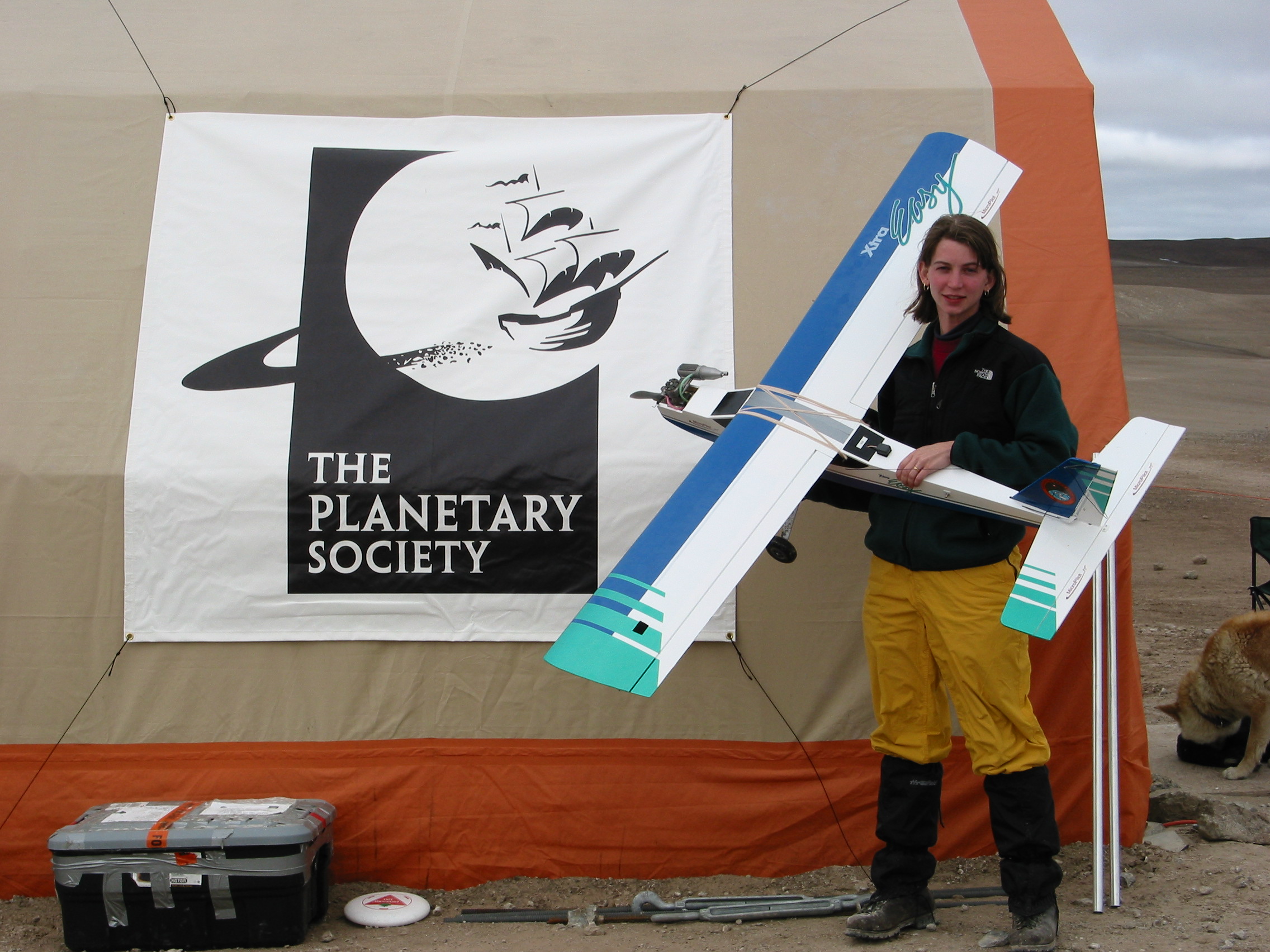
Wings Over Mars: Emily Lakdawalla at Devon Island
NASA Haughton-Mars Project 2002 / The Planetary SocietyThe Planetary Society is taking steps toward the goal of humans and robots working together to explore Mars by participating in the SETI Institute-led NASA Haughton Mars Project. From July 17 to 24, 2002, we joined a team from NASA Ames Research Center to fly an autonomous airplane to capture video of the barren landscape of crater and gullies on Devon Island’s Haughton Impact Crater, just as we hope airplanes will one day be used to scout out new frontiers on the red planet.
The three-member team included The Planetary Society’s Science and Technology Coordinator, Emily Lakdawalla, who helped choose targets for the airplane to explore among the channels and gullies that dissect Haughton Crater. The airplane provided a unique point of view on the landscape—faster than a human or rover, closer than a satellite, able to overfly interesting features and return for another pass from another direction. Also on the team was Benton Lau, Deputy Project Director of the NASA Ames Research Center’s Bio-inspired Engineering for Exploration Systems (BEES) for Mars project. Their goal is to develop aircraft that can explore Mars by mimicking the foraging behaviors of simple living creatures like bees and ants. Lau and Lakdawalla worked together to learn about exploring Devon Island’s Mars-like environment from the air, so that Lau could return to Ames to develop control chips that will allow future Mars exploration aircraft to explore on their own.
Since the BEES for Mars control chips hadn't yet been developed, actual operation of the aircraft was up to the team’s third member, Paul Chambers, a Senior Technician at Micropilot, a Canadian technology company that outfits aircraft with semi- and fully autonomous control devices. Chambers brought UAVs, or Unmanned Aerial Vehicles, outfitted with an onboard autopilot, video capture system, and ground-reference system that are capable of overlaying information about the position of the airplane on the video that it records.
Following are Lakdawalla's reports home from Devon Island.
July 16, 2002
Starting Out
After a brief visit with my family (several of whom were convinced I'm headed for a polar bear encounter), I am finally on my way. Benton Lau of NASA Ames greeted me in the gate area of the Chicago O'Hare airport, before the flight to Ottawa; he had scoped the crowd and guessed who I was by the serious back-country hiking boots I was wearing. Benton, for his part, was wearing brand-spanking-new hiking boots and toting a new fleece from the outdoor company that sponsors Pascal Lee's project. It made me feel a bit like an old hand at this surviving outdoors thing.
Before we boarded the plane we discussed the upcoming UAV (Unmanned Aerial Vehicle) activities. He says that since the plane's autonomous control chips rely on Global Positioning System for navigation, and the GPS coverage at this latitude isn't very good, we will probably be limited to remote piloting of the airplane. As a result we'll be limited to line-of-sight operation, meaning that I'll need to study the topographic map carefully and find high points that we can stand on, overlooking the gullies, to have as long a flight as possible while keeping the plane in view.
We met up with the final team member, Paul Chambers of Micropilot, at our hotel in Ottawa.He said all his planes, fuel, and equipment had been shipped to Resolute, so we seem to be all ready for Devon Island!
As a final note: an explosion in an electrical transformer outside the hotel cut off the power, so I don't know if this message will be getting to you all tonight. At least I'm not the person who's trapped in the elevator...
July 17, 2002
Arrival
I'm writing to you all from Devon Island! It may be true that there's no place on Earth that's quite like Mars--but this must be awfully close. It's a sere landscape of exposed rolling ridges of brown rocks, ice, and gullies, with occasional scarps of fractured rock. No vegetation, and no animals, except a single seagull wandering hopefully around the camp, and the three dogs kept around to warn of bear intrusions.
My day started in Ottawa, in a hotel in which the power had gone out just as I went to bed the night before. I woke up to a still-dark room, and mused on the irony of my last shower in civilization being taken in the dark--while light is the one thing I won't be short of at Devon.
The flight from Ottawa to Iqualuit--capital of Nunavut Territory, which is bigger than California and has a total population of 27,000--felt like a British flight. At Iqualuit most of the southern Canadians and visitors from the States got off, and the plane was refilled with Inuit families. (Inuits comprise over 80% of the population of Nunavut.) I am fairly certain that this is the first time I've ever landed on a dirt airstrip. None of the streets seem to be paved--upon reflection, there would be no reason to pave any of the streets, as they're covered by snow for much of the year, and nobody would drive anything but a 4-wheeler up here anyway.
Iqualuit was an entirely different landscape from Ottawa. The smoothed rolling ridges of rock spoke of massive glaciers; the vegetation gripped so tightly to the rock that it seemed that it, too, had been crushed by the glacier. From Iqualuit we took off again, landing in Resolute, on Cornwallis Island.
Once we retrieved our luggage, we were met by Rick Alena, who is also from NASA Ames. (Ames is a big place; he and Benton were not previously acquainted). Rick quickly got us and four other people organized for our flight in the Twin Otter airplane to Devon Island. We were forced to depart on the plane before the air cargo company had sorted out the cargo containers carrying Paul's airplanes, as the Twin Otter pilots were concerned about a fast brewing storm picking up in the northwest--it was decided that it would be better to get at least the people and their luggage to Devon, and try to carry out the equipment on a second flight if the weather held off long enough.
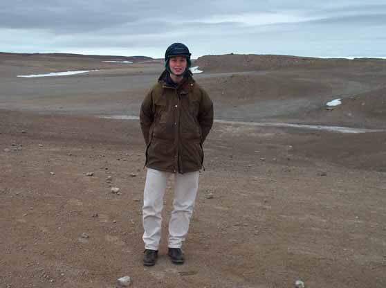
Emily Lakdawalla on Devon Island
NASA Haughton-Mars Project 2002 / The Planetary SocietyThe landscape, as I already described, is pretty alien. Blue blue blue water (where it's not covered by fractured ice pack), rounded brown rocks, white patches of snow. Every patch of snow has a dark brown streak emanating from it toward the nearest gully. When the sun broke through the clouds, the brown rock blossomed into earthy colors--ochre, siena, umber, olive. I don't know what caused the colors--I'll investigate while I'm here.
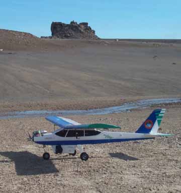
As we came in for a landing, we passed by the cylindrical Mars habitat, know as FMARS (Flashline Mars Arctic Research Station), which was built last year. In the distance I could see lighter-colored rock marking the Haughton impact crater. We circled around and landed on the rocky airstrip--a vibrating but otherwise smooth landing. ATVs with trailers were there to meet us; the hatch opened, and I stepped out on Mars!
The FMARS habitat (white structure on the right) dwarfed by nearby hill
NASA Haughton-Mars Project 2002 / The Planetary SocietyAfter handshakes and greetings all around, the five of us who were "newbies" to Devon Island were taken on a tour by John Schutt, manager of the base camp. The facilities are really quite impressive--not as rough as I'd feared. There are several permanent tents--tool shed, "kitchen" and general mess tent, food storage, and two general-purpose tents for the visiting scientists to work in. Attached to the kitchen tent is a wooden shed supplying--wonder of wonders--running water, not just cold but also hot, to a sink and even a shower. The last two tents--the so-called "poop tents"--are unfortunately rather more primitive. (All waste on the island must be carried out in order to prevent microbial contamination.) I won't go into any more detail about that because I'm not ready to face it yet.
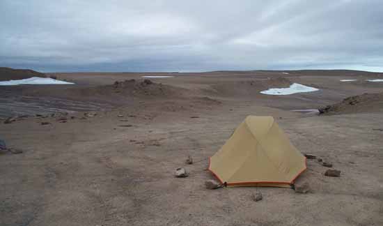
Emily's tent on Devon Island
NASA Haughton-Mars Project 2002 / The Planetary SocietyFinally, we could set up our tents in the "tent city," which is located a hundred yards or so from the main camp in order to establish a quiet zone. I chose a spot for my tent that faced east, in order to help me get oriented--the sun coming in the front of my tent means it's "morning." I face out onto the crater, and can poke my head out the tent and face right to look at the main camp to check out the activity. I staked and guyed my tent as tight as I could--it was warm when we arrived, warm enough for me to work in my T-shirt, but as we worked at setting up our tents, the temperature was dropping rapidly, and the wind picking up.
Dinner was served at 6 pm. Again, I am impressed by the camp! On the menu were calzones--stuffed with sun-dried tomatoes, or spinach and feta, or pepperoni and tomato--and a salad that camp chef Ginger Howell termed "cabbage bouquet." It was remarkably good, and I downed 2 1/2 calzones.
Right now Paul Chambers is working on his airplanes, getting them assembled and ready for flight. We'll jump right into action tomorrow, weather permitting. If the weather is really fine we'll go up to the airstrip and test fly the airplanes to see whether or not they can receive GPS signals well enough to navigate by autopilot. If the weather is more questionable, we will plan to scout out the terrain near the camp, either on foot or by ATV, to find good locations for airplane flights.
We're told that the storm that is brewing will be "nasty," meaning mostly that it'll be very windy; the wind is rattling the kitchen tent as I type. Paul's airplanes can't be flown in wind speeds above 30 km/h, and he'd rather not fly when they're above 20 km/h. This storm is producing wind gusts up to 20 knots, or about 40 km/h. But it's supposed to pass relatively quickly, clearing by Friday, so I anticipate that tomorrow will be a scouting day, and hopefully we'll be able to fly on Friday!
I'm off to my first "night" spent under an Arctic summer sky. I have my sleeping mask to blot out the light and my ear plugs to blot out the wind. I am attaching two pictures for your enjoyment; the network they have set up here is surprisingly fast.
July 18, 2002
Life in the Arctic
Well, it's not easy to sleep in the Arctic sun. Even my sleeping mask couldn't block out the light. And somewhere a draft was snaking through my tent from the 20-knot winds outside. But I hit upon pulling my stocking cap down over my eyes and ears, and that helped immensely. I slept, but I woke up every hour or so, checking my watch to see if it was 6 am yet. The best thing about last night was that my tent was just as tautly staked in the morning as it was when I went to sleep, despite the wind. But surface runoff--which can't soak into the ground because it's permafrost--was sheeting across the ground under my tent, and had turned the ground in the tent's vestibule into a sticky mud slurry.
I eventually exited my sleeping bag (which was tough to do!), donned several layers, and ventured outside. After breakfast, us newcomers were taken through the rest of our training. I learned how to operate the amateur radios we carry along on traverses, then John Schutt took us a ways from camp for training at avoiding polar bears, and in firing a shotgun (in case applying the former training fails to achieve its object). I've never fired a shotgun before; the recoil knocked me back a step or two. I learned more than I want to know about aggressive polar bears. Hopefully I won't run into one.
Next came the fun part--ATV (4 wheeler) training. I now understand why people want to disturb the peace and quiet in public lands with the things--they are awfully fun to drive. But they are very noisy.
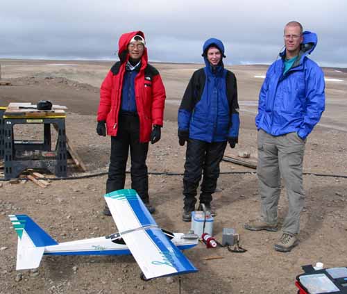
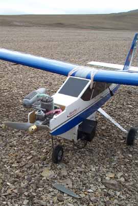
The Wings Over Mars team
Benton Lau of NASA Ames Research Center (left), Emily Lakdawalla of The Planetary Society (center), and Paul Chambers of Micropilot (right), with the recalcitrant plane.NASA Haughton-Mars Project 2002 / Keith Cowing
By noon the wind had died down to a steady 10 km/h or so, and we thought we might try flying the planes from the camp landing strip that afternoon to test them out. So after lunch Paul worked on assembling and testing one of the planes. I was astonished to see him attach the wings to the body with rubber bands! The plane's controls all checked out okay, including the Global Positioning System (GPS) receiver, which worked perfectly. This was great news, because we originally thought GPS wouldn't work well in these latitudes. It takes only seconds for the plane to acquire signals from four GPS satellites, the required number to determine horizontal and vertical position on the planet. That means that the plane's autopilot will be able to navigate it along a course that Paul programs into it, and it won't have to remain within our line of sight.
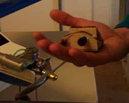
The video camera nestled in Paul's hand.
NASA Haughton-Mars Project 2002 / The Planetary SocietyNext, Paul tested the video camera. It is a tiny device--the lens is about a centimeter across. The camera transmits a wireless signal to a receiver on the ground, which in turn sends the signal to a mini-DV recorder--actually just a regular handheld digital video camera--that records the images. The camera is on a mount covered with Velcro, which allows it to be positioned at many different orientations with respect to the airplane; it can look straight down or at any angle in front or behind, as well as gaze off to the side. The orientation is fixed on any one flight; there's no way to adjust it in midair. The camera worked great! Paul programmed it to overlay position information from the GPS onto the video images.
Unfortunately, by the time we had finished checking out the electronics, the wind had picked up again to over 20 km/h. This is too strong for flying, but we still needed to test the motor. So we brought the plane outside, fueled it up--and found that the starter's battery wasn't supplying enough juice to start the plane. Paul tried starting it manually--no response. Joe Amarualik, the deputy base camp manager, improvised a rip cord to wrap around the plane's prop to try to turn it over fast enough to start; this resulted in a couple of chuckles from the engine but still no start. The difficulty is almost certainly the cold temperature, which is affecting both the starter battery and the engine. We'll try again tomorrow, experimenting with an alternative engine and trying to warm things up a bit before we start.

Emily on her ATV
The FMARS habitat can be seen in the upper left background.NASA Haughton-Mars Project 2002 / The Planetary Society
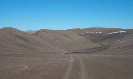
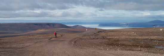
We put the plane away, and set out with Joe on ATVs to scout out good locations for a flight. We have some pretty restrictive criteria. The plane has a limited range, about 15-20 minutes of flight, or roughly 8 km round trip, before it runs out of fuel. It needs a fairly smooth and flat surface about 100 meters long for takeoff and landing. And Paul must lay in a course--in the form of GPS waypoints--for the plane to follow, which means he must be able to traverse the plane's route along the ground. Earlier in the day we had asked Gordon "Oz" Osinski, a Ph.D. student in geology at the University of New Brunswick, for advice on interesting locations for airplane flights that also satisfied the airplane's constraints. He suggested two locations, and we selected the one to the south, along the rim of the Haughton Crater, from which rose several gullies that we could explore.
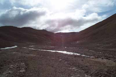
The gullies where the plane will be flying
NASA Haughton-Mars Project 2002 / The Planetary SocietyJoe led us to the site at a fast clip. We had to traverse many different types of terrain--near camp the soil is a mixture of limestone mud and small stones, which is easy to drive over. Then we encountered a stream (the same stream from which the camp draws its drinking water), which the ATVs splashed through with no difficulty. At times the terrain turned to slippery mud; at other times it was sharp, angled rocks as big as my head that shifted and slipped under the wheels as we drove. The sun was coming out and resistant snow was melting quickly, generating fast-moving runoff. In the middle of the drive Joe stopped at a point that overlooked Haughton Crater--its interior gray rock of melted "impactite" contrasted sharply with the neighboring brown carbonate rocks. Much of the crater is on land owned by the Inuit and is currently off-limits to us, but Joe (himself an Inuit) offered us an escorted tour of parts of the crater in a few days if time permits.

Arctic life
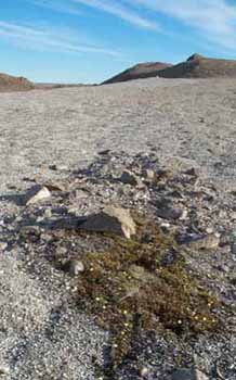
NASA Haughton-Mars Project 2002 / The Planetary SocietyWhile we were up there I realized that there were plants on the ground--all over the place, in fact. Tiny alpine plants with bright magenta flowers were everywhere; and as I looked I spotted mosses and other green things, including green stains on rocks that mark the presence of cyanobacteria. The lesson, I suppose, is that on Earth you can escape neither water nor life--both are everywhere.
We drove on and found what Paul considered a safe site for takeoff and landing, and then explored up into the gully; Paul drove with his GPS in one hand, recording waypoints along the valley floor. The floor was a flat channel filled with fast-flowing braided streams; the walls were shattered limestone. I can't wait to see what it will look like from the plane.
We returned for dinner; I don't know about Benton and Paul, but my hands, arms, and shoulders are very tired from the ATV driving, particularly my "trigger thumb" (which controls the throttle). We had a fine dinner of pork chops, and an after-dinner lecture by Oz on Haughton geology; and I'm ready for bed. Of course, now that it's bedtime it's brightly sunny outside!
P.S. Good news--the plane started right up this morning. It's a bit windy right now, but we're hopeful that we can fly this afternoon.
July 19, 2002
Learning to Fly
First thing this morning, Paul Chambers successfully started the airplane's engine--one worry removed!
We woke to a sky only half covered by an overcast that was rapidly retreating to the south and west behind a strong wind. My second night under the Arctic sun, I had been exhausted enough to sleep through the night, waking only once before 6:45 am, when I got up. It was also noticeably warmer inside my tent this morning.
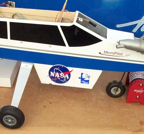
The new NASA and Planetary Society logos on the plane
CAPTION TEXTNASA Haughton-Mars Project 2002 / The Planetary Society
The winds were just at the threshold of Paul's comfort level for airplane flight, about 20 km/h with occasional gusts up to about 24 km/h. We dawdled around, hoping the wind would die down a little, and making the final preparations to the airplane--customizing it with stickers from the sponsoring organizations. NASA and The Planetary Society now have logos on the fuselage, and a Haughton Mars Project patch is emblazoned on the tail. After checking the plane's center of gravity, Paul pronounced the plane absolutely, completely ready to go.
The next problem to solve was how to transport the airplane to the chosen launch site. The wings are easy to remove, so it can be carried in two pieces, but the jouncing ATV ride to the launch site (which our guide Joe Amarualik told us was an "easy" ride!) was a concern for the sensitive electronics, and splashing through meltwater runoff could leave mud on the plane's exterior that wouldn't help it fly. We scrounged around for cushioning materials and ended up wrapping fuselage and wings in garbage bags, and placing packing foam between the ATV racks and the airplane parts, then bungee-cording them down.
In the meantime, the Twin Otter airplane had arrived, dropping off a new geologist and a camp assistant, and picking up the carpenter and a medical team member. This was the first airplane to arrive since the flight I came in on two days ago. It really does feel like an outpost remote from civilization. That is, until I come inside and check my email on the fast satellite Internet connection they have here. In my tent, it feels like I'm roughing it; but in the "kitchen tent," with a full time cook working over 6 gas-powered burners and an oven, with the Internet connection, and with the nightly movies presented using Victor Rundquist's DVD collection, I'm not roughing it at all.
Unfortunately, by the time we'd finished loading the airplane on the ATV, the hoped-for cessation of strong winds had not come to pass; in fact, the winds had picked up to a steady 25 km/h, with stronger gusts. We discussed trying to fly anyway, but Paul felt that it was pretty risky; it was a risk he might be willing to take later in the week, when we're close to leaving, but we still have time in our "launch window" so we decided to scrapp today's planned flight. Consulting the weather forecast, we found that the winds are supposed to be very strong tonight, but diminishing tomorrow, and diminishing even more on Sunday. There was no rain at all in the forecast. So we wait.
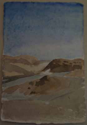
Devon Island watercolor
Emily LakdawallaWhile the cancelled flight was frustrating, the winds had also blown every scrap of cloud from the sky; it was a gloriously sunny day outside, with a clear blue sky. I took advantage of the spare time to do a little watercolor painting.
Later on in the afternoon, Paul, Benton Lau, Joe Amarualik, and I went out again to scope a different location for the plane flight. Since it was our second day out on the ATVs, Joe let us lead on as we explored the gullies. This one was definitely less ideal than the first one Oz (Gordon Osinski) had pointed us to; the walls were both closer together and lower, and the gully windier. Paul led the group down one gully, recording GPS waypoints along the way. After that, it was my turn to lead. I drove onward, searching for a better-looking valley, but as we drove downstream and tributary rivulets entered the valley, the stream got deeper and the rocks got larger, until we were bouncing through a stream about 10 centimeters deep, with bigger and bigger rocks. I finally stopped when I realized that the rocks weren't getting any smaller--in fact, they were beginning to be larger than the ATV's wheels, and up ahead I could see rocks as large as the ATV itself. When I finally stopped, and we pulled off our helmets to talk, I could see that Joe was laughing. "Where are you taking us?" he asked me. We elected to turn around and head back.
End of the road
Where I took us when it was my chance to lead. The rock in the center of the picture, up ahead, is the size of me on my ATV.NASA Haughton-Mars Project 2002 / The Planetary Society
As the landscape gets more familiar, it seems less and less like Mars. After all, there is water, and plant life and temperatures warm enough to walk outside without my parka (provided I'm out of the wind). Yet it seemed so much like Mars when I got here. Thinking about that made me wonder whether astronauts visiting Mars itself would soon find that landscape familiar, and as comfortable as home. People are very adaptable; they probably would.
All in all, it wasn't a terribly successful day for the airplane team, but the bright sun outside mitigates that frustration. None of the other experiments here are hampered much by wind. The greenhouse reached 107 deg F today, to the delight of that team; the biologist was ecstatic about the microbial life he'd observed in rock samples; and HMP camp construction and networking projects proceeded apace. But the airplane team will be in a holding pattern until the wind lets up. I hope we'll be able to fly tomorrow, but I give it only a 50-50 chance.
July 20, 2002
Flight!
I woke this morning to a tapping on my tent. "Emily? It's Paul. The conditions are good for flying, eh?" It was 6 am. I threw yesterday's clothing on and rolled out to the work tent, where Paul Chambers was preparing the plane to go. He, Benton Lau, and I schlepped all our equipment down to the valley below camp, where we'd scoped out a flat place for takeoff. The three of us were loaded down with fuselage, wings, computer equipment, toolbox, gallon of fuel, hard case containing camera equipment, and gasoline generator.
Ready for takeoff!
NASA Haughton-Mars Project 2002 / The Planetary SocietyBy about 6:45 am Paul had everything set up. After the plane is assembled, it must be fueled, and then the GPS and autopilot turned on and initialized; Paul checks its status using a handheld computer as a console. He picks up the airplane and tilts, rolls, and yaws it to test that the data readouts are working correctly. Then Paul tests the controller's range, making sure the plane responds well; and the video transmission system is set up, with the mini-DV recorder on and ready to record. Finally, all the equipment is cleared out of the way, and Paul starts the engine. This takes some doing, as he has to manually rotate the prop blade to kick the engine into motion. Hanging on to the plane, he kicks it up to full throttle, then slows it down and picks up the airplane, tilting it skyward to make sure it won't stall in the air. Finally he sets it down, tells me to turn on the mini-DV recorder, and opens up the throttle.
The plane is reluctant to start over the rocky surface, but soon it jumps into motion, accelerating down the strip. Its bounces turn into hops and then jumps and then as the ground falls away the plane is aloft! Paul lets it climb a little, then banks it into a turn to keep it overhead, still climbing. It circles higher, then it does a funny dip, diving toward the ground, then straightening out again. "Hmm," Paul says. The plane climbs again, then takes another dip. "That's the autopilot," Paul says. He tries the autopilot one more time, and the plane flies north for half a second, then dips again. Paul flies it around in one more big circle, then brings it in for a landing.

Buzzing the landing strip with Paul at the controls
NASA Haughton-Mars Project 2002 / The Planetary SocietyPaul doesn't know why the autopilot wasn't working; he decides to bring the plane in and look at its data logs. When we do so we discover that the GPS reception--which had been perfect while the plane was sitting on the ground--had been lost as soon as the plane started down the runway. On the bright side, the video looks absolutely great, even with a relatively low resolution camera mounted on the plane. The river valleys show up well, without too much sunlight glinting off the water. After breakfast we decide to have another go.
To sum up a long day in a few sentences, we struggled a long time with the autopilot, finally figuring out that the video transmitter was interfering with the GPS reception. Without GPS, the autopilot doesn't know where it is, and quickly sends the plane into a dive. We experimented with different relative positions of the video and GPS antennas. We tried the better camera, and found it lacked power; when we put in fresh batteries we found that it interfered even more with the GPS signal. We did get some successful flights with the small camera and GPS reception working, and one flight with the autopilot working but no video, but no flights with all three working together. We did capture a lot of beautiful video though, so all in all we were happy with the long day of flying. It was a great relief finally to see the plane in the air.
Luckily, we had amazing weather for the day; open blue sky and very little wind. I took advantage of a mid-afternoon break while we were waiting for the plane's batteries to recharge to take a shower. Such luxury! As the afternoon wore on, there were the beginnings of warning gusts, and a cloudy gray front started moving inexorably in on the HMP camp from the northwest. By dinnertime, we had to quit flying anyway, as another Twin Otter landing was scheduled for the evening. And HMP Base Camp Manager John Schutt told us after dinner that we may have a large group of "DV's"--Distinguished Visitors--arriving tomorrow, which will disrupt the morning's activities. But as I write this, the temperature is dropping rapidly, the sky is completely gray, and I am a bit worried about tomorrow...
July 21, 2002
Against the Wind
Yesterday evening and this morning it was camp cleanup time--because at 9:30am a planeload of visiting dignitaries arrived to sightsee: Honorable David Anderson, Minister of the Environment, Canada, and several members of his staff; British Ambassador to Canada, Sir (Robert) Andrew Burns; British Environmental Minister, Right Honorable Michael Meacher; The Honorable Børge Brende, Minister of Environment, Norway; His Excellency Svend Roed Nielsen, Ambassador from the Royal Danish Embassy in Ottawa; and His Excellency Ingvard Havnen, the Ambassador from the Royal Norwegian Embassy in Ottawa. Once they arrived, we all trooped in to the kitchen tent and prepared to give short introductions of ourselves and our projects.
Alain Berinstain, who works for the Canadian Space Agency and was thus the senior Canadian at HMP, had just finished describing how the Haughton site serves as an excellent analog for Mars, when the British environmental minister interrupted, "Why do we care about Mars?" There was general laughter, but HMP biologist Charlie Cockell quickly explained how studying Mars informs us about the early history of terrestrial planets (specifically the Earth), helps to answer questions about why Mars's climatic and geological evolution was so different from Earth's, and finally, satisfies our human desire to explore. At that point an ambassador interjected, "I suppose it wouldn't be hard to find volunteers to go to Mars around here, would it?" Amid more laughter, about half of the HMP team members raised their hands. The visitors were given a tour of the facilities and a show of the activities; we launched the plane for them and buzzed the camp (though we did not fly directly over their heads, as Paul objected to such a display of bad RC etiquette). Ginger, the camp cook, prepared a sumptuous lunch of Brazilian black bean soup for the veggies, pork chili for the meat-eaters, cabbage salad, and incredibly tasty cheese bread.

Emily on "Mars"
The white rocks in the background form the center of the Haughton impact structure.NASA Haughton-Mars Project 2002 / The Planetary Society
Once the Honorables left, we could get back to work. While it's nice to have distinguished attention, we are all acutely conscious of how short is the remaining time at the HMP camp. For the UAV team, that meant we could finally break away from camp to launch the plane in another location. We never solved the GPS problem, so we had to return to the second gully location we had visited, which was not as pretty as the first one, but where the launch and landing strip was on a highland overlooking the gullies, allowing Paul to fly the plane manually. We packed everything onto the four ATVs, and, with Joe Amarualik as our trusty guide (without whom we'd be quite lost), we set off.
The steeper gully we flew today
NASA Haughton-Mars Project 2002 / The Planetary Society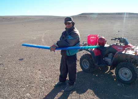
Joe Amarualik holding on to the plane's wings
NASA Haughton-Mars Project 2002 / The Planetary SocietyWhen we arrived, the wind seemed a little bit strong, but Paul said, "We came this far, it'd be a waste not to try." Once the plane took off, it was clear that the winds were not only very strong, but gusty. I gritted my teeth as I watched the plane slew and skid in the gusts. But Paul managed to get it to altitude and obtained some excellent looking video of the gullies. Landing was a challenge--in the strong headwind, the plane did not want to settle to the ground, but Paul got it to drop to a hard landing.
After that flight, it was clear that Paul did not want to risk the plane again in those winds; but Benton and I wanted more data, and based on our experience to this point, we had nothing but faith in his abilities as a pilot. I found it amusing to be in the role of mission scientist, pushing our mission's engineer to accept greater risk to his precious equipment than he was willing to take. Somewhat reluctantly, Paul launched the plane again. We obtained our data, and then he brought the plane back in. The gusts fought him; the plane would not touch the ground, and he had to push the throttle back up, and bring it around for a second pass. Again, the wind got under the plane's wings, keeping it aloft; the engine almost stalled at the end of the runway, fifteen feet off the ground, and just short of a steep drop into a gully, but Paul managed to get it going again and bring it around for a third try. Again, the winds fought; then suddenly they dropped, the plane dipped down, and struck the ground on its prop and nose gear. We were lucky; the only damage seemed to be to the prop, and Paul brought eight more of those with him. But we got our data!
A micro-oasis
NASA Haughton-Mars Project 2002 / The Planetary SocietyAfter dinner (a "tired cook's meal," according to Ginger, of chicken pot pie and mashed potatoes), four of us took a sightseeing drive on the ATVs: me, immunologist Brian Crucian, and HMP Web gurus and greenhouse builders Keith Cowing and Marc Boucher. Marc led us toward the crater, and this time w stopped on the rim for a good long look. It was a sunny, nearly cloudless evening, and the view was spectacular. The gray rock that fills the crater--a mass of shattered rock and glass left behind from the impact called "breccia"--shone brightly against the brown, weathered limestone and dolomite of the surrounding lands. After taking many photos, Marc led us across the plain below the ridge to take us to a little pond, called Trinity Lake, and a white hill of impact breccia that stood beside it. We spent twenty minutes or so scouring the hill for cool rock samples; I found some shatter cones (striated markings on rocks that are a telltale indicator of a meteorite impact), and some nice examples of "impactite," the rock that is made of tiny shattered bits of preexisting rocks, cemented together with glass--material that was melted by the extreme heat of the impact event. At the top of a hill was a "micro-oasis," where some freak supply of water and nutrients allows a profusion of plants to grow. Possibly a large animal once died on this spot, and the nitrogen left behind by its carcass still resides in the soil, feeding new life. Finally, we posed on our ATVs for a group photo using the timer on my camera, and we headed back to camp.
When we returned, I showed my rocks to people, and John Parnell--a geologist who just arrived yesterday to study fluids trapped in the impact glasses--took out his hand lens to have a close look, and said excitedly as he spotted bits of impact-altered sandstone in the rocks, "These are exactly what I came here to look at." What could I do? I surrendered one of my impactite chunks to him.
As I close, it's still sunny. We couldn't have asked for better weather. I could get used to having the sun around 24 hours a day. But I have this sneaking sense that my body is building up a crushing sleep deficit.
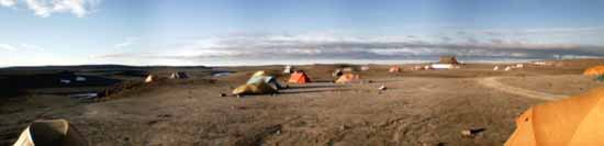
The tent city at night
NASA Haughton-Mars Project 2002 / The Planetary SocietyJuly 22, 2002
Final Flight
Today we woke up to threatening fog advancing over the hills to the northwest; but by 9:30 the clouds had lifted, and it was another beautiful day in the Arctic!
The UAV team decided to strike for the southern location we had initially scouted on Monday. We were packed and ready to go within half an hour or so of breakfast--Benton, Paul and I have really formed an efficient team! This time, we were accompanied by writer and poet William Fox, who is at Devon Island to gain new perspectives on his field of interest, the relationship between human cognition and landscape. With our guide Joe Amarualik leading the way, we set off.
We returned to the interior of the steep-sided gully, to a large, theater-like space in the valley where Joe thought the plane might be able to take off. Paul confirmed that the flat area was large enough for a runway--but that the steep walls of the gully probably didn't give him room enough to get the plane to altitude. You can't do steep turns immediately after takeoff, as steep turns often cause a plane to lose altitude.
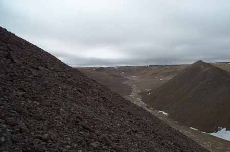
The gully from halfway up
NASA Haughton-Mars Project 2002 / The Planetary SocietyPaul and I hiked up one side of the gully to get a look around at the top and see if there was any flat place at the top where the plane could be launched. The last 50 meters or so of the hike was up a 45-degree slope of scree (shattered bits of rock); every step forward caused me to slide down a bit, and it was tough going getting to the top. (Paul, frustratingly, walked right up the slope like a mountain goat.) The view from the top was spectacular--but the hills here were very pointy; no place to launch the plane. After snapping a few pictures, we came back down. Benton tried to convince Paul to take off within the valley anyway, but Paul insisted the plane would run into the walls. So we headed back out to the valley's mouth. From there, we couldn't fly the plane very far over the gullies until Paul had to turn back, because the plane was soon lost to sight behind the steep gully walls; there was about 100 meters of elevation difference between the valley floor and the ridge tops.
The plane, with the chipped propeller, after its last flight
NASA Haughton-Mars Project 2002 / The Planetary SocietyWe made two flights at that spot. On the last landing, the plane dropped too soon and its nose gear caught a low ridge in the vally floor and tipped right onto its nose, finally breaking the chewed up prop. That seemed a fitting ending to our last flight on Devon Island.
Yes, our last flight. We are scheduled to depart from Resolute on Wednesday afternoon; in order to take no chances with the weather, that means we are scheduled to depart from Devon Island on Tuesday afternoon. If the weather on Tuesday begins to look nasty, they'll push our departure earlier; so we have to be packed and ready to go no later than lunchtime tomorrow. So when we returned to the HMP Base Camp this afternoon, Paul started packing up his planes.
In the evening, after dinner, biologist Charlie Cockell gave a talk on his research results from his many seasons at Devon. (This was quite a feat, as Charlie had not slept for 36 hours, having just returned from performing a round-the-clock experiment outside at Trinity Lake.) Among other things, he has found that microbial life can benefit from the destruction unleashed on environment from an impact. The impact breccia, unlike most crystalline rocks, is full of pores or holes left behind after some of the rock material was vaporized, and these holes allow microbes to colonize the rock. Colonizing the rock is advantageous, because even one millimeter's thickness of rock between the microbe and the outside can cut the harmful, DNA-damaging UV exposure that the microbe can receive from the Arctic summer sun to a tiny fraction of what that microbe would experience at the rock's surface.

A montage of plant and animal life I've seen while I've been up hereE
Top row: cyanobacteria colonizing a rock; and two types of lichen. Next row: some green plants and mosses. Next row: saxifrage, an unidentified yellow flower, and a black inchworm. Last row: Arctic poppy, durba, and a hole dug into a rock by a bird called a snow bunting.NASA Haughton-Mars Project 2002 / The Planetary Society
Tonight I'm going to bed early; tomorrow, I pack, and wait for the Twin Otter to pick me up. But I'm looking forward to exploring Resolute, which bills itself as an "oasis in the Arctic."
July 23, 2002
Starting Back
Today, I departed Devon Island and made it to Resolute. I say "made it" because it was a very chancy business. The day began sunny but there were threatening clouds in the northwest, and Resolute's airport was shut down due to fog. HMP Base Camp Manager John Schutt told us this after breakfast, advising us to pack everything but not to strike the tents yet.
That was the bad news. The good news was that there were several ATVs available for those of us who were leaving today to go out sightseeing one last time. I approached our guide (and Deputy Base Camp Manager) Joe Amarualik and asked him if he'd be able to fulfill his promise of taking us into the crater. To my delight, he said yes.
We started up the usual ATV route, taking us over the landing strip, across the creek that runs by the camp, and up the hill on which the FMARS habitat stands, but this time, instead of turning right--the route that took us to Trinity Lake and to the southern plane flight location, both on the western edge of the crater--we turned left, toward the northern rim of the crater. Finally we were heading toward those rounded gray hills that have only been in the background in photos so far on my trip.
Almost immediately the rocks under my wheels changed. Everywhere we've driven so far, the rocks have been very sharp and pointy, and they are pretty much the same color in any location--from place to place the rocks vary from medium gray to a dark brown, but wherever you stand, the rocks you can see look pretty much the same. In the steep valley we drove down, the rocks were rounded, and there were many kinds of rock, some white, some brown, some gray. The sharp rocks elsewhere on Devon island are so sharp because every summer, water seeps into pore spaces in the rock, and every winter, it freezes. Since water expands when it freezes, this freeze-thaw action widens pores into cracks and finally splits the rock apart. However, in the valley we drove down, running water has been a more forceful agent of weathering than freezing water; the running water carries sediment that wears away at the sharp edges of rocks, rounding them. Also, because floods can carry rocks large distances, that the rocks in a riverbed can come from anywhere within the river's watershed and are often of many types. The rounded, varied rocks told me that we were driving down one of Devon's major watercourses.
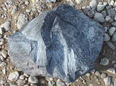
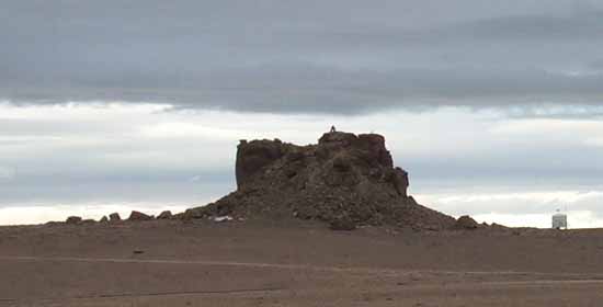
Shattercone from Haughton Crater
NASA Haughton-Mars Project 2002 / The Planetary SocietyQuickly we were among the rounded gray hills. The breccia weathers differently from the limestone. The limestone is often broken into large boulders; but the breccia is very crumbly, and most breccia rocks are no more than 4 cm across. Joe stopped his ATV and told us we were in the crater, have a look around. I immediately looked at the ground, and started picking up shattercones. That's one problem with being a geologist--I sometimes forget to look at the landscape because I spend so much time looking at the rocks at my feet.
Joe pointed out that the longer we stopped, the less we'd get to see, so I ran for my ATV and followed behind him. He took us straight down the watercourse--river bottoms are often rocky and thus provide better traction for the ATVs than the often treacherous mud to be found elsewhere--and we passed by hill after hill of breccia. Periodically, the color of the hills would change, from gray to yellow; I wish I knew more about what type of rocks I was looking at, but I had trouble keeping track of where I was in the crater because my sense of direction--dependent as it is upon a sun that follows an arcuate path across the top of the sky--was not functioning.
As the valley flattened out, we encountered vertical bluffs of yellowish rock with tortured bands of layering. Giant ejecta blocks--house-sized chunks of rock blasted out of the center of the crater by the impact--stood about on the round gray hills. Unlike the yellow rock, the breccia eroded into low, undulating hills with organic shapes, the kind of thing that Georgia O'Keefe might have liked to paint.
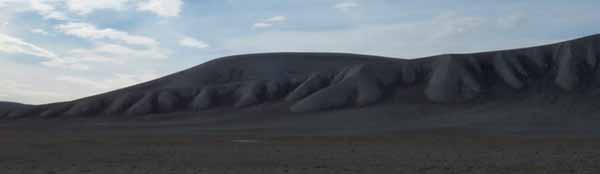
Undulating hills inside Haughton Crater, Devon Island
NASA Haughton-Mars Project 2002 / The Planetary Society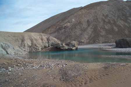
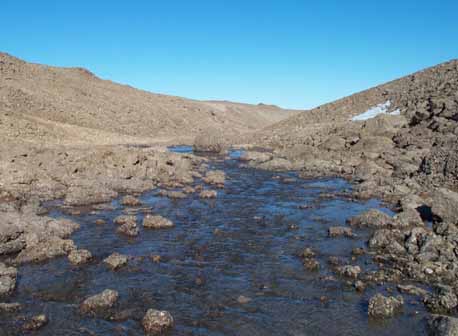
Blue and green in the Haughton River
NASA Haughton-Mars Project 2002 / The Planetary SocietyWe stopped for a while at a rille on the Haughton River, where the water showed unbelievable colors of green and blue. I stopped to listen, and all I could hear was the river flowing--no birds calling, no power lines buzzing, no distant rush of freeway noise, just the river. Along the river bank, I gathered little round river stones, one of each of all the rock types I could find. I love to go to a river and gather different colored stones; each originally came from a different tributary to the river, and the river takes those tributaries and churns them all together.
Just a little down from that place, we arrived at the original location of the Haughton Mars Project base camp, where they were for the very first season, before the Inuit, who privately own this land (as they do a large portion of Nunavut) objected to its location there. The only remaining mark of the camp was a large number of boulders, undoubtedly brought there to anchor tents, and a few interesting rock specimens, including boulders with shattercones and a large chunk of glass-like selenite gypsum. I also found a weathered rawhide dog chew. I was surprised to see no obvious ATV tracks. I suppose in an area with so much fluid water activity (the Haughton River was only a few tens of meters away, and the base camp location clearly on its floodplain), the tracks quickly get wiped away. Up on the hills near the new base camp, where freeze-thaw action is the strongest agent of weathering, it might take thousands of years--or more--for some of the ATV tracks to disappear.
Once there, we turned around. On the way back Joe detoured us to see several beautiful views--a bright blue lake; a massive ejecta block, now split in two, on the shoulder of a gray hill; a ride up and over a ridge jutting into the crater. Finally, we were heading back to camp. As we passed the last hump of gray breccia, I wanted to jump off the ATV and pick up a few more pieces, but I restrained myself, as I already had enough rocks in my pockets. I do feel a bit guilty about taking those rocks. One reason this crater is such a unique place is that it is so undisturbed--pretty much as undisturbed by plants, by animals, or by humans as you can get on a planet that is so covered with water and infested with life. Every time my ATV's wheels bit the ground it felt like a sin.
We returned to camp to have lunch, and then we packed up our stuff. Benton and Paul packed up their tents; I told them they were optimists, as there were mean-looking clouds rolling in from the northwest, and every time I asked Joe whether he thought our plane would be able to arrive at 4:30 he just grinned and told me not to pack my tent yet.
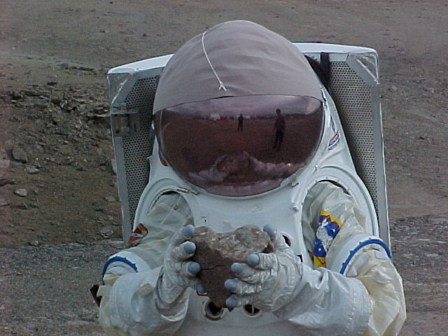
Emily in the Hamilton-Sundstrand space suit
Hamilton-SundstrandI did get another treat this afternoon--I got to try on the Hamilton-Sundstrand concept Mars space suit (at least the top half). That team was hoping that our plane wouldn't arrive, because the suit is small and only fits a few people, and any Mars space suit will have to work for a geologist, and I am both small and a geologist, so they wanted me as a guinea pig. It was fun to wear the suit but I wasn't entirely unhappy that I couldn't be their guinea pig, as the thing is pretty heavy!
By 2:30, it was raining. Paul told me I should have packed my tent before it rained; I told him I thought I might be sleeping in it tonight. But the rain wasn't very serious, and the ceiling was still high. At 3:30, John told me to go ahead and pack my tent. The rain had let up, and the Twin Otter was coming in.
As I was packing, Joe drove by on his ATV to say goodbye. "Come back," he told me, "I could use a good laugh once in a while."
Just as I was putting the tent into my duffel, the skies opened up again, this time bringing in some fog. Benton and I raced to the kitchen tent with my duffel, and I spent the next half hour pacing. Would the Twin Otter be able to land? The fog was blowing in; but the rain let up again.
Suddenly, I heard the distant roar of the Otter's engines. "Plane's here!" John called around to all the tents in camp. Everyone burst outside, throwing suitcases and boxes onto ATV trailers, heading briskly up to the landing strip, knowing that the Otter could be trapped here if conditions got much worse. The Otter offloaded three drums of diesel fuel for the generators and two large coolers full of food supplies, and then our stuff was piled on, and then it was time to say goodbye to everyone--at which point Steve Braham ceremoniously gave us our Haughton Mars Project patches--which you can only get if you've been there. The six of us who were leaving piled on to the plane, and after the Twin Otter pilots abbreviated version of the usual airline safety lecture ("Seat belts on for takeoff and landing, no smoking, no screaming, it's distracting") we were off. And immediately we were lost in the clouds. An hour later, we fell out of the overcast to land in Resolute. It turns out that the fog there lifted only just in time for us to be able to land; and shortly after we left Devon Island, the winds there kicked up to 50 km/h, and the weather turned real nasty.
I'm now in a hotel in Resolute; I've enjoyed the hotel room bath, and will sleep in a bed tonight. Hopefully, tomorrow, I'll write from Ottawa.
July 25, 2002
From Resolute to Southern California

Pack ice in Resolute Bay
CAPTION TEXTEmily Lakdawalla
Yesterday morning I woke up to snow flurries outside the window of my hotel room in Resolute. I can see why nearly everything in sight--snowmobiles, boats, storage sheds--had skis or runners fixed to them. But the cloud ceiling was high--the hotel manager said the conditions were fine for the plane to land. I spent the morning enjoying being warm inside. Shortly before lunchtime I took a walk out to the beach. Small boats and ice rafts alike were pulled up onto the beachfront. The limestone gravel that made up the beach was littered with bones, most of them fresh--picked clean of meat, but still holding on to cartilage and connective tissue. I guess things don't decay very fast in the Arctic, and it's not worth a scavenger's while to try to gnaw at the bones. Many of them looked unusual in shape; I think most were probably from pinnipeds like walruses and seals.
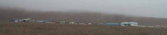
The town of Resolute
Emily LakdawallaNaturally, as it approached time to leave, it started snowing in earnest, and the fog rolled in. The hotel manager called the airport to find out the flight's status. "It will arrive at 2pm," she said (that was about 40 minutes late). "As long as the plane arrives on the right day, we don't consider it late!"
We packed up and left for the airport; as we were waiting around, who should show up at the terminal but the tour group of Ambassadors and Ministers who had visited the HMP camp on Sunday! They were wrapping up their Arctic tour, having just returned from whale watching. It surprised us all to see them waiting for coach-class seats on the First Air jet. On this airline, the front 10 rows of the 727 airplanes--the part that would normally be first class on other carriers--is sealed off from the cabin by a bulkhead and is used for cargo; there's no other reliable mode of transportation between isolated towns besides the jets.
The fog looked awful; but somehow the 727 managed to land in it, and before long we were on our way, bidding goodbye to Resolute.
The first leg of the trip back to Ottawa took us to Nanisivik, also in Nunavut. There is literally nothing at Nanisivik except the airport and a lead-zinc mine. As we flew in, the open, sunny skies illuminated a beautiful landscape of red and yellow rock cut into dramatically steep cliffs abutting the sea--steeper and higher than the cliffs on the Pacific coast of California. Once we landed, I walked out to the terminal and then outside to take pictures. The temperature was 1 degree Celsius, and I was battered by blasting winds, but the landscape was incredibly beautiful.
The view from Nanisivik airport
Emily LakdawallaWhen we took off, I found myself sitting next to a jovial miner from British Columbia. He told me that they do eight-week tours of duty in the mine followed by four weeks off: "too long," he said. "I've done two tours, and I'm quitting. It's just too long." He commented on my rapid typing on my laptop. "I've never owned a computer," he told me, "but now the mines are all computerized. I don't know what to do with them. The techs painted the few buttons on the keyboard that we're allowed to push so we don't mess anything up."
This hop took us to Iqaluit; we stopped there only briefly before heading on toward Ottawa. Midway through the flight, I saw a red glare off the left side of the plane. It wasn't the sun; it was the full moon rising in the east. The sky was darkening. The first sunset I'd seen for a week. When we landed in Ottawa, I was sweltering in the warm clothes I'd donned for the snowy walk on the beach in Resolute. During the cab ride to the hotel I rolled down the window to look at the stars.
Sunny southern California
Emily LakdawallaBenton, Paul, and I parted ways in the Ottawa airport this morning. Three days is a long time to travel in this day and age; yet while Devon Island is relatively inaccessible, I could have got as far as Resolute buying my plane tickets online, no special arrangements necessary. It's a very connected world that we live in.
I'm now safely back in the paradise of Southern California. I had a great time at the Haughton Mars Project; I hope that it continues to prosper, and that I get to return. Thanks to all of you who've had the patience to follow my adventures this week!
Protect Our Shared Future
You help us defend humanity and prevent asteroid impacts. Donate now to become a Planetary Defender!
Donate