Emily Lakdawalla • Feb 09, 2011
Google Mars base maps available for Opportunity's future traverse
Thanks to the work of several amateurs, Google Mars is a great tool for following the past and future peregrinations of the Mars Exploration Rover Opportunity. I've written about this before; today's update concerns some new image layers that the Planetary Society is hosting that will allow rover fans to follow Opportunity's journey from her present position all the way to the rim of Endeavour crater, which is about 6 kilometers away. That's no small distance but since Opportunity has covered more than that in the past year, and the Martian summer is now approaching, I think we can reasonably hope to be at the base of Endeavour's rim by the end of this year.
If you would like to explore Opportunity's landing site using Google Mars, here's how:
- Download and install Google Earth.
- When you run Google Earth, the default view is, of course, Earth. To switch to Mars, click on the little icon at the top of the screen that looks like Saturn and select Mars from the dropdown menu.
- One HiRISE base image for Opportunity is already included within Google Mars, but you'll need to download some additional layers in order to follow the mission. These layers are in the form of KML files (a file format used by Google Earth to describe geographic data). Here are the KML files you need for Opportunity:
- Opportunity Base Maps (4.5 MB), which contains segments of three additional HiRISE images covering Opportunity's traverse (they are ESP_011765_1780, PSP_005423_1780, and PSP_010341_1775). This layer pulls the image data from the Planetary Society's server so you'll need to be online in order to display the images -- but you don't have to download hundreds of MB of images in order to view the maps. You only need to download this KML file once.
- Eduardo Tesheiner's latest Opportunity Route Map. This link takes you to a thread on unmannedspaceflight.com where Eduardo posts a new KML file each time Opportunity takes a drive (whenever he has time to update it). In order to see Opportunity's latest position on the map, you need to return to unmannedspaceflight.com and download the latest KML file after each drive.
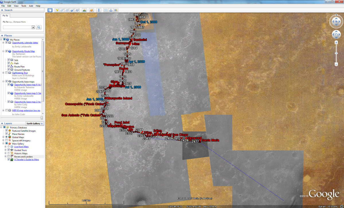
Here's a screen shot showing what the map looks like today, with Opportunity wrapping up her work at Santa Maria crater. Once Mars has exited solar conjunction, she'll be hitting the road again toward Endeavour's rim. The blue line shows the direction Opportunity will likely travel over the coming months. She won't make quite that straight a beeline for Endeavour, but she probably won't veer far from it, as the terrain is just getting easier and easier to traverse and the mission has much more to gain from reaching those hills than it does from stopping and smelling the roses along the way. The new image data are the little postage stamp covering Santa Maria (and Opportunity's current position), and the irregularly-shaped section covering the blue line of the future path.

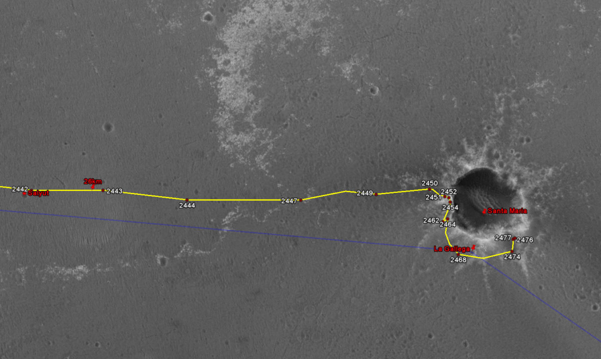
Here's a detailed view:

The image layers were formatted and georegistered by John Cody, Eduardo Tesheiner, and me, and are being hosted by the Planetary Society.


 Explore Worlds
 Find Life
 Defend Earth

