Emily Lakdawalla • Oct 11, 2007
News flash: Lakes at Titan's south pole, too, on top of the land of lakes in the north
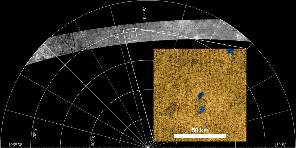
This morning the RADAR team released the following image, from the "T36" flyby on October 2, 2007:

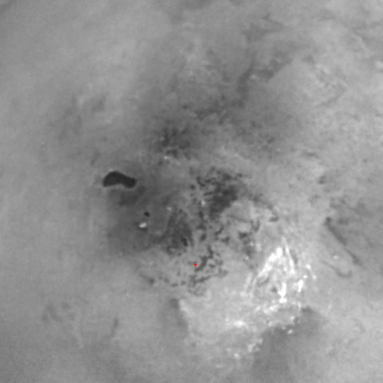
Lakes have been spotted near the south pole before, in this image by the ISS team, which was considered compelling but not conclusive at the time:

Because there are lakes at the north pole that are supposed to be fed by a methane cycle of evaporation, cloud formation, and precipitation, it has been suspected strongly that there should also be lakes in the south. However, it's winter in the north and summer in the south. It was possible that the methane rain only occurs in winter, so the summer pole might be dry, although it was also possible that the input of solar energy to the summer pole might drive a more active methane cycle. This one RADAR swath hasn't answered that question yet, but what it has done is show that the features visible to RADAR near Titan's south pole look a lot like the features visible to RADAR near Titan's north pole. And that, in turn, suggests that, as on Earth climate (rather than internal geologic forces or external forces like impact cratering) plays a large role in the formation of Titan's polar surface features, since climate, averaged over the year, is one thing that will be the same in the north and south.
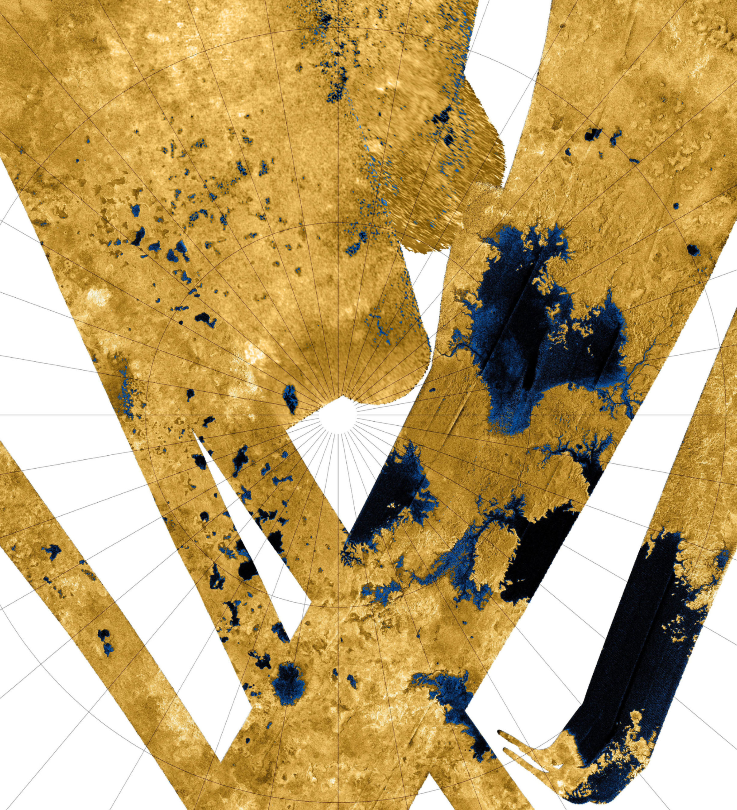
Speaking of Titan's north pole, the RADAR team has released a mosaic of many, many swaths covering the northern polar regions. It is absolutely huge, so to fit it in here I had to crop out the most interesting portion and reduce it in size 50%; visit Photojournal to download the full-size version. The SAR swaths have a wide range of different native resolutions, so some areas of the mosaic are fuzzier than others. Even the fuzzy regions contain features decipherable as fields upon fields of lakes.

The image is a polar projection, with zero longitude (the sub-Saturnian hemisphere) toward the bottom. The leading hemisphere (centered at 90 degrees W) is to the left, and the trailing hemisphere (centered at 270 degrees W) is to the right. The largest lakes are clustered in an area on Titan's trailing hemisphere.Image: NASA / JPL-Caltech
I'm not entirely sure I approve of the way that the RADAR team chooses to color these images. By making dark stuff blue and bright stuff yellow, the images make our brains automatically interpret dark stuff as liquid in lakes and bright stuff as solid ground. But if you look around the mosaic, you can see a lot of things that look a lot like the lakes, but weren't quite dark enough to make the color table cutoff; and you see a lot of light blue lake-margin stuff that might be solid or might be liquid or might be a thin liquid layer or might be sludgy; we just don't know. But because it's blue, my brain wants to interpret it as liquid. I have the same reservation about the way the Mars Global Surveyor MOLA team always colored their Mars topographic maps, with blue at the lowest elevations, which makes the entire northern lowlands of Mars look like a great big ocean, when it's just as dry as the rest of Mars now.
We have to get below Titan's those polar clouds, someday, and get a close look at those putative lakes, to see what they really are!


 Explore Worlds
 Find Life
 Defend Earth

