Emily LakdawallaJan 03, 2014

Looking back at 10 years of imaging by the Mars Exploration Rovers (Video)

The Planetary Society is holding a virtual "Rover Party" to celebrate 10 years of the Mars Exploration Rovers exploring the surface of Mars. (I can't believe it's been 10 years!!) Planetary Society President Jim Bell and I got together to look back at just a few of the great images that both rovers have taken, and tell stories about them. I hope you enjoy this conversation as much as I did!

This content is hosted by a third party (youtube.com), which uses marketing cookies. Please accept marketing cookies to watch this video.

A Photographer on Mars: Emily Lakdawalla Talks With Jim Bell Jim Bell leads the camera team for the Mars Exploration Rovers that reached Mars exactly 10 years ago. He's also the best-selling author of

Because the video can't do justice to the great images, here are all the images that we discuss in the video.
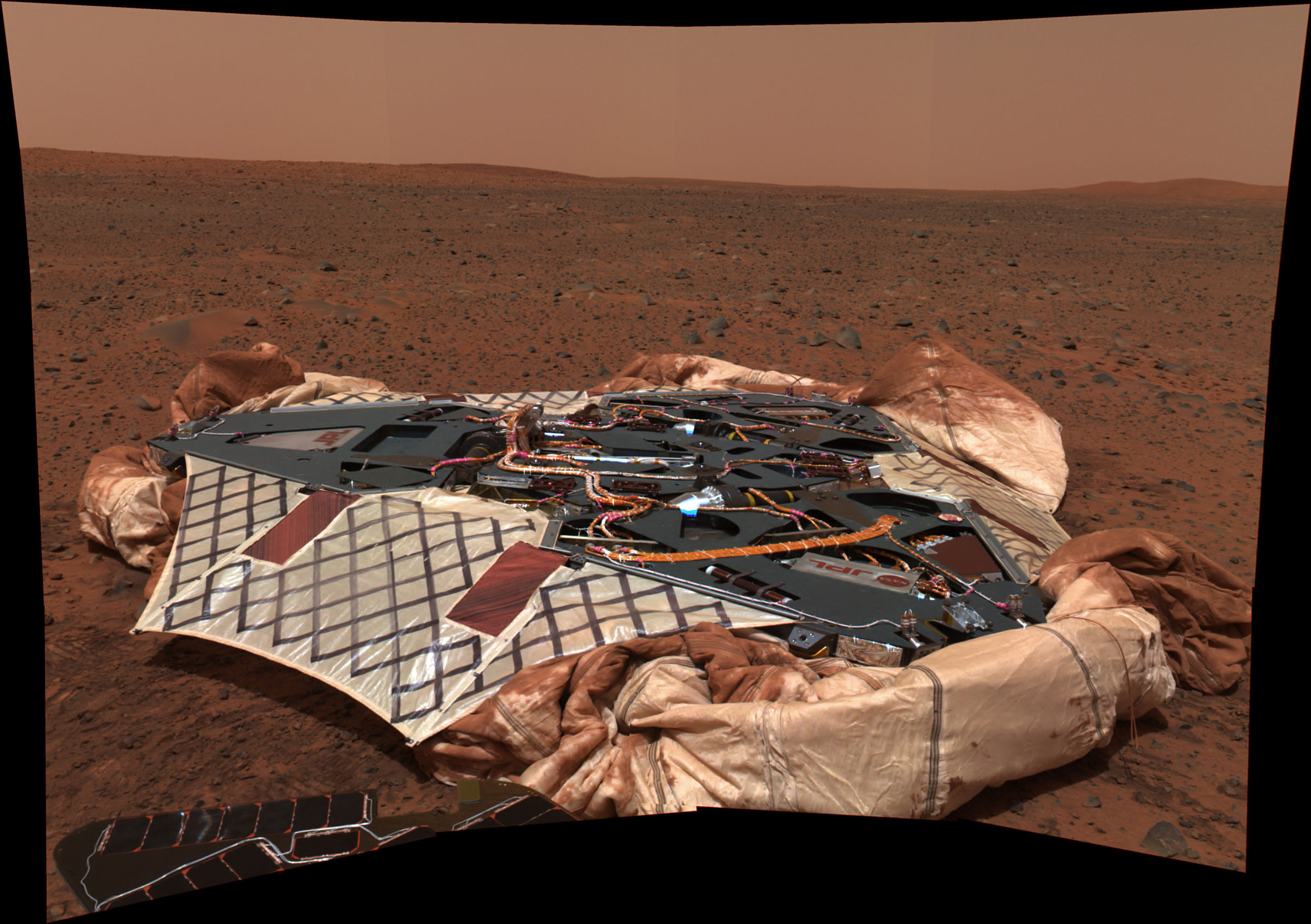
Spirit's lander
Spirit's lander After rolling off its lander onto the surface of Mars, Spirit turned back to capture this 20-frame mosaic of its empty nest on sol 16 (18/19 January 2004). The Red Rover Goes to Mars DVD is visible toward the back of the right-hand lander petal.Image: NASA / JPL-Caltech / Cornell
Opportunity's "Lion King" panorama, sols 58 and 60
Opportunity's "Lion King" panorama, sols 58 and 60 Opportunity took the photos for this panorama -- the largest obtained to date by either rover -- after exiting Eagle Crater on sol 58 (25 March 2004). This panorama depicts a story of exploration including the rover's lander, a thorough examination of the outcrop, a study of the soils at the near-side of the lander, a successful exit from Eagle Crater and finally the rover's next desination, the large crater dubbed "Endurance".Image: NASA / JPL-Caltech / Cornell
Opportunity's first photo from the surface of Mars
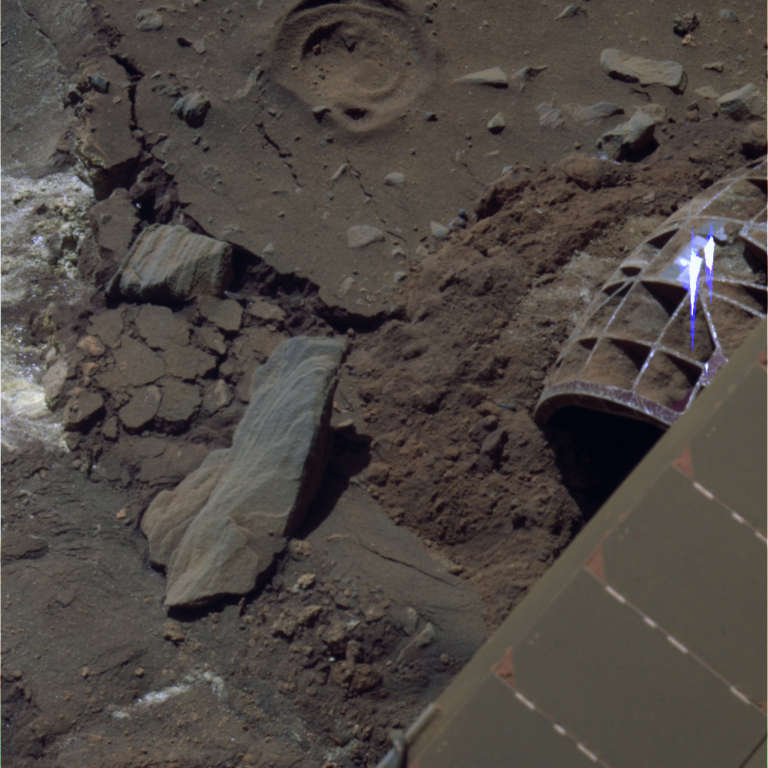
Opportunity's first photo from the surface of Mars This Navcam image was returned by Opportunity shortly after its landing in Meridiani Planum on 25 January 2004. The rover's mast had not yet been deployed, so the Navcams looked down the mast (the cylinder at left), across the pristine solar panels on the deck of the rover, at the wall of Eagle Crater, which contained a bright-colored outcrop of rock.Image: NASA / JPL-Caltech / Emily Lakdawalla
Blueberries at "Stone Mountain," Opportunity sol 14
Blueberries at "Stone Mountain," Opportunity sol 14 When Opportunity examined the soil inside Eagle Crater, the rover spotted strange round pebbles that the rover team referred to as "blueberries" for their relatively blue color (they are actually gray, but that is "bluer" than the red soil) and for the way they appeared dotted around like blueberries in a muffin. This photo is a mosaic of Microscopic Imager images, colorized with lower-resolution Pancam data, from sol 14 (7 February 2004).Image: NASA / JPL-Caltech / USGS / Cornell
Cross-beds at "Overgaard," Opportunity sol 690
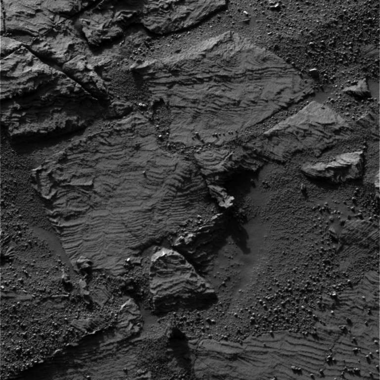
Cross-beds at "Overgaard," Opportunity sol 690 This image shows the best examples yet seen in Meridiani Planum outcrop rocks of well-preserved, fine-scale layering and what geologists call "cross-lamination." Opportunity acquired this image of a rock called "Overgaard" at the edge of Erebus Crater.Image: NASA / JPL-Caltech / Cornell / Emily Lakdawalla
Opportunity panorama at Burns Cliff, sols 287-294
Opportunity panorama at Burns Cliff, sols 287-294 This challenging panorama was taken by Opportunity while the rover was perched on the slope of Burns Cliff. Because it is a wide-angle view, the cliff walls appear to bulge out toward the camera. In reality the walls form a gently curving, continuous surface.Image: NASA / JPL-Caltech / Cornell
Spirit rover tracks at Tyrone, sol 1096
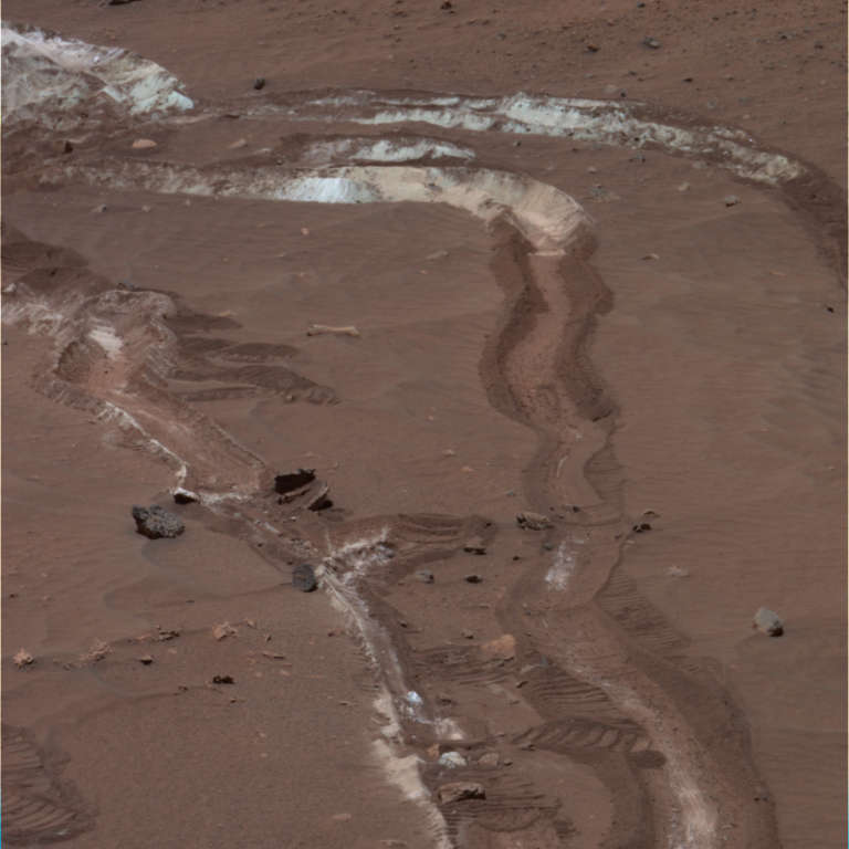
Spirit rover tracks at Tyrone, sol 1096 While dragging a stuck wheel during drives around home plate, Spirit uncovered a strange bright soil at a spot named "Tyrone." The soil was interesting enough that the rover returned to the spot to explore it. This version of the image is from archival science data taken through red, green, and blue filters, so its color is more or less what the human eye would see.Image: NASA / JPL-Caltech / Cornell / Emily Lakdawalla
Spirit's sunset on Mars
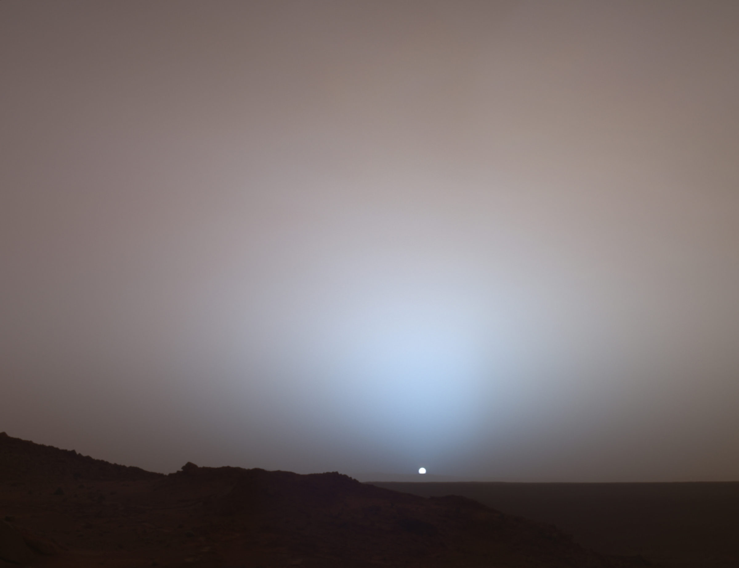
Spirit's sunset on Mars On 19 May 2005, NASA's Mars Exploration Rover Spirit captured this stunning view as the Sun sank below the rim of Gusev crater on Mars.Image: NASA / JPL-Caltech / Cornell / Texas A&M
Spirit at El Dorado dunes, sol 708
Spirit at El Dorado dunes, sol 708 After descending from Husband Hill, Spirit crept to the edge of a dark dune field named El Dorado on sol 708 (30 December 2005).Image: NASA / JPL-Caltech / Cornell / Doug Ellison
A dusty start to Spirit's winter
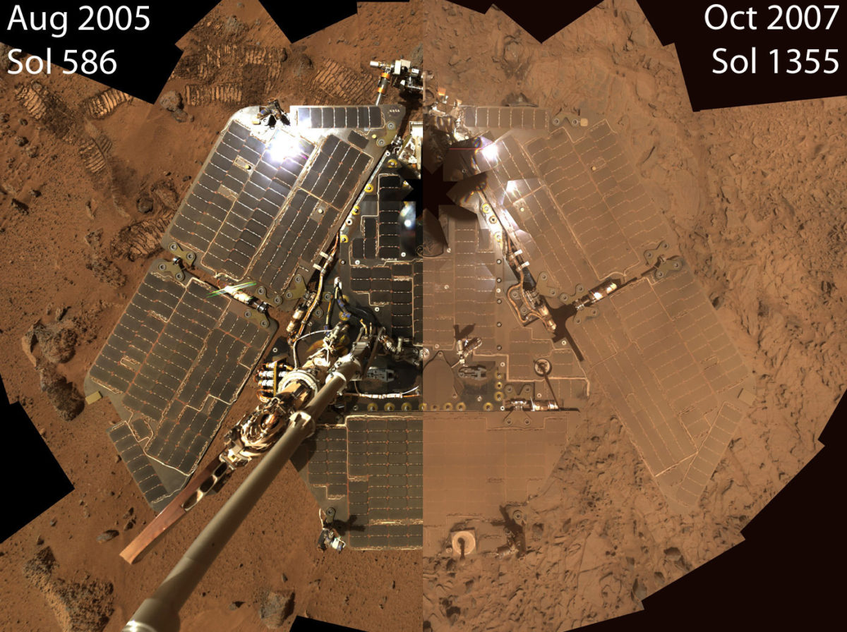
A dusty start to Spirit's winter This image juxtaposes two "deck pans" captured by the Pancam instrument on Spirit at different times in the mission. On the left is the self-portrait from the top of Husband Hill, when Spirit's deck was nearly as clean as the day the rover landed. On the right is a view taken in October of 2007, following the summer's dust storm. Dust from the sky has settled on both the rover deck and the surrounding landscape, coloring the rover the same rust color as the dirt around it. The dust-covered solar cells cannot be able to generate as much power as when they were clean. Spirit survived the following Martian winter despite the high dust levels, and the rover team got very useful practice surviving through periods of very low power during the height of the dust storm. Now, though, even more dust may be falling on Spirit.Image: NASA / JPL-Caltech / Cornell
Cape St. Vincent, Victoria Crater, Opportunity sol 1167
Cape St. Vincent, Victoria Crater, Opportunity sol 1167 This image captured by NASA's Mars Exploration Rover Opportunity shows "Cape St. Vincent," one of the many promontories that jut out from the walls of Victoria Crater, Mars. The material at the top of the promontory consists of loose, jumbled rock, then a bit further down into the crater, abruptly transitions to solid bedrock. This transition point is marked by a bright band of rock, visible around the entire crater. Scientists say this bright band represents what used to be the surface of Mars just before an impact formed Victoria Crater.Image: NASA / JPL-Caltech / Cornell
Late Afternoon Shadows at Endeavour Crater on Mars
Late Afternoon Shadows at Endeavour Crater on Mars Opportunity returned this postcard-perfect shot of her own shadow extending into Endeavour crater on sol 2888 (9 March 2012).Image: NASA / JPL-Caltech / Cornell
Clay coatings on Whitewater Lake rocks at Endeavour's rim, sol 3074
Clay coatings on Whitewater Lake rocks at Endeavour's rim, sol 3074 Unusual dark coatings on rocks at the "Whitewater Lake" outcrop on Endeavour Crater's rim appear to contain clay minerals. Opportunity took this photo on sol 3074 (16 September 2012).Image: NASA / JPL-Caltech / Cornell
Spirit's last color photo, sol 2191
Spirit's last color photo, sol 2191 This is the last color photo returned from Spirit, on sol 2191.Image: NASA / JPL-Caltech / Cornell / Emily Lakdawalla

Finally, here's a super-cool graphical timeline of the Spirit and Opportunity missions, put together by one of the fine members of unmannedspaceflight.com.

Mars Exploration Rover graphical timeline
Mars Exploration Rover graphical timeline A condensed chart showing the operational timelines of both Mars Exploration Rovers. Black lines and ticks denote Earth years and months. Gray bars represent the winter season in Mars' southern hemisphere. Pale blue bars denote Earth-Mars solar conjunction, when communication is difficult. Dark red bars denote the 90-sol prime missions. Bright red bar denotes the serious sandstorm that darkened Mars' sky and impacted the function of instruments on both rovers.Image: Unmannedspaceflight.com user MoreInput

The Planetary Fund

Your support powers our mission to explore worlds, find life, and defend Earth. Give today!

Donate