
 Explore Worlds
 Find Life
 Defend Earth


Bruce Murray Space Image Library
Pluto's badlands
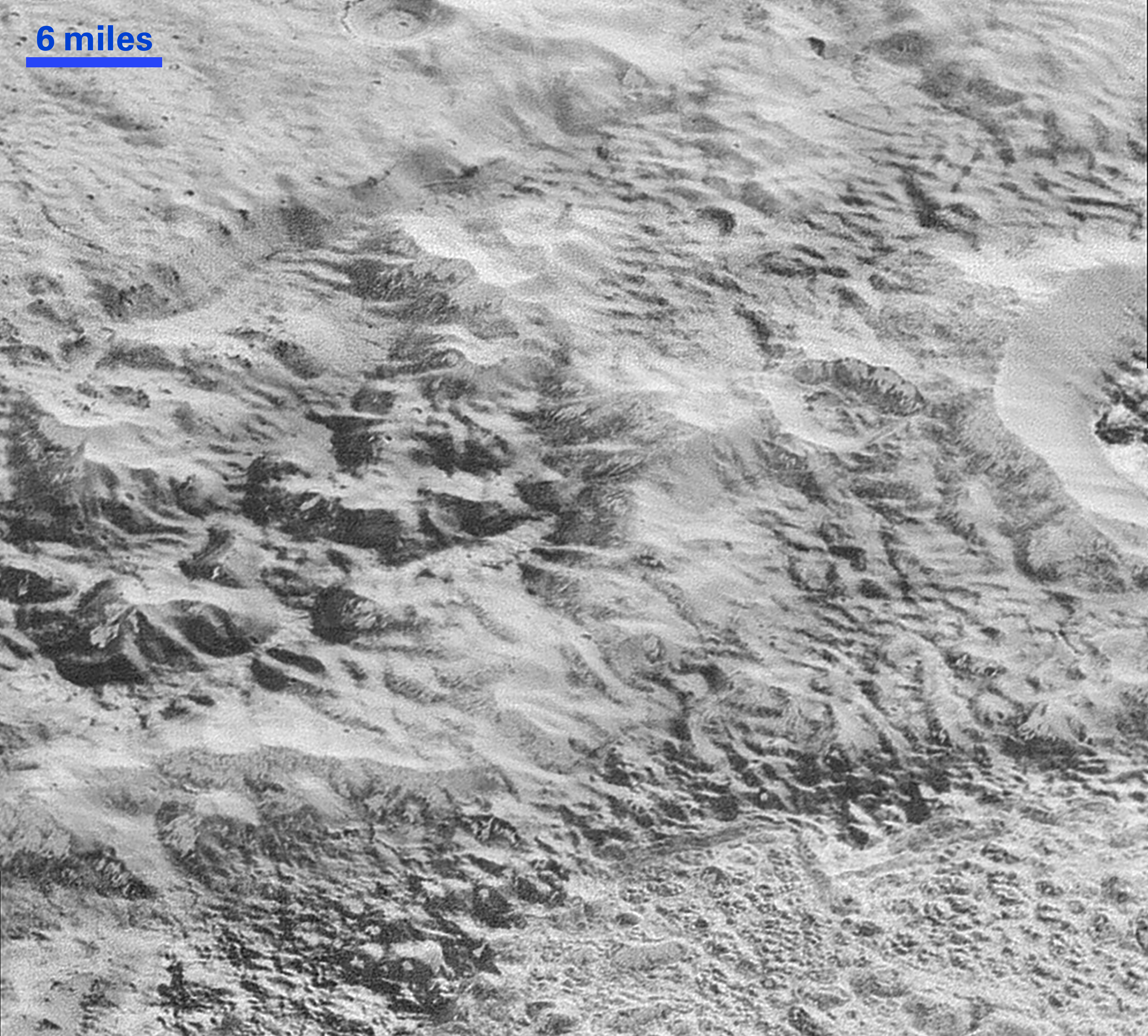
These images were made with the telescopic Long Range Reconnaissance Imager (LORRI) aboard New Horizons, in a timespan of about a minute centered on 11:36 UT on July 14, 2015 – just about 15 minutes before New Horizons’ closest approach to Pluto – from a range of just 17,000 kilometers. They were obtained with an unusual observing mode; instead of working in the usual “point and shoot,” LORRI snapped pictures every three seconds while the Ralph/Multispectral Visual Imaging Camera (MVIC) aboard New Horizons was scanning the surface. This mode requires unusually short exposures to avoid blurring the images.