Emily Lakdawalla • Sep 16, 2011
Video: Zooming around Vesta
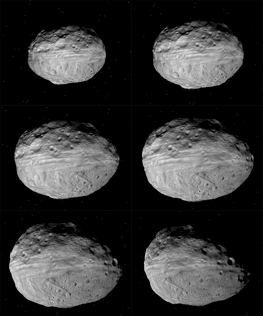
The Dawn team released today a nice little video that flies around a shape model of Vesta produced by DLR, the German Aerospace Corporation, who built and operate Dawn's camera. What's a shape model? It describes Vesta's topography -- every lump and bump visible at the resolution obtainable from Dawn's high-altitude mapping orbit. The link goes to a narrated video; below is an animated GIF version. For some reason I couldn't get the video to embed properly in this blog entry.

What's a shape model good for, besides making pretty videos? It's actually quite important. When we explore planets, we can do a reasonably good approximation of mapping what we see and making global maps from orbital images by assuming that the planet is spherical or a bit oblate (fatter at the equator than at the poles). But Vesta is way too lumpy for that to work very well. In order to accurately map things on Vesta, we need to know a lot more about local topography -- where it's high, and where it's low. Every image that Dawn takes of Vesta will have quite a lot of geometric distortion due to the distorted shape of Vesta's surface. So making a shape model that will help the science team disentangle the effects of foreshortening from the geographic positions of features was a really high priority for the team to accomplish early.
Another priority that the shape model will help with: defining a system of longitude and latitude. We haven't been able to see Vesta well enough before Dawn got there to precisely define a coordinate system to use to measure the locations of things on its surface. That's another early accomplishment of Dawn: producing the first map of high enough resolution to permit global mapping to proceed. The imaging and mapping of Vesta has allowed the team to determine the precise position of the asteroid's rotation axis, which then automatically determines the location of lines of latitude.
Longitude is different -- the choice of the prime meridian (zero longitude) is an arbitrary one that must be defined by picking some point of reference on the surface. The press release issued along with this video states that "The zero-longitude, or prime meridian, of Vesta was defined by the science team using a tiny crater about 1,640 feet (500 meters) in diameter, which they named 'Claudia,' after a Roman woman during the second century B.C. Dawn's craters will be named after the vestal virgins -- the priestesses of the goddess Vesta, and famous Roman women, while other features will be named for festivals and towns of that era." I can't find an image anywhere yet that shows me which crater Claudia is. EDIT: Here's an image of Claudia.
I've received several emails that have expressed impatience with the lack of scientific interpretation coming out of the mission. While I'm with you guys on wishing they'd do raw image releases, I am actually in no hurry to hear scientific interpretation, because anything any scientist guesses right now is almost certainly going to turn out to be wrong later. When a new mission arrives to Mars or even Jupiter, everything that we see can be placed into a preexisting context of scientific interpretation based on past missions. For Vesta, there is no context. Not only have we never seen Vesta up close before, we've never seen anything like Vesta up close before. This is a whole new kind of world, and the team is only now getting their base map together on which they can start placing their observations. So the science is going to take some time -- be patient! We should get some preliminary impressions from the team in a couple of weeks, at the Division of Planetary Sciences meeting in Nantes, which I'll be attending. So stay tuned.
EDIT: This was just one of a veritable bounty of image releases today, including a global map (both gridded and non-gridded), a south polar map, a cool false-color photo (I do intend to explain these false-color photos eventually, when I can make time), and one that points out that a peak near Vesta's south pole is among the tallest known mountains in the solar system, relative to the datum.
The Time is Now.
As a Planetary Defender, you’re part of our mission to decrease the risk of Earth being hit by an asteroid or comet.
Donate Today

 Explore Worlds
 Find Life
 Defend Earth

