
 Explore Worlds
 Find Life
 Defend Earth


Pretty (Partial) Picture: LightSail Catches a Glimpse of Earth

Written by
Jason Davis
June 10, 2015
Following yesterday's download of LightSail's first sails-out image, the spacecraft team spent Wednesday trying to retrieve a second image from the CubeSat's flight software. While having the first image is nice, a second would be nicer, especially if it comes from the opposite-facing camera. The team would very much like to get a complete, 360-degree view of the sails if possible, before LightSail tumbles back into Earth's atmosphere. Now that the sails are out, the spacecraft's orbit has started to decay quickly. Early estimates show a reentry date of Sunday, June 14.
Communications with LightSail have become more erratic since sail deployment on June 7. The spacecraft is still tumbling—albeit much more slowly than it was in CubeSat form—and on many ground station passes Cal Poly engineers report the connection is sluggish. On Wednesday's last two overflights, no usable data were returned.
An image from the opposite-side camera has almost finished downloading, but it has yet to compile into anything more than a vacant, all-grey scene. This morning, we crowdsourced the problem in hopes the imaging community might be able to help. So far, no one has had any luck. The team must soon decide whether or not to give up and capture fresh images with the second camera, and kick off a new download.
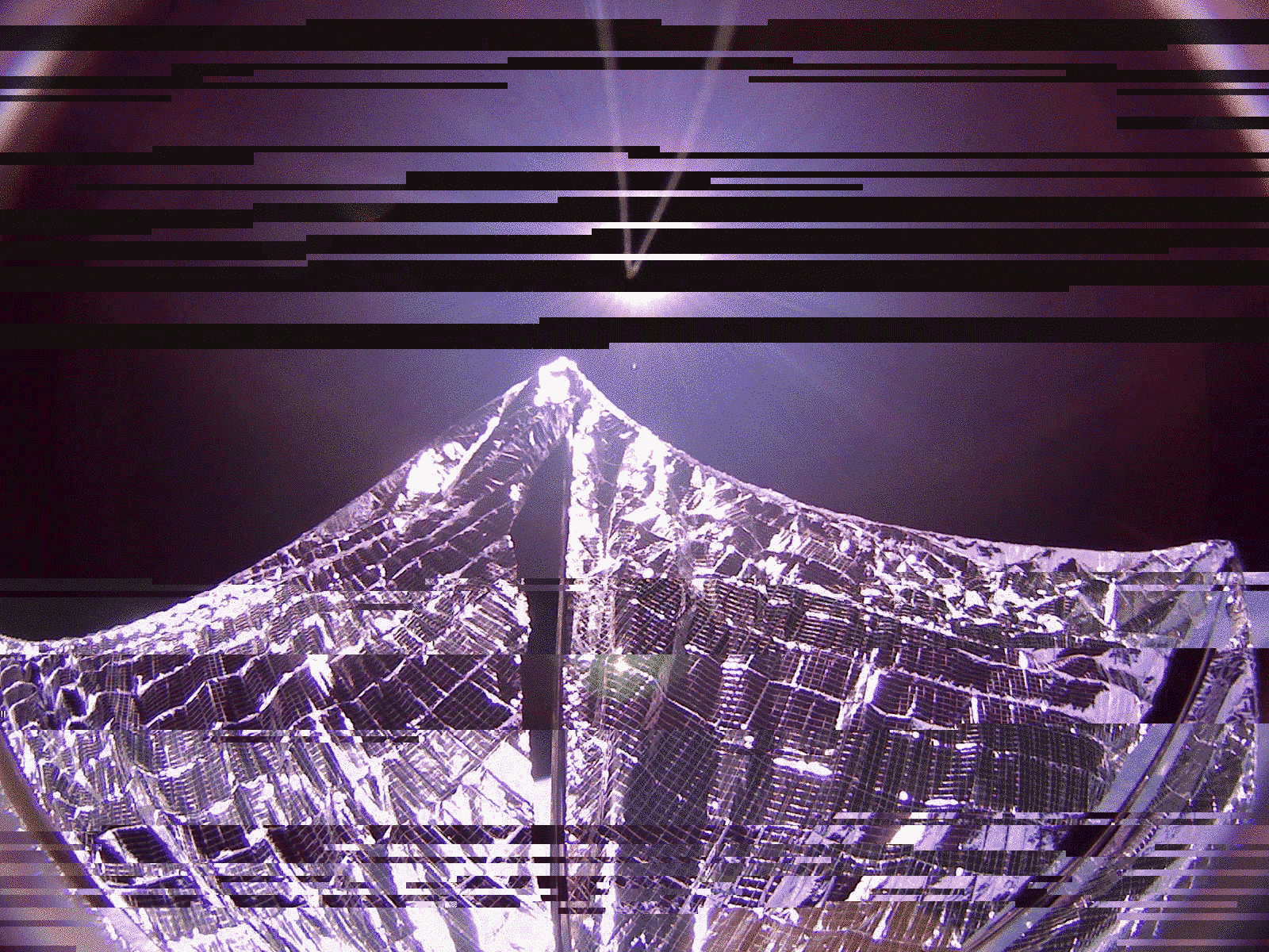
In the meantime, there is also a partial second image that was captured with Camera 0—the same camera responsible for the full sails-out image. On a telecon today, Cal Poly engineer Justin Foley pointed out the partial, scrambled image might contain a slice of Earth, which had rotated into the frame during the imaging sequence. At The Planetary Society, Emily Lakdawalla processed the image, and here is the result.
The partial image shows Earth peeking through gaps next to LightSail's metallic, 4-meter sail booms. At the time the image sequence began June 8, LightSail was over Pooley Island on the coast of British Columbia, 330 miles (530 kilometers) northwest of Vancouver.

Protect Our Shared Future
You help us defend humanity and prevent asteroid impacts. Donate now to become a Planetary Defender!
Donate