
 Explore Worlds
 Find Life
 Defend Earth


The official publication on the second Titan RADAR swath is out
Written by
Emily Lakdawalla
June 7, 2006
Today Nature published an article titled "Titan Radar Mapper observations from Cassini's T3 fly-by." For those of you who have been following the Cassini mission closely, this might seem like surprisingly old news; the "T3" flyby is the one that happened on February 18, 2005 -- 16 months ago! -- and the data from that flyby was already released to the Planetary Data System earlier this year, fair game for all scientists to look at and study. But it is the first description in peer-reviewed literature of this important swath of RADAR data, the second one from Cassini, which contains the first two unambiguous craters identified on the surface of Titan, as well as fields of cat scratches and some interesting fluvial features.
The lengthy publication time made me curious about how long it took for the first official publication to come out on the first "Ta" RADAR swath. That one was in Science, titled "Cassini Radar Views the Surface of Titan," and it came out on May 13, 2005, a little more than 6 months after the October 26, 2004 flyby. I am sure that there is a story behind the lengthy publication delay—but the story may turn out to be no more than the fact that the people who have to write the paper also have an active mission to plan, not to mention an extended mission, and they may just not have had the time to write the publication. That scenario is one that plays out a lot on these active missions. It's worse for the Mars Exploration Rover folks, who can't plan their mission as far ahead as the Cassini team can. The rover team pretty much has to work on planning activities every single week; that makes it terribly difficult to get any writing done. The scientists love their long-lived rovers—but I'll bet that more than one of the team members will feel a kind of guilty relief once the rovers have passed on and stopped sending back so much wonderful new data.
Anyway, getting back to the RADAR team publications...first, as a reminder, here's what those two swaths look like. To see them in greater detail, check out the page I put together on all the Cassini RADAR data released to date.


I think it's interesting to compare the opening remarks from the publications about the two swaths.
From "Cassini Radar Views the Surface of Titan," May 13, 2005
The images reveal a complex surface, with areas of low relief and a variety of geologic features suggestive of dome-like volcanic constructs, flows, and sinuous channels. The surface appears to be young, with few impact craters.
From "Titan Radar Mapper observations from Cassini's T3 fly-by," June 7, 2006
These data provide the first definitive identification of impact craters on the surface of Titan, networks of fluvial channels and surficial dark streaks that may be longitudinal dunes. Here we describe this great diversity of landforms. We conclude that much of the surface thus far imaged by radar of the haze-shrouded Titan is very young, with persistent geologic activity.
The language in the first publication sounds much more tentative—"appears to be"—than the second one—"We conclude that..." Titan geology, while still a field in its infancy, has matured a great deal in the year that separates these two publications.
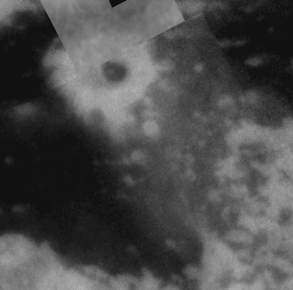
Here are some of the thought-provoking statements from this latest publication. With regard to the smaller of the two craters, Sinlap, the team notes that it "shows no evidence of a raised rim. Craters of this diameter on Ganymede have domed floors, probably due to viscous relaxation, and central pits. There is no indication of such features in Sinlap...the floor seems flat, similar to lava-flooded craters on the Moon or to craters with smooth deposits on Mars." They compare Sinlap to Ganymede craters because Ganymede is a very similar body to Titan -- it's a similar-sized icy satellite. But unlike Ganymede and more like the Moon and Mars, they are saying, Titan has had some pretty extensive modification of its surface, in this case by some process that can fill a crater floor, either volcanism or some kind of fluvial or wind activity.
Here's an interesting paragraph: "We have not detected significant numbers of craters with diameters between 20 and 100 km. If Titan's cratering rate is similar to Rhea's, more than 200 craters larger than 20 km in diameter should have formed in the ~2% of the surface sampled using SAR...they have been erased...it is possible that viscous relaxation made most such craters extremely shallow, and these were subsequently buried." In other words, Titan, being icy, might have very shallow craters, because solid ice will behave as a fluid over time and seek its own level, doming up the floors of craters and making them shallower. This doesn't happen much on rocky planets like Mars or the Moon (except to the biggest of craters), but if you look at the icy moons of Jupiter and Saturn you'll see that their craters are all very flat. (Check out Tethys, Rhea, and Dione, for example.) Shallow craters are easier to fill than deeper ones. Therefore, Titan might more easily obliterate its craters than Mars does.
But there are plenty of mysteries left to solve. For example, "we do not fully understand the relative contributions to SAR brightness from surface roughness, surface topography, material composition, and/or volume scattering." This is interesting, because an awful lot of conclusions are being drawn from the study of the shapes of things that are clearly visible in the RADAR swaths in the patterns of brighter pixels and darker pixels -- but the instrument team still can't tell us exactly why some things look brighter than others. For another example, "We are not satisfied that the modeling of the current data establishes meaningful bounds on key physical quantities."
Also somewhat mysterious is the fact that the paper doesn't mention the altimetric data at all. The RADAR instrument gathers altimetric data on each end of nearly every SAR swath. The fact that it's not published here likely means that something is making it hard for them to make sense of the data. I am very curious about that story!
Finally, they conclude, "The striking difference in overall appearance of the two swaths...emphasizes the diverse nature of Titan's surface and provides justification for the expectation of entirely new surface landforms yet to be detected in additional SAR images and other radar data." In other words, every RADAR flyby of Titan should show us something new!
Protect Our Shared Future
You help us defend humanity and prevent asteroid impacts. Donate now to become a Planetary Defender!
Donate