
 Explore Worlds
 Find Life
 Defend Earth


Bruce Murray Space Image Library
The surface of Venus from the Parker Solar Probe
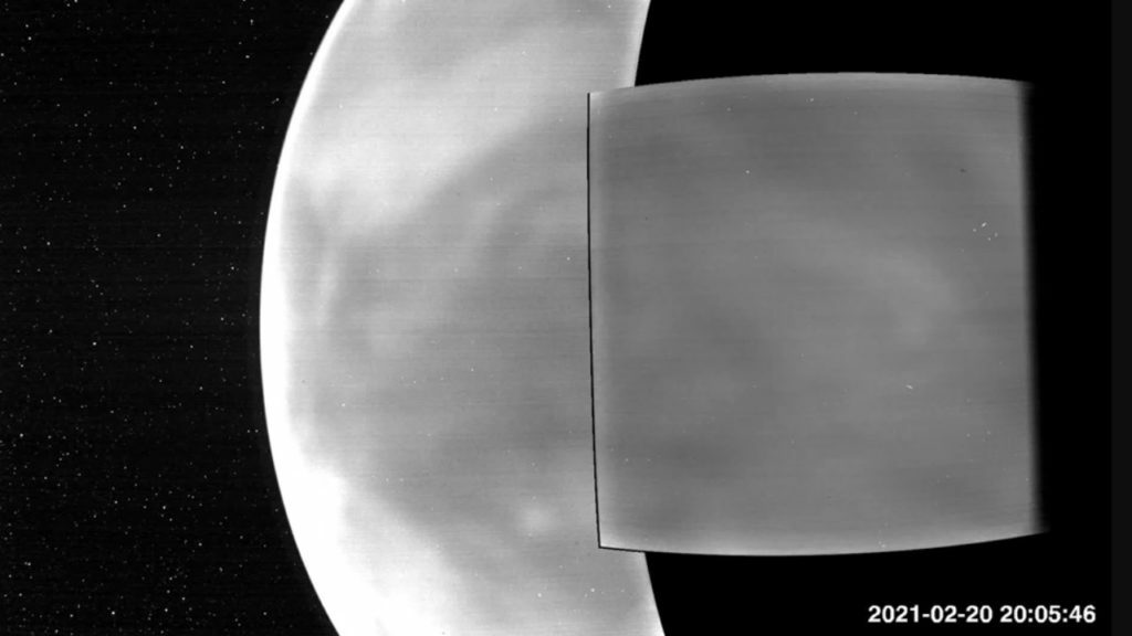
Smothered in thick clouds, Venus’ surface is usually shrouded from sight. But in two recent flybys of the planet, the Parker Solar Probe used its Wide-Field Imager, or WISPR, to image the entire nightside in wavelengths of the visible spectrum – the type of light that the human eye can see – and extending into the near-infrared.
The images, which include this one, reveal a faint glow from the surface that shows distinctive features like continental regions, plains, and plateaus. This glow comes from the sheer temperature of the rocky surface.
In 1975, the Venera 9 lander sent the first tantalizing glimpses of the surface after landing on Venus. Since then, Venus’ surface has been revealed further with radar and infrared instruments, which can peer through the thick clouds by using wavelengths of light invisible to the human eye. NASA’s Magellan mission created the first maps in the 1990s using radar and JAXA’s Akatsuki spacecraft gathered infrared images after reaching orbit around Venus in 2016. The new images from Parker add to these findings by extending the observations to red wavelengths at the edge of what we can see.
The WISPR images show features on the Venusian surface, such as the continental region Aphrodite Terra, the Tellus Regio plateau, and the Aino Planitia plains. Since higher altitude regions are about 85 degrees Fahrenheit cooler than lower areas, they show up as dark patches amidst the brighter lowlands. These features can also be seen in previous radar images, such as those taken by Magellan.