
 Explore Worlds
 Find Life
 Defend Earth


Mars Exploration Rovers Update: Spirit Finds "Explosive" Evidence of Past Water, Opportunity Revs Up, Revisits Cape of Good Hope

Written by
A.J.S. Rayl
Contributing Editor, The Planetary Society
May 31, 2007
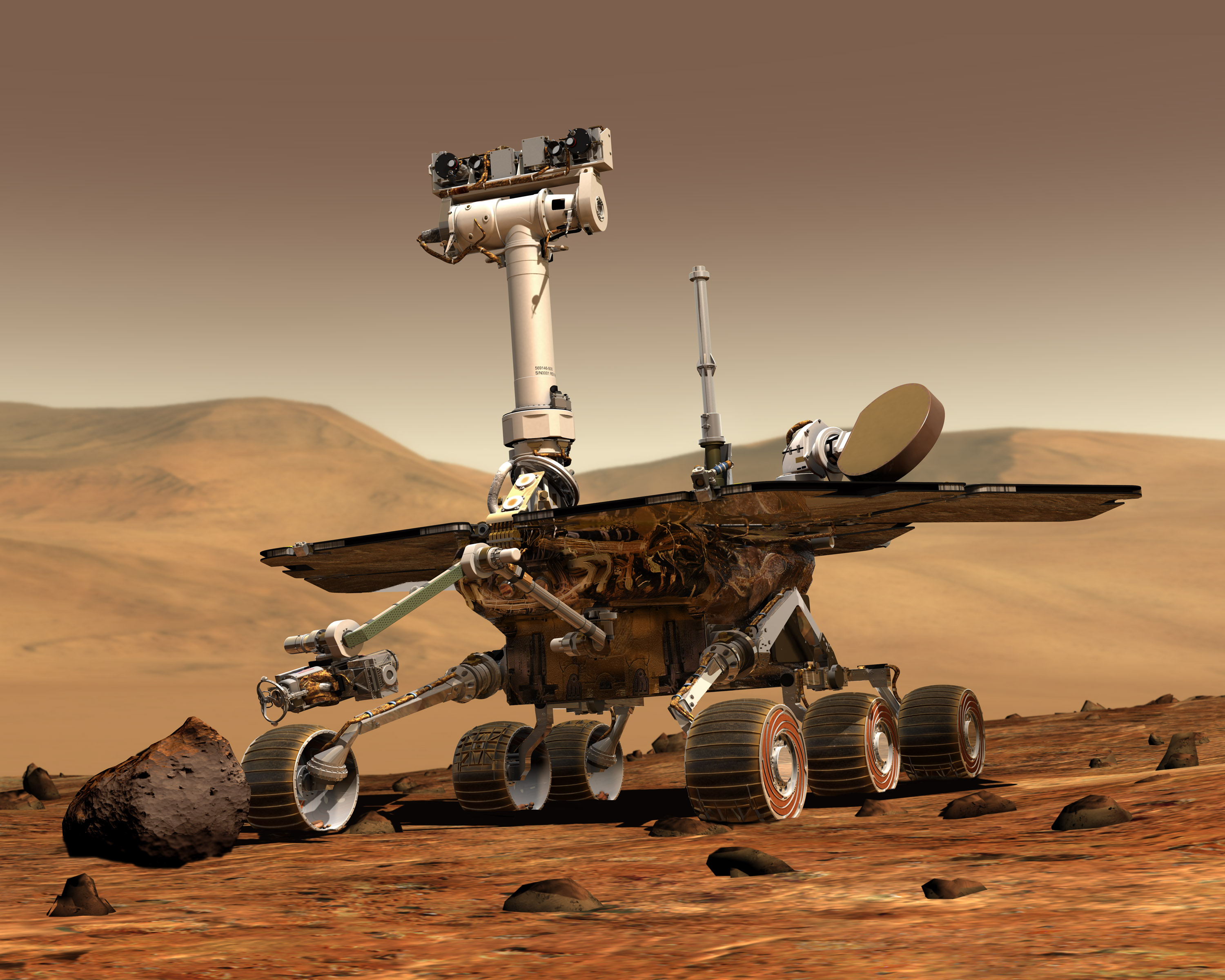 Mars Exploration Rover
Credit: NASA / JPL / Maas
The Mars Exploration Rovers sent home field reports this past month -- some 1,200 days into their missions -- that drew gasps of amazement from both the science and engineering teams.
Spirit roved back into the spotlight on May 3 when NASA and the Mars Exploration Rover (MER) science team announced that the rover discovered evidence of an ancient volcanic explosion at Home Plate, the 2-meter (6-foot) plateau within the Inner Basin of the Columbia Hills at Gusev Crater that it's been studying for the last coupe of months. Team members have been talking about the circular plateau of layered bedrock being an eroded-over volcano or remnant of some volcanic activity for weeks now and publication of their report in the Science made their hypothesis official. This is the first explosive volcanic deposit identified on the mission with what scientists deem "a high degree of confidence." But that's not all.
Last week, Spirit revisited a patch of Martian soil that turned out to be so rich in silica it may provide some of the strongest evidence yet that ancient Mars was much wetter than it is now. "This was a thrill," Steve Squyres of Cornell University, principal investigator for the rovers' science instruments, said during an interview yesterday. "This immediately becomes one of our Top 10 discoveries, maybe in our Top 5 discoveries and it comes 1200 sols in. And it makes you wonder what else is out there."
Silica commonly occurs on Earth as the crystalline mineral quartz and is the main ingredient in window glass. The Martian silica, found in a target named Gertrude Weise, is non-crystalline, with no detectable quartz.
However ironically, Spirit's discovery happened because of its broken right front wheel, one of the very few real failures on the mission to date. "We wouldn't have found this if the bad wheel hadn't been bad," said Squyres. Since that wheel no longer rotates, Spirit typically drives backward, excavating a deep track or trench as the lame wheel drags through soil. At different points along the way, those trenches have churned up several patches of bright soil. But no one really expected this recent, serendipitous find of silica soil.
"The kind of evolving understanding that we're sitting on the eastern flank of an eroded down explosive volcano where the explosions were charged with magma interacting with groundwater is a pretty neat kind of revelation," added Ray Arvidson, of Washington University, St. Louis, deputy principal investigator for the rover's science instruments, who has been overseeing the science planning for Spirit of late. "We have a story coming together here -- finally."
 Gertrude Weise/Kenosha Comets
Spirit took the false color image of the 90% silica at Gertrude Weise's Kenosha Comets with the panoramic camera (Pancam) on Sol 1198 (May 17, 2007). Jim Bell, principal investigator for the Pancam, chose this as one of his favorite images from the Gusev Crater landing site this month. Credit: NASA / JPL-Caltech / Cornell
Spirit is currently beginning its climb to the top of Home Plate. It will take its time, Arvidson said, to check out the distinctive layers in the plateau walls in an attempt to characterize the depth of these silica-rich deposits. The rover's continued exploration will now focus largely on proving that water was involved in its formation process.
On the other side of the planet, Opportunity spent the month of May following the plan laid out late last month, roving back along the rim of Victoria Crater toward its start point, Duck Bay, checking out more of its new drive software as it went. After finishing its northeast tour of the rim at Tierra del Fuego -- the end of the line -- at the end of April, Opportunity literally bounded into the month with newfound energy. As this rover's luck would have it, three dust-cleaning events in late April caused the peak electrical current from this rover's solar arrays to climb above 4.0 amps and levels not seen since early in the mission. So the rover hit the rim road energized and ready to begin what may be the most challenging part of its journey.
After completing a checkout on its new autonomous driving, hazard avoidance software early in the month, Opportunity drove to the southeastern edge at the Cape of Good Hope and took the planned set of super high-resolution pictures of the cross-bedding at Cape St. Vincent, then continued on. It is currently on the long drive back to Cape Verde where it will get another set of super high-resolution images of Cape St. Mary, which, like Cape St. Vincent boasted the most impressive cross-bedding the rover found. At that point, Opportunity and the MER team will be ready for Duck Bay and -- if NASA headquarters approves -- entry into the big hole in the ground.
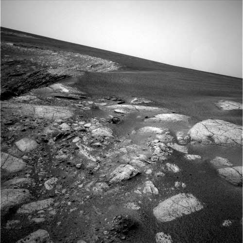
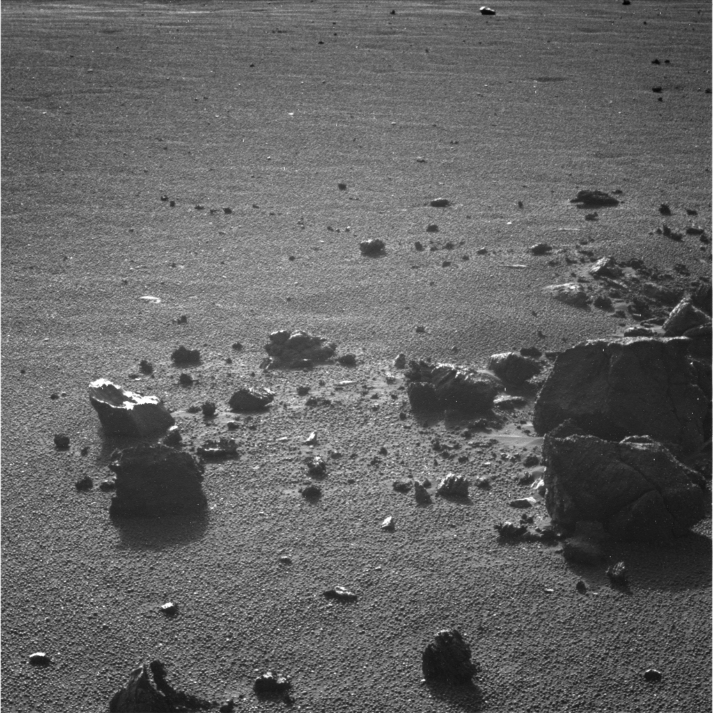 Looking into May
Opportunity used the Pancam to take this artsy black & white view of some blocky impact debris from the small crater Granada in the plains north of Victoria, on Sol 1161 (April 30, 2007), just before roving into May.Credit: NASA / JPL-Caltech / Cornell
Beyond the stunning new science and feats of performance they returned in May, the twin robot field geologists continued to stream down one spectacular, jaw-dropping, Martin image after another from the panoramic camera (Pancam). "The adventure -- and beauty of the imaging -- never ends," wrote Jim Bell, author of Postcards from Mars: The First Photographer on the Red Planet (Dutton, 2006) in a kind of e-postcard to The Planetary Society. The Cornell University professor of astronomy is the principal investigator of the Pancam.
Through it all, Spirit and Opportunity have remained in good health with all instruments continuing to defy the odds, reported Bruce W. Banerdt, MER Project Scientist at the Jet Propulsion Laboratory (JPL) where the rovers are being managed. "There have been no new problems or injuries and both rovers are doing well," he said.
As spring settles on the southern hemisphere of Mars, the tau is dropping a little bit -- meaning the atmosphere is clearing of dust -- and both rovers are getting enough sunlight to power their batteries. While Spirit is faring well with an output of 450 watt-hours, Opportunity set a new power record for this late in the mission of more than 850 watt-hours. There were no significant Martian dust storms and nothing in the immediate forecast, insofar as weather n Mars can be forecast. The weather has been pretty benign this past month," Banerdt confirmed.
Spirit From Gusev Crater
After finishing work at Madeline English completing a Mössbauer study of a knobby rock called GoodQuestion at the end of April, Spirit turned around and headed back to the northeastern side of Home Plate. The science team decided to head up onto Home Plate sooner rather than later and decided to take the accidental onramp it found there some weeks ago.
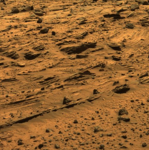
 Spirit's view of Home Plate Sol 746
Spirit discovered Home Plate, which the MER science team now believes is the remnant of volcanic activity, looked more like the layered rocks of Opportunity's landing site than anything it had previously encountered at Gusev.Credit: NASA / JPL / Cornell / Tesheiner
The rover logged a busy first day in May, recording a movie in search of dust devils with the navigation camera (NavCam), checking out a light-toned patch of churned-up soil dubbed Gertrude Weise from a distance with the miniature thermal emission spectrometer (Mini-TES), and then driving 1.9 meters (6.2 feet) to the target north of Elizabeth Mahon and on the way to its onramp onto the circular plateau.
Throughout May, Spirit balanced its geology agenda with daily atmospheric studies as it has been throughout the mission, monitoring dust levels with the Pancam, surveying the sky and ground with the Mini-TES, as well as periodically searching for clouds with the NavCam and monitoring dust on its mast.
On Sol 1183 (May 2, 2007), the rover again surveyed Gertrude Weise with the Mini-TES and later used the instrument to determine the mineral make-up of targets dubbed Philomena Zale, Alma Ziegler, and Ruth Heverly, each named, like Gertrude, in honor of former star players in the All American Girls Professional Baseball League. The rover also acquired more full-color Pancam images of GoodQuestion and super-resolution images of another target called Fern Shollenberger.
On the following sol, Spirit watched again for dust devils in the morning and checked for drift (changes over time) in the Mini-TES, then drove 6.7 meters (22 feet) to another target called White Soil en route to Gertrude Weise.
MER science team member Steve Ruff of Arizona State University (ASU) proposed using the Mini-TES to observe Gertrude last month. The rover had actually exposed the soil when it dragged its bad right wheel over it on Sol 1150 (March 29, 2007). The Mini-TES provides mineral composition information about targets viewed from a distance and the indications it found for silica in the churned-up soil prompted Ruff who prompted the team to direct Spirit close enough to touch the soil with the APXS. "We've looked at dozens of disturbed soil targets in the rover tracks, and this is the first one that shows a high silica signature," said Ruff.
"Not only did he say, 'Hey -- this looks different,'" recalled Squyres, smiling. "He said, 'You guys got to go check this out. It's got silica in it. You have to go check this out. Everybody goes -- 'Ohhhh, okkkaaay.'"
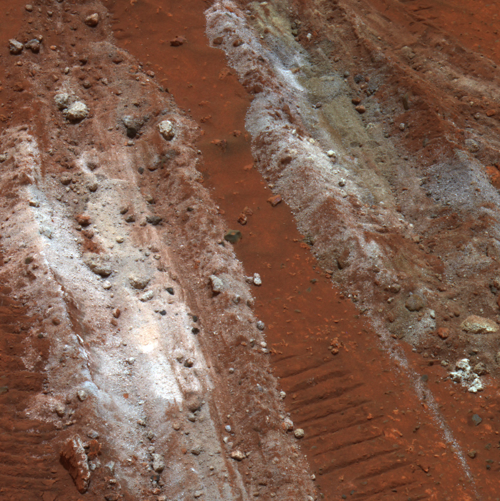
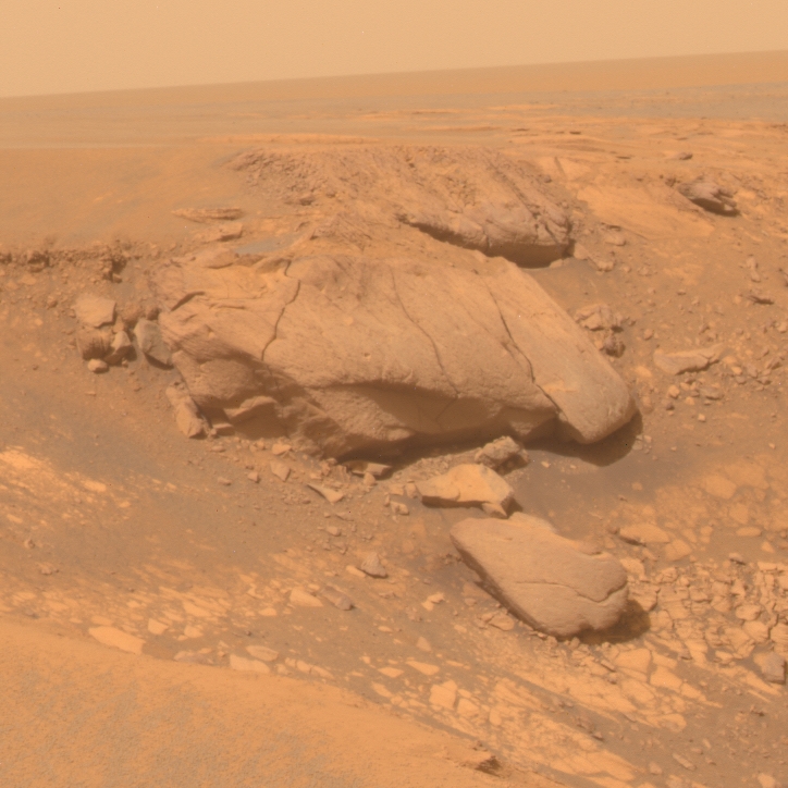
 Silica Valley girl
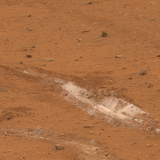
Spirit churned up the patch of bright-toned, silica-rich soil dubbed Gertrude Weise back on Sol 1150 (March 29, 2007). Most of the patches of disturbed, bright soil that this rover has previously uncovered are rich in sulfur, but this one -- roughly 20 centimeters (8 inches) wide -- has very little sulfur and is about 90% silica. The rover took this approximately true-color image with its panoramic camera on Sol 1158 (April 6, 2007). Credit: NASA / JPL-Caltech / Cornell
"Most of the science team thought, 'Oh, this is another right-toned Paso Robles-like (sulfate) target,'" added geochemist Albert Yen, of the Jet Propulsion Laboratory (JPL), who works with the APXS. "But then we got the hint that this was going to be something a little bit different because the Mini-TES saw a high silica signature that had also been seen in other rocks nearby."
As Spirit headed for Gertrude Weise, down on Earth, NASA and the MER team made their Home Plate hypothesis official: this 2-meter (6-foot) tall circular plateau and other features in the area are remnants of an ancient volcanic explosion or perhaps volcanic explosions. In its report in the May 4 issue of Science, Squyres and colleagues revealed the evidence that shows the area near Home Plate is dominated by basaltic rocks.
"When basalt erupts, it often does so as very fluid lava, rather than erupting explosively," Squyres said. "One way for basaltic lava to cause an explosion is for it to come into contact with water. It's the pressure from the steam that causes it to go boom. When you look at composition of the rocks in detail, there are hints that water may have been involved." One example is the high chlorine content of the rocks, which might indicate that basalt had come into contact with a brine. One of the strongest pieces of evidence for an explosive origin for Home Plate is a "bomb sag" preserved in layered rocks on the lower slopes of the plateau. On Earth, bomb sags form in volcanic explosions when rocks ejected skyward by the explosion fall into soft deposits, deforming them as they land."
It may well be that he volcano or volcanoes in the area were dramatically dynamic. "We've actually been carrying several hypotheses for the structures in the Inner Basin in the Columbia Hills, including Home Plate," Arvidson said. "One is that they are part of a regional depositional unit of ill-defined origin. Another is Home Plate and perhaps its buddies nearby are a suite of volcanic explosives. The third is we're looking at various impact deposits."
Since leaving Low Ridge last November, its haven during the last Martian winter, Spirit has been driving up and down this little valley in between Mitcheltree Ridge and Home Plate proper and looking at these layers. "What strikes me is the very, very high degree of variance or difference in the composition, the mineralogy and the textures as we've been exploring the layers on the eastern part of Home Plate," said Arvidson. "In some places within that eastern valley, we found what we call lapilli, then the outcrops right on the periphery of Home Plate on the eastern and northeastern side have this massive cross-bedding and this structure we call cut and fill, where high velocity sediment-charged fluids came by and cut and then the material filled in," he pointed out.
"The variety of chemistry and mineralogy and texture suggests that we're looking at an explosive volcano that put down many, many different units, and the processes that led to the explosion varied as a function of time," Arvison continued. "Sometimes there was deposition of high silica deposits and sometimes lapilli. It's possible the Tyrone sulfate deposits also represent volcanic exhalations from Home Plate and whatever other volcanoes were in the Inner Basin actively spewing things out," he suggested. "It's all making sense now."
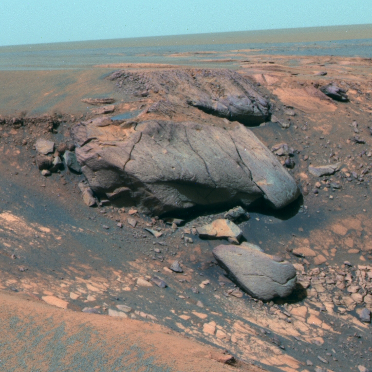
 Gertrude Weise
The silica-rich soil patch was found by Spirit in Gusev Crater after spending months working within 50 yards of the spot. Scientists believe that the high concentration of silica -- 90%-- is strong evidence for the presence of water on ancient Mars. Credit: NASA/JPL/Cornell
That is all in contrast obviously to an impact where one would expect that single event to massively jumble things together. "Instead, we have this exquisitely defined stratigraphy exposed, which we think shows variations in the nature and degree of explosiveness," said Arvidson.
Spirit continued its fieldwork as the month progressed, watching for dust devils, completing a systematic foreground study with the Mini-TES, acquiring NavCam images in support of observations with the Mini-TES, and conducting a study of atmospheric argon using the alpha-particle X-ray spectrometer (APXS) on Sol 1185 (May 4, 2007). The following sol, the rover snapped some full-color Pancam pictures of a target called Kathryn Beare and studied Kathryn Beare and targets known as GertrudeWeise2 and Janice Ohara with the Mini-TES.
After acquiring more full-color Pancam images of Gertrude Weise on Sol 1187 (May 6, 2007), Spirit drove 5 meters (16 feet) in its final approach to the now much-anticipated soil target. There, it autonomously placed the microscopic imager (MI) on the patch and took some more images, including a 360-degree panorama of the terrain with the NavCam and a mosaic of images with the Pancam. And on the seventh day, Spirit rested, spending the afternoon recharging its battery with energy from its solar array, after taking thumbnail images of the sky with the Pancam.
Spirit began the second week of May on Sol 1189 searching again for dust devils with the NavCam and beginning what would be a two-week analysis Gertrude Weise and a specific target there called Kenosha Comets [after the team for which Weise played]. On this particular sol, the rover collected close-up pictures with the Microscopic Imager (MI) and placed the APXS on the target, and also acquired mineralogical data from targets known as Virginia Bell and Nancy Warren with the Mini-TES.
For the next week or so, Spirit continued it close-up examination of Kenosha Comets using all of the instruments on the instrument deployment device (IDD). After acquiring a full-color panorama of Virginia Bell with the Pancam on Sol 1190 (May 9, 2007), the rover switched tools from the APXS to the Mössbauer spectrometer to begin the final analysis of its composition. During the ensuing sols, when the rover wasn't working on Kenosha Comets, it was taking full color Pancam images of such targets as Muriel Bevis and Marie Wegman, which it also analyzed with the Mini-TES, and taking images of the horizon and a low Sun survey of McCool Hill.
When the data from Gertrude Weise was in and the analysis done, the MER science team was stunned by the results. During a recent teleconference mid-month, members of the MER science team listened as a colleague told them that the APXS, a chemical analyzer at the end of Spirit's arm, had measured Gertrude's composition to be in the neighborhood of 90% pure silica. "And almost all of the rest of it is the results of contamination of nearby soil," noted Yen. Combined with mineralogical findings of the MINI-TES, its composition was unequivocally confirmed.
"You could hear people gasp in astonishment," said Squyres. Considering the staggering amount of silica, the soil seemingly had to be formed by processes that require the presence of water. "I don't know of any way in which you can concentrate that much silica without liquid water," noted Yen.
Spirit's silica discovery underscored the value of teamwork and strong payload of investigative tools. "One of the things I liked the most about this was how nicely the payload worked together," Squyres said. "This is fundamentally a Mini-TES discovery. I would say this is probably Mini-TES' finest hour on the whole mission and this is the way the whole mission is supposed to work -- you use the remote sensing tools to find the interesting stuff, then you use the stuff from the IDD to really nail it down. It worked beautifully. We looked at this with Mini-TES, then we go over there and slap the APXS down and sure enough -- it's 90% silica. It's crazy," he said. "The only bad thing about this target is there's so much silica in this stuff that it's very hard to say much about everything else that is there because there's so little of anything else. It's so nearly pure silica it makes it hard to analyze."
Spirit previously found other indicators of past water at the site, including patches of water-bearing, sulfur-rich soil; alteration of minerals; and evidence of explosive volcanism. But this nearly pure silica soil is "some of the best evidence" this rover has found for water at Gusev, Yen assessed.
Perhaps even more amazing is that the rover actually accidentally uncovered Gertrude Weise when it was driving near Home Plate, dragging it lame front right wheel, one of few failures on mission, a definite silver lining in what had to be assumed to be a dark cloud. "It's a phenomenal silver lining," said Squyres. "The bad wheel makes it hard to drive the rover, but the rover planners have gotten pretty good at maneuvering this thing with the bum wheel. The consequences of it are that we're scraping up the terrain as we go along now and we're uncovering all sorts of interesting stuff. This is one of the biggest findings of the whole mission and it was brought about by the failure of the right front wheel and that is a silver lining -- plus having the payload we need to find things and follow up."
Spirit is now on the lookout for more exposures of this concentrated silica soil in order to learn more about it and try to determine for certain how this forms. Now that we know that we know Mini-TES is such a good silica-finder now, we're just hitting everything in site to find more of this stuff," confirmed Squyres.
One possible origin for the silica could have been interaction of soil with acid vapors produced by volcanic activity in the presence of water. Another could have been from water in a hot spring environment. "Those are the two options that we're pursuing now– is the silica a residual and additive?" said Yen.
"You could imagine a process where you have sulfuric acid vapors moving through the soil and surrounding terrain and enough water to flush out everything that dissolves out. The only thing that you tend to leave is silica and titanium and these are the elements that we see that are enhanced in this particular sample." The alternative method is that silica-rich water is moving through the area and, as the water evaporates, the silica precipitates out. "There's evidence for both," Yen said.
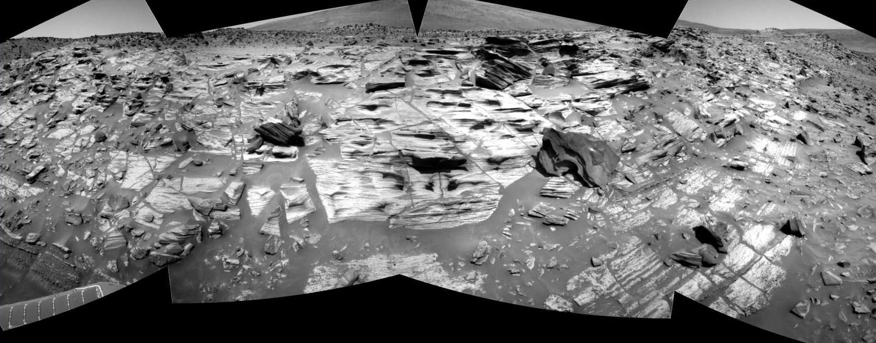
 Volcanic Home Plate
This false color, panoramic camera images of an edge of Home Plate contains the evidence on which the science team is basing its hypothesis that the circular plateau was created from volcanic activity. The lower coarse-grained unit shows granular textures toward the bottom of the image and massive textures. A feature interpreted to be a "bomb sag," which is 4 centimeters across, is pointed out.
Credit: NASA / JPL-Caltech / USGS / Cornell
"The former one, where you strip out everything except the silica is consistent because there is a little more titanium in this sample than you would expect from just soil contamination alone," he continued. "The reason we're thinking along the lines of the other process is because of the silica-rich nodules that Mini-TES is seeing, the surroundings of which appear to be typical rocks, so it's a question of whether you're just getting a little bit of precipitative silica somewhere or maybe it's just that all the other elements are being stripped out locally. We're seeing high variability in this area and so, bottom line, we don't fully understand what's going on, but it likely involves water."
The high silica content is not rare on Earth, even in basaltic volcanic complexes. "We find deposits like that at Kilauea and Kau Desert in Hawaii that are associated with vapor deposition and the evaporation of the vapor to leave behind high silica deposits," Arvidson pointed out. "It represents transport by water, so the vapor is coming out of the pit crater in Kilauea called Halemaumau – just a lot of ground water that's being recycled and lot of steam coming out and it's charged with all sorts of complexes. When it deposits, basically, it's acid rain in the Kau Desert and when the vapor comes down as liquid and the liquid evaporates, it produces high silica deposits in many locations. It's also true that if you walk around and kick up the ash, in some places where there are steam vents you can see sulfate deposits. I think what's happening is the sulfate is soluble in rainwater, so you don't get it at the surface; whereas, you do get the high silica deposits." That means, he added, that Tyrone, which is high sulfate, "just might be one of the phases coming out in kind of vapor form from Home Plate in ancient times, plus whatever else was active in the vicinity."
Spirit worked within about 50 yards of the Gertrude Weise area for more than 18 months before the silica soil was found. "This discovery has driven home to me the value of in-depth, careful exploration," Squyres said. "This is a target-rich environment, and it is a good thing we didn't go hurrying through it."
After all those months of observations, however, the story is coming together. "And water was involved in getting sulfates forming, and water was involved in terms of transporting the silica, probably in vapor phase, and then depositing the material out," Arvidson said. "Some of the team does think the silica represents a residual, because you can also form high silica deposits by dissolving everything else and it depends on the local conditions and the water that was there. In either case, we're winning – in dissolving away everything but the silica or adding the silica in the vapor phase. Both involve water."
Finding evidence of past water is the mission objective and Spirit's May day discoveries clearly follow NASA's theme of Follow the Water and the notion that the older the rocks, the more likely they are to have preserved evidence for interaction with water. The silica-rich sample also adds compelling new evidence for ancient conditions that might have been favorable for life.
 At the edges of Home Plate
Spirit took this image on Sol 744 (March 7, 2006) with its panorama camera as it left Home Plate in the Inner Basin and headed for McCool Hill. It shows some of the most complex layering patterns seen so far at this location. In fact, the layered nature of these rocks presents new questions for the rover team. Beyond their chemical properties, which scientists are now studying using the rover's spectrometers, these rocks record a detailed history of the physical properties that formed them. In the center of this image, one group of layers slopes downward to the right. The layers above and below this group are more nearly horizontal. Where layers of different orientations intersect, other layers are truncated. This indicates that there were complex patterns of alternating erosion and deposition occurring when these layers were being deposited. Similar patterns can be found in some sedimentary rocks on Earth. Physical relationships among the various layers exposed at Home Plate are crucial evidence in understanding how these Martian rocks formed.
Credit: NASA / JPL / Cornell
This latest discovery from Gusev has only reinforced the MER science team's Home Plate volcanic hypothesis. "We feel very confident that Home Plate is the remnant of a volcanic explosion," said Squyres. "Everything else that we have seen in the Home Plate area since we did the science reported in that paper supports that idea. There is very strong evidence that not only was this a place where there was explosive volcanism, but volcanism taking place in the presence of water, which may well have been what caused the explosion. But we're seeing so much evidence now for interaction of volcanism and water in the details of the mineralogy and chemistry – for example, the silica – that we feel very good about the interpretations we put forward in the Home Plate paper."
"Everything we've seen so far is volcanic or potentially volcanic," Arvidson expounded. "Remember, the Meridiani plains represent lava flows without a lot of evidence for interaction with water, except maybe frost. But as we've been climbing up West Spur, Husband Hill, and into the Inner Basin, we've thought that the best idea was that we were looking at set of coalescing volcanoes. Now, seeing the eroded eastern edge, looking at cross-sections through Home Plate, and all the materials we're seeing there, it's pretty much a certainty now that we're looking at a whole set of explosive volcanic events where the explosions were most likely due to the interaction of magma with groundwater," he posited.
Last week, on Sol 1203 (May 22, 2007), Spirit drove away from Gertrude Weise. The rover is currently making its way up onto Home Plate by way of "a nice sweet spot relatively free of rocks," as Arvidson put it, on the northeastern side of the plateau. "We're very slowly climbing up onto Home Plate, and along the way doing remote sensing and IDD measurements of the several different layers that make up the eastern part of this plateau," he added. "We're going to cut across caddy-corner the topographic contours rather than climbing straight up." Depending on what Spirit finds, the rover should be up on top of Home Plate sometime next week or the week after that.
From there, it all depends really on what Spirit sees. "The general desire is to stay on top of Home Plate, but follow the outcrop exposures around to the portion that everybody really wants to get to -- the far end or southwestern portion of Home Plate," said Yen. "It is really remarkable that we are this far into the planned life of the vehicle and we're still finding really amazing things," he added. "It's a real tribute to the team that put this vehicle together."
Opportunity from Meridiani Planum
Opportunity bounded into May, with newfound energy when its power supply shot up passed 800 watt-hours and levels not seen since the first weeks of the mission. On two separate occasions late in April -- on Sol 1153 (April 22, 2007) and Sol 1158 (April 27, 2007) -- the rover's solar array power increased significantly, and on Sol 1160 (April 29, 2007) the level soared to 848 watt-hours, the highest measured since Sol 18 (February 10, 2004), just 2.5 weeks after the rover bounded to a landing in Meridiani Planum.
 Opportunity's tour of Victoria's rim
This image -- taken by the HiRISE camera onboard MRO -- shows the "coves," promontories, and "bays" that Opportunity has been studying for the last 8 months.Credit: NASA / JPL-Caltech / Univ. Az / USGS/ T. Parker
"It's pretty incredible," said Bruce Banerdt, MER project scientist, during an interview yesterday. "We probably had a little bit of tilt in the direction of the Sun that day, but the arrays must've been pretty spic 'n span to get that much energy out of it."
The science team still doesn't know exactly how these cleaning events happen. One day the dust is there, the next it's not. Strong winds perhaps associated with channeling caused by Victoria Crater's jagged rim may have contributed to the rover's dust clearing events. "Presumably it's got to do with the wind, but it may not just be wind," Banerdt pointed out. "Part of it could be electrostatics. We just don't know, but we're happy to being taking advantage of it."
Opportunity has been exploring Victoria Crater, which is nearly 800 meters (about half a mile) in diameter, for about eight months now and the science team decided late last month to finish up its tour of the crater rim and head back to Duck Bay. That's the port into which the rover first "sailed" into Victoria and the location on the rim that may provide a safe path down into the crater. Following that plan, the rover drove into May, making tracks toward the Cape of Good Hope on Sol 1162 (May 1, 2007), with plans to make stops to complete new software checkouts and to re-image Cape St. Vincent and Cape St. Mary in super high-resolution with the Pancam.
As it headed out, Opportunity used the Pancam to take a color mosaic image of the course it would drive around a rock target called Granada, to complete a checkout of the new D-star hazard avoidance drive planning software – what the team called the Granada D-star drive -- with the Pancam. It then stowed its arm and drove 74 meters (243 feet) toward the Cape of Good Hope. After the drive, it took a series of images with both its navigation and Pancam of it surroundings and Granada. Then -- the test. D-star was told that rocks in its path were hazards, when actually Opportunity was capable of safely driving over them. The rover planners set a waypoint on the opposite side of Granada so that a straight path would have taken the rover directly over these non-hazardous hazards. But not much gets by the MERs. The rover drove 15 meters (49 feet) around Granada, seemingly hardly noticing the challenge it had been given and clearing the checkout with flying colors.
Opportunity began the next sol by taking pictures of its own tracks with the navigation camera (NavCam), then stowing its arm and driving on another 97 meters (318 feet) toward the Cape of Good Hope. By the following sol, the rover was near the rim at that location and positioning itself to take the desired super high-resolution images of the western face of Cape St. Vincent over that first weekend in May.
"Cape St. Vincent and Cape St. Mary are the places where we've seen the best examples of cross-bedding and layering in the cliff faces, which we think we can analyze to learn more about the depositional environment for the rock strata in the subsurface there at the crater," Banerdt said.
 Madrid-Guadarrama outcrop
Opportunity took this image of the Madrid-Guadarrama outcrop at the Cape of Good Hope on Sol 1097 (Feb., 23, 2007. Madrid is the big boulder in the middle, Guadarrama is just above it (from this perspective) at about 1:00.Credit: NASA / JPL-Caltech / Cornell
Super resolution is, in essence, a method of achieving enhanced resolution in images that is actually better than the pixel resolution of the camera. The Pancam attain this super resolution by taking multiple images with miniscule changes in the camera angles. The overlap between the pixels in those images is then processed to produce a sharper image than what is attainable from a single picture."
While the rover has been imaging these cliff faces, including stereo images, and conducting a photographic survey of the crater walls as it's been touring the rim during the last 8 months, the science team did not direct Opportunity to shoot any of the super high-resolution imaging for the simple reason they didn't know what at that point would be particularly outstanding.
"Cape St. Mary was the second place we imaged," reminded Banerdt. "Our main objective then was to do a survey of the crater walls, the various bays and cliff faces, and get as far around as we could. Now we're going back and doing these super hi-res images of the particularly scientifically interesting ones on our way back to Duck Bay. We'd love to drive right up and stick the MI on there but we can't. So we're still looking at these things from tens of meters away. We're trying to get the best resolution we can out of Pancam, to be able to analyze the layering and be able to tell as much as we can about the geomorphology of this stratigraphy."
With these new, super high-resolution images, scientists will able to see the layering in these cliffs in much sharper contrast and be able to pick up more subtle features. "These images may even be able to tell us something about the texture of the various layers or give an idea of grain size variations or the very subtle bedding plains," Banerdt added.
 Madrid-Guadarrama outcrop
Opportunity took this image of the Madrid-Guadarrama outcrop at the Cape of Good Hope on Sol 1097 (Feb.23, 2007) as it began its journey around the rim of Victoria. Madrid is the big boulder in the middle, Guadarama is just above it (from this perspective) at about 1:00. "In this false color image, you can see that these rocks appear to be different than the pinkish-appearing rocks that typically outcrop from the side of the crater," says Bruce Banerdt, of JPL, MER project scientist. Credit: NASA / JPL-Caltech / Cornell
Like Spirit, Opportunity continued its atmospheric studies throughout the month, including daily measuring atmospheric dust with the Pancam and surveying the sky and ground with the miniature thermal emission spectrometer (Mini-TES), and periodic searches for clouds with the navigation camera (NavCam).
Testing of the new "workaround" on its rock abrasion tool (RAT) was also on Opportunity's agenda in early May. On Sol 1165 (May 3, 2007), while the rover was acquiring stereo microscopic imager (MI) pictures of the "lab rock," Viva la Rata (Long Live the Rat) prior to grinding the rock surface, joint 1 of the rock abrasion tool (RAT) stalled, so the rover wound up conducting a touch test on Viva La Rata with the RAT and spent the rest of its time that sol searching for clouds with the navigation camera. But the following sol, Opportunity performed a successful grind/scan and found the target surface.
"We created a workaround using software onboard that measures current that goes to the grind motor," informed Banerdt. "Now we watch the motor current and when the RAT comes up against an obstruction, the current rises and it raises a fault flag and stops automatically if it doesn't get a command. We can read the fault flag, then place our RAT just above the rock, start it spinning, then bring it slowly down on the rock."
Opportunity filled out the first week of May by taking more super-resolution images of Cape St. Vincent, brushing Viva La Rata with the RAT, then taking pictures of the brushed area with the MI and studying it with the alpha-particle X-ray spectrometer (APXS). The rover also surveyed a target known as Rodrigues with the Mini-TES, acquired Pancam images of the terrain ahead, monitored dust on the rover mast, and acquired thumbnail images of the sky with the Pancam. The work never seems to stop.
On Sol 1169 (May 8, 2007), Opportunity postponed a planned drive to study some cobbles because of another joint 1 stall that occurred while stowing the robotic arm before the drive. This stall was similar to previous stalls. Instead, the rover acquired sky images with the Pancam and checked for drift (changes with time) in the Mini-TES. The next sol, the rover did drive, reaching a dual outcrop of rock faces known as Madrid/Guadarrama in the Cape of Good Hope. After acquiring the usual post-drive images with the NavCam, it conducted a diagnostic test of the IDD or robotic arm, stowed the IDD, and acquired Pancam images of Madrid, as well as images of rock cobbles in the area.
 Cerdedilla in the raw
In this raw Navcam image that Opportunity took on Sol 1172,(May 11, 2007) Cercedilla is the small dark cobble in the center of the image. Guadarrama,in this image, is the darker looking rock jutting out into the crater at about 10:00 from Cerdecilla.Credit: NASA / JPL-Caltech
While stationed at Madrid/Guadarrama -- two separate boulders that appear similar in the Pancam and Mini-TES spectrum -- Opportunity also studied some of the cobbles as representative of the crater wall, homing in on one they dubbed Cercedilla that had some unusual spectral characteristics as measured by the Pancam. The cobbles or loose rocks on the ground caught the collective eye of the science team, because they appear similar in color and texture to the Madrid-Guadarrama outcrop, feature different properties from other materials seen at Victoria Crater, and are believed to be crater ejecta. Moreover, Madrid and Guadarrama and the cobbles under study are chock full of "big blueberries" or small, round rocks.
The scientists hope to get an idea of the composition of the outcrops as well as the cobbles by examining the cobbles up close. "The outcrops are stuck in the cliff face and not accessible to the rover – one comes up to the top surface, but it's a steep slope and is not accessible," Banerdt explained. "These cobbles have same color and spectral characteristics that Madrid did and so the presumption is if we analyze these cobbles, we're analyzing the same material in the boulders, which they're right next to." Interestingly, the initial APXS and Mössbauer analyses on the rocks indicated that they were essentially similar to other Meridiani rocks the team has been analyzing. "There were small differences but within the range of things we've seen," Banerdt said.
After acquiring a set of Pancam images of Guadarrama and Madrid, Opportunity stowed the IDD in preparation for a drive on Sol 1171 (May 10, 2007), but the planned drive, to a cobble called Pedriza ended prematurely after about 0.86 meters (2.8 feet) when the rover's left middle wheel snagged a rock. The rover unstowed the IDD, acquired post-drive NavCam images, and turned its attention to measuring atmospheric argon with the APXS.
On the following sol, Opportunity surveyed the horizon with the Pancam in the morning, took color images of targets known as Cercedilla and Fuenfria, also potentially ejecta from inside the crater, then studied Cercedilla and another target known as Navacerrda, as well as its own external calibration target with the Mini-TES. The rover also took Pancam pictures of Guadarrama, and performed a thermal inertia experiment on a soil target in order to complete measurements inside and outside of the dark streaks on the northern side of Victoria that it studied last month. This experiment, which the rover continued the next sol, measured temperature-related properties of the soil during the day and overnight. Once the soil experiment was finished, Opportunity stowed the IDD, completed the previously planned drive, and unstowed the IDD without further incident.
Opportunity spent most of the third week in May examining the cobbles that may be crater ejecta. On Sol 1175 (May 15, 2007) the rover inched backward toward Cercedilla, acquired Pancam images and NavCam images after the drive, then surveyed targets dubbed Cardosillas, Quintanar, Machotas, and Hierro with the Mini-TES. The next sol, the rover took some stereo microscopic imager (MI) pictures of a particular exposure of Cercedilla, called Penota, then placed the APXS on Penota, and re-surveyed Hierro with Mini-TES as well as targets dubbed Matabueyes, Morcuera, Carpetanos, and Somosietta.
On Sol 1177 (May 17, 2007), Opportunity conducted another successful seek/grind procedure with the RAT, acquired post-drive images, as well as pictures of Mataueyes, Morcuera, Carpetanos, Somosierra, and Pedriza with the Pancam, and spent the next couple of sols wrapping up its work on the Cape of Good Hope.
 Cercedilla
Opportunity used the Pancam to take this false color shot of Cercedilla, the cobble near the Madrid-Guadarrama outcrop on Sol 1175 (May 15, 2007. It's easy to see why Jim Bell picked this one as his favorite pic of the month from Meridiani Planum.
Credit: NASA / JPL - Caltech / Cornell
Opportunity departed Madrid-Guadarrama last week, on Sol 1182 (May 22, 2007). "Since then we've been doing two things -- lots of driving, trying to cover as much ground as we can, and finishing up the checkout of our R9.2 flight software," said Squyres.
In recent sols, the rover has really been putting the pedal to the metal, striking out for the plains and wide open territory where there is "redtop" for as far as the rover eyes can see . . . well, almost. But there are certainly no major obstructions and in fact virtually no targets, perfect for long drives and covering a lot of distance. On Sols 1184 (May 24, 2007), 1187 (May 27, 2007), and 1188 (May 28, 2007), Opportunity left the Cape of Good Hope in a cloud of red dust, so to speak.
"We went out into the plains, away from the rim and had a couple of really long drives, 80 to 90 meter-drives," said Banerdt. "Right now we're opposite Cabo Anonimo and generally headed for Cape Verde where we'll take the super high-resolution images of Cape St. Mary.
With the D-star checkout a resounding success, the rover still must still pass a Virtual Target Tracking (VTT) checkout, a method by which the rover can safely chart its course, assisted by the Pancam which "follows" a target as the rover drives along. "We're driving as fast as we can, but I've made a commitment that we're going to complete this entire flight software checkout before we consider entering Victoria Crater," Squyres said. "So some days we drive and some days we do the software checkout."
There are multiple steps in the checkout process for each of these capabilities, and one of those steps for the VTT checkout was slated for today. "The software checkout requires the proper terrain configuration -- VTT requires a target," Squyres explained. "That means there has to be an object on the surface with the right characteristics and the right distance away. When we ended most recent drive, we found this cobble we named Paloma that is just about 6 or 7 meters away from us. It turned out to be a good position for doing the VTT test, so we shifted gears immediately and decided to do the VTT test in today's drive. Basically, we're moving toward Duck Bay as quickly as we can, but we have this to-do list of flight software checkouts we have to complete and when an opportunity presents itself, we do it. Sometimes these tests provide us with everything we need and sometimes they don't. And when they don't we have to go and try it again. So we'll see how much more needs to be done. At the current time, we've got 3 more boxes to check off and we're planning on checking one off today."
Over this weekend and into next week, Opportunity will continue on to Duck Bay, sticking to the plan made last month. "Specifically we'll be heading to Cape Verde, for two reasons. Of course, we want to do more imaging of cross-bedding at Cape St. Mary, which showed up in the panorama that we took we during superior conjunction. But the best stuff was in shadow at the time and we didn't get a long baseline stereo on it and we didn't do super resolution on it, so we can definitely improve our coverage of that stuff. It turns out that Cape Verde is also a good place for doing a long baseline stereo imaging of Duck Bay that we can then use to support our decision-making process for a possible entry into Victoria."
As for when, exactly, Opportunity might being making its grand entrance at this queen of crater is anybody's guess. Those who've been following the MER mission know Squyres' rule: "That will be coming up when we get to it," he said.
For all the MER Updates, go to: http://www.planetary.org/explore/space-topics/space-missions/mer-updates/
Protect Our Shared Future
You help us defend humanity and prevent asteroid impacts. Donate now to become a Planetary Defender!
Donate