
 Explore Worlds
 Find Life
 Defend Earth


Mars Exploration Rovers Update: Spirit Finds Past Water at Home, Opportunity Takes in Tierra del Fuego

Written by
A.J.S. Rayl
Contributing Editor, The Planetary Society
April 30, 2007
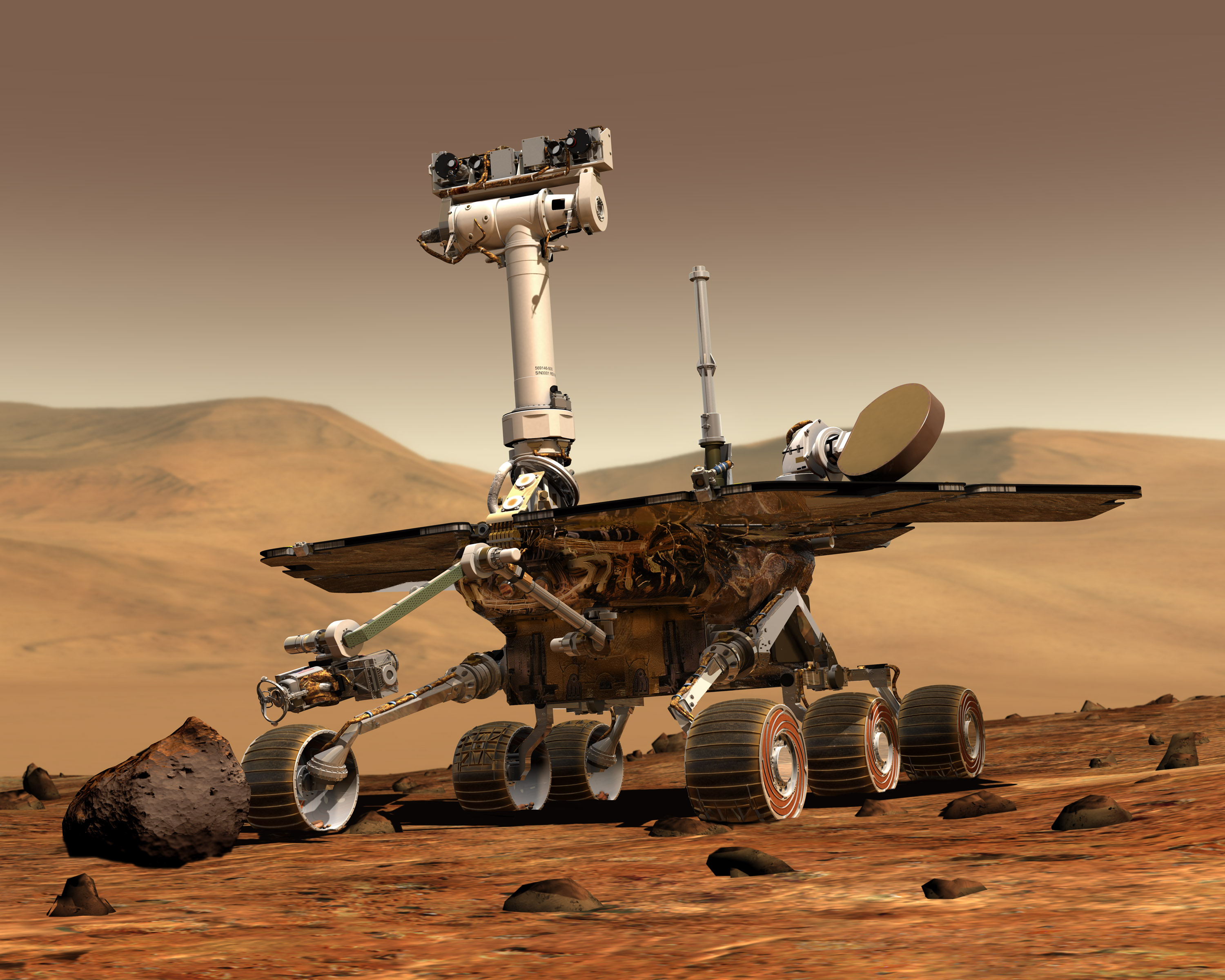 Mars Exploration Rover
Credit: NASA / JPL / Maas
The Mars Exploration Rovers (MERs) traveled to new targets and made discoveries ranging from the magnificent to the mundane in April, four fast weeks that essentially led both of the twin robot field geologists to the next phase of their explorations.
It's been a long time coming, but in the Columbia Hills area of Gusev Crater Spirit roved back into the spotlight this month by uncovering solid evidence of past water around Home Plate. The rover spent the last four weeks investigating various rock targets along the base of Home Plate, the round plateau that the MER team believes is a volcanic formation of some kind. At one unusual outcrop of nodular units called Elizabeth Mahon, located just a few meters away from Home base, the rover discovered rocks containing 72% silica, the highest amount of silica seen so far on the mission and a sign of past water about as sure it gets.
Meanwhile, on the other side of the planet, Opportunity ventured into the dark streaks emanating from Victoria Crater in Meridiani Planum and found nothing surprising at all. As this rover continued to the last planned stop on its clockwise tour around the rim of Victoria --"the end of the line," as lead rover scientist Steve Squyres put it, Tierra del Fuego -- it dusted off any doubt as to the source of the streaks. Just as MER science team expected, the streaks were sand blown out from the crater floor. After venturing out into Tierra del Fuego and examining the second of two dark streaks, the rover wrapped that assignment and followed the sandy trail back to the crater rim. There, the robot rover took a set of stereo, full-color picture of Cape St. Vincent with the panoramic camera (Pancam).
Now, the rovers are shifting gears once more and in coming sols will be beginning new phases in their missions. "We have made major operational decisions on both rovers," Squyres, of Cornell University, said during an interview April 27. "At Gusev, we had two possible 'onramps' that could take us to the top of Home Plate – one at the far southern end [of the formation] and one on the northern end. We decided [April 26] to turn around and head back north to take that onramp up onto Home Plate," he informed.
At Meridiani, Squyres said, "we've established our long-term plan for Opportunity from now up to when we enter Victoria Crater," he added. Since driving into the huge crater could be life threatening to the rover, that plan still must be approved by NASA headquarters. Of course, no one has any reason to believe at this point that the plan won't be approved. The MER team tends to dot all the i's and cross all the t's all the time and has never taken chances that weren't highly calculated.
A dust storm that swirled up in the Hellas region during the third week of April had the potential to impact both Spirit and Opportunity, but it dissipated pretty quickly and concern about the rovers' safety blew over with it. "The storm in Hellas didn't spread as much as it might have," reported Bruce W. Banerdt, MER project scientist at the Jet Propulsion Laboratory (JPL), mission control for the twin rovers. "As we watched it, the lifecycle of the storm was that of a more restricted dust event than it might have been this time of year." Springtime on Mars brings dust storms that can build up and on occasion even encircle the entire planet, a process that intrigues and puzzles scientists. "We still don't understand completely what makes these things spread to planet-encircling storms," said Banerdt, "but this one fortunately remained a regional dust storm."

The fallout from Hellas storm, however, did cause the dust levels in the atmosphere to rise noticeably at Gusev. "We had a little bit of a tau spike, but we still didn't drop below 380 watt-hours," Banerdt said in an interview April 26. The MER team has been hoping for a gust of Martian wind to blow through the Columbia Hills and clear off some of Spirit's solar arrays. That solar-array cleaning gust did arrive -- but not for Spirit.
Opportunity, which has been averaging a strong 580 watt-hours, doesn't really need an energy boost like Spirit does, but it experienced one of the biggest mini-cleaning events ever. "We're seeing 700 watt-hours on Opportunity now, up from 580 or 590, so that's a significant jump," noted Squyres.
After yet another productive month of work, both rovers continue to be "healthy," and all instruments continued to work on both rovers almost without incident, according to Banerdt. "We had a fault flag on the instrument deployment device (IDD) [or robotic arm] on Spirit a couple of weeks ago," he noted. "But it turned out to be that it was reaching out quite a bit and just pushed it past its stop [point]. The engineers ran some diagnostics and everything turned out to be normal it its checkout." That, remarkably, was the only instrument anomaly this month.
In other mission news this month, the MER team received the Best Corporate / Team Achievement Award at the 2007 Sir Arthur Clarke Awards presented Saturday, April 14, at the close of the British Rocketry Oral History Programme 2007 Conference, Space Really Matters, in Surrey, England, while Squyres accepted the Best Individual Achievement Award.
Spirit From Gusev Crater
 A view from Home
Spirit took this image of Home Plate with its front hazard camera on Sol 1150 (March 29, 2007), after accidentally driving part way up the circular formation that some science team members believe is an eroded-over volcano.Credit: NASA / JPL-Caltech
After finishing work at Mitcheltree Ridge at the end of March, Spirit headed back to Home Plate once more, this time to begin its in-depth examination of the round plateau that the team believes is either an eroded over volcano or a volcanic formation of some other sort. "On Sol 1150 (March 29, 2007), we did a drive towards the edge of Home Plate and we overshot by maybe a meter," Squyres recalled. In many cases, that might have caused problems, but on this drive it was "fortuitous," he said. Spirit has been way overdue for a little of the luck that seems to so often be there for Oppportunity, and it finally showed up on this drive. "What happened was the rover drove up about half-way onto Home Plate and it was clear then that we could make it all the way to the top from there," he said. "We knew we had a good route up."
Still, the lure from formations around the base beckoned. So, after taking panoramic camera (Pancam) images and mini-thermal emission spectrometer (Mini-TES) data of a rock exposure dubbed Clara Zaph and using the Mini-TES on Sol 1152 (March 31, 2006) to check out a number of other targets, including Rita Briggs and Twila Shively, the MER team decided Spirit would continue its agenda as planned. It would work its way clockwise, heading to the south, around one side of Home, hit a couple of outcrops along the way, then try to get up on the circular formation somewhere along its southern margin.
If the names of the targets seem to be getting a little anthropocentric here, it's because the objects of examination in this Home study are being named in honor of past players in the All-American Girls Professional Baseball League, keeping with the baseball theme that began during the rover's first visit to Home Plate in February 2005. Squyres and deputy principal investigator for rover science, Ray Arvidson, of Washington University St. Louis, decided back then that in honor of Black History month they would name the features the rover studied there after star players and managers of the Negro Leagues of Baseball from the first half of the 20th Century.
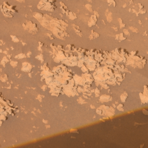
 Home Plate from above
This image from the Mars Reconnaissance Orbiter's High Resolution Imaging Science Experiment (HiRISE)camera shows the area in the Inner Basin of the Columbia Hills that Spirit is currently roving around.Credit: NASA / JPL / Cornell
The two huddled with noted essayist and baseball fan Gerald L. Early, also of Washington University in St. Louis, and a consultant on the Ken Burns documentary Baseball that aired on the Public Broadcasting Service (PBS) network. Together, they came up with the list for the targets during that phase of research. Now, it's gender equity time, but the names of the girls are being chosen for this phase of Home work by MER team members.
On Sol 1153 (April 1, 2007), Spirit turned toward the southeast and drove backward 4 meters off the Home Plate slope to a heavily eroded, rocky formation a few meters away named for Elizabeth "Lib" Mahon, a star player for the South Bend (Indiana) Blue Sox. There, it spent the first week of April analyzing the iron and mineral content of the unusual little outcrop with the Mössbauer spectrometer and the alpha particle X-ray spectrometer (APXS) and taking a series of pictures with the Microscopic Imager (MI).
"We actually started describing this stuff as nodular, because it's almost like these little fingers of eroded material," said geologist Steve Ruff, a research associate at Arizona State University (ASU), who is currently overseeing the Mini-TES research on Spirit. "If you're not really training your eye on them, they almost look like little piles of broken-up rocks or cobbles or something," he added during an interview April 27.
Structurally, however, Elizabeth Mahon is surprisingly resilient. While these little nodular rocks, which range in size from 10-to-20 centimeters (about 4-to-8 inches) tall, appear to be delicate, they are actually strong enough to hold up under the weight of the rover. "We've driven over them and they don't break apart," said Ruff. "So, we're sort of forced to conclude that what looks like piles of clasts are actually either cemented together in a way that makes them one unit or their erosional morphology makes them look like they're separate."
Although Elizabeth Mahon looks a bit unusual close up, this outcrop is visually relatively unassuming. Had Mini-TES not documented an alluring spectral signature from over many tens of meters away, it's possible the rover could have missed what may turn out to be one of the most significant discoveries on the mission, especially in term of NASA's strategy to Follow the Water.
Spirit actually first encountered these nodular little rocks back by Tyrone -- the white and yellow, high-sulfur soil patch between Home Plate and Low Ridge -- on an outcrop given the uninspired name Tyrone Nodules. But it wasn't until the rover found Elizabeth Mahon that the MER team decided it should deploy the IDD instruments and undertake a more in-depth analysis with the Mini-TES.
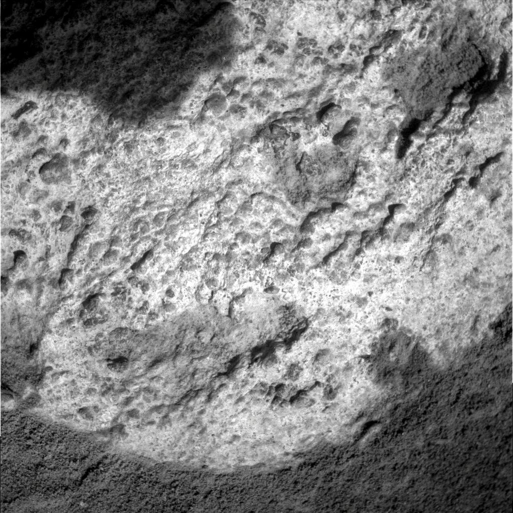
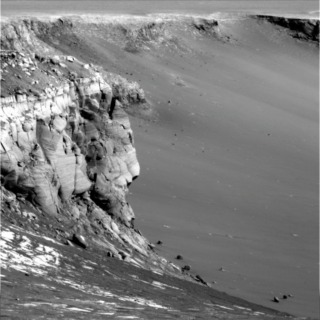
 Elizabeth Mahon
Spirit took this image of the bizarre nodules that it encountered at Elizabeth Mahon on Sol 1160 (April 8, 2007) with its panoramic camera. As it turns out, this site boasts the highest silica seen on the mission to date. Credit: NASA / JPL-Caltech / Cornell
In addition to the research on Elizabeth Mahon, Spirit also snapped a lot of images with the Pancam during the first week of the month. It acquired a mosaic of images of the area surrounding the odd outcrop and full color pictures of an outcrop further to the south and along the edge of Home, named for Madeline English, who covered the field from third with "a never say die" attitude for the Racine Belles back in the 1940s. The rover also imaged a target off in the distance named Tars Tarkas and rounded out the week by once again employing the Mini-TES, this time to analyze the mineralogical content of nearby targets named for the All-American's Betty Hill, Noreen Arnold, Carol Habben, Phyllis Wise, and Johanna Hargraves.
As usual, Spirit balanced its geology agenda throughout the month with daily atmospheric studies -- monitoring dust levels with the Pancam, surveying the sky and ground with the Mini-TES, searching for clouds with the navigation camera, and monitoring dust on its mast.
The rover began the second week of the month finishing its study of Elizabeth Mahon with a final set of Pancam images. "This eroded outcrop is actually quite extensive, running along ridges for a couple meters at this location, and it has the highest silica value of anything we've seen in the mission," Ruff informed. The silica in these rocks appears to be an undeniable sign of past water. Silicon is present in all igneous rocks, but the percentage of free silica (SiO2) found at this Martian outcrop is only found in rocks that have undergone weathering processes that involve liquid water, at least on Earth.
"The typical rocks that we encounter with both rovers have silica values in the mid 40% range and here all of a sudden we're seeing a value that's jumped way up to 72% SiO2," Ruff explained. In addition to that APXS-derived percentage, the Mini-TES spectra of these high silica rocks, he said, indicate they are associated with "an amorphous silica," meaning a non-crystalline-like silica. "Although we still haven't quite put that whole puzzle together, we can be pretty confident that this area of Mars went through a process that involved interaction with water." Moreover, he added, "it would take a significant amount of water to enrich this outcrop or layer to this level of silica."
By examining Elizabeth Mahon in-depth and getting all its spectral characteristics, the MER team can then link it via morphology to a much larger region, Ruff said, suggesting that this may be part of a layer that goes all the way back to Tyrone Nodules in one direction and further to the south of Home Plate in the other direction. "It all adds up to something happening here in this area, in this particular layer, at this particular point in Mars' history," he said.
"Silica is a common hydrothermal chemical," pointed out Jack Farmer, a professor in the School of Earth and Space Exploration at ASU, and one of the long-term science planning leads on Spirit this past month. "At Yellowstone Park, most of the hot springs are delivering silica to the surface. Those big center mounds you see there are mostly made up of silica. While I personally don't think that’s what's going on at Home Plate, the point is there are a variety of origins for silica in terrestrial settings and they all, more or less, involve either enhanced water contents and magmas during explosive volcanism."
On Earth, similarly silica-coated basaltic rocks can form, for example, as rainwater leeches away all other elements to leave behind the enriched layer or via volcanic emanations that carry and deposit water and other gaseous elements on the rocks, which then lead to the enrichment.
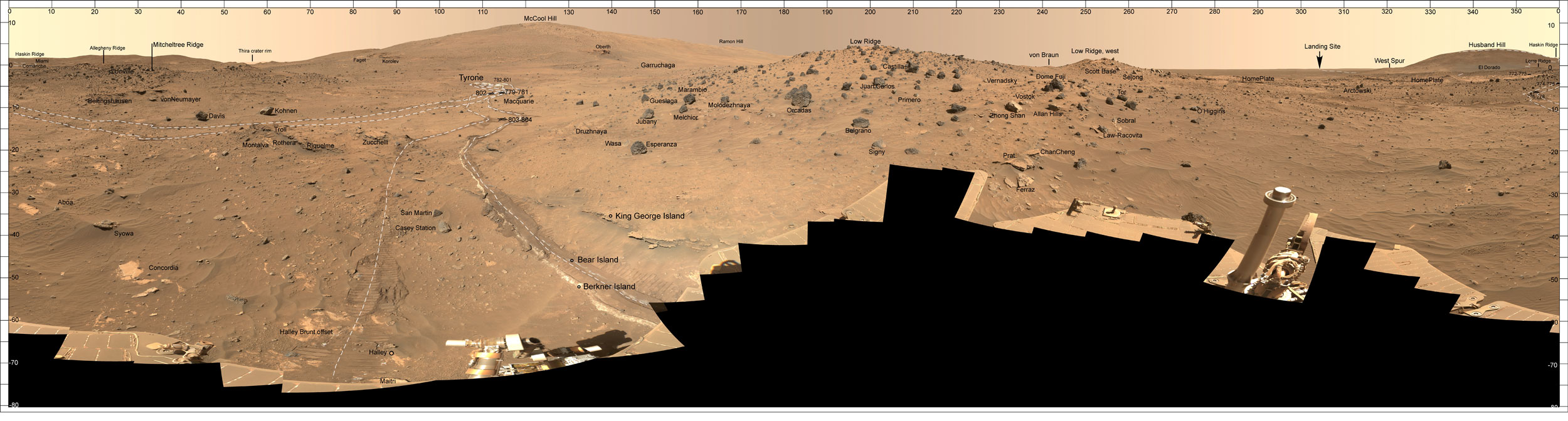 McMurdo pan labeled
During the last Martian winter, Spirit sojourned in Low Ridge, its winter haven. The robot field geologist spent from late April 2006 into December 2006 parked on a north-facing slope in order to keep its solar panels pointed toward the Sun. During that time, while the rover spent the daylight hours conducting as much scientific research as possible, science team members assigned informal names to rock outcrops, boulders, and patches of soil commemorating exploration sites in Antarctica and the southernmost islands of South America. Antarctic bases are places where researchers, like the rovers on Mars, hunker down for the winter in subzero temperatures. During the past Martian winter, Spirit endured temperatures lower than -100 degrees Celsius (-148 degrees Fahrenheit. This full-color mosaic of images -- taken from the mission's largest panorama,the McMurdo pan -- was acquired by the rover's PanCam. It shows the various features of the landscape that Spirit has been investigating.Credit: NASA/JPL-Caltech/Cornell
"All this thinly bedded material with lots of structures around Home Plate is telling us that there was explosive activity here," Farmer noted. "But was it a volcanic explosion or an impact explosion? We can't say for sure yet, but a lot of people are leaning toward volcanic interpretation. If that's the case, the silica here could be telling us we're dealing with a very silicic volcanic composition, which is unusual for Mars. But we have here what could be an explosive volcanic center that erupted locally and laid down these beautifully bedded deposits that we see."
"Even though we can't really pin down the source of the aqueous alteration, based on what we've seen with Spirit, we do think we've found a style of aqueous alteration that is often found in association with volcanic deposits," added Ruff, who also supports the volcanic explosion hypothesis. "This is comparable to what we find in silica-covered rocks around active volcanic environments where there is interaction with water, such as in Hawaii – and this is potentially the largest occurrence that we've found in Gusev."
"The real goal now is to test that hypothesis," Farmer summed up. "We're doing that by driving around this formation and looking at the outcrops and at structures in the rocks for features that might tell us. And in the next couple of weeks we'll transition onto Home Plate to continue the effort."
With the assignment at Elizabeth Mahon finished, Spirit packed up and headed further south to Madeline English, an outcrop along the edge of Home Plate. The science team members are interested in this outcrop because of the apparent presence of clasts or rock fragments. If the clasts have a different composition from surrounding material, it could mean that this outcrop represents one of the lowest stratigraphic layers in the area.
En route to Madeline English, the rover took a survey of some of the rock clasts there with the Pancam on Sol 1161 (April 9, 2007) and looked for the iron content in other rock targets called Muriel Coben and Elise Harney with the Mössbauer spectrometer. In addition, the rover measured the atmospheric density of argon gas in the atmosphere with the APXS, as it and Opportunity have been doing regularly to add new data to an ongoing study of atmospheric mixing processes.
The rover pulled up to Madeline English on Sol 1162 (April 10, 2007). "We're driving Spirit mostly backwards still because of the right front wheel that has been out of commission, so we usually have to turn the rover around to get the IDD where we want it and we're using that right front wheel to pivot into position," said Banerdt. Once it arrived, however, the rover not only had to turn around. It also had to parallel park between two sizable rocks flanking the target, a maneuver that proved tricky and elusive on the first try. On Sol 1164 (April 12, 2007), Spirit made its second attempt to bump into position, and again didn't quite make it. Two sols later, the third time proved to be the charm.
Spirit once again pivoted clockwise on the right front wheel, then "crabbed" forward into position by steering the two rear wheels toward the stuck right front wheel, thus opposing resistance from the front wheel and keeping the yawing -- or swinging from side to side -- to a minimum. On Sol 1166 (April 14, 2007), the rover settled into position. "It was a bit of challenge and it took some additional time," Farmer said. "But the rover planners (RPs) eventually got it in there as they always do." The rover took the usual after-drive images with its navigation camera and then continued the inspection of Madeline English by taking full color Pancam pictures of the outcrop.
 Everett
Spirit took this image of Everett, a small patch of light colored soil that it scuffed up while approaching the outcrop Madeline English at the base of Home Plate, with its front navaigation camera on Sol 1171 (April 19, 2007). Although it initially looked like it might be like the sulfate soils uncovered at Tyrone, the preliminary analyses indicated it was "very low in sulfur," according to Bruce W. Banerdt, MER project scientist at JPL. Credit: NASA / JPL-Caltech
Although the main focus was on Madeline English, Spirit did devote time in the middle of the month to a remote sensing campaign on rocks named for All American's Phyllis Wise, Elise Harney, Carol Habben, Senaida Wirth, Charlene Barnett, Alice Haylett, and Clara Zaph, taking images with the Pancam and measuring the mineral content with the Mini-TES. In addition, the rover also began acquiring a large, approximately 180-degree, Pancam mosaic of the Home Plate area called -- what else? -- the Ballpark Panorama.
The rover continued its search for dust devils throughout the month, but it didn't catch any new images of whirling clouds of dark Martian dust. After one dust devil search on Sol 1168 (April 16, 2007), Spirit turned its attention back to Madeline English, unstowed the IDD, and acquired pictures of a particular exposure target on the outcrop dubbed Belles with its microscopic imager (MI), and later examined its with the spectrometers.
Over the next several sols, Spirit acquired more Pancam images of Home Plate, continued the Mössbauer analysis of Belles, and acquired close-up, MI pictures of other targets there known as Peaches and BlueSox. In addition, the rover continued work on the Ballpark Panorama and on Sols 1173-1174 (April 21-22, 2007) it checked out a light-colored soil target dubbed Everett that it inadvertently scuffed up on approach to Madeline English.
"Everett is below Madeline English in one of the rover's tracks where our wheels were kind of scratching around in getting to that outcrop," Banerdt explained. "As we backed off, there was a place where the soil had been scraped away exposing a light colored patch in the tracks." Initially, science team members thought the rover might have uncovered more of the sulfate-rich soils found at Tyrone. The preliminary analysis, however, indicates otherwise. "It appears to be very low in sulfur and some people are speculating now that that it might actually not be soil but a scuffed up piece of another bedrock layer that is covered up for the most part," said Banerdt.
 More nodular material
Spirit took this image of some of the nodular material near the Madeline English outcrop, just a few inches from the soil target Everett, with its front hazard camera on Sol 1175 (April 23, 2007. "It's part of a low outcrop that is partially buried in the soil," said Jack Farmer, of Arizona State University, one of the long-term planning leads for Spirit in April.Credit: NASA / JPL-Caltech
With that soil analysis complete, the science team instructed the robot field geologist to bump back another 60 centimeters on Sol 1175 (April 23, 2007) "to get a look at another nodular unit the rover had driven over, which is actually in the soil," said Farmer. "It's part of a low outcrop that is partially buried in soil and the texture of the rock -- which we call Slide -- is telling us something. But part of the problem is that the surfaces of these outcrops are weathered and Spirit no longer has a RAT, so we can't [grind] through the surface. We do have a brush though."
On the following sol, Spirit deployed the IDD to get an analysis of Slide. "We got a nice brush on the surface and the brushed-surface MIs have come down and they look beautiful," said Farmer, noting that the analysis is still underway. On Sol 1177 (April 25, 2007), the rover placed the APXS on that brushed surface and on the next sol deployed the Mössbauer spectrometer.
Meanwhile, Spirit had located more silica-rich outcrop further to the south with the Mini-TES and the MER science team had a decision to make -- continue on to the south and check out more of this silica-rich material and hope to find the southerly onramp benign and inviting or turn around and head back to the easy onramp the rover accidentally discovered late in March.
"We measured a much larger example of this silica-rich material and demonstrated spectrally that it was identical the Elizabeth Mahon target on which we did the IDD campaign," Ruff confirmed. "There is merit in going to and analyzing that larger occurrence to try to really nail down how this high-silica material came to be." One detail driving interest from Mini-TES side, he said, is that this particular material is spectrally similar to the still-enigmatic Mars Global Surveyor (MGS) Surface Type 2 unit, a globally distributed spectral class identified years ago with the orbiter's thermal emission spectrometer (TES). "There's still some question about whether the Surface Type 2 unit, which is concentrated in the northern lowlands, represents primary igneous rock -- meaning direct from the magma source -- or if it represent an altered igneous rock," he noted.
The silica-rich outcrop, the MER team is now finding at Gusev would not have shown up in the MGS / TES orbital data and probably won't show up in the data from the more sophisticated thermal emission spectrometers onboard other current orbiters, because it's in too small an area. "No spectral instrument from orbit today would see this stuff," Ruff said. "It's very contaminated by soil. The sand that blows around and erodes this stuff is trapped in all the crevices and crannies of this rough-textured outcrop. But we can sort of see the meter-scale shape of these little ridges of outcrop in the HiRISE [High Resolution Imaging Science Experiment image of Gusev in the Home Plate area." [The HiRISE camera is onboard the Mars Reconnaissance Orbiter.]
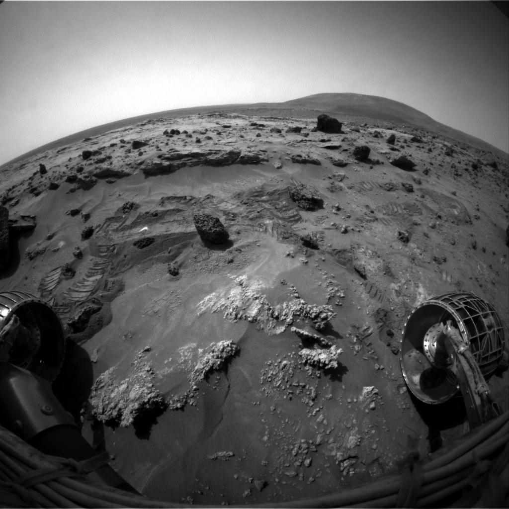
 Slide up-close
During the last week of April, Spirit took this picture of a nodular unit not far from the base of Home Plate called Slide. The rover used the brush on its rock abrasion tool (RAT) to get below the weathered surface of the tough little target, which the rover had driven over, and then used its Microscopic Imager to get this close-up image.Credit: NASA / JPL-Caltech
"Elizabeth Mahon and other of these outcrops spectrally resemble this TES-found Surface Type 2 material more than anything we've seen at the two MER landing sites," Ruff continued. "It could be there is an alteration process that is common to these little outcrops we found at Gusev and these much larger global scale occurrences of this TES Surface Type 2 material." Even though, he added, "there is definite disparity in the absolute abundance of silica that is derived from the TES data -- around 50% versus the 72% we're seeing at this new location."
During the science planning meeting for Spirit on Thursday, April 26, the team made its decision: It would not continue south and visit another silica-rich outcrop but turn around, head back north for the "accidental" onramp and get on with the exploration of the top of Home Plate.
"It is disappointing," sighed Ruff. "But this is the nature of this exploration. We can't go everywhere. We have to make decisions and sometimes those decisions are painful to some members of the team."
Spirit is finishing the IDD work at Madeline English then heading back to the "accidental" onramp for the next phase of exploration at Home Plate. "While there was some appeal of doing this southern onramp, it's 23 meters away from our current location, and we concluded this onramp to the north is a bird in the hand," Squyres explained. "Rather than hauling ourselves all the way down to the southern onramp and finding it doesn't work and having to haul our way back north again, we decided to go with the lucky, northern onramp."
Actually, there is add-on value to that choice. "There is some really excellent exposed cross-bedding in the exposed side of Home Plate right near the where this onramp is and some of the team members have been wanting to go back and do some in-depth analysis with the MI and APXS and possibly the Mössbauer spectrometer to characterize it," Banerdt said. "We want to see if these are layers that have the same granularity, whether they have a gradation in them, things like that. Then, we'll use those findings to tell the difference between the postulates for the origin of Home Plate."
Home Plate has so far proven to be "a very interesting place with excellent outcrops of rocks, which geologists love, of course," offered Farmer. "Everybody's eager to learn all we can about Home Plate so we can figure out how it formed. Every rock tells a story and we're just trying to get up to all these new rocks to see what they have to say."
Opportunity from Meridiani Planum
As March turned to April, Opportunity was charged with finishing work at Valley Without Peril and moving on to analyze the dark streaks emanating from Victoria Crater.
On Sol 1133 (April 1, 2007), the rover completed the second stereo image of the Valley and conducted some more remote sensing of the area, assessing the slope for a possible "toe-dip," as Squyres described it, into the crater. The following sol, the rover drove to an area between dark streaks to set up for Microscopic Imager (MI) pictures and alpha particle X-ray spectrometer (APXS) measurements. The science team will use the data collected there to compare with the data collected inside the streaks.
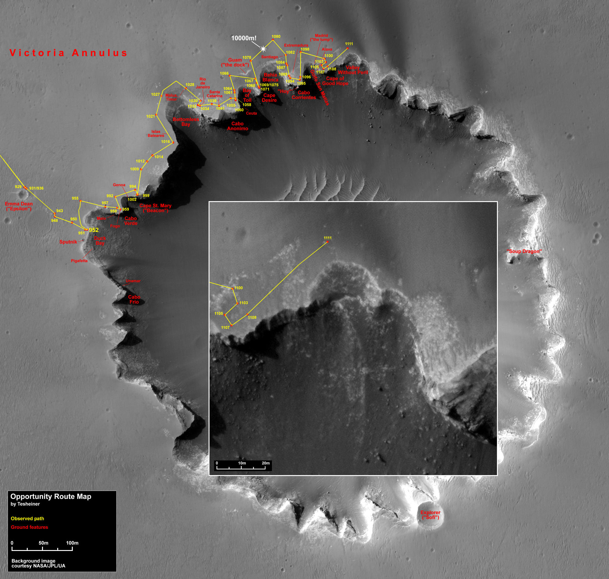 Opportunity traverse map
This image, taken by the HiRISE camera onboard the Mars Reconnaissance Orbiter (MRO) shows Opportunity's route along the northeastern rim of Victoria Crater.The dark streaks the rover investigated this month can clearly be seen emanating from the crater in the upper right portion of the image. Visit the HiRISE Operations Center for a full-resolution view.
Credit: NASA / JPL / Univ. of Arizona / Eduardo Tesheiner
Like Spirit, Opportunity is continuing to collect daily atmospheric data, taking images with the panoramic camera (Pancam) to monitor the tau or dust levels in the atmosphere, surveying the sky and ground with the Mini-TES, searching for clouds with the navigation camera, and occasionally monitoring dust on its mast.
On Sols 1135 and 1136 (April 3-4, 2007), the rover took MI pictures to look at soil targets called Salamanca and Sevilla in the area between two dark streaks up close and subsequently it looked at Sevilla with the APXS. With that task completed, the rover stowed its IDD and drove toward one of the more prominent dark streaks trailing out into the Valley, logging about 35 meters (115 feet) on Sol 1137 (April 5, 2007). During the first week of April, the rover also took Pancam images at three different times during one sol as part of a photometric experiment and tested a "fix" for a bug in the steering portion of the mobility flight software, among other chores.
The rover came to a stop in the middle of the first targeted dark streak and snapped a series of images with the Pancam. Since Opportunity was to conduct two instrument deployment device (IDD) campaigns at different areas about 33 meters (108 feet) apart, this investigation kept the rover occupied for much of the second week in April.
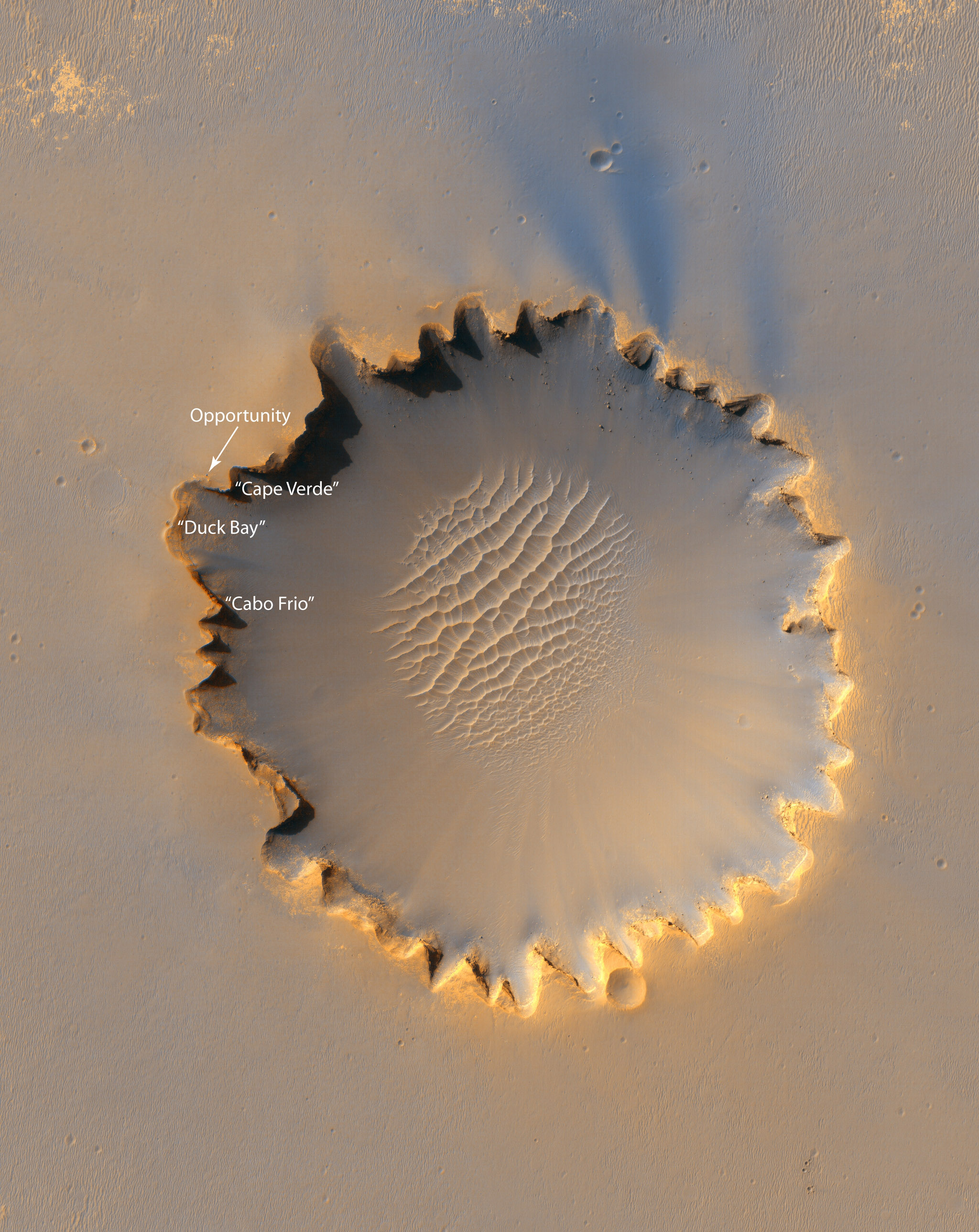 Victoria from the eye of HiRISE
This image from HiRISE on the Mars Reconnaissance Orbiter shows Victoria crater, with its distinctive scalloped rim. The dark streaks that Opportunity investigated this month can clearly be seen emanating from the crater in the top right protion of the image. Visit the HiRISE Operations Center for a full-resolution view.
Credit: NASA / JPL / Univ. of Arizona
On Sol 1139 (April 8, 2007), the rover looked at the dark streak with the Pancam and Mini-TES, and then took MI pictures of the two chosen targets there, Palencia and Pontevedra. For the next two sols, Opportunity continued its campaign on the dark streak with APXS analyses. It also took also took full color Pancam images of a target in its tracks called Zamora, which it then examined with the Mini-TES and APXS and initiated an APXS integration to measure argon gas in the atmosphere, part of the ongoing experiment to determine Mars' atmospheric mixing processes and track changes over time.
On Sol 1142 (April 11, 2007), the rover packed up and drove 31.2 meters (102.5 feet) toward the second streak target, which emanates from Tierra del Fuego. There, it homed in on a soil target dubbed Alicante. On the following sol, Opportunity bumped 2.2 meters (7.3 feet) to image the target in full color with the Pancam, then stowed its IDD and drove the final 3 meters (9.8 feet) up to Alicante, where it took MI pictures and APXS measurements.
Opportunity continued remote sensing of the second dark streak on Sol 1144 (April 13, 2007), using the Pancam and Mini-TES on a second soil target called Avila, ending its Friday the 13th sol with some atmospheric measurements before going into DeepSleep.
As the third week of the month set in, Opportunity worked on completing its investigation of Avila and Alicante in the second dark streak. But on Sol 1145 (April 14, 2007), the Mössbauer touch sequence, which is used as a reference point for determining where to start taking the MI pictures, did not make contact with the soil because of a minor targeting discrepancy and that caused the images taken on that sol to be out of focus. As a result, the team decided to stay another two sols and reacquire the in-situ observations on Alicante.
In the meantime, Opportunity used the Pancam to shoot targets out on the plains nicknamed Huesca, Granada, Cordoba, and Colmenero. After taking thumbnail Pancam images of the sky on the morning of Sol 1148 (April 17, 2007), the rover once again commanded the Mössbauer spectrometer to touch the soil and then took the desired pictures of Alicante with the MI. The rover then placed the APXS on Alicante for a good long integration. As usual, Opportunity took a tau measurement before the regularly scheduled Odyssey pass, and, during the pass, used the Mini-TES to look at the sky and ground to complete its daily atmosphere studies. After the Odyssey pass, it again placed the APXS on Alicante for another six hours.
The rover switched to the Mössbauer spectrometer on Sol 1149 (April 18, 2007) for another 12 hours' worth of readings on Alicante. The Mössbauer continues to need about 48 hours of integration time on its targets to get a solid reading on how much iron is present, because its radioactive power source is decaying.
 Granada
Opportunity took this image of Granada on Sol 1157 (Aril 26, 2007) with its navigation camera. From afar, scientists thought it might be outcrop, but on closer inspection It looks to be "a little impact crater," said Steve Squyres, the principal investigator of rover science.
Credit: NASA / JPL-Caltech
On Sol 1150 (April 19, 2007), Opportunity turned its attention and the Pancam to Granada, a formation the rover had passed en route to the second dark streak in Tierra del Fuego. It had appeared, oddly, to be a lone outcrop emerging from the middle of the plains and team members wanted the rover to check it out on the return trip to Victoria's rim. The rover then bumped back 1 meter (3.3 feet) and took a final full color picture of Alicante with the Pancam.
The mystery of the dark streaks -- if there ever was one -- was easily solved. "The dark material appears to be just sand blown out of the crater," informed Squyres. "It's dark because the sand on Mars is dark. Basically it's a higher concentration of basaltic sand. It's a depositional wind streak and not a big surprise." Although the dark streaks may not have been much of a Martian mystery, investigating them serves the greater science objective at Gusev. "We had to do the dark streak campaign, because it was a scientific problem that we had to make sure we understood," he explained.
With its venture into the dark streaks over, Opportunity headed back to the rim of Victoria, driving 42.79 meters (140.39 feet) through Tierra del Fuego. Since the second dark streak it inspected emanates from Tierra del Fuego, the rover simply "followed the streak back down to the rim," explained Banerdt.
On its return trip, the rover did drive closer to Granada. An outcrop out in the middle of the plains would have been rather unusual and there had been some talk of brushing a spot on the target with the rock abrasion tool (RAT). But what initially appeared to be outcrop turned out on closer look to be a small impact crater, according to Squyres. As a result, the tentatively-planned RAT session was cancelled, because Granada just didn't look all that special. There was, however, another reason for that drive-by.
"Among the things on our To Do List before we go into Victoria Crater is to finish testing all of the R9.2 flightsoftware," Squyres explained. "One of those tests involves maneuvering the rover in the presence of obstacles and Granada turned out to be a good one. So decided on a close drive-by of Granada as a part of that flight software checkout."
At some point about a week or so ago, Opportunity's power began rising from the high 500s to 700 watt-hours, leading the MER team to conclude it had experienced a cleaning event. Whether or not the gust of wind that surely cleaned the rover's solar arrays was in any way related to the Hellas dust storm or not is anybody's guess. "But I wouldn't rule it out completely," said Squyres. In any case, "it's is one of the bigger cleaning events we've had on Opportunity."
After arriving back at Victoria's rim, Opportunity took the usual post-drive images with its hazard avoidance, navigation, and panoramic cameras, and devoted the next sol to checking out its immediate surroundings. "We named it Tierra del Fuego, because it's the end of the line," Squyres chuckled. It is, of course, only the end of this line of fieldwork for the rover. From Tierra del Fuego, the rover took a set of stereo Pancam images of Cape St. Vincent as "the last task at this part of Victoria," added Banerdt. When put together, these stereo images will present these "capes" in all their stratigraphic glory in simulated 3-D, giving Mars scientists a new view of Victoria that before this mission could only have been imagined.
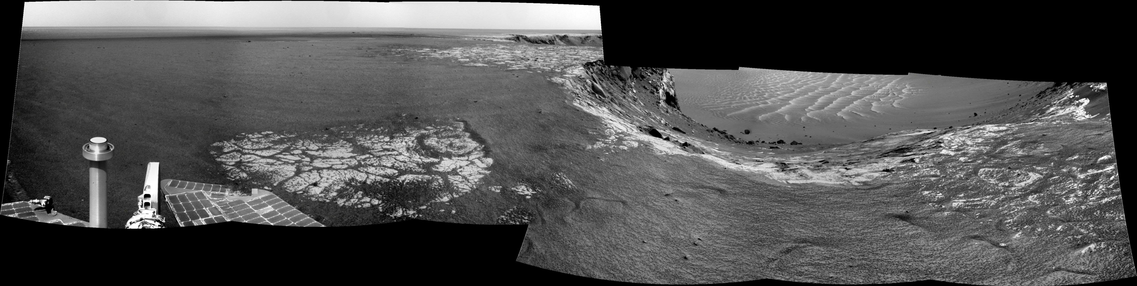 Opportunity's view on Sol 1129
On Sol 1129, Opportunity stood on a promontory at Victoria Crater, between the Cape of Good Hope and Cape St. Vincent, and gazed 30 degrees downward to get a good look at the slope of the Valley Without Peril. As it turned out, the tentatively planned "toe-dip" into the crater here wasdeemed a no-go. Credit: NASA / JPL / Eduardo Tesheiner
A lot of Opportunity's work during the last month has been aimed at evaluating whether the rover could easily slip into the crater via the Valley Without Peril. Alas, the answer to that turned out to be -- 'No.' "Having finished the work at Tierra del Fuego, we made the decision not to attempt a toe-dip, a short excursion, into the Valley Without Peril even though it was something a lot of us really wanted to do," said Squyres. "We concluded that the to-dip we could do safely was not going to gives us the kind of science that made it worth doing. The safe toe-dip we could do would have only gotten us into jumbled up ejecta blocks. We wouldn't have been able to get down to the intact bedrock."
There was this nasty band of dark sand that the RPs named Rubicon -- as in -- "don't cross the rubicon," noted Squyres. [The Rubicon is an ancient Latin name for a small river in northern Italy, which is believed to have flowed in Roman times into the Adriatic Sea between Ariminum (Rimini) and Caesena. The actual modern identity of the river is uncertain, although it is usually identified as the Pisciatello in its upper reaches and then the Fiumicino to the sea and is an ancient boundary between Gaul and Italy. "Crossing the Rubicon" is a popular idiom meaning to go past a point of no return. Julius Caesar crossed the river in 49 BC deliberately as an act of war. Source: Wikipedia]
"The real problem with going into Victoria at the Valley Without Peril was that the rock we wanted to get to was on the down side or far side of the Rubicon and there was no place where we could get the rover to touch the rock we wanted to look at with the IDD without getting at least 4 wheels into this band of sand," Squyres explained. "And if we had gotten 4 wheels in a band of sand like that on that steep, 15-20-degree slope, there was a good chance we wouldn't have driven back up it. We didn't want to commit ourselves to a deep entry into the crater at Valley Without Peril, so we made the decision not to do an ingress there." That means Opportunity is heading back to Duck Bay."
 Cape St. Vincent
Opportunity took this raw image of Cape St. Vincent, the last promontory it visited along the rim of Victoria Crater in March 2007, with its Pancam on Sol 1121 (March 20, 2007). The rover is headed back now to Duck Bay and will stop once again at this location to take high-resolution images of the excellent cross-bedding or stratigraphy it saw here then. Credit: NASA / JPL-Caltech / Cornell
No one on the team is terribly disappointed about not toe-dipping in the Valley, said Squyres. "All of the science we felt we could have hoped to have gotten at Valley Without Peril, we feel confident we could get at Duck Bay anyway, so there really wasn't any reason to go in unless there was really something special we could get at and it was easy," he explained. "In the end it would have been fun to drive but it wasn't worth the risk."
Beyond completing the remaining flight software checkouts, the other things on Opportunity's To-Do-Before-Entering-Victoria List is acquiring two sets of super high-resolution imaging of the best cross-bedding seen on the way to Tierra del Fuego. "One of those is going to be Cape St. Vincent as imaged from the Cape of Good Hope," said Squyres. "So we'll drive out on the southeastern limit of Cape of Good Hope and image across toward Cape St. Vincent doing Pancam super resolution. Then we'll hit the road and do a long drive all the way back to Cape Verde and re-image Cape St. Mary with really good illumination and super resolution to do the best possible documentation of the cross-bedding there." At that point, Opportunity and the MER team will be ready for Duck Bay.
"We're going to be motoring pretty fast except these flight checkouts will slow us down," said Squyres. "So when you see the rover lingering on the path back to Duck Bay, it's primarily because we're doing these flight software checkouts. We've got quite a few boxes to check off and it's going to take a number of days enroute."
If all goes well, sometime around mid-June Opportunity should be taking position and preparing to enter Victoria -- if, that is, ingress into the big crater passes a formal review at NASA headquarters and is given the greenlight.
For all the MER Updates, go to: http://www.planetary.org/explore/space-topics/space-missions/mer-updates/
Protect Our Shared Future
You help us defend humanity and prevent asteroid impacts. Donate now to become a Planetary Defender!
Donate