
 Explore Worlds
 Find Life
 Defend Earth


Bruce Murray Space Image Library
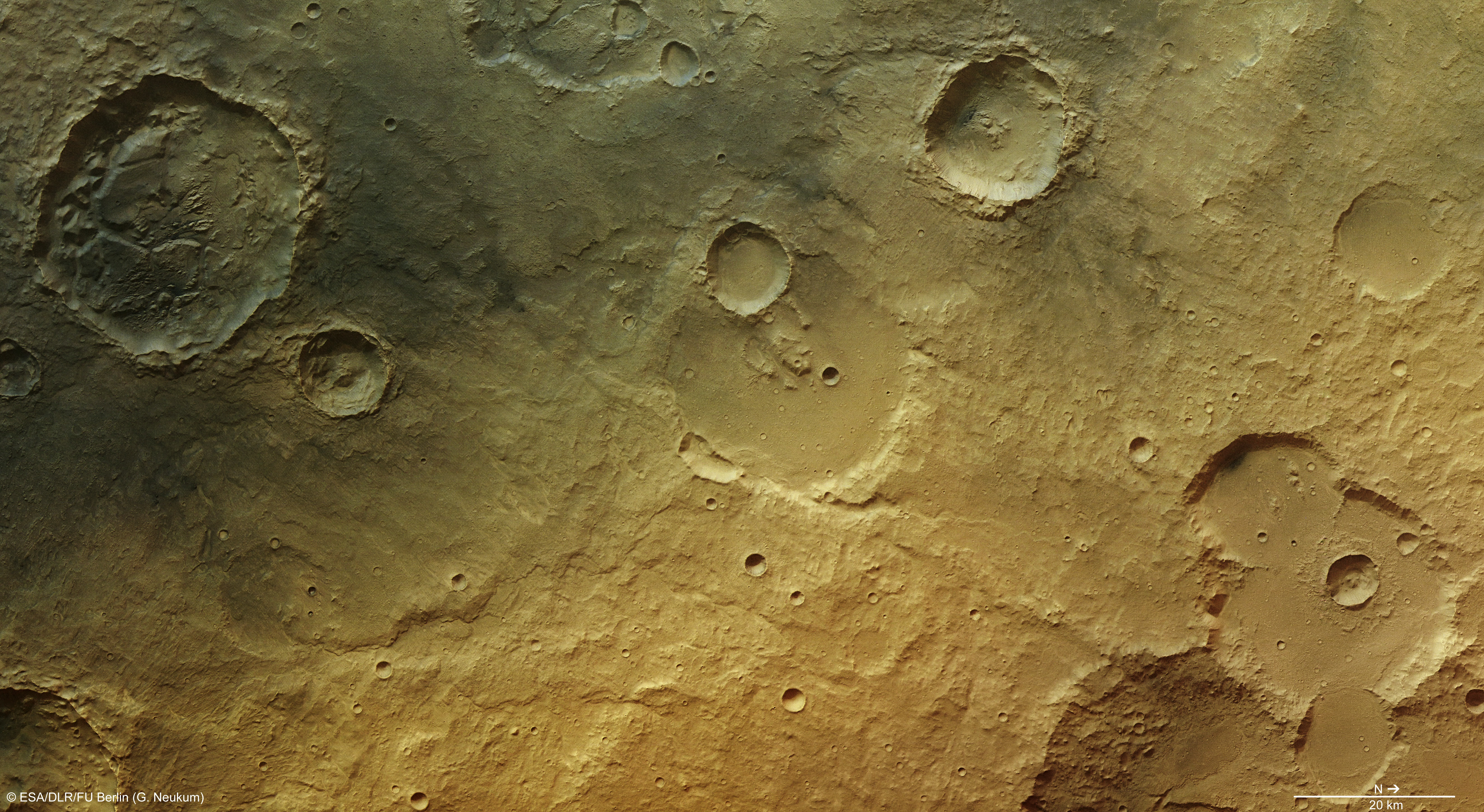
Highlands near Tagus Valles - ancient evidence for water in a Martian desert
Here is further information about the photo from ESA. More information and versions of the image, including topographic, oblique views, and 3D anaglyph, are available at the same page.
Craters once brim-full with sediments and water have long since drained dry, but traces of their former lives as muddy lakes cling on in the martian desert.
The 34 km-wide crater in the top left of the main images perhaps draws most attention with its chaotic interior. Here, broad flat-topped blocks called mesas can be found alongside smaller parallel wind-blown features known as yardangs.
Both mesas and yardangs were carved from sediments that originally filled the crater, deposited there during a flood event that covered the entire scene. Over time, the weakest sediments were eroded away, leaving the haphazard pattern of stronger blocks behind.
Further evidence of this crater’s watery past can be seen in the top right of the crater in the shape of a small, winding river channel.
Clues also hang onto the ghostly outline of an ancient crater some 20 km to the east (below in the main images). While the crater has all but been erased from the geological record, a long meandering channel clearly remains, and flows towards the crater in the centre of the scene....
But it’s not just water that has played a role in this region; volcanic eruptions have also had their say. A dark layer of fine-grained ash covers the top left corner of the main image that may have been deposited from the Elysium volcanic province to the northeast. Over time, the ash was redistributed by wind, and buried deposits exposed in localised areas by erosion.
This region is one of many that exposes evidence of the Red Planet’s active past, and shows that the marks of water are engraved in even the most unlikely ancient crater-strewn fields.