Bruce Murray Space Image Library

Curiosity's path during 2015 studies of silica-rich rocks

Curiosity's path during 2015 studies of silica-rich rocks
Curiosity's path during 2015 studies of silica-rich rocks This map shows the route on lower Mount Sharp that Curiosity followed between April 19, 2015, and Nov. 5, 2015. During this period the mission investigated silica-rich rock targets including "Buckskin," in the "Maria Pass" area, and "Greenhorn," in the "Bridger Basin" area. High-silica sites were identified both in the Murray formation—the lowest and oldest geological unit the rover has visited on Mount Sharp—and in the overlying Stimson geologic unit, which is visible in sandstone ridges within this study area. NASA / JPL-Caltech / Univ. of Arizona

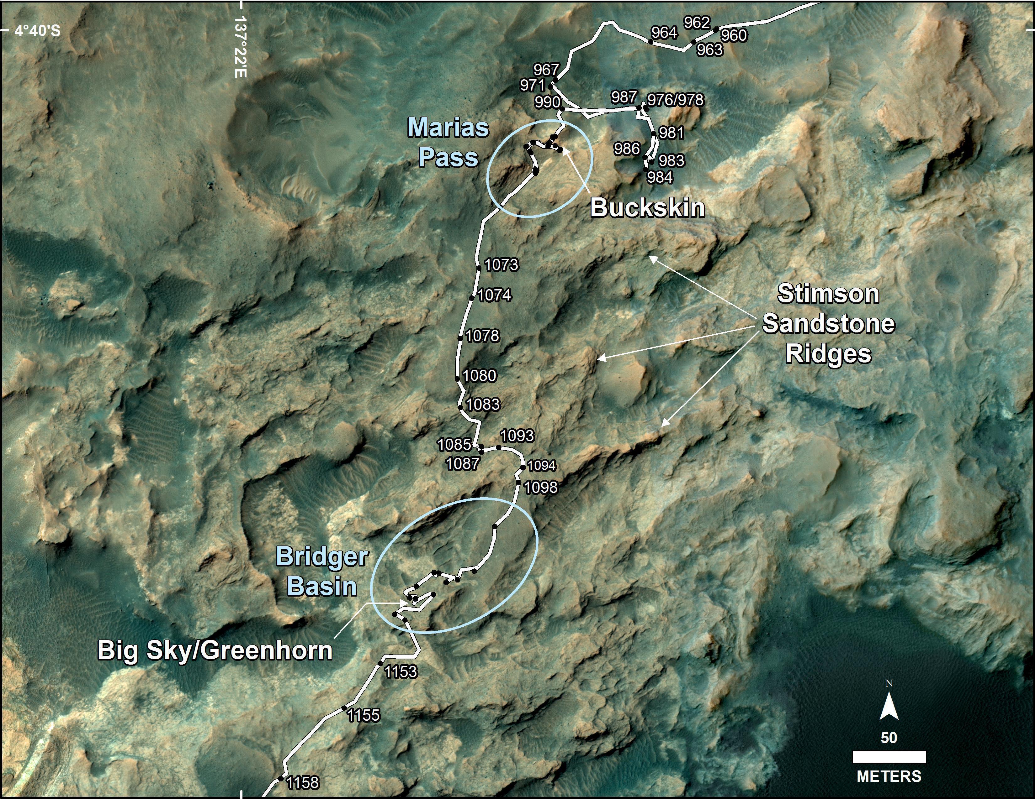
The map covers an area about three-fourths of a kilometer across. North is up. The base image is from the High Resolution Science Experiment (HiRISE) camera on NASA's Mars Reconnaissance Orbiter. Numbers along the route identify the sol, or Martian day, on which it completed the drive reaching that point, as counted since its 2012 landing.