Bruce Murray Space Image Library

Before & After: Colorizing a higher-resolution monochrome image with lower-resolution color data

Before & After: Colorizing a higher-resolution monochrome image with lower-resolution color data
Before & After: Colorizing a higher-resolution monochrome image with lower-resolution color data The base image (left) is a monochrome view from the Context Camera (CTX) on Mars Reconnaissance Orbiter. On the right, it has been colorized with lower-resolution color data from the High Resolution Stereo Camera (HRSC) on Mars Express. NASA / JPL / MSSS / ESA / DLR / FU Berlin (G. Neukum) / Tanya Harrison / Emily Lakdawalla

Here is the full-resolution colorized image (click to enarge to its total enormousness):
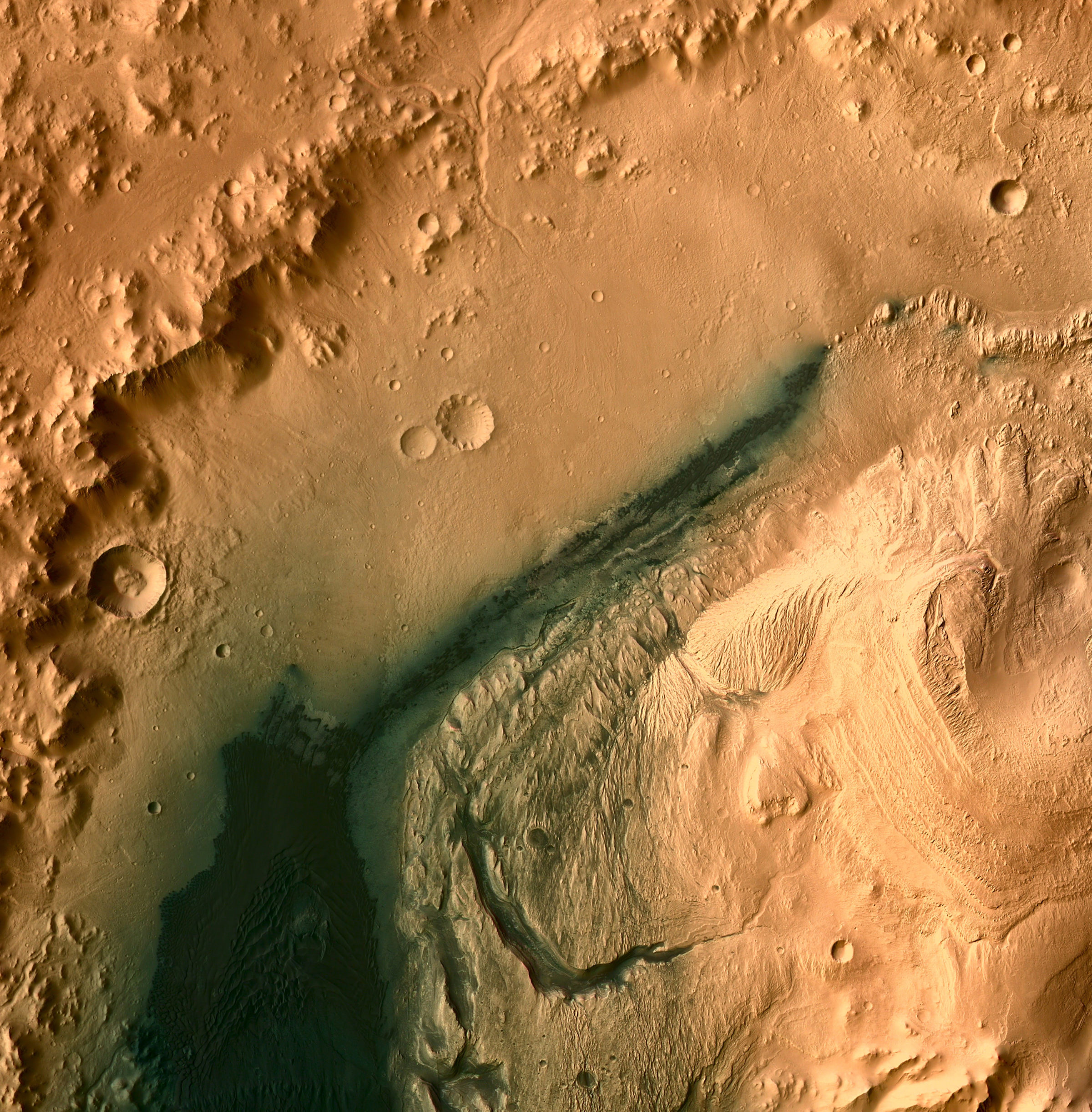
Base map for Curiosity traverse within Gale Crater: CTX colorized with HRSC, 10 m/pixel
Base map for Curiosity traverse within Gale Crater: CTX colorized with HRSC, 10 m/pixel A region of northwestern Gale crater about 70 kilometers square, including the Curiosity landing site and all of the terrain that it is likely to traverse during the mission's lifetime (and then some). At full resolution, the base map is a 10-meter-per-pixel mosaic of Mars Reconnaissance Orbiter Context Camera images produced by Tanya Harrison. It has been colorized with Mars Express High Resolution Stereo Camera data with an original resolution of 25 meters per pixel.Image: NASA / JPL / MSSS / ESA / DLR / FU Berlin (G. Neukum) / Tanya Harrison / Emily Lakdawalla