
 Explore Worlds
 Find Life
 Defend Earth


Up-to-the-minute map of the Phoenix landing site
Written by
Emily Lakdawalla
May 20, 2008
EDIT: I've corrected an error in the location of the ellipses on the geologic map below.
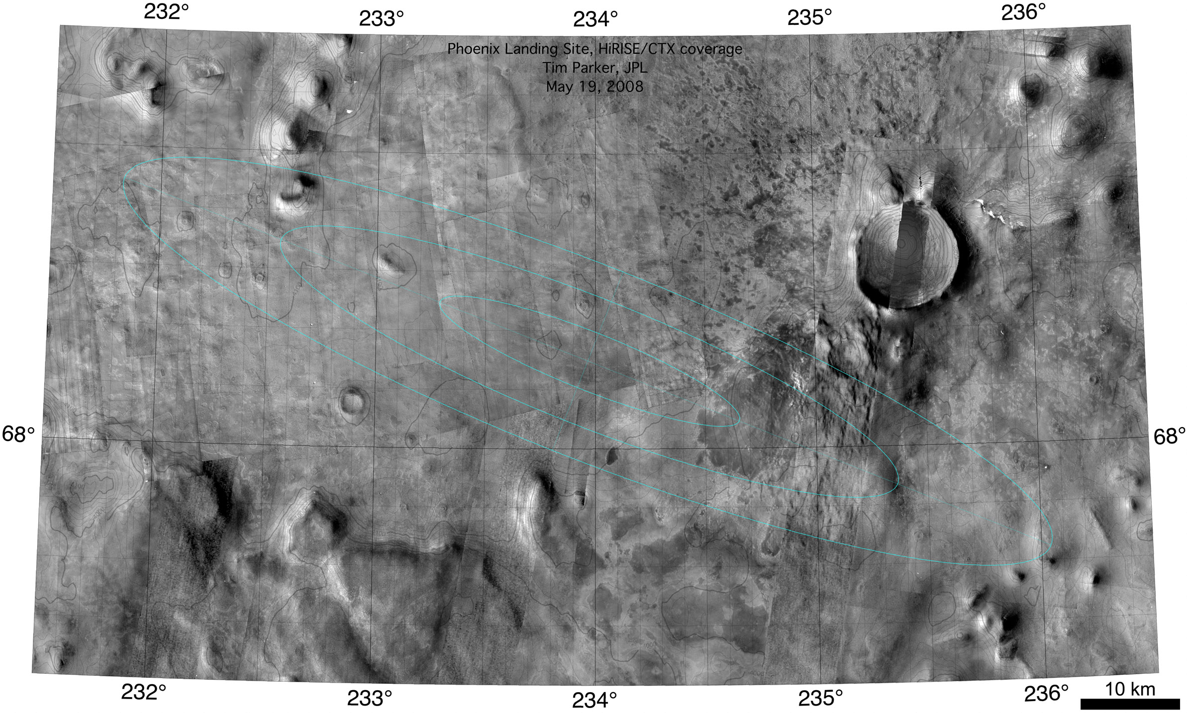
NASA / JPL / U. Arizona / Tim Parker
The Phoenix landing area
The 1, 2, and 3-sigma landing ellipses for Phoenix are overlaid on a base map composed of images from Mars Reconnaissance Orbiter's HiRISE and CTX cameras. This map of the Phoenix landing site is up-to-date as of May 19, 2008. The center of the landing area is at 68.151N, 233.975E.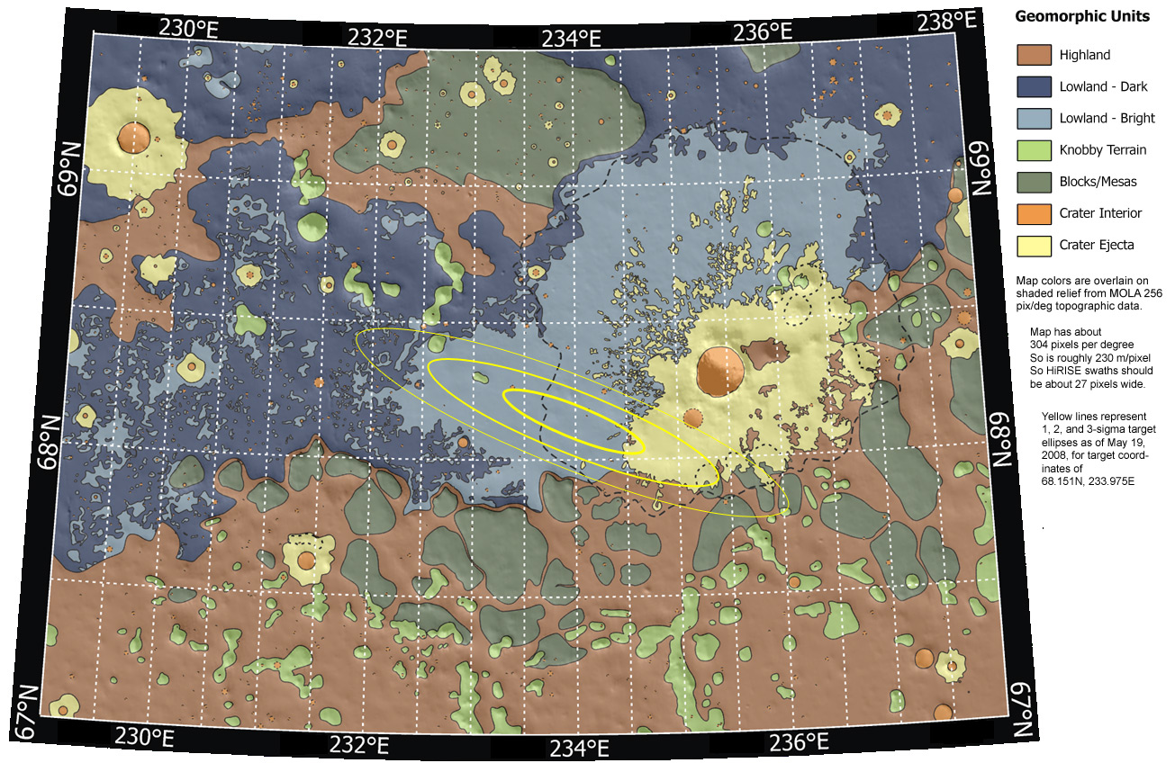
NASA / JPL-Caltech / Washington Univ. St. Louis / JHU APL / Univ. of Arizona / Tim Parker / Emily Lakdawalla
Phoenix landing site map as of May 19, 2008
Phoenix is scheduled to land May 25, 2008 in a region above Mars' Arctic Circle. Its 3-sigma landing ellipse (largest yellow oval, the region in which there is a 99% certainty that the lander will come to rest) is about 100 kilometers long and 19 kilometers wide, centered at 68.151 degrees north, 233.975 degrees east. This map is current as of May 19, 2008, a week before the landing, and accounts for a late northwestward shift of the target point. This map has been corrected from previous versions, which had the lines of longitude mislabeled, with the result that the ellipses were shifted from their correct locations by half a degree.Protect Our Shared Future
You help us defend humanity and prevent asteroid impacts. Donate now to become a Planetary Defender!
Donate