
 Explore Worlds
 Find Life
 Defend Earth


Mars Exploration Rovers Update: Mission Looks Back in Honor to Apollo 12, and Drives Exploration Onward

Written by
A.J.S. Rayl
Contributing Editor, The Planetary Society
November 30, 2010
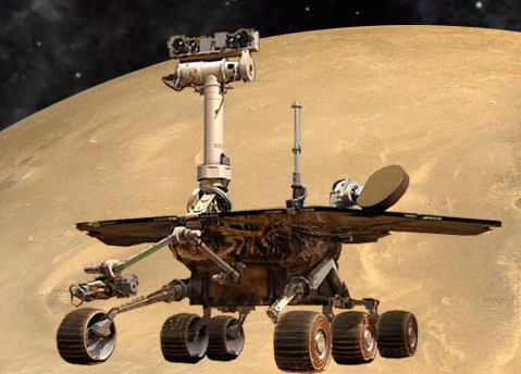 Mars Exploration Rovers
Credit: NASA / JPL-Caltech / Maas Digital
The Mars Exploration Rovers (MER) forged on in November, their 83rd month of an expedition originally planned for three months: Spirit remained silent at Gusev Crater presumably still re-charging her batteries, as Opportunity roved through a field of craters pressing on toward Endeavour Crater, quietly claiming title along the way to being the first roving robot to drive 25 kilometers on Mars.
There was no fanfare to speak of on Earth, and out on the Red Planet Opportunity just kept on truckin'. But considering that mission success called for just one rover to make it 600 meters, and considering that this rover is now driving backwards because of a troublesome front wheel, and with its arm partially unstowed because of a broken shoulder, 25 kilometers on Mars is an achievement that is certainly noteworthy. Even genius inventor, Nikola Tesla, the father of remote control, would be, no doubt, impressed.
As focused as they are on roving onward though, the MER team members took a moment to look back this month and remember a few of the pioneers who inspired them by honoring Apollo 12, the second mission to land on the Moon on its 41st anniversary.
On November 19, 1969 -- just fours months after Apollo 11 put the first Earthlings, American astronauts Neil Armstrong and Buzz Aldrin (now a Planetary Society Adviser), on the Moon -- astronauts Charles “Pete” Conrad and Alan Bean left the Apollo command and service module, Yankee Clipper, where Richard F. Gordon was to maintain post, and headed for the Moon in the Intrepid.
Once again the world seemed to stop and hold a collective breath. Televisions and radio stations could be heard blaring the news, second-by-second, everywhere when the Intrepid dropped down toward the dusty lunar surface.
Realizing the Apollo 12 anniversary was this month, MER science team member James Rice, of the Goddard Space Flight Center, remembered the feeling so many people had back then. "The Apollo missions,” he recalled, "were so inspiring when I was young."
While it has been overshadowed in history, Apollo 12 was, in many ways, as important as Apollo 11, because it proved we could do it again – and with lessons learned, we could do it even better, more precisely the second time around. Indeed, as the Intrepid touched down in the southeastern portion of the Ocean of Storms, Bean, the lunar module pilot, made it look almost easy.
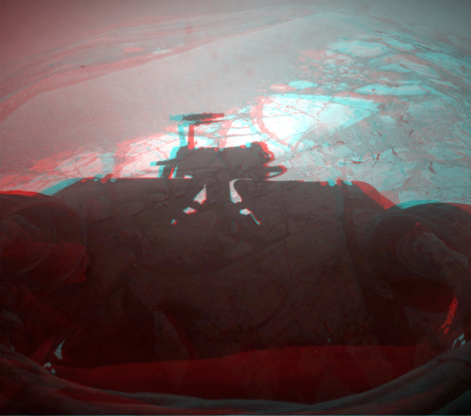
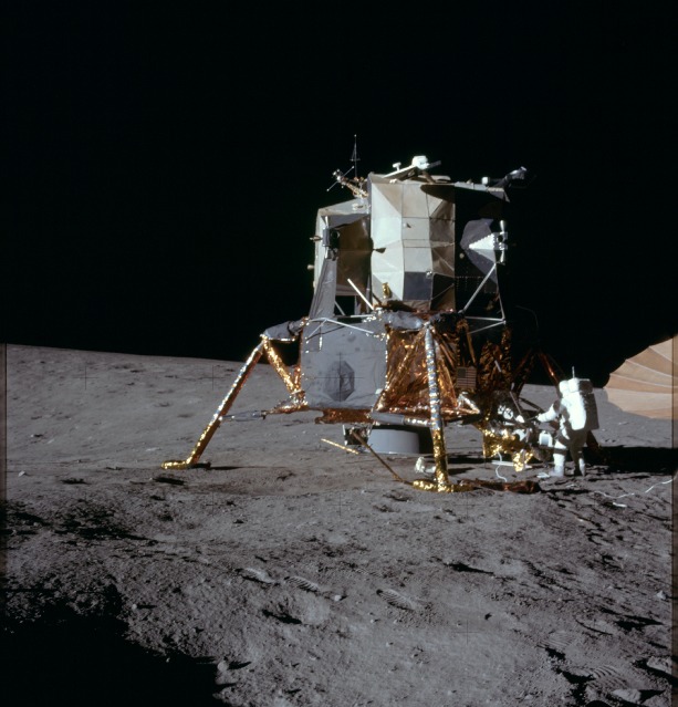 Apollo 12's Intrepid
Astronaut Alan L. Bean, lunar module pilot for the Apollo 12 lunar landing mission, works at the Modular Equipment Stowage Assembly (MESA) on the Intrepid during the mission's first extravehicular activity, (EVA) on Nov. 19, 1969. Astronaut Charles "Pete" Conrad Jr., commander, and Bean descended in the Intrepid to explore the Moon while astronaut Richard F. Gordon Jr., command module pilot, remained with the command and service module in lunar orbit.Credit: NASA
When Conrad, the mission commander, who was somewhat shorter than Neil Armstrong, stepped onto the lunar surface and said: "Whoopie! Man, that may have been a small one for Neil, but that's a long one for me," it was pretty obvious to everyone on Earth that despite the risk, the astronauts were loving the adventure.
During their 30 hours on the surface, Conrad and Bean took pictures, collected rocks, set up a nuclear-powered station to relay data from the surface over the long-term and equipment that took measurements of the Moon's seismicity, and, yes, bounced along on the Moonscape to the Surveyor 3 robotic probe to retrieve parts for analysis. The mission ended just five days later, on November 24, 1969, with a near perfect splashdown in the South Pacific near American Samoa.
By the end of 1969, humanity's perspective really was forever changed, and Apollo 12 played no small role in that shift.
So when Rice suggested naming two craters Opportunity was imaging this month after the Apollo 12 spaceships, it didn't require much discussion. “We all agreed it was the right thing to do,” said Steve Squyres, principal investigator for rover science, of Cornell University.
The team decided long ago to name Opportunity's craters after historic ships of exploration. In fact, many people probably remember that just hours after this rover bounced to a landing, scoring a 350-million-mile hole-in-one, on January 24, 2004, the 22-meter (0.01 mile) diameter hole in the ground where the rover had come to rest was named Eagle Crater, after Apollo 11's lunar lander. It was then that this tradition was born and it was there in Eagle Crater that Opportunity found multiple lines of evidence for a wet environment in the area's ancient past – exactly what it had come to find.
Once the sites were duly christened and Opportunity had finished taking pictures of Yankee Clipper Crater and Intrepid Crater, Rice sent Bean and Gordon the photographs. Even though the names the MER team confers aren’t official, it's an honor to be acknowledged this way on Mars, and Bean responded to Rice with an email for the team:
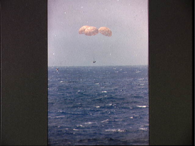 Apollo 12 splashdown
Apollo 12, carrying American astronauts Charles "Pete" Conrad, Alan Bean, and Dick Gordon, was the second manned mission to land ont eh Moon. This image was taken on Nov. 24, 1969, when it safely splashed down.Credit: NASA / JPL-Caltech / UA/ labeled by Stuart Atkinson
“I just talked with Dick Gordon about the wonderful honor you have bestowed upon our Apollo 12 spacecraft,” he wrote. “Forty-one years ago today, we were approaching the Moon in Yankee Clipper with Intrepid in tow. We were excited to have the opportunity to perform some important exploration of a place in the universe other than planet Earth where humans had not gone before. We were anxious to give it our best effort. You and your team have that same opportunity."
It's an opportunity the MER team grabbed by the tail from the moment the mission got the green light. Scientists and engineers alike imbued Spirit and Opportunity and joined forces to give these robot twns the best of everything they had to give. Now, nearly seven Earth years later the two rovers are still in the game, beloved around the world, MER is one of NASA’s most famous missions ever, and the team is still giving it, by all observed actions, its best effort.
As November comes to a close at Gusev Crater, Spirit sits parked as she has since March, on the western side of Home Plate, silently taking in the sunlight and trying to re-charge her batteries, at least there’s no reason right now to believe otherwise, Callas reported.
NASA-JPL engineers have been doing all they can to listen for and reach out to Spirit, making use of the Deep Space Network (DSN) and the Mars Odyssey orbiter, according to John Callas, MER project manager at the Jet Propulsion Laboratory (JPL), where the rovers were ‘born,’ and are being managed. Whether Spirit suffered just a low-power fault or has suffered both a low-power fault and a mission clock fault, they're prepared to pick up just about any sound emitted by the rover, and they are continuing to attempt to nudge the rover to respond. Making the connection involves timing though, and not knowing what condition the rover is in or when exactly it might be waking up complicates the effort to make contact.
There had been enough buzz about Spirit possibly phoning home in October or November that the ongoing silence might be viewed from the outside as not so good. True, noted Callas, with each passing week of now, some of the team members get “a little bit anxious.” But by all appearances, the team remains undaunted. In other words, hope still floats.
 Spirit at Home Plate
The HiRISE camera on the Mars Reconnaissance Orbiter took thi look at Spirit's parking spot at Home Plate on July 16, 2009. Spirit is at lower left, on the west side of Home Plate.
Credit: NASA / JPL / University of Arizona
“Importantly, the model is a computer model and it has its limitations," Callas pointed out. "The solar insulation levels are increasing at Gusev Crater as the seasons move from spring towards summer, and each passing day should provide more power to the rover."
So, while the team’s computer model did predict that the rover could phone home sometime around October, the recovery window has really just opened. “There are perfectly plausible scenarios in which we would hear from a happy healthy vehicle months from now,” Squyres pointed out. “We're just waiting.”
“We still have opportunities up through March,” added Ray Arvidson, the deputy principal investigator, of Washington University St. Louis.
As for when and how they might expect to hear from Spirit, all bets with Squyres, true to form, are off. “We just don't know," he said. “We’re sweepin’ and beepin’ and crossing our fingers.”
On the other side of Mars, at Meridiani Planum, Opportunity commanded the spotlight this month with all its driving. Powered up with plenty of Sun-fueled energy, the rover regularly ripping across the landscape with 80 to 100 meter drives. And with miles to go to get to Endeavour Crater, the rover seemed almost content to just keep on driving.
Always the glamour girl, Opportunity may be less glamorous these days, driving backwards with her arm partially unstowed (because of her broken shoulder joint) and looking something like she’s fishing off the back deck. But this rover is a charmer and a trooper and this past month she did not disappoint in any way.
Following the chosen route, Opportunity literally cruised through November, putting another 680 meters behind her with relative ease. She roved through a crater field, meandering over and around a host of impact depressions, some stark and some nearly invisible, taking dozens of pictures as she went. On the drive away from Intrepid Crater during the middle of the month, Opportunity clicked off kilometer 25, and at computers around the world people in the know had to be smiling.
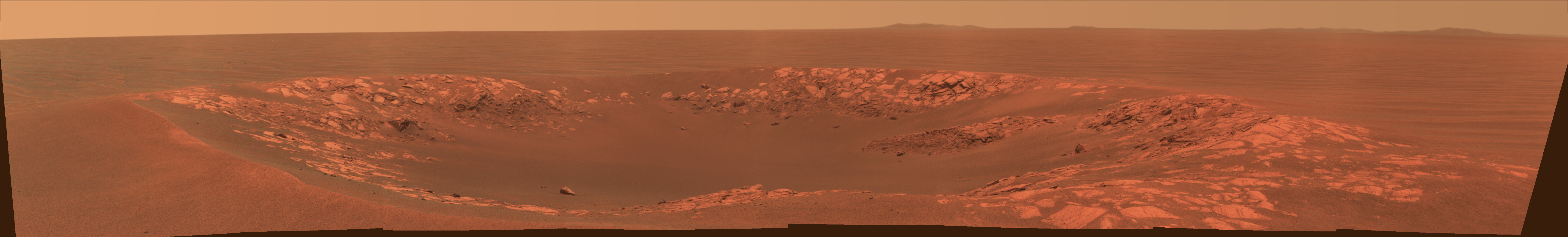 Intrepid Crater
The MER team looked back in honor to Apollo 12 this month, naming craters Opportunity checked out after the Apollo 12 spacecraft. The rover took this view of Intrepid Crater with its panoramic camera during its Sol 2417(Nov. 11, 2010). Apollo 12's Intrepid carried astronauts Pete Conrad and Alan Bean to the surface of Earth's moon on Nov. 19, 1969, as crewmate Dick Gordon orbited overhead in the mission's command and service module, Yankee Clipper.Credit: NASA / JPL-Caltech / Cornell University
“The fun thing about crater-hopping is that not all these craters formed at the same time; some are younger and some are older,” said Squyres. “One of the things we want to understand is how do craters get erased on Mars? By adding images of these craters in different stages of degradation to the Mars database, we can begin to figure out that process.”
As November comes to a close at Meridiani Planum, Opportunity is on the way to its next intermediate destination, Santa Maria Crater, a planned stop some 1.3-to-1.5 kilometers away. Orbital data has revealed the signature of hydrated minerals on the surface near this small size crater, that is, minerals with water bound in their structure, evidence of past water. While this rover has been driving over hydrated minerals since the beginning, they have never before been detected in orbital data taken over this part of Meridiani Planum.
What that means is a mystery right now, but the scientists are intrigued. Some are even exuding the giddiness of kids lined up and forced to wait to get into the amusement park. They know for sure though that Santa Maria is a young crater and it’s fresh, and no matter what they find, whether it’s more of the same or something entirely new, the monstrous Endeavour is on the horizon promising the best is yet to come.
 Santa Maria vs Victoria Crater
This image shows a HiRISE image of Santa Maria Crater, on the left, superimposed on a HiRISE image of Victoria Crater, the larger crater on the right. In reality, these two craters are not located next to each other. This image was put together by rover aficionado Stuart Atkinson to show the difference in size between the two craters, for comparison purposes only.Credit: NASA / JPL-Caltech / UA / S. Atkinson
In other MER news, NASA-JPL announced this month that the MER mission is the first NASA space mission to use cloud computing for daily mission operations. A term that refers to computing capacity (space, power, speed) on demand, cloud computing is basically a method of gaining speed and flexibility in computing ability, as if from the clouds, hence the name.
“The cloud is the ability to access computing power when you want it without having to own it,” explained JPL’s chief technology officer Tom Soderstrom, of the Office of the Chief Information Officer, who spearheaded use of the industry trend at the Lab. “You can rent the computing space and power when you need it, ordering it from a web browser so it’s self-service, and pay only for what is used.”
"This is a change in thinking about computer capacity and data storage to a commodity like electricity, or even the money in your bank account," Callas added. "You don't keep all your money in your wallet. Instead, you go to a nearby ATM and get cash when you need it. Your money is safe, and the bank can hold as much or as little of the money as you want. Data is the same way: You don't need to have it on you all the time. It can be safely stored elsewhere and you can get it anytime via an Internet connection. This way we don't waste electricity and air conditioning with servers idling waiting to be used, and we don't have to worry about hardware maintenance and operating system obsolescence."
The virtually limitless capacity of cloud computing is especially attractive to MER mission, Soderstrom and Callas both noted, because the rovers have lived and prospered so long that their unexpected longevity and volumes of data used have outgrown the systems originally planned for handling and sharing data. In addition, the mission has “a widespread user community acting collaboratively,” said Khawaja Shams, a JPL software engineer supporting the project. “Cloud enables us to deliver the data to each user from nearby locations for faster reaction time."
The MER mission actually made the switch to cloud computing in late October, and is now using a public cloud for the software and data that the rovers' flight team uses to develop daily plans for rover activities. The benefit, Soderstrom said, is that MER scientists around the world are now getting the rover planning data at record speed. “We went from queries taking tens of minutes to just a second or two,” he said. “And we are seeing cost savings.”
 MER body parts
The Mars Exploration Rovers are robot field geologists designed with parts to substitute for the organs all living creatures would need to stay "alive" and explore, as well as some super-human powers. Spirit and Opportunity, for example, each have a body that protects "vital organs;" brains to process information; temperature controls, including internal heaters, a layer of insulation, and more; a "neck and head" formed from a mast for the panoramic cameras for a human-scale view; eyes and other "senses," such as cameras and instruments that give the rovers information about their environment; an arm to extend reach; wheels and "legs" for mobility; and energy sources in the form of batteries and solar panels; and antennas for "speaking" and "listening."
Credit: NASA / JPL-Caltech
The rovers’ activity-planning software, Maestro, was developed in-house at JPL. Soderstrom and the team at JPL then collaborated with the cloud team of Amazon.com Inc., in Seattle, to plan and implement the use of cloud computing in the MER mission’s daily operations.
JPL, which is one of the few agencies in the federal government that is incorporating cloud computing, “gained confidence” in it, Soderstrom said, from experience with other projects, including the NASA public participation "Be a Martian” website with Microsoft and a school project on Mars, with Google.
The first challenge, he said, was getting beyond the hype that ‘cloud computing will save you an infinite amount of money, will work so fast you won't have to do anything, and it will have your babies, feed them and put them through college,’” Soderstrom said, clearly exaggerating to make a point.
"To implement the vision of Jim Rinaldi, the CIO at JPL, of renting instead of buying capacity, we pragmatically looked past the hype to find the practical, cost-efficient real mission applications. Our strategy was to keep it real, the early exploration of multiple clouds.” And keep it real became the mantra.
To that end, Soderstrom and crew “worked closely” with multiple cloud vendors, large and small, for several years, he said, to learn the best ways to gain the advantages of cloud computing and to find the most practical, cost-efficient real mission applications. "We defined a 'cloud-oriented architecture' to use clouds as an extension of our own resources and to run the computing and storage where it is most appropriate for each application," he said.
Within that cloud architecture, JPL is currently experimenting and or working with three kinds of clouds: private, in-house within the walls of JPL; public, like Amazon, Google, and Microsoft; and a hybrid cloud, which they hope will become a secure reality in the not too distant future. The hybrid cloud, Soderstrom suggested, is “the most promising” for space missions “because you would run some things inside in a private cloud and some things outside in a pubic cloud, like we are doing with MER now.”
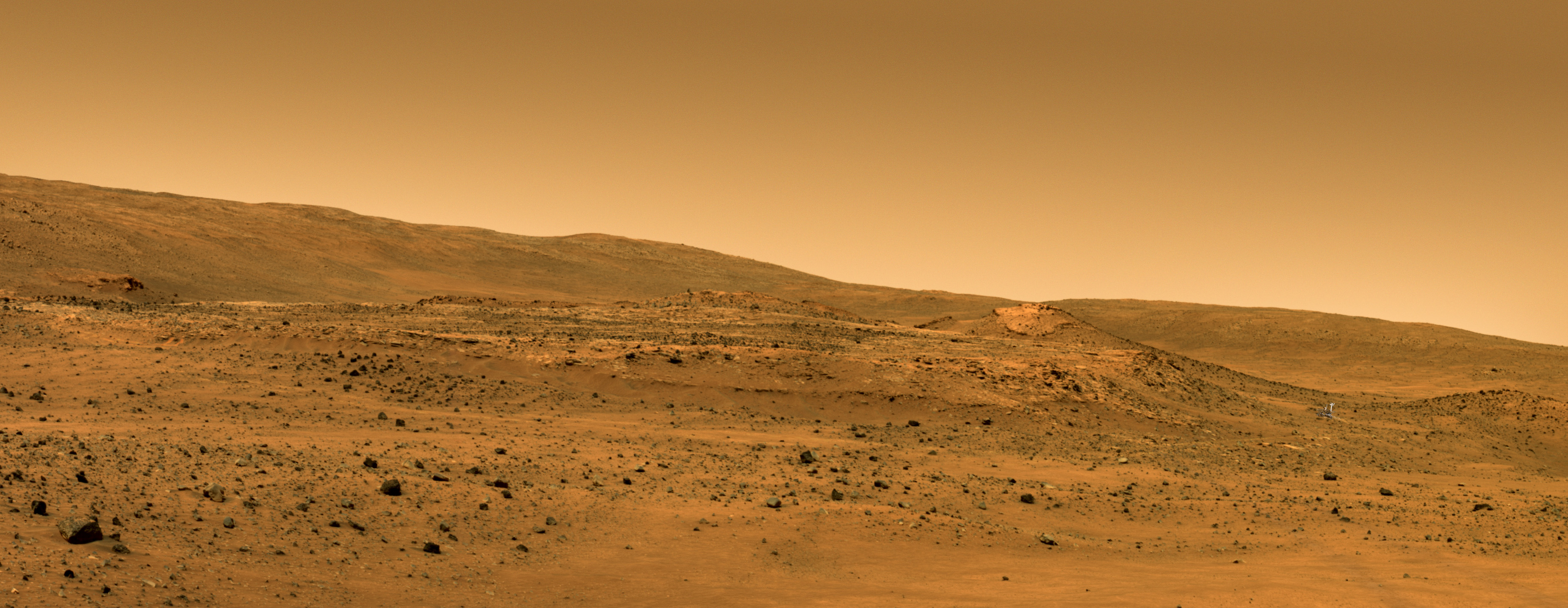
 Martian -not computing - clouds
Credit: NASA / JPL-Caltech / UA
To efficiently determine which cloud is appropriate for what data, Soderstrom and others in the IT office developed a Cloud Application Suitability Model and a Wheel of Security, so that officials and project managers could quickly and effectively determine if the data goes in a private cloud inside JPL, or a public cloud like Amazon, Google or MS, or is suited for a hybrid.
As for the risks Soderstrom said JPL has considered them all, from cloud vendor failure to hackers. Having a cloud go down or become inaccessible, is, he said, “one of our biggest” risks; consequently, JPL decided early to work with a number of cloud vendors and not be permanently aligned with or assigned to one. While the MER data is using an Amazon public cloud now, he said that JPL is currently “developing mechanisms where we can go to any cloud of those we have chosen, so if one vendor stops performing we'll run the computing in someone else's cloud.”
And security? “What could they do if they cracked through security? In reality, not that much,” Soderstrom said. “They would have access to the plans. But they wouldn't be able to access the rover or execute those plans. They couldn't cause any harm to the rovers.” Just to be safe, though, JPL is “triply encrypting” the rover planning data. Like the rovers, “we are early explorers and we try lots of new technologies,” he noted, “but we tend to be careful at the same time.”
Spirit from Gusev Crater
Spirit is still parked on the west side of Home Plate, where she’s been since April 2009 when she inadvertently broke through a crusty top layer of soil along the rim of a hidden crater, and her left wheels sunk into the shallow, sand-filled depression. Her odometer is, for now, frozen at 7,730.50 meters (4.80 miles) and the MER team has had no communication with the rover since Sol 2210 (March 22, 2010). It is believed that the winter cold sent the rover into hibernation, a mode wherein she shut down all systems except emergency, life-supporting heaters and her mission clock.
With spring now shining down on the southern hemisphere of Mars, the solar-powered rover should be taking in the sunlight and charging up her batteries. Meanwhile, NASA engineers continue to listen for the rover’s ‘beep,’ with the Deep Space Network (DSN) and Mars Odyssey orbiter. The rover should emit its signature series of tones once autonomous recovery from the low-power fault begins. The team is also conducting a paging technique, known as sweep-and-beep, a strategy to electronically ‘nudge’ or prompt the rover if it turns out that she lost so much power that her mission clock faulted. If that is the case, then Spirit wouldn’t know what time it is, and would be waiting to hear from her crew on Earth, rather than taking the initiative of phoning home.
 Spirit at Troy
Spirit is like a golf-cart on the shoulder of Home Plate in this artist's rendition showing the rover's position where she became bogged down at Troy. The panorama was taken by the rover on its Sol 743 as she descended from Husband Hill toward Home Plate, the circular plateau in the center of the image; the rover is in the valley to its right.Credit: NASA / JPL / Cornell / Glen Nagle
“We're trying to maximize the number of sweep-and-beeps we do,” said Callas. The fact that MER has to negotiate with the Mars Reconnaissance Orbiter (MRO) for the use of the frequency, because it's shared between the two missions, makes the scheduling a little tricky sometimes. "It's a very tight choreography for that time,” he added, “and we're constantly adjusting things to minimize the impact to orbiter and maximize the amount of communication time we have available for Spirit.”
Past that, the story with Spirit has been the same for months now, and November gave the team nothing new to report. “A lot of people are not comfortable with 'we don't know' as an answer,” said Squyres. “That’s the problem I have in talking with a lot of people in the media about this. People want odds. They want guesses. We don't know. We simply don't know.”
Opportunity from Meridiani Planum
As the calendar turned to November, Opportunity was producing a healthy 610 watt-hours under slightly hazier-than-normal skies. With 24,775 meters on her odometer, the rover pressed onward to Endeavour Crater, following the charted course, and navigating through a field of small impact craters.
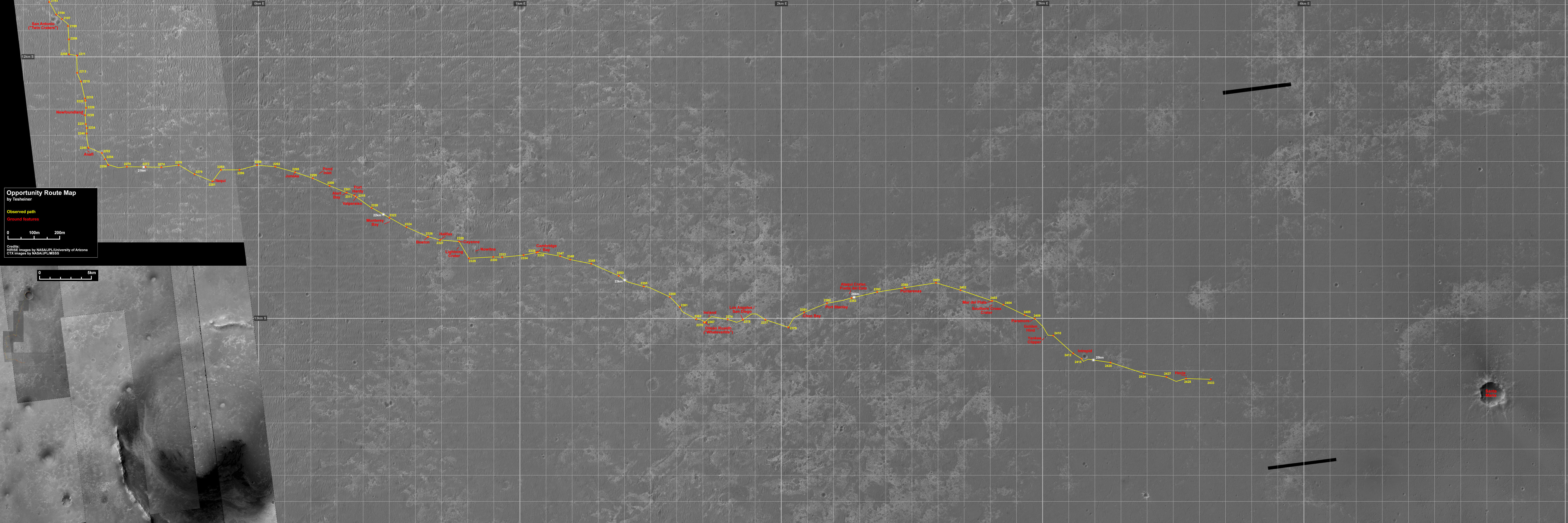 Opportunity route map
This map -- which features images taken by the High Resolution Imaging Science Experiment (HiRISE) camera and the Context Camera onboard the Mars Reconnaissance Orbiter -- shows Opportunity's route, along with features observed, from the twin San Antonio Craters which the rover cruised by last March to its current location this month. You can't miss Santa Maria, the large depression in the lower right of the image, which is the rover's next intermediate stop. Then, it's onward to Endeavour.Credit: NASA / JPL-Caltech / UA / MSSS / annotated by Eduardo Tesheiner
While this ‘sea of holes’ is rich territory for the scientists, Opportunity stuck to the no-loitering plan settled on several weeks ago. The rover would stop and rest every so often as usual, and would reposition itself here and there, but it would not stop for long at any of the small impact craters it was passing -- unless something truly different, something weirdly Martian turned up. Rather, the rover was tasked with what the team has come to call "drive-by shootings," snapping pictures of the craters from multiple angles, while pressing ever onward.
On Sol 2409 (November 2, 2010), Opportunity warmed up with a 38-meter (125-foot), drive, stopping midway to take some pictures. Two sols later, after rising early to catch an image of the transit of Phobos across the Martian sky with her panoramic camera (Pancam), the rover put her pedal to the metal on Sol 2410 (November 4, 2010) and put more than 100 meters (328 feet) behind her. Along the way, she collected more photographs of more impact craters, and homed in on the 10-meter diameter crater the team dubbed Yankee Clipper, after Apollo 12’s command and service module.
“We know what a fresh crater looks like and we know that craters can erode away completely,” said Squyres. “We would like to understand how that erosion takes place. And, if we can see dozens of craters, all roughly in the same size range in different states of preservation, ranging from very fresh, like Fram [Crater] was at the beginning of the mission, to just about everything in between, then we can take them and arrange them in a chronological sequence according to the stages of the destruction and/or preservation. By looking at many craters in such a fashion we will actually get a much better handle on what that process was like.” And, once that timeline of images in the database is rich enough, they could and likely will create a crater erosion 'movie' that actually shows a crater getting erased.
 Yankee Clipper Crater in 3-D
Yankee Clipper Crater on Mars, which is about 10 meters (33 feet) in diameter, is named after the command and service module of NASA's 1969 Apollo 12 mission to the moon. Opportunity snapped this stereo view of the crater during a pause in a 102-meter (365-foot) drive on its Sol 2410(Nov. 4, 2010). The scene appears in 3-D when viewed through red-blue glasses (red lens on the left). It combines images taken with the left eye and right eye of the rover's navigation camera. The MER science team has been naming craters after historic ships of exploration since Opportunity bounced into a crater on landing and the team named it after Apollo 11's Eagle, which was the first Earth spacecraft to land on the Moon. Apollo 12's Yankee Clipper orbited Earth's moon while the mission's lunar module carried two astronauts to the lunar surface on Nov. 19, 1969, and later brought all three of the mission's astronauts back to Earth on Nov. 24, 1969.Credit: NASA / JPL-Caltech
Opportunity performed an in-place 40-degree turn on Sol 2411 (November 5, 2010) in order to more clearly communicate with Mars Odyssey. The move paid off in that the rover was able to sent transmit substantially more data over the afternoon UHF relay pass than she would have been able to otherwise. The following sol, the rover began her approach to Intrepid a 20-meter (66-foot) diameter crater named after the lunar module piloted by Alan Bean and commanded by the late Pete Conrad. That sol, she completed a 96-meter (315-foot) drive just to the southwest, the last 12 meters (39 feet) of which she did all by herself under autonomous navigation.
After a quiet weekend, Opportunity completed the approach to Intrepid with a 36-meter (118-foot) drive on Sol 2415 (November 9, 2010), positioning herself safely near the crater's rim. Then, during the next several sols, the rover snapped away, taking pictures from many angles, inside out, and outside in of the crater named in honor of the Apollo 12 lander.
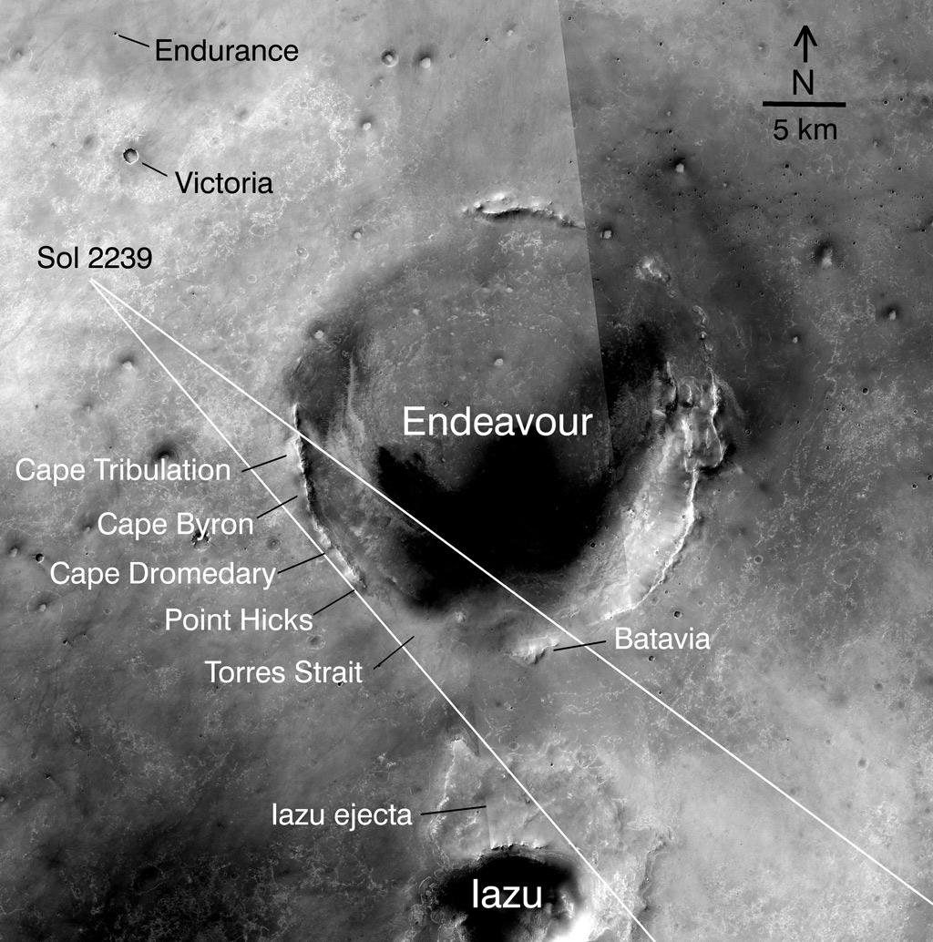
As the second week of November came to a close, Opportunity hit the Meridiani bedrock highway again, with plans to continue taking images of craters all along the way to Endeavour, the monstrous, highly-eroded crater that is the rover's next major destination. At 22 kilometers (13.70 miles) in diameter, Endeavour, which is named after the ship in which Cap’t. James Cook's took his first Pacific voyage, is the grandaddy of craters for Opportunity, about 1,000 times wider than Intrepid and more than 20 times larger than Victoria Crater.
 Between craters
This map of the region around Opportunity shows the relative locations of several craters and the rover in May 2010, when the rover took the pictures for a super-resolution view of the horizon to its southeast. The base map here is a mosaic of images from the Context Camera on NASA's Mars Reconnaissance Orbiter. The scale bar is 5 kilometers (3.1 miles).Credit: NASA / JPL-Caltech / /Malin Space Science Systems / WUSTL
When Squyres announced the destination back in September 2005, it seemed ambitious to say the least, an impossible dream by some accounts. Now, that crater is visible on the horizon and the road ahead is looking good. Opportunity departed Intrepid on Sol 2420 (November 14, 2010), with a drive of more than 116 meters (381 feet).
The rover paused midway to take one last series of pictures of Intrepid from a different vantage point. It was on this drive that she crossed the 25-kilometer (15.53 miles) mark. That's more than 40 times the driving-distance goal set for Opportunity to accomplish during its original three-month prime mission in 2004.
"It's not how far the rovers have gone, but how much exploration and science discovery they have accomplished on behalf of all humankind,” Callas offered.
Squyres agreed: “Each time we tick off another kilometer, it's nice and a number like 25 is especially nice but for me the more important milestones are the geographic ones, not kilometers, but interesting new things.” And this mission has been loaded with interesting new things. Not the least of which is the big one on the horizon.
Still, Opportunity is driving with all she’s got, and distance does matter now. In fact the rover is pushing the limits of every drive almost, driving blind as commanded from Earth and following most of those jaunts with autonomous driving. The imagery needed for the Opportunity to do her backward autonomous driving can quickly fill up the robot’s memory banks, however, and data management has become something of an issue.
“We've been having a little difficulty with data management because driving produces a lot of data products from the rover and we have to get them off the rover, so data volume can be a constraint on driving,” said Callas. “We're managing that. It's a complicated coordination with Mars Odyssey," he noted. Whenever there's a wrinkle or glitch or fault with another spacecraft, the impact can ripple through the armada of spacecraft dependent on the DSN. "Stardust went into safe mode a week ago, so we lost an Odyssey pass and didn't get the Opportunity data down in time, so we couldn't drive that next sol,” he confirmed. “But those are things we have always had to deal with.”
Despite the unplanned sol off from driving, Opportunity made impressive progress this month and the road ahead looks nice and flat, and oh so rovable.
 Intrepid Crater in (false) color
Intrepid Crater is presented here in false color to make differences in surface materials more visible. This image combines exposures that Opportunity took with its Pancam through three filters admitting wavelengths of 752 nanometers, 535 nanometers and 432 nanometers. Intrepid crater is about 20 meters (66 feet) in diameter, about the same size as Eagle Crater into which the rover bounced on landing, and where it found signs of past water.Credit: NASA / JPL-Caltech / Cornell
Not long after MRO arrived at Mars in March 2006, the MER team began using orbital pictures taken by the High Resolution Imaging Science Experiment (HiRISE) camera and the Context Camera (CTX) and data from the Compact Reconnaissance Imaging Spectrometer for Mars (CRISM) to adjust the rover’s route, making the trip as safe and scientifically interesting as possible.
Even though HiRISE can image objects the size of a basketball on the surface of Mars, and the even subtle depressions of ancient craters can be detected, could a hidden, 'stealth' crater be laying in wait for Opportunity, as Scamander was for Spirit?
“We're always on the lookout for odd things,” said Arvidson. “The craters we can see we know where they are down to 2 meters across. Now there are a lot of buried craters in this area of Meridiani Planum and we can see them too, because they're circular, kind of palimpsest, eroded down and filled with basaltic sand and hematite concretions. At Meridiani Planum, we're driving across this eroded down bedrock with eroded down craters that are probably buried with the sand. I have paid careful attention when we've driven across some of these buried craters and have seen no change in terms of sinkage or the slip.”
 Opportunity in Endurance Crater
A computer-generated image of Opportunity is placed in context in an image it captured of Endurance Crater on its Sol 134 (June 9, 2004.) Credit: NASA / JPL-Caltech / Cornell / synthetic imagery by Maas, Gorjian, Kuramura, Stetson, and De Jong
Simply put, the terrain at Meridiani Planum is just that much different from the Home Plate area of Gusev. Spirit sunk into soft soil right next to Home Plate, which is, as Arvidson reminded, "a late stage volcanic construct with a lot of steam eruptions. "So the hydrothermal and fumarol deposits are unique to Home Plate and the surrounding area,” he explained.
“We've got nearly seven years experience of driving on this terrain, and it's been very constant in terms of its basic geology, basically from ‘day one’,” said Squyres. “But is there a chance there is something lurking out there that we don't understand that's going to catch us by surprise? Hell yeah, it's Mars!”
“There's always concern,” concurred Callas. “There's always the risk of unseen hazards – they're unseen. That's why we have slip checks and telemetry limits on the rover's mobility system so if there is a hazard like that then the vehicle would do the right thing and keep itself safe.”
In fact, Opportunity is conducting a slip-check every 20 meters these days. “Even if we get into some kind of horrible, bumpy, fluffy stuff, if we’re doing a slip-check every 20 meters,the worst the rover is ever going to get into something is 20-meters of wheel turns, and chances are it could be less than that,” Squyres continued.
“We should be ready for surprises, but we are confidently and consistently driving 100 meters per sol,” said Squyres. “We are monitoring our slippage every drive, and we are consistently seeing slips in single digit percentages, nothing more than 10%. Look at the wheel tracks. We're not slipping.”
It would be tempting to open up the limit. Slip-checks take time, specifically they take time away from driving, and so in a given sol or week or month, the rover covers less distance. “We don't want to do too many of them, but we feel doing slip-checks every 20 meters is something that provides an appropriate level of protection," said Squyres.
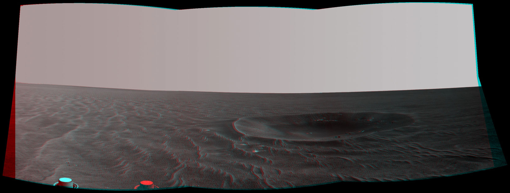
 Opportunity self portrait in 3-D
Opportunity took this self-portrait in August thisyear. Rover poet and image processor Stuart Atkinson has turned it into a 3-D experience.Credit: NASA / JPL-Caltech / S. Atkinson
They learned the hard way to never get complacent. Everyone around back in April 2005 remembers how this rover was merrily roving along, riding the ripples as if they were waves, when suddenly in April 2005 she hit one at the wrong angle and dug in 50 meters worth of wheel turns. Purgatory Dune the team would call this ripple, and for six long weeks it really was a kind of purgatory for Opportunity. "We got out of it, and we know how now to get out of things like that," said Squyres. "With this strategy, the worst case is that the rover will get 20 meters of wheel turns into something. We’re being conservative, but that’s what we need to do."
The orbital imagery has revealed that the closer Opportunity gets to Endeavour Crater, the easier the driving gets. It’s mainly sand-covered bedrock for as far as the rover can see, right up to the ejecta rays and rim of Endeavour. “As you look head from where we are now to Endeavour, the terrain that Mars is presenting us with gets easier and easier,” said Squyres. The obstacles, the hazards -- we're through the worst of it. Look at the ripples these days, they're a couple centimeters high compared to the things we were driving over months and years ago.”
As November progressed, Opportunity roved on, passing more small craters. “The most recent two craters we've named Hecla and Fury," said Squyres, after the British royal ships used in the Arctic. [The HMS Hecla made three journeys to the Arctic in search of the Northwest Passage and one attempt on the North Pole, all under William Edward Parry or George Francis Lyon. On her second expedition, in 1821-1823, Hecla was commanded by Lyon, with Parry helming the overall expedition from sister ship HMS Fury. The furthest point on this trip, the frozen strait between Foxe Basin and the Gulf of Boothia, was named Fury and Hecla Strait after the two ships. In 1824-1825, the Hecla made a third expedition to the Canadian Arctic, again in the company of Fury, but ice conditions damaged the Fury and it was abandoned.]
Coming up for Opportunity, the last planned stop on the rover’s agenda before Endeavour, is a crater called Santa Maria. It looks, from the orbital images to be a lot like Endurance Crater, which this rover studied way back in 2004. Plus, it's right along the rover’s current route, just about 1.3-1.5 kilometers down the road.
“We're very excited about Santa Maria, because it is the last really spectacular thing we expect we’ll come across before the rover gets to Endeavour,” said Squyres. “Because it's in the same size class as Endurance, but appears to be a little fresher, we think there might be some interesting things to see in the ejecta," he noted. "We'll go into it with eyes open, and we'll make our decision about how long we will spend there when we see it,” he said.
Although there is no detailed exploration plan for Santa Maria, Squyres said that he does not anticipate the rover will venture into the crater. “We have been in craters that size before and we think we know more or less what we could learn – and it would just take time,” he explained. Mostly though, the risk of going in is just too great at this stage of Opportunity’s journey. “If the rover loses a wheel, it may never get out," he said. “If we had never done Endurance and never seen Victoria we would we would be planning to go in and really milk it for everything it's worth. As it is, Endeavour is the goal.”
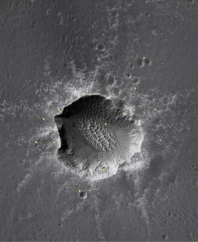 Santa Maria Crater
This HiRISE image shows Santa Maria Crater, Opportunity's last planned science stop for the rest of the long journey to Endeavour Crater. Stuart Atkinson marked it with tiny yellow dots which roughly approximates the size of Opportunity at different positions at the impact site. Credit: NASA / JPL-Caltech /UA / annotated by S. Atkinson
Still, Squyres leaves the door open. “If we get there and there's some compelling reason that we hadn't anticipated to spend more time there, then we will consider doing it. We will make the decision when we get there. It's exploration and we'll take it as it comes.”
This much is certain: Opportunity will take a roverload of pictures of Santa Maria from multiple angles. “One of the most valuable things we did at Endurance is we took big panoramas from a couple of points around the rim that enabled us to developed a very, very good 3-dimensional digital elevation model for that crater and terrific science has come from that,” Squyres pointed out. “We will probably want to do something very much like that at Santa Maria.”
The real lure is the evidence for past water, the hydrated minerals, as discussed in detail in recent Updates, which were detected in the orbital data from MRO. This is the first orbital data that has found the signature of hydrated minerals in Opportunity’s landing region. “We had been driving for years across what are hydrated minerals – minerals that are mostly hydrated sulfates,” noted Squyres. “But Santa Maria is going to be the first place along our path where we've actually been able to see the signature of hydrated sulfates from orbit. All of the other places we've been, including Victoria, you couldn't really see that spectral signature,” he pointed out.
That may mean something -- or not, said Squyres. “We don't have any indications from orbit that the mineralogy there is something weird. We're not seeing minerals we didn't expect to see. It just may mean this is a fresh crater deposit. There is well-exposed rock over a large enough area and we finally got a clean enough exposure of this stuff that's actually been seen from orbit. So it may not have anything particularly important or significant to say.” On the other hand, he added: “We may pull up to the rim of this thing and find something different.”
“The road ahead,” said Arvidson, “is very much like the terrain we encountered between Eagle and Endurance. It’s flat and has a very few small ripples, and a shallow sand cover, and a couple cracks, but no big deal. The rover is good to go.”
Protect Our Shared Future
You help us defend humanity and prevent asteroid impacts. Donate now to become a Planetary Defender!
Donate