
 Explore Worlds
 Find Life
 Defend Earth


Mars Exploration Rovers Update: Opportunity Heads for New Discovery as Winter Blows In at Cape York

Written by
A.J.S. Rayl
Contributing Editor, The Planetary Society
October 31, 2011
As Opportunity roved on this month, driving alongside the rim of Endeavour Crater toward the northern end of Cape York in search of more science gold and a place to hunker down for winter, the robot field geologist set new drive records, helped the Mars Exploration Rover mission take home another award, and in the 11th bewitching hour as All Hallow’s Eve descended on Earth sent a postcard home that revealed something the science team had been hoping to find before the brutal cold of the season takes hold.
“It popped up in the data this morning,” said Steve Squyres, of Cornell University, the MER principal investigator during an interview earlier today. ‘It’ is a white or light-toned vein running through the Bench, the smooth apron that surrounds the ancient Noachian terrain of Endeavour’s rim. “It's called Homestake. It's 4.8 meters away and we're driving there now," he announced.
“This is a real triumph of geology,” said Squyres. “We saw these veins as we crossed from the Meridiani plains into the Noachian terrain back in August. We've kept those in mind as a very important thing we wanted to look at, but we were so focused on getting into the Noachian and new terrain that we made that the highest priority, figuring that we would get the veins later.”
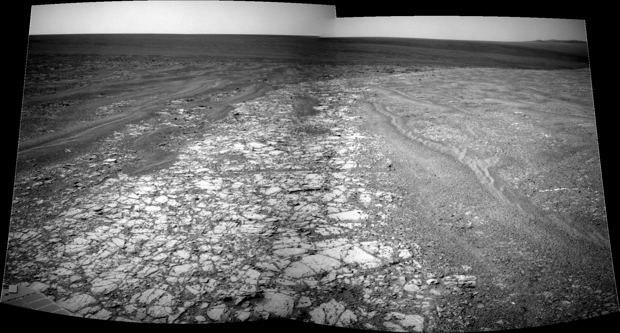 Vein of discovery
On the right hand side, a little more than half way down from the top of this image, you can see the white or light-toned vein that Opportunity spotted and is currently checking out. It runs side to side and almost looks like an artifact. UMSF's Stuart Atkinson, MER poet and frequent contributor of images to the MER Update, processed this in the wee morning hours for publication here.Credit: NASA / JPL-Caltech / S. Atkinson
When Opportunity first pulled into Spirit Point at Endeavour on August 9th, there was a lot of excitement and hope that the rover would uncover the clay minerals, the smectite that had been detected in the area from orbit in 2009. Clay minerals are hydrous aluminum phyllosilicates that feature varying amounts of iron, magnesium and other metals and constituents and form in a more alkaline water. Phyllosilicates are sure signs, good evidence for past neutral water more conducive to the emergence of life than the acidic past water for which both MERs have found evidence.
The first robot to send home evidence of past near neutral water was Opportunity's twin, Spirit. That rover found evidence of carbonates in a rock called Comanche and the discovery is one of the MER mission's most notable. If Opportunity could find the clay minerals, it would be another major discovery for the mission, even a scientific coup of sorts, because finding phyllosilicates is on the list of objectives for the Mars Exploration Rovers' descendant, the Mars Science Laboratory's Curiosity, slated to launch next month.
But with winter coming and the difficulties presented in finding the smectite clay minerals – which in this area were detected in the inboard side of the Endeavour’s rim at Cape York – the scientists decided to try to find a vein or two to check out before the rover had to settle in for the season. “The veins are easy features to spot while the smectites would have been more of a fishing expedition,” said Squyres. Given the need to get north and onto a decent slope for winter where the rover can take in as much sunlight as possible from the winter Sun, the decision was easy, and, as it turned out, finding them was pretty easy too.
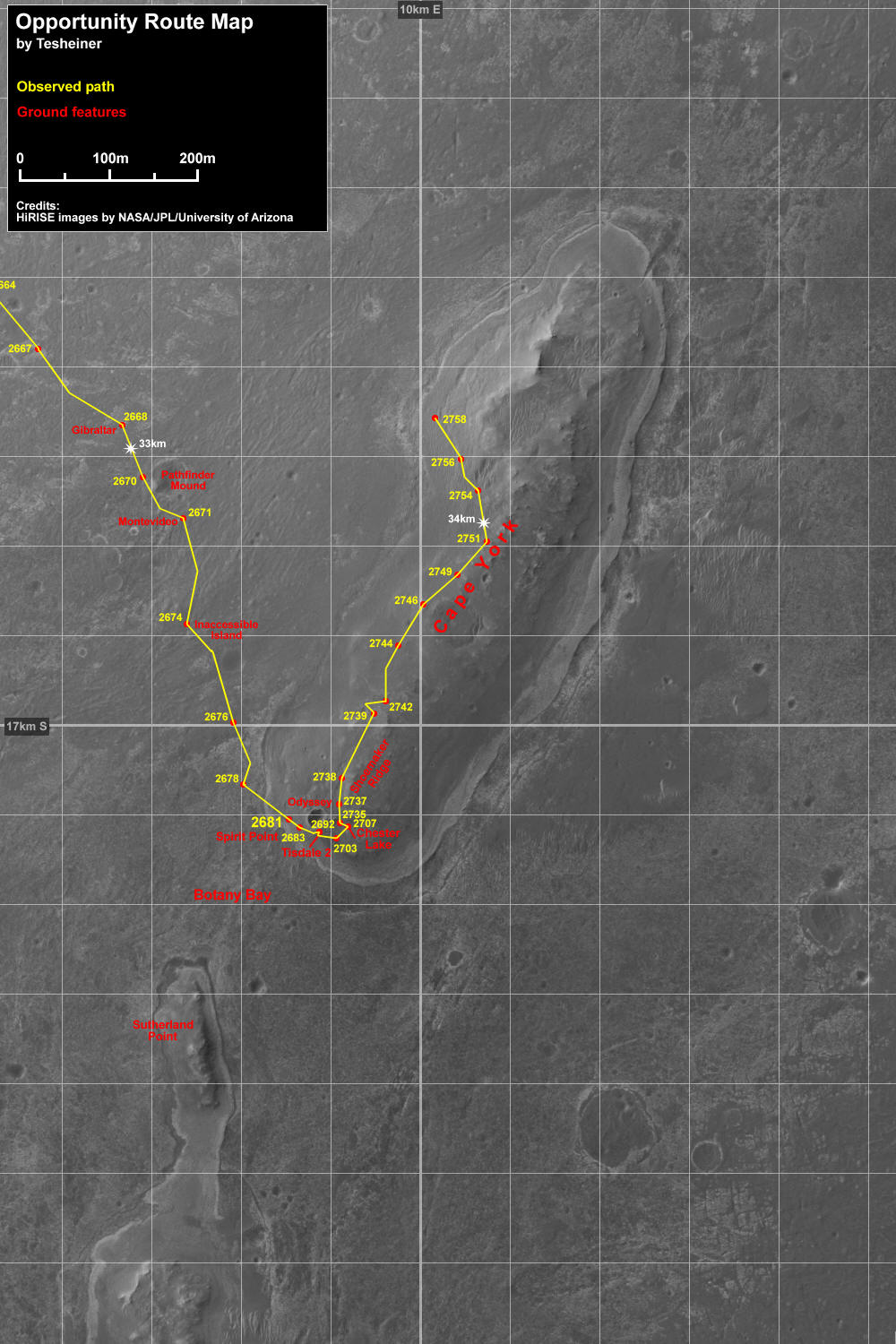 Opportunity route map
Eduardo Tesheiner, of UnmannedSpaceflight.com, created this Opportunity route map from images taken by cameras onboard the Mars Reconnaissance Orbiter. It shows the rover's travel to its Sol 2758 (Oct. 27, 2011). The rover officially reached the rim of Endeavour Crater on Aug. 9, 2011 and is currently checking out a white or light-toned vein just to the west.Credit: NASA / JPL-Caltech / UA / MSSS / E. Tesheiner
“We drew a mental geologic map and found a unit where those veins had been, traced it all the way up to the northern end of Cape York, figuring, just based on geologic sense, if that unit is really the same unit then we would likely see the same things," Squyres recounted. "We headed to the northwest, intersected that unit and – bingo! There are the veins. So we're going to go to the vein and make a measurement of it and find out what it is."
While Squyres, not surprisingly, wouldn't “hazard a guess" as to what they may find in that vein, he did say this: "These are different than anything from anything we've ever seen with either rover, a completely new thing on Mars, never seen anywhere. And we're pretty charged up about it.”
It made for an exciting end to a busy month for Opportunity, a month of driving around and checking out rocks and bedrock.
The team considered having the rover “toe-dip” into the eastern inboard side of Cape York where the Mars Reconnaissance Orbiter's Compact Reconnaissance Imaging Spectrometerfor Mars (CRISM) detected the "subtle but real signature for smectite," as Ray Arvidson of Washington University St. Louis, MER’s deputy principal investigator and a co-investigator on the CRISM team, described it. But the driving there is tricky, and there just wasn’t enough time before the rover had to get to a winter haven. "We decided instead to drive along the western side of the spine that defines Shoemaker Ridge in a northerly direction, hugging the outcrop and looking for interesting features,” said Arvidson.
Named for the legendary Gene Shoemaker, this ridge is, in effect, the scientists believe, the spine that defines the break in slope for all of Cape York.
By mid-month, when the team decided Opportunity would winter at the northern end of Cape York, the rover was already part way there. Then, late last week, the scientists commanded their robot field geologist to divert slightly to the west onto the Bench and the brief excursion to search for veins. It was a decision that paid off and won't cost much time.
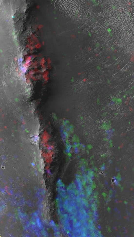 Mineral map of Endeavour's western rim
CRISM spectral maps of Endeavour's western rim show smectite (red) associated with the upraised rim rocks and hydrated sulfate minerals (blue) associated with the lower-elevation sedimentary fill. The image is about 1.5 kilometers wide.Credit: NASA / JPL / UA / JHUAPL
“The detour from her originally planned path took Opportunity on a jog west to the Bench, and added maybe 100-120 meters to her drive path, about two to three extra drive sols,” reported Bill Nelson, chief of the rover engineering team at the Jet Propulsion Laboratory (JPL), the rovers' mission control. He noted that there is "adequate margin to support this" before the rover must get snuggled in for winter.
The depth of winter – winter solstice in the southern hemisphere of Mars where the rovers are located – is March 31, 2012. With the seasons on Mars generally twice as long as the seasons on Earth, that means winter is already beginning to blow in.
This will be Opportunity's fifth Martian winter and it will be the "most challenging" this rover has ever endured, marking the first time the team has to take special precautions for its survival, pointed out John Callas, MER project manager, of JPL.
Spirit, which is located further south of the equator, always had to find a north-facing slope to angle its solar arrays directly toward the winter Sun to survive the brutal Martian winters, and in all likelihood it was the MERs’ fourth Martian winter that took out Spirit.
While the warmer clime and less rugged terrain of Meridiani Planum have made roving and exploration a little easier for Opportunity, this robot field geologist is now nearing her 8th birthday on Mars. Of more concern at the moment is the thick coating of dust on the solar arrays and the hazy sky overhead. “It's because the atmospheric opacity is a little bit higher, and the dust factor on the solar arrays is a little lower than in past years, that we have to take more steps this winter than in any of the past winters for Opportunity," Callas confirmed.
“We just haven't had very many cleaning events this fall and so the solar panels are more than 50% dust covered at this point," added Bruce Banerdt, MER project scientist, of JPL. "It is going to be a little bit snug this winter, but it doesn't look dire."
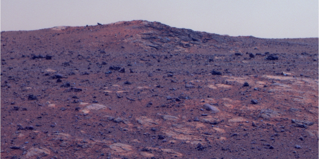 Shoemaker Ridge
Opportunity took this picture of the southern extremity of Shoemaker Ridge with her stereo panoramic camera on her Sol 2715 (Sep. 13, 2011). The Pancam team processed it in false color to bring out the detail. "The outcrop on the southeast side in the picture is Boston Creek," noted Ray Arvidson, deputy principal investigator for rover science. Credit: NASA / JPL-Caltech / Cornell
The MER team established a Winter Planning Group, “much as we did with Spirit,” said Nelson. Adapting the same strategy that kept Spirit going through her first three winters, the group spent weeks scouting for good north-facing slopes in nearby areas where the rover could hunker down for the seasonal freeze and angle its solar arrays directly toward the Sun through the Martian winter solstice.
Team members used orbital images from the Mars Reconnaissance Orbiter, digital elevation models created by Ron Li and his team at Ohio State University, as well as imaging data from the rover to home in on slopes with favorable northerly tilts in the general area.
“The attention to making sure we keep the vehicle safe and happy through the winter is to find some north-facing slopes to shelter on as we have done so many times in the past with Spirit. But this is a little bit less of a fire drill though than some of the previous winter haven searches with Spirit, because we still have six good wheels,” summed up Squyres.
The scientists' desire to explore Cape York, the location's close proximity, and the arrival of winter were the primary considerations that led the team to choose the northern part of Cape York. “That's where we saw not only north-facing slopes, but an extent of north-facing slopes such that we don't have to be 'frozen' in one place so we could perhaps be able to move the vehicle during the winter in this area... and still maximize solar energy production during the deepest part of the winter,” elaborated Callas.
 Opportunity's truly excellent road trip
The yellow line on this map shows where Opportunity has driven from landing in January 2004 - inside Eagle crater, at the upper left end of the track - to a point approaching the rim of Endeavour. The map traces the route through the rover's Sol 2670 (July 29, 2011).Credit: NASA / JPL - Caltech / MSSS / NMMNHS
The orbital images indicate there are slopes up to the 20-degree range on the northern end of Cape York "scattered all over the area," corroborated Nelson. "It was fairly obvious to everybody that there was really only one good choice and we already kind of headed that way."
The scientists concurred: “It was a pretty easy decision,” said Arvidson.
As the month progressed , Opportunity followed her commands, roving north along Shoemaker Ridge, taking pictures of various rock and boulder targets along the way, including Sheba, and Tjakastad, Hooggenoeg, Onverwacht, and, last week, New Consort.
Fortunately, there’s no immediate rush and Opportunity has the time now to investigate the newfound vein called Homestake before the rover absolutely has to get to a north-facing slope, Banerdt assured. The scientists couldn’t be happier.
The veins could be hiding more mission gold. At least a few scientists on the MER team are suggesting these veins just might harbor carbonates – long believed to be hidden somewhere on Mars and which Spirit, was the first robot to groundtruth.
The fact that the Bench is smooth terrain also played into the team’s decision. “Probably the key thing about the Bench at this point is that it's really flat and we can drive across it quickly and easily, Banerdt said.
Once Opportunity finishes her investigation of Homestake – named for the mine in South Dakota, Arvidson informed – the plan calls for the rover to continue north on the Bench most of the way to the end of Cape York, and then cut back and move up hill looking for the best slopes, said Nelson. “The best guess is that it will probably take us another couple of weeks," he said.
The hopes for Opportunity finding those smectite clay minerals are still high, although that discovery may not come until after this Martian winter, or it may. This much is certain: the team knows they’re there. In 2009, a group of scientists including Scott Murchie of Johns Hopkins University’s Applied Physics Laboratory, who leads the CRISM team, J.J. Wray of Cornell, Alfred McEwen of the University of Arizona, Squyres, Arvidson, and others announced in the Geophysical Research Letters journal that they had found the signature for smectite using data collected by CRISM. The first visible-infrared spectrometer to fly on a NASA Mars mission, CRISM basically looks for the residue of minerals that form in the presence of water – the “fingerprints” left by evaporated hot springs, thermal vents, lakes or ponds. Since it detected smectite at Endevour, the race between Opportunity and Curiosity has been on.
Although the smectite signature from Cape York was subtle and coming from the inboard side of Cape York, there is a notion floating about now that those smectites might actually wrap around a geologic unit that goes to the north end of Cape York. “We could end up parked on materials that, if we get lucky, have clays in them, so we'll see what we see,” said Squyres.
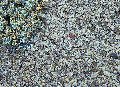 Smectite clays on Earth (closeup)
Close up of the crinkly cracked soil surface typical of a soil rich in smectite clay.Credit: University of Pittsburgh / Norris W. Jones
At the same time, some scientists think finding the smectite in the northern end of Cape York is a longshot. That’s okay with most of them too, because they know unequivocally through CRISM data that a motherload of the stuff is just waiting for them further south along Endeavour's rim.
“We always assumed that Cape York was going to be kind of a crapshoot in terms of the phyllosilicates,” said Banerdt. “The real strong signature two to three kilometers to the south, at Cape Tribulation, and right now two or three kilometers is like nothing to Opportunity,” he said. And the science team has every inention of going there. "The scientists are looking for the rover to stay healthy for a good long while so we can do some real exploration of this whole area, including making that journey south to Cape Tribulation once the Martian winter is over."
In any case, Opportunity hasn't stopped since pulling up to Endeavour and has already sent home reams of new data. “All the rocks we're seeing here are completely different than Opportunity has ever seen and different significantly than the rocks Spirit saw as well,” Banerdt pointed out. “So we're already picking up new geology and new rocks and new petrology that no one's ever encountered yet on the Martian surface. It's all great stuff. There is a lot of activity going on and the science team is really jazzed right now.”
The rover apparently is feeling pretty good too, despite the dust on its solar arrays and in the sky overhead. Opportunity began the month of October producing power levels of around 320 watt-hours, about 1/3 the power it was producing after it bounced to a landing in 2004. At months' end, the rover's power levels had decreased by only 22 watt-hours or so.
All things considered, Opportunity is in remarkably good health and roving well despite her handicaps, which include a broken shoulder, stuck "on" heater that forces it to shut down every night, and a troubled right front wheel that means it has to drive backward. “It's been a pretty routine month actually,” reported Nelson. “There are no issues with the rover and Opportunity is driving well. The energy is declining a bit, but it's pretty much as predicted and so there are no serious issues there.”
 Kirkland Lake
Opportunity took this image of a boulder field dubbed Kirkland Lake named for the former gold mining camp and now "friendly community of 9000 people" in Ontario Canada. UMSF's Stuart Atkinson processed it in color.Credit: NASA / JPL-Caltech / Cornell / S. Atkinson
The rover drove a total of 620.81 meters (0.38 mile) in October, setting new records as she went. In fact, 2011 is shaping up to being Opportunity’s Year of Driving Dauntlessly.
On October 13th, its Sol 2744, Opportunity broke the 21-mile mark (33.796 kilometers). It then roved on to break its 2010 annual odometry record of 7.578 kilometers (4.703 miles), on October 27th, with a new record of 7.630 kilometers (4.74 miles). “That only stood for two sols when the latest drive, Sol 2760, on October 29th gave us a new total of 7689.92 meters for all of 2011 – and the year isn't over yet," Nelson said. The rover ended the month with 34.195 kilometers (21.247 miles) on her odometer.
Winter has arrived though, and that will slow Opportunity down soon eneough. “We want to drive as much as we can right now,” said Callas. “We want to have enough time to get to a good slope and be able to do some reconnaissance and some science before things slow down. When the music stops, we don't want to sit in just any chair, we want to pick ahead of time what chair we want to end up in,” he added using one of his helpful metaphors.
 Rove on, Opportunity
This rendered image of Opportunity is an image produced using "Virtual Presence in Space" technology, developed at JPL. It combines a photorealistic model of the rover and a false-color mosaic taken by the rover on Sol 134 (June 9, 2004) with its panoramic camera while in Endurance Crater. We at The Planetary Society liked it for the symbolism it imparts of the robots that just wanna rove. Rover model by Dan Maas, synthetic image by Zareh Gorjian, Koji Kuramura, Mike Stetson and Eric M. De Jong.Credit: NASA / JPL-Caltech / Cornell University
“If we're very lucky, we'll be able to find a good slope or slopes and be able to make short forays into the general area, and then come back to our ‘lily pad' [north-facing slope] for the best angle on the Sun," said Nelson. "Or in the not so good case, we'll just stay parked. But first we have to get to a place where there are slopes.”
Opportunity needs to position itself on a 5-degree slope to survive, while a 10 to 15 degree slope would enable the rover to produce enough energy to work through the winter. And it may end up on one of those 20-degree slopes visible in the oribital pictures.
“When you're seeking a winter haven, steeper is obviously better so we're going to look for the safest, steepest slope we can get to,” noted Squyres. [Spirit spent its third Martian winter parked on a slope of 30 degrees, about the limit for a MER.]
If, for the first time in its robot lifetime, Opportunity does have to park for a while, it would be a welcome scenario for some science team members, because it would allow for two important scientific studies. If the rover were to remain stationary in front of an intriguing rock, for example, maybe even one that is harboring the smectite or other clay minerals, it could spend a good month or two gleaning the rock’s iron content since the Mössbauer now takes on the order of a month and more to acquire a decent observation. At the same time it is parked, the rover could conduct the radio science experiment that Spirit was to have done to describe in measured detail the core and density of Mars’ core.
“From the science point of view, a very big return this winter will be radio science,” said Arvidson. “There's a big mystery concerning the size and density of the core, and therefore what it's made of, and there are a number of permissible models. The way to deduce this is [for the rover] to track the dynamics of the planet’s spin axis over a number of months. That allows you to back-calculate interior density as a function of depth that is needed to produce the spin axis dynamics,” he explained.
 First neighborhood at Endeavour
This image taken from orbit shows the path Opportunity drove in the weeks around the rover's arrival at the rim of Endeavour Crater. The sol or Martian days are indicated along the route. For example, Sol 2674 corresponds to Aug. 2, 2011; Sol 2688 corresponds to Aug. 16, 2011. The route leads to a rock dubbed Tisdale 2, which is a block of material ejected by an impact that excavated the small crater called Odyssey on an are of the Endeavour rim the team calls Cape York. The next Endeavour rim fragment to the south is called Sutherland Point, and a gap between Cape York and Sutherland Point is called Botany Bay. The base image of the map is a portion of an image taken by the High Resolution Imaging Science Experiment (HiRISE) instrument onboard the Mars Reconnaissance Orbiter, on July 23, 2010. Credit: NASA / JPL-Caltech / University of Arizona
While two stationary months would probably render useable radio science or Doppler data, six months would be ideal. “With a couple of months we think we can get a good enough signal to augment the data we already have and improve our determination of the spin direction, which gives the precession, but we'd really like to have three or four months or more to get some of the detailed dynamics,” said Banerdt, who is involved in the planning of this experiment being led by JPL’s Bill Folkner.
“It won’t be a discovery, but it will make a determination that could help us narrow down our uncertainty about the size of the core,” Banerdt continued. “That's a pretty important piece of information in terms of understanding Mars' long-term history, and how it formed early on too.”
If the MER luck shines down on Opportunity as it has on numerous occasions in the past, the rover just may find an unusual rock worthy of a Mössbauer investigation and managed to conduct both studies at the same time.
As October scares November onto the calendar, Opportunity’s focus is on finishing work on Homestake, and then finding a place to settle in for winter. “We'll be looking for is a good northern slope, 10 to 15 degrees, good site view for imaging and monitoring, with hopefully bits and pieces of outcrop that we can do IDD work on,” said Arvidson.
The general consensus among team members, scientists and engineers alike, is that Opportunity will carry on through the winter and well beyond. Still, Opportunity is getting on in years. “I'd be crazy if I wasn't a little bit concerned,” said Squyres. “But the power projections are fairly favorable and the terrain ahead looks good and right now the rover is healthy and doing well, so we'll do our best.”
“Our latest projections are a little more optimistic than some of the ones we've had in the last month or so,” Nelson confirmed. “It's not a huge amount, but it's enough to make a difference.”
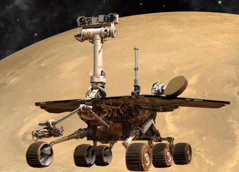
 MER body parts
The Mars Exploration Rovers are robot field geologists that were designed with parts to substitute for the organs all living creatures would need to stay "alive" and able to explore, as well as some super-human powers. Spirit and Opportunity, for example, each have a body that protects its "vital organs;" brains to process information; temperature controls, including internal heaters, a layer of insulation, and more; a "neck and head" formed from a mast for the panormaic cameras for a human-scale view; eyes and other "senses," such as cameras and instruments that give the rovers information about their environment; an arm to extend its reach; wheels and "legs," necessary parts for mobility; and energy sources in the form of batteries and solar panels; and antennas for "speaking" and "listening."Credit: NASA / JPL-Caltech
For now, it’s “business as usual,” said Arvidson, “and making sure quantitatively we have the right approach and access to 10 to 15-degree slopes so that we don't have to go into survival mode, but can do some science this winter. Those slopes are there,” he assured. “We're going to start planning soon.”
Meanwhile, Spirit and Opportunity were honored this month with the Breakthrough Mechanical Lifetime Achievement Award, presented by Popular Mechanics magazine. The magazine's officials presented the award in a ceremony at the Hearst Tower in New York City on October 10th. “On the top floor where part of the event was held there was this magnificent panoramic view of NYC and it was just spectacular,” said Callas.
The honor acknowledged the Mars rovers' engineers, as well as the robot field geologists, "for overcoming great challenges in their dogged pursuit of new discoveries on the Red Planet," and cited MER mission leaders Squyres, Callas, and Peter Theisinger and Richard Cook, former project managers at JPL for turning "a 90-day mission into one of space exploration's longest-lasting adventures, making stunning discoveries about the Red Planet along the way."
“It was a nice event," said Callas. "The Popular Mechanics people were gracious hosts and we were made to feel most welcomed and appreciated."
“It's always gratifying to see the project receive recognition and we were very pleased with this one,” added Squyes, who missed the actual event because of his participation on the latest NASA Extreme Environment Mission Operations (NEEMO) mission.
In other MER news: Sadness descended on the MER team members and virtually all of the planetary science community this month with news that they had lost one of their own, Ronald Greeley.
 Dr. Ronald Greeley 1939-2011
Dr. Ronald Greeley was involved in lunar and planetary studies for more than four decades and was a valued and highly respected member of the MER science team. His most recent research focused on understanding planetary surface processes and geological histories, utilizing a combination of spacecraft data analysis, laboratory experiments, and geological field studies on Earth of features analogous to those observed on the planets. He was a mentor and friend to so many planetary scientists.
Credit: Arizona State University
The beloved planetary scientist – the Regents Professor in the School of Earth & Space Exploration at Arizona State University (ASU), and Director of the NASA Regional Planetary Image Facility – passed away October 27th at his home in Tempe, Arizona. He was 72.
A MER science team member and science team member of the European Space Agency’s Mars Express mission, Greeley had been involved in lunar and planetary studies since 1967.
“It's hard to describe the personal and professional loss of a mentor and world leader,” said Planetary Society President Jim Bell, the science lead on the MERs stereo panoramic cameras, and professor in the School of Earth and Space Exploration at ASU. “Ron was a mentor and role model for me and so many of colleagues in planetary sciences."
Greeley earned undergraduate and graduate degrees from Mississippi State University. After receiving his Ph.D. in Geology, in 1966 at the University of Missouri in Rolla he worked for Standard Oil Company of California as a paleontologist. Through military duty, he was assigned to NASA's Ames Research Center in 1967, where he worked in a civilian capacity in preparation for the Apollo missions to the Moon. Subsequently, he remained at NASA to conduct research in planetary geology.
With the results from planetary missions in the early 1970s, Greeley’s attention shifted to Mars and research on volcanism and Aeolian processes through the analysis of Mariner 6, 7, and 9 data. He applied results from this work as a science team member on the Mars Viking Mission, 1976-‘80. During that mission, in 1977, he joined the faculty at ASU with a joint professorship in Geology and the Center for Meteorite Studies.
 MER science team member Dr. Ron Greeley
Dr. Ronald Greeley -- the Regents Professor in the School of Earth & Space Exploration at Arizona State University, and Director of the NASA Regional Planetary Image Facility --was a beloved planetary scientist and geologist, involved in space exploration since 1967. He passed away unexpectedly on Oct. 27, in Tempe, Arizona. Credit: Tom Story / Arizona State University
In recent decades, Greeley’s research focused on understanding planetary surface processes and geological histories, using spacecraft data analysis, laboratory experiments, and geological field studies on Earth of features analogous to those observed on the planets. The author or co-author of 15 books and more than 250 papers, Greeley served on various NASA and National Academy of Science (NAS) panels to assess space science and planetary geology activities. He was serving as chair of the NASA Astrobiology Institute Icy Satellites Focus Group, the NASA Planetary Geology and Geophysics Management Operations Working Group, and co-chair of the NASA Science Definition Team for the Europa "flagship" mission at the time of his passing.
"Whether in the field or running through an airport, Ron was always one step ahead, literally and figuratively, in determining the next place to go, the next destination to study, or the next big science question to address," remembered Bell. "His breadth of knowledge of planetary surface and atmospheric processes was truly impressive, and his leadership, wisdom, and cheery presence at seemingly every important conference and meeting will be deeply missed in our community.”
Greeley will live on in the proposed missions to Europa, and more profoundly in all the students he mentored and colleagues he supported throughout the years. He was preceded in death by his daughter, Vanessa. He is survived by his wife, Cindy, and his son, Randall (Lidiette), and three grandchildren.
 Endeavour Revealed
Without further adieu and needing no further introduction, here is the latest poemster from Stuart Atkinson and Glen Nagle. For full resolution, go to AstroO's blog at: http://astro0.files.wordpress.com/2011/10/endeavour_poemster_med.jpg
Credit: Poetry: S. Atkinson; Artwork: G.Nagle; raw images: NASA / JPL-Caltech / Cornell / UMSF
Opportunity from Meridiani Planum
October was another busy, productive month for Opportunity. After nearly three Earth years of driving across the Meridiani plains from Victoria Crater, the rover arrived at the 22-kilometer (14-mile) diameter Endeavour Crater in early August, a veritable scientific jackpot in front of her. The robot field geologist has not stopped since, and this month drove two or three times each week, seemingly trying to take it all in as fast as possible.
It’s winter actually that has the rover and her team keeping the move on, because with the season setting in Opportunity’s pace will soon slow dramatically. “As the energy decreases each day, the drives get shorter and shorter, so we want to drive today as opposed to driving tomorrow,” said Callas.
 Opportunity on Endeavour's rim
This HiRISE image, taken on Sep. 10, 2011, shows the Opportunity sitting atop some light-toned outcrops on the rim of Endeavour Crater, near a smaller crater nicknamed Odyssey. Opportunity travelled nearly three Earth years to reach this rim, because it contains rocks even more ancient than the rocks of Meridiani Planum, which the rover has been exploring since 2004, and thus may take scientists further back in Martian time.Credit: NASA / JPL / UA
After finishing an in-depth examination of the rock Chester Lake in September and roving on to take some stunning panoramic images of a boulder field dubbed Kirkland Lake among other rocks and outcrop, Opportunity began October at the southern end of Cape York, on the rim of Endeavour, looking for any intriguing targets, as well as north-facing slopes that might serve as winter perches where she could angle her solar arrays to the winter Sun.
On Sol 2737 (October 6, 2011), Opportunity moved on, turning to the north and beginning her planned approach to Shoemaker Ridge with a 28-meter (92-foot) sprint. “We named segments of it Shoemaker Ridge A and Shoemaker Ridge B when we were looking for northerly slopes on the southern side of Cape York,” said Arvidson. Now, the rover was on her way to check out those segments out from the western side.
Producing 320 watt-hours of energy, Opportunity still had plenty of power to drive at the top of the month, although the atmospheric opacity or Tau registered a very hazy 0.840, and her solar array dust factor was 0.513. Yet, despite the accumulated dust and the coming cold, you could almost hear her say, “Life is good.”
Opportunity drove into the second week of the month and continued her scouting trek for north-facing winter slopes and any interesting targets, logging 78-meters (256-feet) to the north-northeast, along the western edge of Shoemaker Ridge. After taking a couple sols to rest and catch up on some remote sensing, the rover conducted a 40 meter (131-foot) reconnaissance of the local area on her Sol 2742 (October 11, 2011), though it might have looked more like something of a joyride from the zigzag course she left behind.
Opportunity finished out the second week of October taking more pictures of her surroundings, and then drove into the third week of the month on Sol 2746 (October 15, 2011) putting 51 meters (167 feet) on her rocker bogie. She came to a stop at a small outcrop called Sheba.
 Sheba
ShebaThis triptych image shows the outcrop dubbed Sheba that Opportunity photographed as she drove by it this month. It i rendered here in color by MER poet Stuart Atkinson. For more of Atkinson's word and images, check out his Road to Endeavour blog: http://www.planetary.org/explore/topics/curiosity/Credit: NASA / JPL-Caltech / Cornell / S. Atkinson
After giving Sheba a good once over with her cameras, the rover took off again, logging 167 feet (51 meters) to the northeast on Sol 2749 (October 18, 2011). That same day down on Earth, the MER team decided that Opportunity would spend her fifth Martian winter somewhere at the north end of Cape York. “The project did an analysis of all the options, the pros and cons, and made an assessment,” said Callas.
This Martian winter marks the first time in Opportunity’s charmed robotic life that the team has had to concern itself with the rover’s survival. The engineers had already been preparing. “Some months back, I looked at the trends on the dust factor – the amount of dust building up on the array -- and I didn't like what I saw,” said Nelson. So they started crunching data, “and the numbers that came out were not all that attractive,” he said.
As a result, a Winter Planning Group was formed, just as had been done in Martian winters past for Spirit, to figure out the best way to keep Opportunity warm and actively working through the season. Scientists and engineers alike began scouring orbital images from HiRISE, as well as digital elevations maps (DEMs) provided by Ron Li and his students at Ohio State University, looking for the best possible slopes where Opportunity could take shelter.
The Winter Planning Group looked at several possibilities for north-facing slopes, said Nelson. “There are two structures to the south, Sutherland Ridge and Nobby's Head, neither of which appeared to have particularly great north-facing slopes, and there is the north end of Cape York, where we're at already. Since power is starting to drop and we didn’t want to have to take on another 1.8-kilometer drive, the decision was pretty clear,” he said. “The north end of Cape York was the closest location with north-facing slopes, and an area the scientists wanted to explore.”
The Cape York North location, Arvidson said, would give Opportunity “time to get there and poke around and find the right slope with some bedrock exposure and a good site view.”
 Spirit on the flank of Husband Hill
Spirit spent her first winter on north-facing slopes on Husband Hill. This image was created from a computer simulation of Spirit that was dropped into a Pancam panorama that the rover took on the flank of Husband Hill on the rover's Sol 454 (April 13, 2005). The image is available in a poster-sized rendering at JPL's website (25 MB).Credit: NASA / JPL-Caltech; Rover model by Dan Maas; synthetic image by Koji Kuramura, Zareh Gorjian, Mike Stetson and Eric M. De Jong
If Opportunity can position herself on just a 5-degree slope, she should be able to get through the winter without too much difficulty, and probably do a bit of science, according to Nelson. “If we make 10-degrees, we should have enough [power] to actually be able to do some real science, and a 15 to 20-degree slope would be great, and give us plenty of margin,” he added, summing up the engineers’ analysis.
Even in the depths of the Martian winter, the MER team hopes to keep the rover producing power levels in the low 200 watt-hour range, allowing her to drive a little here and there.
“Opportunity is dustier this winter than it's been in previous Martian winters and so [getting the rover to a north-facing slope] is the safe and prudent thing to do,” said Squyres. “We’re on pretty flat terrain here, so finding a place that will give us enough tilt to really help has been and will continue to be a challenge. We think we've identified some areas that are very promising and we'll be heading there soon.”
“This fifth winter for Opportunity is like the first winter for Spirit,” said Callas. “Spirit spent that first winter on the north-facing slopes of Husband Hill, and we were able to remain relatively active throughout the winter. That's our objective here.”
“Cape York has a little bit more topography and some interesting features, even though it probably doesn't have the best probability of finding the phyllosillicate signature [smectite] that CRISM located on the rim of Endeavour,” Banerdt said. “But there is a possibility [of finding the smectite this winter], because there is a lot of stuff that goes on below the CRISM resolution.”
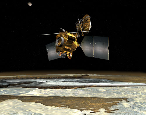 MRO in science orbit
Artist's depiction of the Mars Reconnaissance Orbiter (MRO) as it orbits over one of the Martian poles. The infrared spectrometer, CRISM, detected phyllosilicates, specifically smectite, a kind of clay mineral, along the rim of Endeavour Crater in 2009, and Opportunity is now on the hunt for that evidence of a more neutral water past environment. Credit: JPL / NASA
In 2009, CRISM detected a signature for smectite up and down the rim of Endeavour Crater. The signal that emanated from Opportunity’s current general location, however, was back where the rover had been a couple of weeks ago, tucked into eastern inboard side of the rim on the southern end of Cape York.
“The smectites were just to the east of the outcrops we've hugged for the last two weeks, but those are done,” said Arvidson, who is a co-investigator on the CRISM team. “We couldn't drive into the smectite terrain, because it would take us even further away from the northerly tilt we need for winter. That meant we needed to stay on the western side of the spine that defines Shoemaker Ridge. And, we knew that we wanted to get onto material that was Cape York for the winter, because we're probably going to call all that the Shoemaker Formation.”
In all likelihood, the Shoemaker Formation is probably impact breccia, similar to the rover’s recent rock targets Tisdale 2 and Chester Lake, essentially rock composed of broken fragments of minerals or rock cemented together by a fine-grained matrix. Getting Opportunity to Cape York North place with enough time to find the best slope to settle on, and, if nothing else, confirm that would make for a productive winter.
Even if the solar-powered rover is able to produce enough energy to move throughout her fifth Martian winter, that doesn’t necessarily mean she will. The winter science campaign may in fact dictate that Opportunity stay in place for an extended period of time. “If we can find an exciting surface target, there's a possibility we might deliberately keep the rover stationary and do a Mössbauer integration,” noted Callas. “Since the radioactive source for the Mössbauer has already gone through 11 or 12 half-lives, we'd be interested in doing a multi-month integration, and if we find a science target that justifies it, we may do that.”
Such an “exciting target” would most likely be something that looks like it’s been altered by past water and could be harboring the evidence of an ancient environment within its ‘borders.’
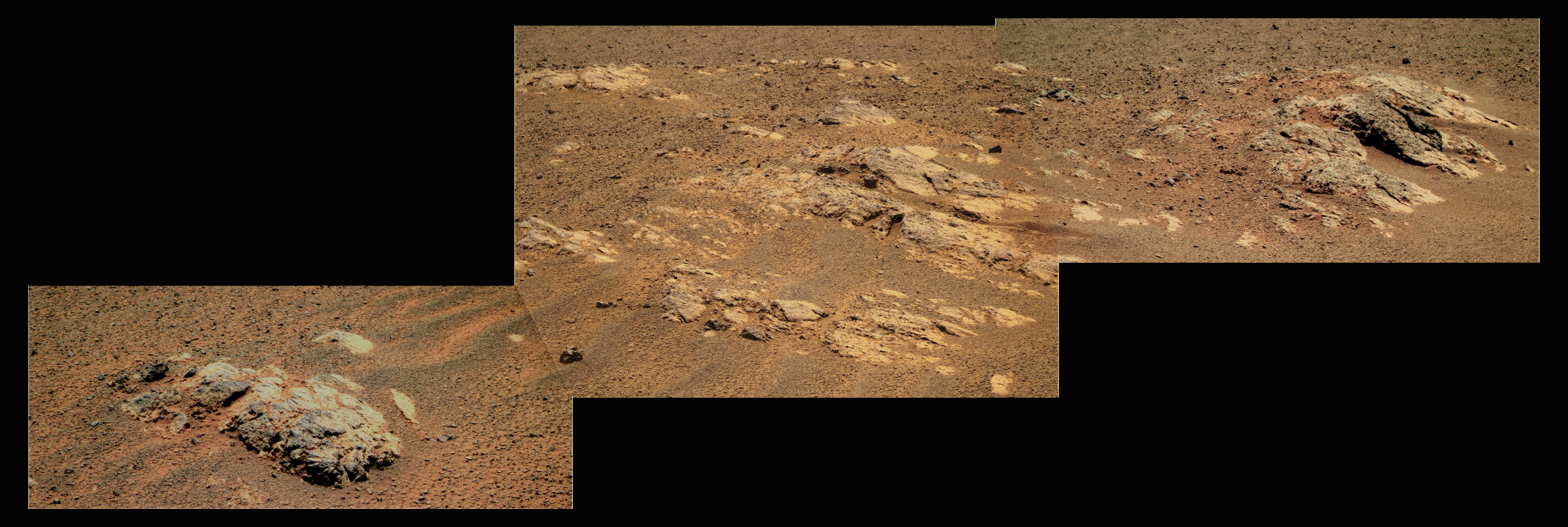
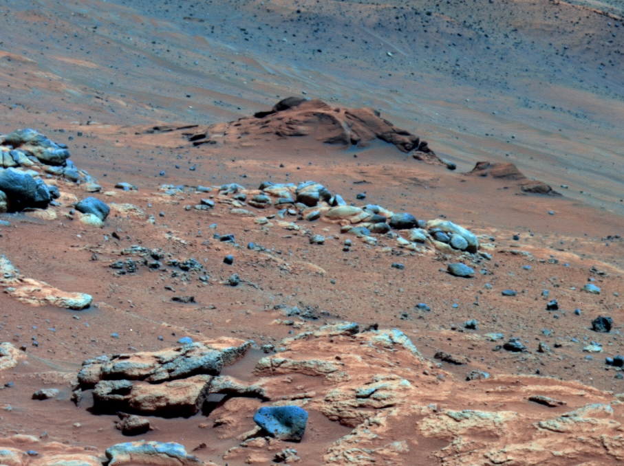
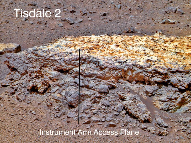 Tisdale 2
This close-up of Tisdale 2, the first rock Opportunity examined in detail on the rim of Endeavour crater, has textures and composition unlike any rock the rover has examined to date. Its characteristics are consistent with the rock being a breccia, a type of sedimentary rock in which broken fragments of older rocks are fused together. Tisdale 2 is about 30 centimeters (12 inches) tall. The black vertical line that is superimposed on the image indicates the work plane for Opportunity's robotic arm when the arm placed its microscopic imager and alpha particle X-ray spectrometer at a series of locations from the top to the bottom of the boulder.Credit: NASA / JPL-Caltech / Cornell / ASU
“If the rover is stationary for a while, we may also attempt to do radio Doppler tracking of the X-band signal, as a proxy for the rotation of the planet,” said Callas. This study should sound familiar. It’s the same radio science experiment Spirit was to have done after rousing from her first hibernation. But Spirit apparently never woke up, at least she never phoned home and the team’s attempts to reach out to her at Gusev Crater were met with the staticky sounds of silence.
“The radio science campaign is the most important thing we can do this winter,” said Arvidson. “You have the bulk density of the planet and that's well known. But you don't know how it's segregated. There's a core, but how big is it? And how dense is it relative to the lithosphere, the mantle? The constraints right now are pretty poor. There are a lot of permissible models that basically trade off the density versus the size of the core,” he added.
It’s a Martian mystery that the MER mission could solve just by staying put for a while. From a parked position, the rover can track the dynamics of the Mars’ spin axis. With that data collected from over a period of months, scientists could “back-calculate interior density as a function of depth that is needed to produce the spin axis dynamics,” said Arvidson. Opportunity would have to stay parked though for months, not something this rover has ever been wont to do.
“With the Doppler experiment, a couple of months would give us a good enough signal to augment the data we already have and improve our determination of the spin direction, which gives the precession,” said Banerdt who is working on the planning of this investigation, led by Bill Folkner, also of JPL. “We'd really like to have three or four months, and six months would be really optimal because we'd have data from one-quarter of the Martian year at that point, and getting some of the detailed dynamics of it.”
Theoretically, they might be able to use data even if the rover moves a little. The radio science experiment needs precision on the order of 10 centimeters or less, maybe 5 centimeters depending on the specific measurement, however, so the rover couldn’t move much. “We're looking at that right now and what we can do with optical navigation for doing relative locations of the rover,” Banerdt informed.
 Mars core
Scientists do not know much about Mars' core although they believe that, like Earth, the Red Planet may have a largely iron core. Recent planetary missions have offered some clues. For instance, the fact that the Mars Global Surveyor discovered magnetic stripes in the ancient terrain of Mars seems to indicate that the iron-rich core probably formed during the hot accretion of Mars 4.5 billion years ago and subsequently cooled at a faster rate than Earth's core. They believe from the study of the data that, today, Mars has probably a liquid outer core and a solid inner core like Earth. If Opportunity conducts the radio science study this Martian winter, which entails tracking the rover's X-band signal as a proxy for the rotation of the planet, scientists may be able to get a better handle on the density and size of Mars' core.Credit: Athena MER / Cornell
The radio science experiment would produce new planetary science knowledge and could be one of the most scientifically significant studies on the mission. “It would be a major contribution to understanding of geophysics of Mars, which is a kind of forgotten area,” said Arvidson.
At this juncture, however, Opportunity’s winter science campaign has not been determined. “We'll decide our winter plan once we find out where we're going to be parked.” said Squyres. This [radio science study] is on the books and one of the things we hope to do at an appropriate time during the mission.”
With a little MER luck, Opportunity will find the way to do as much as is robotically possible this winter. The radio science work has a good shot of moving to the top of the science agenda, especially if the rover finds a choice, compelling rock. “We have high hopes that we will end up parked for the winter on a rock that is interesting enough that it merits a good Mössbauer investigation,” Squyres said.
It's all a matter of the slopes Opportunity finds. “The maps that we have, based on orbital information, show there are slopes that appear will provide enough energy for the vehicle to be active 20-30 minutes a day during the worst part of the winter,” said Callas.
By the time the team decided it was ‘Cape York or Bust,’ Opportunity had already driven nearly half the distance to the north end along the western side of Shoemaker Ridge, and on Sol 2751 (October 20, 2011) the rover continued on, traveling more than 49 meters (161 feet) in a northeasterly direction. As she drove, the rover took a bunch of pictures along the way, of rock and boulder targets nicknamed Fairview, Havelock, Tjakastad, Hooggenoeg, and Onverwacht.
The science team wanted Opportunity to pack in one more science discovery if possible before the winter chill took hold and debated whether to have the rover “toe-dip” into the eastern inboard side of Cape York, said Callas, do a quick reconnaissance, and then leave. “But the science team assessed that the time would be better served looking for the white veins we've seen, trying to do a quick in situ measurement on those,” he said.
“Based on their importance and the geologic experience we had further south, we thought that the probability of finding [veins] was high,” explained Squyres, who actually participated in the discussion from the Aquarius habitat while participating in the latest NEEMO mission. “They are easy features to spot. You can make a measurement of great scientific significance very quickly. The smectites just don't ‘jump out’ the way the veins do. We’d have to make a measurement to even get a hint if they're there, and then if we find them, the best instrument to confirm is the Mössbauer, and that takes months.”
Still, the only veins Opportunity had actually seen were when she crossed the Bench coming into Endeavour’s rim last August, Arvidson noted. So last week, the Bench was back on the rover’s agenda. "A bench is a geomorphic term that describes something that is flat and surrounds something else, and in this case is an apron, the very smooth layer surrounding the ancient terrain that defines Cape York,” he informed.
 Shoemaker Ridge, western side
Opportunity took this image of the western side of Shoemaker Ridge with her stereo panoramic camera (Pancam) on her Sol 2678 (Aug. 6, 2011, during her final approach to the rim of Endeavour Crater. The Bench is visible in the foreground. This image was rendered here in true Martian color by the Pancam team.Credit: NASA / JPL-Caltech / Cornell
The Bench is most likely a sedimentary layer from an ancient lake environment, Arvidson said. "We have the Noachian Endeavour Crater, eroded down though there are bits and pieces of it today sticking above the sedimentary deposits. We have massive erosion transport, fluvial systems, all the rest. Then this drying out period [occurred], when the groundwater was coming up. It became much more acidic, probably because of a change in the atmosphere. That produced shallow lakes, and material was blown around by wind and formed into sandstones [that were] re-cemented by rising groundwater,” he theorized.
“Surrounding the ancient rim of Endeavour, you would have basically a pinch-out, where the sediments get thinner and thinner and thinner until they don't exist anymore,” Arvidson continued. “There is not much depth between the top of the sedimentary sequence and the underlying Noachian in those sediments; whereas, if you go further into Endeavour, or west where we've been, the sediments were probably thicker [as a result of] more groundwater updwellings, because topographically they were further down,” he explained.
A de-watering followed, Arvidson hypothesized. “And that leads to pretty massive compaction, except where there is a pinch-out. Then a lot of Aeolian erosion [occurs] and what could be left is what we're calling this geomorphic Bench that surrounds Cape York,” he concluded. “All the cracks we're seeing, the polygonal cracks, that probably is all de-watering on a small scale. But if you have hundreds of meters of section produced in a water environment, when that water leaves, it's going to leave space and that's what we think is going on here.”
The veins could add a lot to that story, so it’s no wonder the scientists want to investigate one up close. “By the time we realized we have to find a winter haven [sooner rather than later], we were pretty far north and it didn't make sense to go back to where we saw the veins in the first place,” Squyres said, continuing the story. “That raised the issue of how do we get to these veins?”
Opportunity would have to divert from her northern course and go west, back into the Bench from her current position. Smooth as it is, the Bench would provide for easy roving north, almost to the end of Cape York, once she was done looking for veins. Then she’d just have to cut across the Bench and rove into the hills of Cape York North. That became the plan.
 The vein in 3D
Get your blue/red glasses and check out this 3D image of the vein that Opportunity just found and is investigating now. Stuart Atkinson processed it for the MER Update just hours after the raw images came down from the rover. Thank you Stu.Credit: NASA / JPL-Caltech / S. Atkinson
On the orbital maps, MER scientists identified the unit where Opportunity saw the veins coming into Endeavour and extended the unit in their minds, marking a spot in the Bench not too far from the rover’s then-current location and during the three-sol plan over the October 21-23 weekend, the rover headed west, taking a 60-meter (197-foot) jaunt on Sol 2754 (October 23, 2011). Along the way, she established a new rover drive record of 34 kilometers -- 21 miles.
Two sols later, Opportunity drove on, logging another 41 meters, (135 feet) first northwest, then due north on her 2756th day on Mars (October 25, 2011). Then, on Sol 2758 (October 27, 2011) she broke her own 2010 annual odometry record of 7.57 kilometers (4.70 miles), establishing a new robot drive record of 7.63 kilometers (4.74 miles).
Sure enough, as Opportunity continued on her course northwest in the Bench last weekend, she crossed the intersection of the extended unit, as the scientists imagined it, on her Sol 2760 (October 29, 2011), and a vein “popped up,” Squyres said.
By Halloween morning, the images had streamed into JPL. The vein was right there in the navigation camera pictures, looking like an artifact, a simple white line. The team dubbed it Homestake, after the mine in South Dakota, which may be telling. And, as October gave way to November, Opportunity was on it.
 Comanche in false color
Spirit found carbonates in Comanche as she descended Husband Hill in 2005. Nearly five years and a lot of painstaking research later, a team of scientists led by Dick Morris of NASA's Johnson Space Center announced the discovery and Spirit became the first robot groundtruth of these minerals that form in near neutral water. In this image, Comanche is the dark rusty-reddish mound above the center of the view. The image is presented in false color, which makes some differences between materials easier to see. The main Comanche outcrop is about 5 meters (16 feet) from left to right from this perspective. The paler material visible at bottom right is part of another outcrop called Algonquin.
Credit: NASA / JPL-Caltech / Cornell
“When you see a vein like that, the most likely thing is that it's some kind of fracture filling material. In other words, there are fractures that cut through the material and some mobile material has moved along those veins and solidified and precipitated out or somehow solidified there,” Squyres said.
Past that, the principal investigator is making no guesses as to what exactly they will find.
But the buzz among science team members is that these veins may well harbor carbonates, something Opportunity has never seen -- although Spirit and her team did, after Dick Morris and other MER science team members spent five years analyzing and corroborating results on the rover’s data.
Carbonates are minerals, salts made of carbonic acid that form in a more neutral water environment, creating possibly an inviting habitat for the emergence of life.
Spirit was the first robot to groundtruth the presence of carbonates on Mars, at a rock called Comanche. This discvoery remains one of the MER mission’s most significant scientific achievements. Opportunity could second that discovery on the other side of the planet.
The engineers want Opportunity in the area of her winter haven soon. Therefore, while the rover is focused for the moment on Homestake and not rushing, she is acting without delay. Once her work at Homestake is finished, she will head immediately for the northern slopes of Cape York.
It goes almost without saying that the smectites are still very much on the science wish list. “The smectites are clearly exposed where there's a large amount of outcrop exposed, outcrop exposed based on HiRISE, and smectite based on CRISM,” noted Arvidson. “We get up north on these big northern slopes, there's lot of soil cover. We can only pick out the outcrops once the rover gets there.”
 American engineering
The Mars Exploration Rover (MER) design is a current example of American ingenuity and engineering. When all else goes wrong on Earth, look to the Red Planet in the night sky and take solace. Opportunity is still exploring Mars, nearly eight years after she and her twin, Spirit, bounced down to the Martian surface for a 90-day tour.Spirit's last communique was in March 2010, and her mission was declared over in May 2011. Credit: NASA / JPL-Caltech
“We really don't have any idea yet what that CRISM signature is coming from, in what form Opportunity might find these clay minerals, whether it's going to be spread out in loose soil or bedrock exposures or a little bit of both, or whether it's some concentrated veins that are making the whole pixel light up a bit,” Banerdt added. “That's one of the things we're here to find out.”
While finding the clay minerals remains the “shining goal,” as Banerdt put it, “there is a lot of [other] science to be done. There are a lot of observations that are being scheduled and taken, and a lot of analysis being done on the stuff we're finding. Everyone is working and excited.”
“We still expect the clays are there, because they have been seen from orbit in some but not all places along the rim of Endeavour,” said Squyres. “Of the couple of rocks we've looked at carefully so far, we have not found compelling evidence for clays, so the hunt will continue. But first we need to hunker down for the winter.”
As Opportunity heads into another month, her power levels hover around 297 watt-hours. The skies overhead are slightly dustier, and the rover reported an increased atmospheric opacity, Tau of 0.913, with a solar array dust factor of 0.510. But she’s carrying on without complaint and roving just fine. “We have is a planned cadence of getting to the north end of Cape York,” added Callas, “and we're making excellent progress.”
“We’d like Opportunity in place by the middle of November,” added Nelson, “and we should make that goal.”
Protect Our Shared Future
You help us defend humanity and prevent asteroid impacts. Donate now to become a Planetary Defender!
Donate