
 Explore Worlds
 Find Life
 Defend Earth


Mars' valley networks tell us of a dry, then wet, then dry Mars
Written by
Emily Lakdawalla
September 10, 2013
While researching my "Water on Mars" article for Sky & Telescope, I read a couple of really important papers that I had missed when they were first published a couple of years ago: "Updated global map of Martian valley networks and implications for climate and hydrologic processes," by Brian Hynek, Michael Beach, and Monica Hoke; and "Roaming zones of precipitation on ancient Mars as recorded in valley networks," by Hynek and Hoke. They're key because they establish a subtle point about the changing style of geology on Mars that I had not realized before: there was probably rain or snow on early Mars -- but not on earliest Mars.
The papers concern a type of Martian feature called valley networks. Valley networks are branching channels, hundreds of meters to 20 kilometers wide, and up to hundreds of meters deep, that have been observed and mapped since Viking. Here is a Viking image:
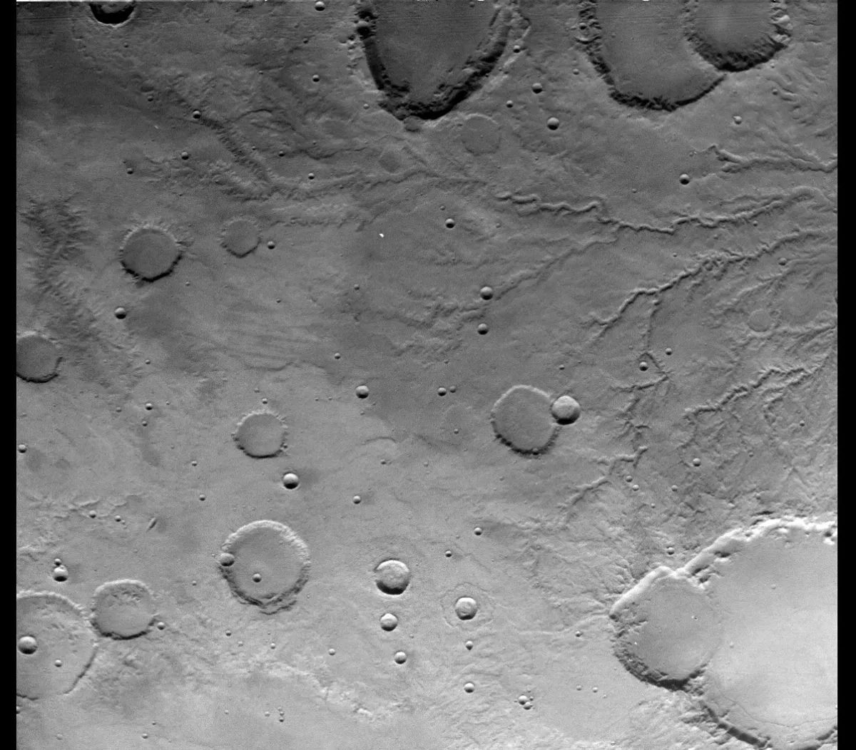
Look at those valleys. When I look at them, I think: of course Mars was wet once. But then I look around the valleys, and I see impact craters, lots of impact craters, some of them degraded (that is, not pristine anymore, worn down). Impact craters make me think: ancient, unchanging, dead. The juxtaposition of valley networks and impact craters is the Martian paradox: alive and dead.
How to explain valley networks? They clearly require a fluid for their formation, and that fluid is most likely water -- I think most people agree about that. Where people disagree is on how that water got to the Martian surface, for how long (or for how often). Maybe it rained, but not for very long. Maybe it snowed, and then melted underneath the snow once in a while. Or maybe there was liquid water underground that reached the surface at springs, and then flowed across the surface. (Geologists call this "groundwater sapping".)
Earlier work based on Viking mapping tended to support the sapping conclusion. When it rains, there is water running off of every solid surface, so the whole landscape gets dissected into channels that hook up into branching networks that look like trees; the tiniest branches of those trees reach all the way up to the peaks and ridges that separate watersheds. When water springs from the ground, it only comes out in certain places; the streams may hook up into networks but they don't have many branches, like a tree that's been pollarded. The networks visible in Viking images looked like pollarded trees, with few, stubby tributaries.
Well, the two papers I'm describing today provide a good example of how higher-resolution data can totally change scientific conclusions. Hynek, Beach, and Hoke made a new global map of valley networks on Mars, based on a global mosaic of Mars Odyssey THEMIS images. That map has a resolution of 230 meters per pixel. (If that seems like a weird number, the map has a resolution of 256 pixels per degree, which works out to about 230 meters per pixel. The Odyssey team has since released a global 100-meter-per-pixel map.) This is still coarse by comparison to ridiculously high-resolution imagers like HiRISE, but it is detailed enough for geomorphology. There are other things that make the THEMIS map better than the Viking one. For instance, THEMIS mapped the planet under much more constant illumination conditions (which is really important for getting at the shape of the landscape), and its images are just crisper than Viking's.
Making a global map of squiggly valleys on a 230-meter-per-pixel base is, as the authors themselves acknowledge, "tedious and somewhat subjective." It is exactly the kind of task that a researcher is likely to give to a graduate student, which is what Monica Hoke was at the time that they did this work together. I wonder if she sees squiggly lines in everything now and can hardly keep herself from tracing them.
Here's an example set of images showing their mapping work. Here are the valleys they traced out in one section of the THEMIS map:

You can see how the valleys follow local topography:

In just about every place they looked, they found more valleys in the THEMIS data than in the Viking data. The density and complexity of the networks makes it much more likely we're looking at valleys that formed by runoff of some kind of precipitation. Also, in the THEMIS images, valleys tend to go right up to the tops of drainage divides, which is something you'd expect of rainfall-driven but not sapping-driven valley formation.
Since the 230-meter-per-pixel THEMIS map improved our ability to see the networks, it's reasonable to ask: what if we looked at the full-resolution THEMIS data? Would we see even more valleys? They checked in some areas and found: yes, they see even more valleys, but not many. They tried mapping a couple of sample areas at full resolution (better than 20 meters per pixel), and while they found about twice as many segments, it didn't substantially increase the density of the mapped drainage networks, presumably because those little segments were short so added up to a relatively minor fraction of the total number of valleys.
You can see for yourself how this might be true in the THEMIS image below. You can see lots of valleys, but zoom all the way in and you'll find they have a soft texture; their edges have been smoothed by eons of erosion. So it doesn't help much to have substantially higher resolution -- in fact, if I were doing this mapping, I'd zoom out to be able to see the forest for the trees.

Okay, so after mapping the entire planet at 230 meters per pixel -- what next? First, you take your map of the networks and see if there are any correlations with other globally mapped data. For instance, you can ask: what's the age of the terrain on which these valleys formed? The answer is, unsurprisingly, that it's mostly pretty old terrain, from what's called the Noachian era. We knew that already. The Noachian era was the time in Mars' history that was dominated by asteroid impacts, before impact activity waned. You have to be careful, though, to avoid confusing correlation with causation. The age of the terrain on which a valley is superposed only gives you a maximum age for the valleys. Suppose, for the sake of argument, that valleys formed at the same rate everywhere on Mars at all times, just like impact craters. You'd see more of them on the oldest terrain, because it's been exposed for the longest time to accumulate the most.
So if you actually want to know when the valleys formed -- if you want to do better to know they can be no older than the end of the Noachian -- you have to find a way to figure out how old the valleys themselves are. You do that by finding something that has happened to the valleys that you can age-date. Hoke and Hynek selected ten very large, well-preserved valley networks and counted the craters that overlap them to age-date them, the same way you age-date a lava flow. This is a little tricky because of the more linear than areal nature of the valley networks, but geographic information systems let you do this.
And here's the surprise. All ten of the big networks that they looked at had a very narrow span of ages, from the end of the Noachian to the beginning of the Hesperian, or roughly 3.8 to 3.6 billion years ago. That's a very narrow span, at a very ancient time. And yet it's also a long span, too long to be considered geologically instantaneous. Several of the networks have distinctly different ages, though others appear to have formed at the same time. Hoke and Hynek say:
"This research suggests the late Noachian and early Hesperian were characterized by roaming zones of precipitation that occurred during either continuously warmer and thicker atmospheric conditions or intermittently clement conditions, with precipitation occasionally returning to previously rainy regions and overall continuing near Meridiani Planum longer than in Terra Sabaea."
The narrowness of the time frame is interesting. It is also interesting that it happens after Mars' major impacts. Why is that important? Because some people have suggested that Mars could've been ordinarily dry, cold, and desert-like, much like today, and that valley networks only formed when major impacts briefly enriched the atmosphere with volatile gases. But if rain only happened mostly after all of Mars' major impacts, not during the impact era, then the impact-generated atmosphere explanation for valley networks just doesn't work.
There are valley networks that are younger than this brief period. They are isolated in a few locations that tend to be on the flanks of volcanoes. When Hynek, Beach, and Hoke looked at the younger volcanoes closely, they found that the younger volcanoes (like Arsia Mons, for instance) have networks that look quite different from the ancient ones. They're much more primitive (less branched) and are often associated with volcanic pit crater chains. They look more like the kinds of channels that form from groundwater springs in hydrothermal environments, not from rain.
So what does this all mean? Hynek, Beach, and Hoke tell the following story: Mars started out with a thin atmosphere and cold, dry conditions, somewhat like today's. The early Sun's energetic ultraviolet radiation would've stripped away Mars' atmosphere as it does today. But toward the end of the Noachian, the massive volcanic eruptions that began to build Tharsis had thickened the atmosphere, at the same time that the Sun's ultraviolet radiation was declining. Mars spent roughly 200 million years with a thicker atmosphere and more rainfall before volcanic activity declined enough that it could no longer resupply Mars' atmosphere with gases being stripped away by the Sun.
This is not inconsistent with the paper I wrote about earlier, where Edwin Kite and coauthors explained the distribution of sedimentary rocks on Mars with very infrequent episodes of snowmelt punctuating ordinarily dry and cold conditions. The briefly wet Mars that Hynek, Beach, and Hoke talk about could predate Kite's dry, cold Mars.
Is a 200-million-year-long Paradise sufficient for life to originate on Mars, and flourish? We don't know, because we don't know how life got started on Earth. What we can say is that if we want to look at Mars rocks that may contain evidence for life, we need to be looking at rocks from that span of time -- from the very end of the Noachian to the very beginning of the Hesperian.
Hmm, let's see, how old is Gale crater? Let's go look up Brad Thomson's paper, "Constraints on the origin and evolution of the layered mound in Gale Crater, Mars using Mars Reconnaissance Orbiter data." From the abstract: " The formation age of the layered mound, derived from crater counts and superposition relationships, is ∼3.6–3.8 [billion years old] and straddles the Noachian–Hesperian time-stratigraphic boundary." Hot diggity dog. Curiosity appears to be in the right place!
That's no accident, of course. The scientists involved in landing site selection were keenly interested in exploring this particular era of Mars' history, the time straddling the boundary between the Noachian and Hesperian eras. Curiosity may possibly already have seen rocks of this vintage; we don't know yet the age of the rocks at Yellowknife Bay. They could be Noachian, though. But there's more of a story to tell in that thick stack of rocks mounded in the center of the crater.
Let's rove to those old rocks and see if we can tell if Hynek, Beach, and Hoke were right about them forming at a time when Mars was wetter -- and if the rocks above them record the loss of Mars' Paradise. Curiosity is now making landfall at her first waypoint on the trek from Yellowknife Bay to Gale's central mountain. This is just the first of several science stops that will provide clues as to how the Yellowknife Bay sediments relate to the history of Gale -- and, by extension, to the history of Mars.

Postscript: I want to thank Brian Hynek and Monica Hoke for talking with me about their work, and especially Brian for making the two figures for me, the ones showing the mapped valley networks. I asked him to make those as illustrations for my Sky & Telescope article, and then my editor didn't wind up using them, and I'm chagrined about that. That happens in print publication. That's one reason I love blogging -- I can use exactly as much space as I need to explain and illustrate a point, and include every image that will help me tell my story.
Protect Our Shared Future
You help us defend humanity and prevent asteroid impacts. Donate now to become a Planetary Defender!
Donate