Bruce Murray Space Image Library

Landslide in Iapetus' Malun crater

Landslide in Iapetus' Malun crater
Landslide in Iapetus' Malun crater Global view of Iapetus’ dark, leading hemisphere and a close up of a large, blocky type landslide in the crater Malun. Malun crater formed right on the edge of the large Turgis basin, which likely triggered the fall of material from the tall (~8 km) Turgis rimwalls. This landslide extends 55 km at its greatest length. The equatorial ridge is also visible in the global view, giving Iapetus a walnut-like appearance. Large white arrows indicate the direction of incoming sunlight. NASA / JPL-Caltech / SSI

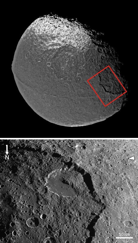
See also this photo of a lobate landslide

Landslides have also modified Iapetus' ridge:

Landslide modification of Iapetus' ridge
Landslide modification of Iapetus' ridge Iapetus' unique and ancient equatorial ridge shows diverse morphologies, sometimes flat-topped, other times sharp and steep-sided, and in some places there are individual mountainous peaks. This portion of the ridge (Toledo Montes) shows where landslides have modified the flat-topped ridge (at ~225 m/px). Arrows indicate landslide margins and dotted lines show alcoves that are possibly sites of more ancient landslides. No matter how the ridge originally formed (a debated topic), its appearance has been considerably altered by a long history of mass wasting.Image: NASA / JPL / SSI / annotated by Kelsi Singer