
 Explore Worlds
 Find Life
 Defend Earth


What’s Seeping on Mars? Recurring Slope Lineae

Written by
Matthew Chojnacki
HiRISE Postdoctoral Research Associate, Lunar and Planetary Institute, University of Arizona
May 13, 2014
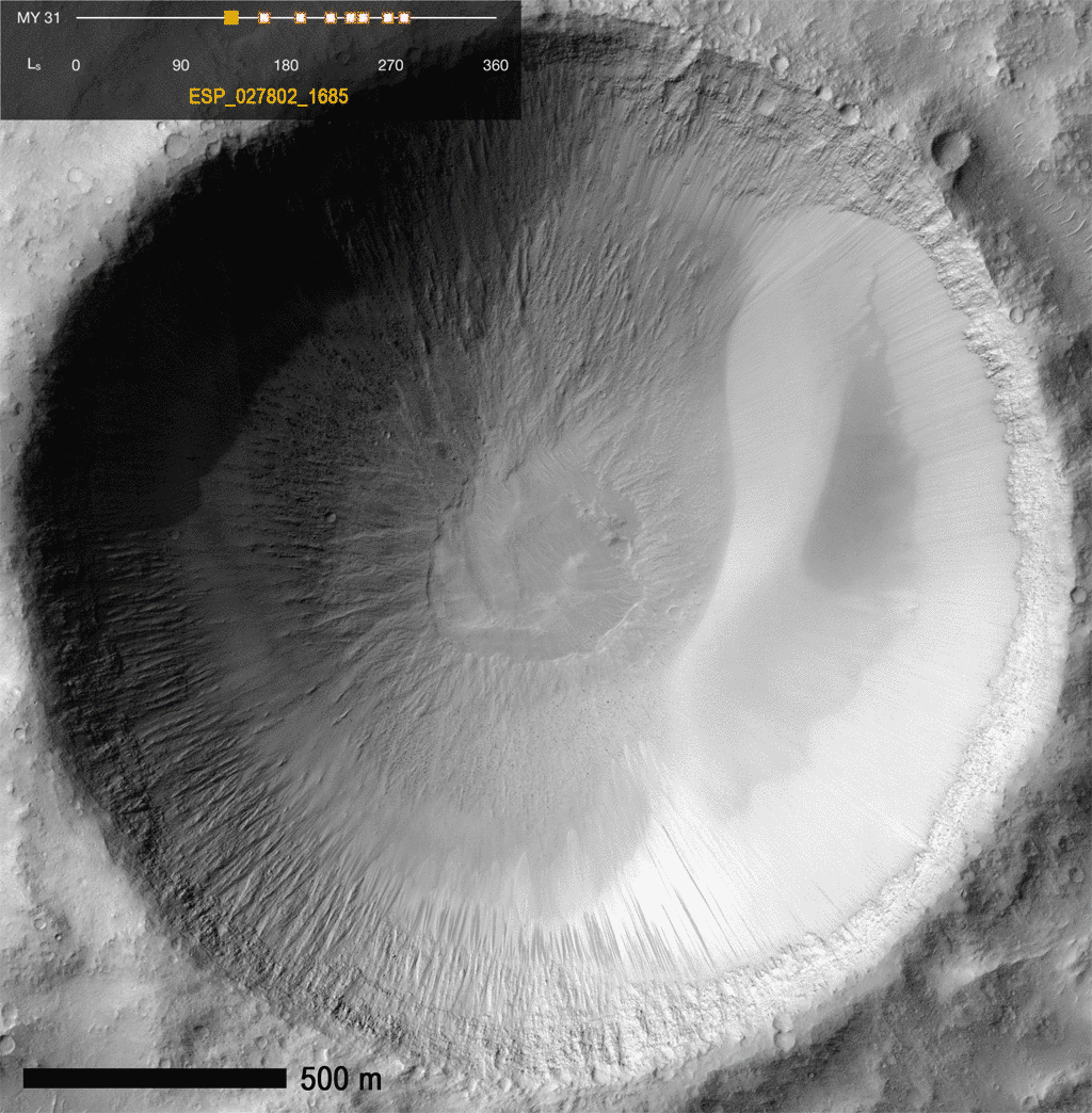
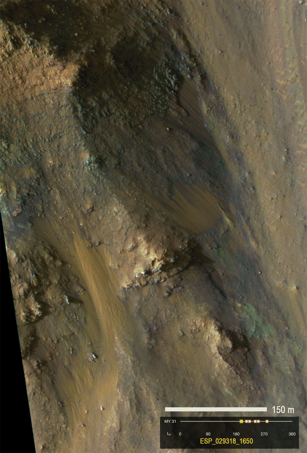
Perhaps the most intriguing planetary dynamic process discovered in recent history was hidden in plain sight for over a decade. Recurring Slope Lineae (RSL) are narrow, dark-toned streaks that descend steep Martian slopes, beginning in higher-lying rocky outcrops. We have watched them grow, fade, and reappear every year by taking repeated orbital images. They grow fast, over time scales as brief as a week. Their seasonal behavior and preference for warm equator-facing slopes suggests that something volatile, like briny water, could be involved. For example, the crater below in central Valles Marineris shows how RSL follow the Sun, always forming on the warmest slopes.
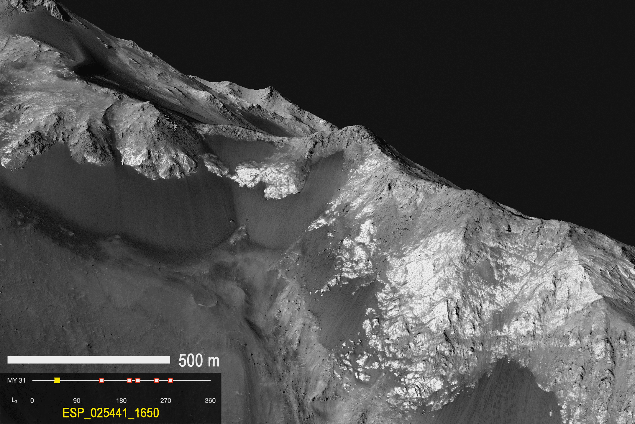
RSL were first detected within isolated craters, but we now find them regularly along canyon walls, small mounds, landslide scarps, and other landforms.

Note: the shapes and seasonal behavior of RSL are not the same as mid-latitude contemporary gully formation, which is most likely driven by seasonal carbon-dioxide frost (dry ice).
Hidden in Plain Sight
RSL were hidden for many years despite frequent imaging of the walls and floors of Valles Marineris by the Mars Orbiter Camera on Mars Global Surveyor. The typical resolution of those data (about 3 meters per pixel, but in very narrow images) and infrequent repeat imaging of the surface kept the Recurring Slope Lineae undetected. It wasn’t until the advent of repeat fine-scale images (25 centimeters per pixel) from the High Resolution Imaging Science Experiment (HiRISE) onboard Mars Reconnaissance Orbiter that RSL could be discovered. Even then, steep canyon and crater slopes are complicated geologic sites where landslides and wind erosion hide these active features. When I was studying Martian sand dunes at the University of Tennessee, I constructed one of the first Digital Terrain Models (DTMs, derived from HiRISE stereo pairs) in Valles Marineris; I didn't notice RSL growing high on the slopes in the two stereo images!
Initial Discovery
It was another student, Lujendra (“Luju”) Ojha, also working on DTM production, who finally caught the small lineae on crater walls growing between images. After Luju raised a flag to the HiRISE Principal Investigator Alfred McEwen, the hunt was on to track down the origin of the strange lineae. They were first discovered in the mid-latitude southern highlands (published by Alfred and coauthros in Science in 2011), but are now known to be abundant in equatorial regions (announced in Nature this year), particularly within the deep canyons of Valles Marineris (work I presented at the Lunar and Planetary Science Conference this year).

Ongoing Monitoring
Now that we know the properties of “typical” RSL-hosting terrain we can identify candidate sites in lower-resolution images from other instruments, including MOC, and the Context Camera on Mars Reconnaissance Orbiter (~6 meters per pixel, but much broader coverage than MOC or HiRISE). We are also finding them on older serendipitously located HiRISE images. We have found candidate sites to be widespread in places like eastern Valles Marineris (Coprates and Melas chasmata)! The problem is, we can only quantify slope lineae growth and raise these sites' status from "candidate" to "confirmed" using HiRISE data. Because of limited viewing opportunities and the camera’s narrow field of view, choices must be made by the HiRISE team: do we focus on a few sites to monitor regularly, or spread out the images in an attempt to confirm as many sites as possible?
The HiRISE team regularly monitors several sites across Mars that show thousands of slope lineae forming in the same locations every year, when temperatures are warm enough for liquid water. But pure water should rapidly evaporate or even boil in the thin Martian atmosphere. In contrast, liquid brines that would form in the salty soils commonly observed at Martian landing sites have depressed freezing temperatures, and are much more stable in the harsh conditions of the Red Planet. A tempting terrestrial analog occurs in Antarctica during the warmest summer months. There, similar features, called "water tracks," form from salty brines on steep slopes.
The analog is compelling, but frequent HiRISE monitoring has not yet solved the mystery of how RSL actually form. One puzzle is that we don't know where the putative water that create RSL originates. Periodic melting of shallow ice, regional groundwater, deep ancient brines, or some atmospheric phenomena (e.g., deliquescence or vapor phase transport) are all possibilities, but all have problems. For example, shallow ground ice is a plausible water source at higher-latitude sites, but not at warmer equatorial locations. Within craters, a regional groundwater source seems like a possibility, but the hydrology doesn't work for RSL that begin within 100 meters of the tops of precarious peaks and ridges. Preexisting faults may could provide pathways from the deep subsurface for ancient brines, but how this would work in detail is not understood. Atmospheric deliquescence is a process by which salty soil absorbs water from the atmosphere when temperatures and pressures are sufficient (like at the Phoenix landing site and for Antarctic water seeps) and could explain special topographic occurrences. However, it isn’t clear that enough deliquescent water could accumulate in equatorial Mars to cause the widespread flows that we have observed.
Multiple working hypotheses are being tested for the genesis of the RSL. In addition to ongoing HiRISE monitoring, science teams are also working in the laboratory, measuring fluid interaction with Mars analog soils. These efforts won't just help us understand the unique phenomenon of RSL, but also contribute to our understanding of potential extraterrestrial life.
Protect Our Shared Future
You help us defend humanity and prevent asteroid impacts. Donate now to become a Planetary Defender!
Donate