
 Explore Worlds
 Find Life
 Defend Earth


Bruce Murray Space Image Library
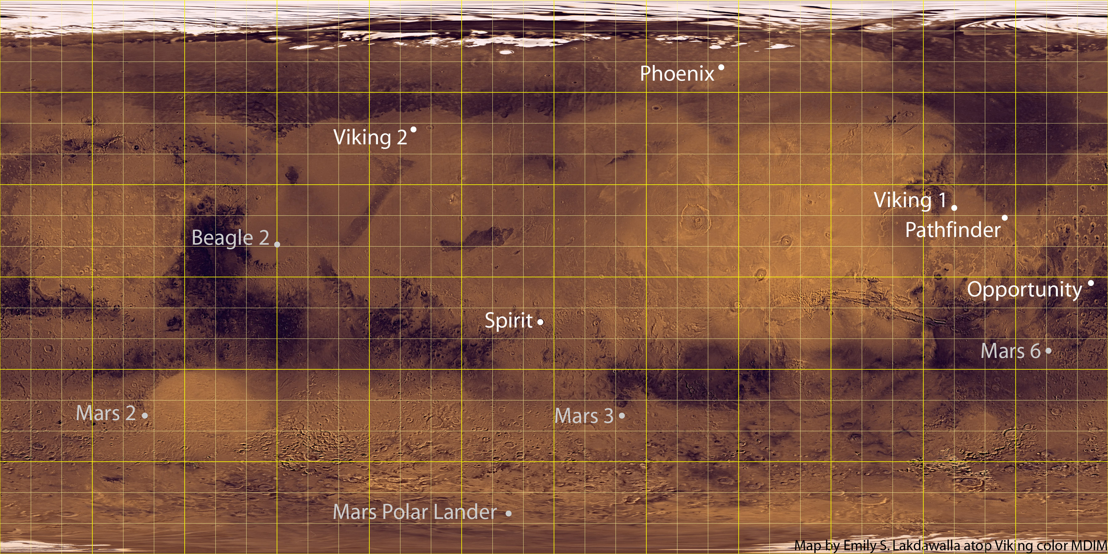
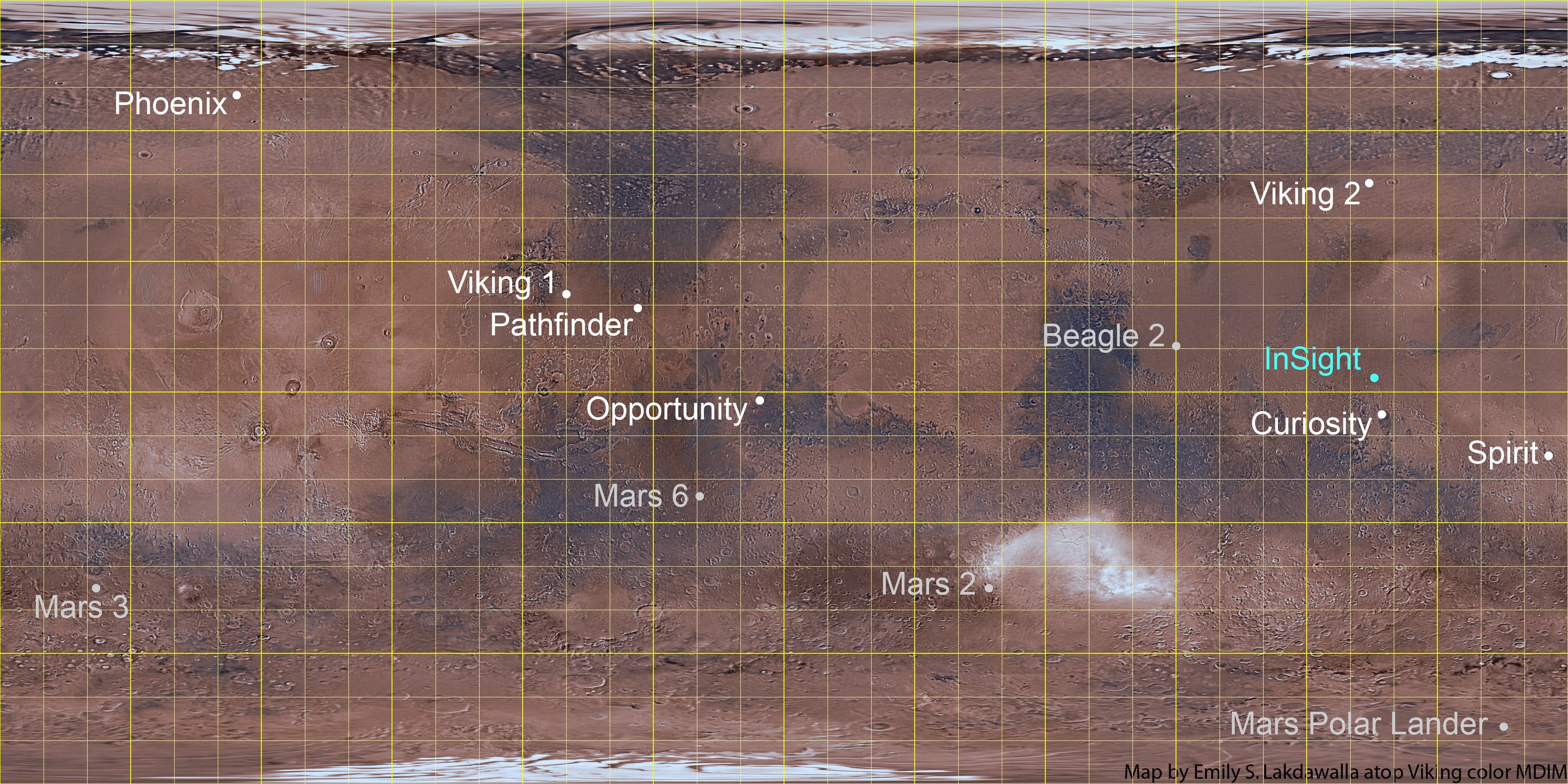
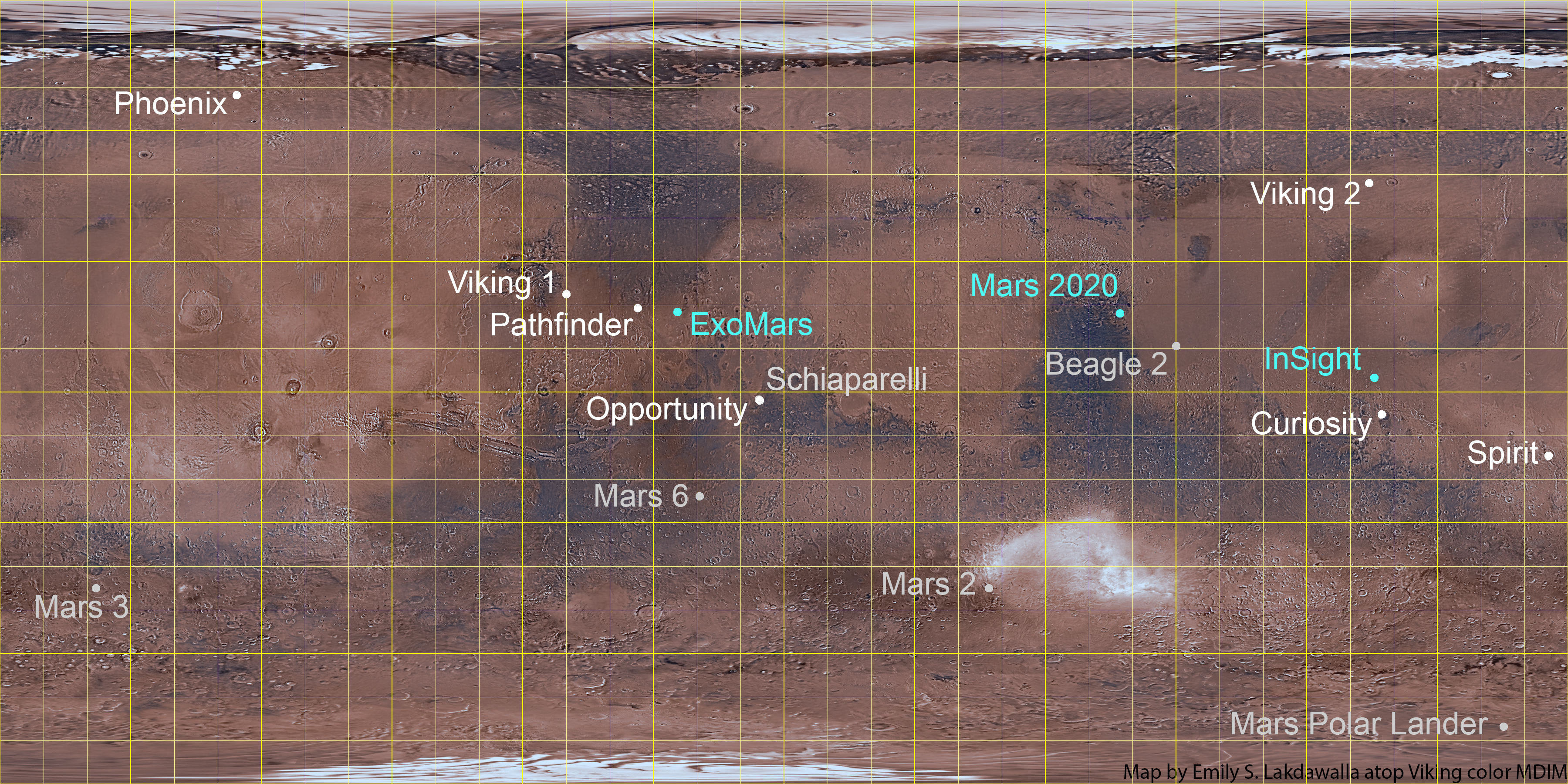
Map of all Mars landing sites as of November 2018
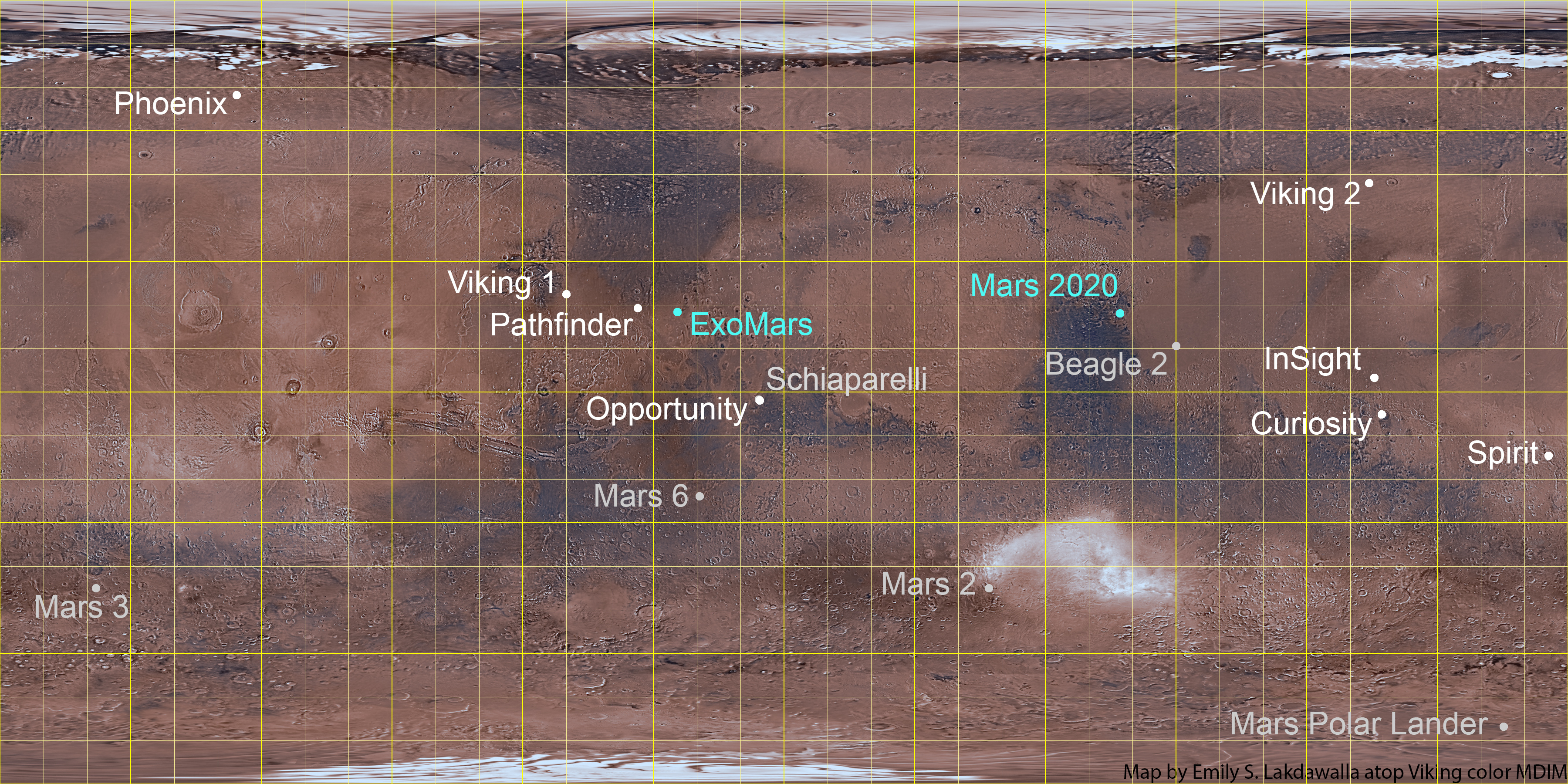
The map was assembled by Emily Lakdawalla from the following sources; any errors are hers. The base map is the Viking orbiter MDIM 2.1.
Mars 2: 45 S, 313 W (NSSDC)
Mars 3: 45 S, 158 W (TPS)
Mars 6: 23.90 S, 19.42 W (TPS)
Viking 1: 22.48 N, 49.97 W (NSSDC)
Mars Polar Lander: 76.57S, 165.2 E (read from map provided by HiRISE team)
Pathfinder: 19.33 N, 33.55 W (NSSDC)
Beagle 2: 10.6 N, 270 W (NSSDC)
Spirit: 14.571892 S, 175.47848 (Arvidson et al, JGR, 2006)
Opportunity: 1.9462 S, 354.4734 E (Squyres et al, JGR, 2006)
Phoenix: 68.218830 N, 234.250778 E (via press briefing)
Curiosity: 4.5895 S, 137.4417 E (Vasavada et al, JGR, 2014)
InSight: 4.502 N, 135.623 E (Golombek et al., LPSC, 2019)
ExoMars Schiaparelli: Near the Opportunity landing site.
ExoMars rover: 18.1N, 335.7E (read off this map from ESA, 2018)
Mars 2020 rover: 77.5945 E, 18.3628 N (landing site workshop)
The map was originally developed and posted in 2008; the 2008 version is available here, the 2014 version is available here, the 2015 version is available here, and the 2018 version is available here.