J. Brian Balta • Apr 10, 2014
Will We Finally Rove Mawrth Vallis?
A few years ago I attended a seminar by one of the members of the Curiosity Rover team discussing the geology of the four final candidate landing sites. Two of the sites were craters that contain features which, from orbit, look exactly like river deltas deposited on crater floors - Holden Crater and Eberswalde crater. One site contained a mound of sediments thought to cross a key boundary in Mars’ history and had detections of the spectral signature of phyllosilicate (clay) minerals from orbit – Gale crater. Finally, there was a location known as Mawrth Vallis. That slide described Mawrth as “The oldest rocks on Mars.”
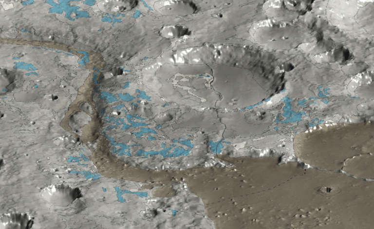
That last detail might not be completely accurate; some sites on Mars that could be well over 4 billion years old have been imaged from orbit – “Pre-Noachian” in martian age terminology (Martian geologic eras are divided into 3 regions, the recent Amazonian, the Hesperian, and the Noachian). Despite that caveat, Mawrth Vallis remains a very interesting place on Mars. It sits close to the dichotomy boundary, the dividing line between the southern highlands and the northern plains. It therefore could preserve and expose rocks from very early in Mars’ history, brought to the modern surface either through tectonic processes or from erosion as sediments wash into the lowlands to the north. The location is also extremely interesting mineralogically – spectra from orbiting spacecraft have identified the same clay minerals in Mawrth that are found in Gale Crater.
As we know, the Curiosity rover went to the Gale Crater site and has already analyzed some of the clay minerals it targeted. Mawrth was still an interesting candidate, but it wasn’t picked probably for one big reason; even the scientists are still trying to understand it. The stratigraphy at Gale Crater was fairly simple; layered, bedded rocks with a firm sequence up Mount Sharp. Mawrth is much more complex; the rock layers vary in chemistry a lot over short distances and contain evidence of folding, potentially due to the presence of buried impact craters or buried channels. This complicated sequence suggests that the rocks went through several episodes of burial and erosion, making them tough to piece together but also extremely interesting geologically.

Although Mawrth Vallis wasn’t picked for the Curiosity rover, the story for these unique rocks isn’t over yet. In 2018, the European Space Agency is planning to launch a rover known as “ExoMars” – short for Exobiology on Mars. In late March, a group of ESA scientists met in Spain to begin narrowing down the landing site candidates for this rover, and on March 2, they announced their final four candidate landing sites.
This rover will be ESA’s first attempt to land a rover on another world, and therefore it is in some ways more limited than the audacious Curiosity rover. Unlike the radiogenic isotope power source for Curiosity, the ExoMars rover will be solar-powered; a choice that limits the cost but makes the rover less flexible. The rover has to land somewhere near the Martian equator, at a location where it will get enough energy from the sun to operate for its entire planned 6-month initial mission. The rover also will use a “traditional” entry, descent, and landing system; it will use a heat shield and slow down due to friction with the martian atmosphere, with parachute deployments afterward to allow a soft landing on the surface. The Curiosity Rover flew its remarkable, guided cruise stage through the Martian sky, giving it flexibility to land in many areas of the planet’s surface as it could steer its way to its landing site, even lifting in altitude if necessary. The ExoMars rover, on the other hand, can only land in lowland areas because it needs to traverse a certain amount of atmosphere in order to slow down enough.
The 4 final candidate landing sites that fit these requirements and have interesting geology are shown in this image: their names are Oxia Planum, Hypanis Vallis, Oxia Palus…and Mawrth Vallis.
The goal of this rover is to search for signs of life in an extensive way, using capabilities that have never been tested before on Mars. The ExoMars rover will carry a drill designed to bore deep into the martian surface, extracting rock cores from depths of up to 2 meters. It will then process those rock cores, analyze the mineralogy of the sediments using IR and Raman techniques, and most importantly look for “biomarkers” – specific molecules that could be the fingerprint of early life on Mars.
To accomplish its goals, the ExoMars rover needs to go to a place where there are rocks from early Mars exposed within two meters of the surface that could contain those biomarkers. The proposed sites are intriguing in this regard, but in my eyes, one stands out in particular.
All four sites sit in the lowland areas just north of where Valles Marineris would have had its outflow if water ever did flow from those grand canyons towards the northern plains, and several of the landing site candidates may be controlled by these processes. The Oxia Palus and Hypanis Vallis sites both show physical evidence for flowing water in the form of river channels and delta-like deposits. Both of those settings could be places where organic material could have been deposited in sediments and preserved through time, but the detections of minerals from orbit that have interacted with water are lacking compared to the other sites. The Oxia Planum site is close to Mawrth Vallis and does contain measured clay minerals, but the exposures are not as extensive or intriguing as those at Mawrth.
For the preservation of biosignatures that could be detected by this rover, the Mawrth Vallis site could well represent the best possible candidate. Mawrth Vallis contains one of the thickest sequences of clay minerals found anywhere on Mars, with hundreds of meters of clay-bearing rocks exposed at the surface. The clays contain a chemical boundary within them; the upper portion is made of aluminum-rich clays while the lower portion is made of iron- and magnesium-rich clays, suggesting either a change in the rocks that were subsequently altered to clays or a change in degree of alteration preserved throughout the unit. Multiple layers of each unit are observed from orbit, potentially suggesting a rich history of sediment deposition possibly predating the formation of clays as well. Clays like these are important for detecting signatures of life because they not only require the presence of large volumes of water (as suggested by the clays at Gale Crater), they also have the ability to trap surrounding molecules in them as they grow, just like organic molecules found in soils on Earth. Other interesting minerals have been detected in this area, including hydrated silica, sulfate salts jarosite and bassanite (iron and calcium rich, respectively), which also could also help entomb and protect biomarker molecules if they were ever present.

There are a variety of proposals for how to create the rocks found there, including water flowing through already-deposited sediments, sediments deposited in lake-settings similar to that proposed for Gale Crater, and even paleosols – soils that could record interaction between the martian atmosphere and surface environment.
I have no connection to the team, but when I saw that Mawrth Vallis was a candidate for the ExoMars mission, I have to admit I got a little bit excited at the idea that we might finally get a glimpse of what is there (excited enough to write over a thousand words, it seems). Orbital measurements tell us that this location is extremely complex, but it is tantalizing in terms of understanding early Mars. The rocks there almost certainly formed earlier in Mars’ history than any of the other rocks we’ve seen on the surface, with the possible exception of the rim of Endeavour crater, and they record chemical changes unlike those exposed almost anywhere else on Mars. The thicknesses of the units, the record of change, and the complexity of chemical interactions could set the stage for a remarkable mission that completely rewrites the book on what the surface environment on Mars was like early in its history.
Of course, the scientific intrigue is only part of the criteria for selecting a landing site; engineering factors count as well. When the ExoMars lander enters the atmosphere, it will fall uncontrolled, with its path controlled by an unpredictable combination of atmospheric conditions on the day of entry. That type of uncontrolled landing will lead to uncertainties in exactly where the rover will land; basically the engineers will draw an ellipse 104 kilometers long and 19 kilometers wide on the Martian surface and say with confidence the rover will land somewhere within it. This landing ellipse is similar in size to those of the Mars Exploration Rovers Spirit and Opportunity, but it is much larger than that of the Curiosity rover, which used active guidance systems during its atmospheric entry to land within an ellipse only 20 kilometers by 7 kilometers. The uncertainty in the ExoMars landing location means the site selection must be done with care – the rover must be able to land safely in an area close enough to its target to pull off a successful science campaign no matter where in its landing ellipse the rover winds up. (In that sense, Mawrth may actually be perfect; if a landing ellipse can be fit in the area, the intermingling of so many different compositions could allow easy investigation of multiple, distinct geologic units.) Furthermore, the team also needs to locate sites that are safe; sites full of too many boulders or large cliffs would put safe landing in jeopardy.
In the release published after those sites were announces, Brown University Planetary Scientist Jack Mustard was quoted as saying of Mawrth that it clearly “stands out” as a unique potential science opportunity. It has been several years since the Gale Crater site was selected for Curiosity and, with the rocks already discovered, Gale appears to have been an ideal site for that rover. Since then, scientific investigations of the Martian surface have continued using the instruments on the (now aging) Mars Reconnaissance Orbiter. Key minerals potentially involved in the formation and preservation of biosignatures, including clays, salts, and even carbonates have been located all over the martian surface. But, despite all this new data, Mawrth Vallis still stands as a complicated but tantalizing place on the martian surface to visit with a rover.
If the rover is capable of landing there successfully and conducting its science campaign, imaging and drilling into the rocks of Mawrth Vallis could give information about early Mars that can’t be found anywhere else on the planet, and I’m intrigued and excited that we might get a chance to really see what is there.
Let’s Go Beyond The Horizon
Every success in space exploration is the result of the community of space enthusiasts, like you, who believe it is important. You can help usher in the next great era of space exploration with your gift today.
Donate Today

 Explore Worlds
 Find Life
 Defend Earth


