
 Explore Worlds
 Find Life
 Defend Earth


On space kindness and the Chelyabinsk meteor

Written by
Vitaliy Egorov
October 4, 2013
Editor's note: This blog entry originally appeared in Russian on Vitaliy Egorov's personal blog. It was run through Google Translate and edited by me (Emily Lakdawalla), with Egorov's review and approval. --ESL
While NASA is not communicating, it's a good time to talk about how some Russian space kindness won a small victory over the Russian space indifference.
I hope that many already know about the Russian weather satellite Elektro-L, which is in his third year of operation in a geostationary orbit. I have repeatedly talked about him, and showed the results of his labors. Today I will share some more happy news about the satellite.

He takes a photo of the visible disk of the Earth once every half hour, and his pictures are in the public domain. Therefore, people may engage in processing them. Here you can find a program for Windows, which displays the images on your desktop. Here you can sign up for twitter alert that sends a new photo every day from orbit. In short, this satellite of the Earth gives beauty to all.
The results of the Electro-L are of interest not only to us but to a Western audience, even one spoiled by the abundance of NASA, a fact made clear by a recent series of articles in the American media. An Elektro-L picture of Earth at equinox was the September 28 NASA Astronomy Picture of the Day; its publication has brought a lot of rave reviews from abroad.
Pictures from Elektro-L were available to all -- but not all pictures. Electro-L actually has two operators: Roscosmos and the Russian Federal Service for Hydrometeorology and Environmental Monitoring (Roshydromet). Roscosmos takes and puts satellite imagery through its subsidiary Science Center for Earth Operative Monitoring (NTsOMZ). RosHydromet receives and processes the images through the Research Center for Space Hydrometeorology (FGBU "SRC "Planeta").
The problem was that NTsOMZ did not accept four of the images during each day, taken between 6:30 and 8:00 Moscow time, and therefore these images do not exist on the public server. Data from this period is archived in Novosibirsk in the Siberian branch of "Planeta".
Therefore, video and animations that were going through pictures from NTsOMZ contain a nasty jump in the coverage that is noticeable, and disrupts the harmony of the observed perpetual motion of the Earth:
January 2013 on Earth viewed by Elektro-L Earth as viewed by the Russian weather satellite Elektro-L, which is in a geostationary orbit at a distance of 36,000 kilometers, throughout January 2013.Video: Roscosmos / SayJabberwocky
For the same reason, we could not see a trace of cloud from the Chelyabinsk meteorite, which it left in the morning sky, during its fabulous flight on February 15 at 7:20 am Moscow time. That day shots from space came from European spacecraft like Eumetsat:
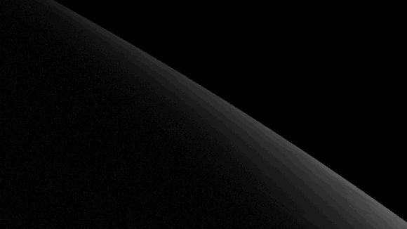

Electro-L has a better viewing angle, but the meteorite fell in the unfortunate "Novosibirsk" time, and attempts to get these pictures through official means were not successful. I had to settle for the dissipating shadow, taken after 8:30:
Pictures were not available for examination even by the media.
However, a recent post by one of the admins the of Electro-L Vkontakte group received a response:
Good afternoon. I am Michael Zahvatov, director of the scientific department of FGBU "SRC" Planeta. I stumbled across your article about Electro-L. Quite frankly, I was surprised by the existing problem of lack of data availability in the public domain for that four-image time period. I am pleased to tell you that I have decided to correct this "error." I have now finished the software and have opened a new output stream on our public FTP service.
ftp://ftp1.rcpod.ru/ElectroL/
My reaction on reading: :D
These began in early September, so the February meteorite remained in the depths of Hydromet. On the other hand, I could finally make a smooth animation of the daily movement of the Sun:
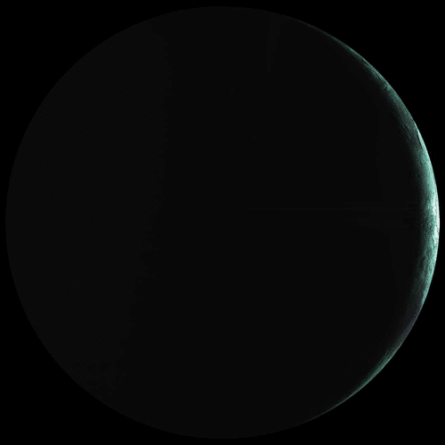
It is this animation of the autumn equinox, along with a still image, that "went around the world" and starred on Astronomy Picture of the Day:

It's a shame that these pictures, and the fact that they have made such an overseas "tour", are not of interest to the domestic media. Only RIA-Novosti wrote about it in their Twitter . More news came out on astronet.ru and, oddly enough, on the Ukrainian site facenews.ua. I sent the link to the post to the "Rossiyskaya Gazeta", but apparently, for them the importance of such an event is not sufficient.
But space enthusiasts are insatiable! I wrote to Michael's to request the images for February 15, 2013. Even though he was on vacation, he turned to his colleagues, who uploaded the desired four archives worth of data to the server.
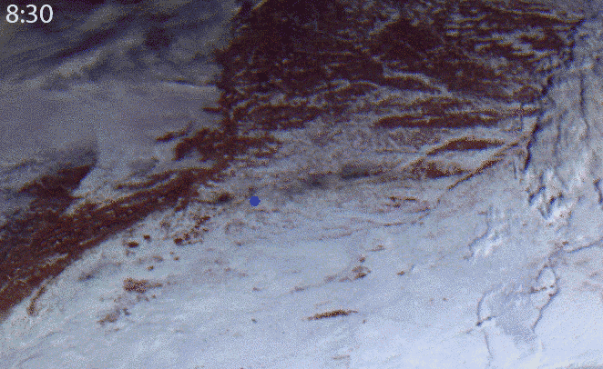
And so here, six months after it fell, is the Chelyabinsk meteorite, in a view from above, from a distance of 36 thousand kilometers:

The picture captures a trail in the sky, as it appeared 10 minutes after the fall. It is evident that it is illuminated by the Sun even when the land below is dark. That tells you the trail is significantly higher than the cloud at this longitude.

If desired, from satellite imagery, you can determine the height of clouds formed, their thickness and length, to estimate the direction and place of the alleged fall of the celestial body. I remember in the early hours, and even days after the event - these were important questions that were being argued, both professionals and amateurs. But these satellite images were not available in the public domain. I do not know whether the Elektro-L data were used by our scientists, but something tells me this opportunity was neglected.
Now, finally, we have in the public domain, all pictures from the Electro-L. You can use them at their discretion. For example, it would be great to see similar weather site like sat24.com or something similar. (The efforts of enthusiasts did not work to accomplish this idea, so I give that away as a business idea ;) Well, I will continue to seek out his shots any good and / or interesting events and, if possible, to talk about it.
In conclusion, I want to thank Michael Zahvatov, for his decision to "correct the error", all of employees "SRC" Planeta", and NTsOMZ for having shared with us the results of the national system; NPO Lavochkin, for having built Elektro- L, and all staff involved in the space industry to create, launch and operate the satellite. Hopefully, this example will show all responsible parties that open data is the best way to showcase the work of our spacecraft. High-quality visual results say the right thing in all languages, and are better than a thousand words.
Thank you!
Protect Our Shared Future
You help us defend humanity and prevent asteroid impacts. Donate now to become a Planetary Defender!
Donate