Jason Davis • Oct 24, 2014
Surveyor Digitization Project Will Bring Thousands of Unseen Lunar Images to Light
It's hard to believe, but just three years before Neil Armstrong and Buzz Aldrin walked on the moon in 1969, humanity had yet to soft-land anything there. If the United States was really going to put astro-boots on the ground, it would be nice to get a preliminary look at the surface.
In 1964 and 1965, three camera-equipped spacecraft called Ranger crash-landed into the moon, giving scientists their first up-close look. The Soviet Union's Luna 9 gently touched down in the Ocean of Storms in February 1966, becoming the first spacecraft to send home images from the surface. Four months later, the U.S. followed suit with Surveyor 1, the first of seven robotic spacecraft sent to investigate Luna firma between 1966 and 1968. Two didn't make it in one piece, but of the five that did, some 87,000 images were relayed back to Earth via television cameras.
Astonishingly, less than two percent of those images have ever been seen. That's according to a team of scientists at the University of Arizona Lunar and Planetary Laboratory (LPL), which plan to bring Surveyor's unseen work to light. The group, led by Dr. Shane Byrne, will digitize the entire collection and release it into the public domain.
NASA's Lunar Advanced Science and Exploration Research (LASER) program graded the project's proposal "excellent," awarding Byrne's group $97,000 for the year-long project. "The review panel was gung-ho about it," Byrne said. "Everybody was enthusiastic." The project will be carried out by the Lunar and Planetary Laboratory Space Imagery Center, one of several NASA-designated facilities that store archival images from planetary exploration missions.
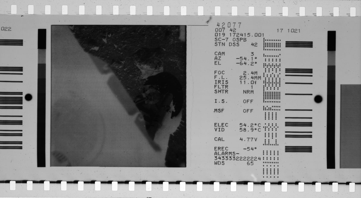
The Surveyor images are stored on about 30 reels of 70 millimeter film negatives. Maria Schuchardt, who oversees the Space Imagery Center's day-to-day operations, said the negatives are in very good condition. The Austin-based company Stokes Imaging, which specializes in digitizing archival images for libraries and museums, plans to setup a portable clean room at the Lunar and Planetary Laboratory. There, the Surveyor film reels will be fed through a digital imaging system and individually scanned. The process will take about three months, and Shuchardt said the images will eventually be published on a web portal where both the scientific community and public at large can download and enjoy the collection. The digital collection will complement other efforts to restore vintage NASA images, such as the Lunar Orbiter Image Recovery Project.
The science buried in 50-year old lunar images
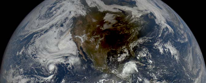
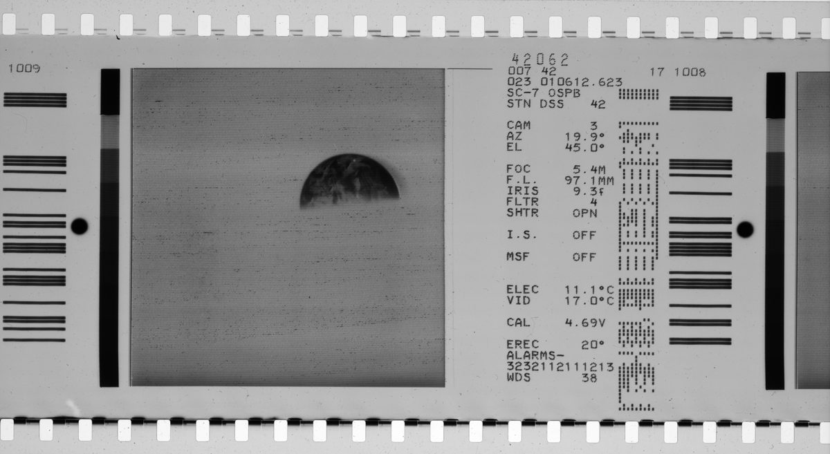
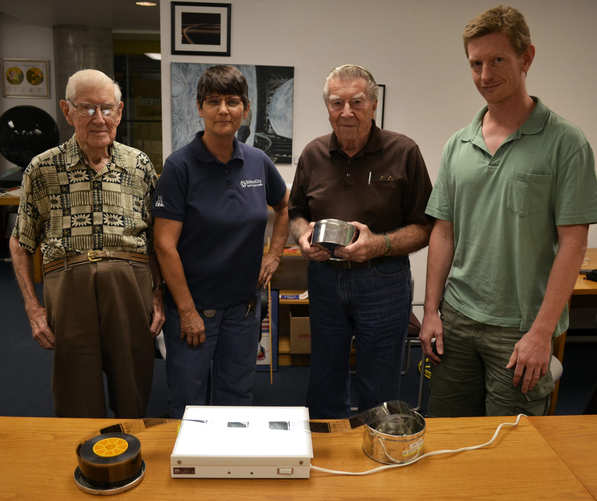
The scientific value of Surveyor's 87,000 television images was highlighted in a letter signed by four of the project's original co-investigators. The oldest co-investigator, Ewen Whitaker, is 92 years old. "The scientific value of this film medium cannot be underestimated, as much still remains to be researched and extracted from the images," the scientists wrote. Surveyor's cameras were primarily used for engineering investigations that helped pave the way for the upcoming Apollo landings. These included close-ups of the spacecraft's foot pads to see how deep Surveyor had sunk into the lunar soil. But there were also scientific observations, such as dozens of panoramic photographs taken under a range of lighting conditions. Additionally, the Surveyors captured shots of the constellation Orion, the lunar horizon glow, and a 26-hour timelapse of Earth—part of an experiment to see if our planet's sea state could be inferred using various polarization filters.
Philip Stooke, a geography professor at the Centre for Planetary Science and Exploration at the University of Western Ontario, said Surveyor's unseen images could be used to help with future mission planning—especially missions that involve rovers. When the sun is directly overhead, there are minimal shadows, making it difficult for rover drivers to spot hidden obstacles. Likewise, when the sun is on the horizon opposite a rover's direction of travel, shadows inside small lunar craters can be hidden from view. Stooke said the Soviet Union's Lunokhod 2 may have fallen victim to this effect in 1973, driving into a crater and banging into an outcrop, covering the rover in dust that eventually doomed it.
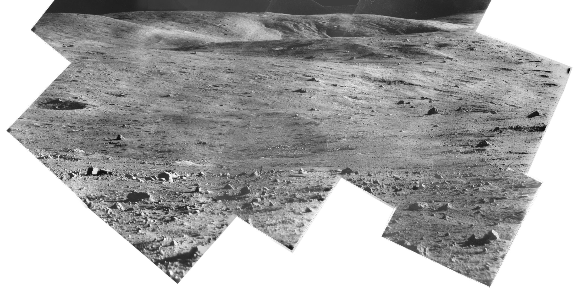
Stooke has done some of the most extensive—and most tedious—Surveyor panorama work to date. He said that because the original Surveyor images were processed in darkrooms, it was extremely difficult to correct for natural lighting gradients that occur in each image.
"Anytime you take an image of a landscape, there's going to be a gradient of light across it where one side is a little brighter than the other," he said. "When you stick the pieces together to try to build up a mosaic, you can see the seams between them because the dark side of one image is placed next to the light side of another image." As a result, the original panoramas resemble fish scales, where each individual image can be seen.
Around the year 2000, Stooke set out to rescan the original panoramas and correct the brightness of each individual fish scale. It took him about a year of on-and-off again work to restore a single panorama—five years total to do all five Surveyors. Buried within some of the 87,000 original unseen images are more panoramas. Since the individual images in these panoramas will be digital from the get-go, correcting for lighting variances should be easier. Better yet, making the archive publicly available means the entire space image processing community will be able to give it a try.
Images from the moon, stored silently for decades
Justin Rennilson, a Surveyor co-investigator and digitization project team member, said one of the reasons most of Surveyor's images have never been seen is the enormous amount of resources that were required to process the images in the late 1960s. The Surveyors relayed their television signals back to Earth in the form of radio waves, which were received by NASA's Deep Space Network satellite dishes. There, the signals would be recorded onto magnetic tapes, and later converted to reels of 70 millimeter film negatives. These negatives comprised a so-called first generation copy of the images, which could then be duplicated to make second-generation reels, or converted to other formats like 35 millimeter film.
The first-generation reels were cut into individual frames and cataloged, said Rennilson. Initial, high-priority images like shots of the spacecraft's footpads, as well as the soil sampling arm included on later Surveyor missions, were processed immediately. Processing the film meant running it through a large IBM mainframe computer. Each film negative contains calibration data that can be interpreted by a computer, which spits out the final grayscale-corrected product. Scientific images and pretty pictures were given low priority, and as a result, Rennilson said he had to apply for mainframe time between 12 and 4 a.m., when the computer wasn't utilized. He said that over the course of four hours, he could typically process just three images.
The original magnetic tapes containing the raw signals from Surveyor have long been discarded. Ironically, because the first-generation film reels were cut into individual frames, digitizing the collection became impractical, since each frame would have to be hand-scanned. The digitization team estimated such an effort could take up to one-and-a-half years.
Fortunately, before the first-generation reels were cut, secondary copies were made. These second-generation copies were distributed to Surveyor's scientific investigators, which included Dr. Gerard Kuiper, the founder of the Lunar and Planetary Laboratory. Ewen Whitaker said he took possession of the films for Kuiper and carefully stored them in the basement of the Flandrau Science Center and Planetarium, which sits next to LPL on the University of Arizona campus. Said Whitaker: "A NASA fellow came out to see Gerard, and said, "We'll give you these cans of film from Surveyor. Have you got somewhere to put them?"
A final report
While scanning the film reels won't require each frame to be individually handled, the process still requires the presence of an eagle-eyed operator. In addition to scanning the reels in LPL’s possession, the digitization team plans to augment any missing frames with similar collections stored elsewhere, such as at the U.S. Geological Survey in Flagstaff, Arizona. The Flagstaff branch was home to Dr. Gene Shoemaker, the founder of the USGS astrogeology program, and the principal investigator for Surveyor.
Rennilson said that with preparations to land humans on the moon in full swing, NASA was eager to receive a quick turnaround on Surveyor's findings from Shoemaker. "The pressure was to create a first-generation report," he said, recalling that Shoemaker would pace around his office, dictating notes into a tape recorder. Rennilson also said a final report by the television team was never issued, as the scientific community shifted its attention to the samples and data brought back from the moon by Apollo astronauts.
Rennilson and Shoemaker often joked that one day—perhaps when they were retired—the two scientists would get around to analyzing all of Surveyor's images and issue a final report. It was not to be. Shoemaker was killed in a car accident in 1997. The geologist had a lasting effect on his co-investigators, as evidenced by a line in their proposal letter dedicating the project to Shoemaker. Surveyor 1's fiftieth anniversary occurs in 2016. By then, the LPL team plans to give the spacecraft a proper retrospective by showcasing its hard work—as well as the efforts of the scientists who shepherded America’s first lunar landers.
Let’s Go Beyond The Horizon
Every success in space exploration is the result of the community of space enthusiasts, like you, who believe it is important. You can help usher in the next great era of space exploration with your gift today.
Donate Today

 Explore Worlds
 Find Life
 Defend Earth