
 Explore Worlds
 Find Life
 Defend Earth


Pluto on the Eve of Exploration by New Horizons: A problem of cartography
Written by
Emily Lakdawalla
July 30, 2013
Last Thursday at the Pluto Science Conference the main topics of the talk sessions were Pluto's and Charon's geology and interactions between the surface and the atmosphere. But late in the morning session there was a surprising and interesting talk by Amanda Zangari, who pointed out a serious problem with Pluto cartography. How can cartography possibly be a problem?
Here's the situation. To draw a map, you need to define a coordinate system -- latitude and longitude. All bodies in space rotate. Latitude is usually measured as an angle that deviates, north or south, from the orientation of the spin pole. The equator is on a plane that's perpendicular to the spin axis. Longitude is an angle, east or west, rotating around the spin axis. That much is invariant -- we always describe positions on things in space in latitude/longitude terms.
Where you run into problems is in defining:
- Which of the two poles is the south pole, and which is the north pole?
- Where is zero longitude?
- Do you measure longitude positive to the east, or positive to the west?
On Earth, where latitude and longitude were defined a long, long time ago, we've got an arbitrarily defined north pole and south pole. You know where those are. Longitude is measured positive to the east and ranges from -180° to 180°. The Moon works the same way. That's historical, and that won't change, but you won't see negative values for longitude anywhere else in the solar system. Well, I shouldn't say it so absolutely, I'm sure there's a map somewhere that applies this convention on another world, because coordinate systems are arbitrary and people can do whatever they want. But I digress.
On almost all other planets and their moons, the modern convention as defined in "Report of the IAU Working Group on Cartographic Coordinates and Rotational Elements: 2009" (PDF) is that:
- The north pole is the pole of rotation that lies on the north pole of the invariable plane of the solar system. This convention means that Venus and Uranus rotate "backwards" (retrograde). Latitude ranges from -90° to 90°.
- Longitude increases to the west.* So if you watch a planet or moon in the sky over time, if its rotation is direct (forward, or prograde), the longitude of the spot that you are observing increases with time. Longitude ranges from 0 to 360°W. When planetary cartography began, maps were made based on views through telescopes, which placed south at the top. On a map with south at the top and using west longitude, longitude increases to the right. Nowadays, with maps mostly based on spacecraft data, we usually put the north pole at the top of our maps, so west longitude increases to the left. I still do see south-up maps from time to time, so watch out for those.
- For planets, there's nothing natural to peg zero longitude; so zero longitude (also known as the prime meridian) is usually arbitrarily defined with reference to a specific landmark, like a crater. But for most moons, there is a place to peg zero longitude. Nearly every single moon in the solar system is locked into synchronous rotation with its planet. Just like our moon, other planets' moons keep the same face toward the planet all the time. It makes sense to define zero longitude as the longitude that faces the planet all the time, just as on our moon. It's slightly complicated by the fact that moons' orbits aren't perfectly circular, but still: 0° faces the planet; 90°W is the center of the leading hemisphere; 180°W faces directly away; 270°W is the center of the trailing hemisphere. That works for everyone except Triton, which is the only big moon in the solar system that orbits retrograde, so leading and trailing are swapped, though longitude is still measured positive west, like all the other moons. (It's the exceptions that make life interesting!)
Look at Iapetus. Its dark hemisphere is its leading hemisphere. That's centered at 90°W. It has a band of mountains running conveniently along its equator. So you know the photo below is centered at around 30-ish north latitude and 45-ish west longitude.

A major exception to this system is Mars, where the convention described above was the standard for decades (and indeed was the model that inspired the definition of the convention in the first place). However, in 2001, the standard was changed to one that measures longitude positive to the east. You can read about that change here. It wasn't a popular change. A nuance of the definition affected Mars' latitudes, too. You can read Mike Malin's dissenting opinion on that change here, and it's an opinion that a lot of people agree with. Many people still use west longitude in scientific publications. I'm not going to say more about Mars in this blog entry except to advise that you ALWAYS have to check which cartographic convention is being used whenever you're dealing with Mars data, and get used to calculating 360 minus longitude in order to compare one data set to another or find a location on Mars, and realize that your latitudes may be off by as much as a degree in certain places. But I digress, again.
There is a different convention defined for asteroids, comets, and dwarf planets. Why would that be? There's a good reason. The problem with small bodies is that the orientations of their spin poles can change drastically in relatively short periods of time. If we used the convention defined above for planets and moons, you'd get the north pole suddenly turning in to the south pole, and longitude convention switching whenever that happened. That's clearly impractical. Instead, you define a convention that's based on the direction they are spinning. It's possible for an asteroid's spin axis location to change, but it's a bit harder to do than changing the direction of the spin axis.
The convention for small bodies is the right-hand rule: the body rotates counterclockwise around its north pole. Actually, that's not quite the convention. The real convention is that the body rotates counterclockwise around its "positive pole." This is because positive poles can, and do, point toward the south side of the solar system; calling it "positive" instead of "north" avoids that potential source of confusion. In practice, though, we're too used to calling the top of a map "north" and the bottom of a map "south," so people will probably always say "north" pole when they mean "positive" pole. Which is confusing and technically incorrect but it's just the way things are.
Okay, so if you're still with me, to use the right-hand rule this is what you do: stick your thumb up, and your thumb is the positive (usually called "north") pole, and your fingers curl in the direction of rotation. That's the same direction that longitude increases. So right-hand rule worlds always have longitude increasing to the east. Conveniently, that's to the right, on a map oriented with north up. Less conveniently, it's opposite to the convention for moons and planets. Except Mars and Earth and the Moon (and maybe Venus*), which do have longitude positive east. Here's a view of one small body, Tempel 1, with the coordinate system overlaid and defined. Note that the caption as written (taken from the NASA website) would allow for the positive pole to be called the south pole if it points toward the solar system's invariant south pole, which is confusing although apparently technically correct according to the IAU definition.

What does this all have to do with Pluto? Pluto is a very funny case, as Zangari demonstrated in her talk. For all the time that Pluto was considered a planet, most scientists were using the "wrong" convention, as defined by the IAU. Pluto, like Venus and Uranus, rotates retrograde. But nearly all scientists and all mapmakers used the angular momentum convention, so that what they called Pluto's north pole, the positive latitude direction, actually points toward the solar system's south. When Pluto was "demoted" from a planet to a dwarf planet, the IAU redefined the coordinate system convention, which actually aligned it with what scientists were already doing anyway.
Just let that sink in a moment. Thanks to the IAU's redefinition, all existing maps of Pluto turned from "wrong" to "right." This is, as Zangari remarked in her abstract, a rarely commented upon "silver lining" to Pluto's demotion.
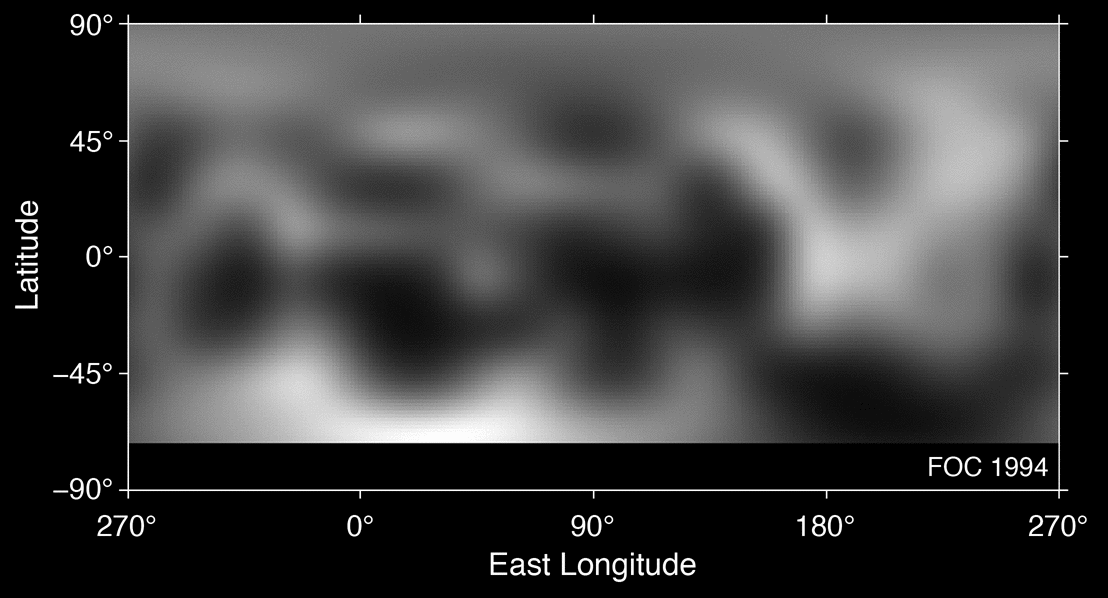
So the modern convention, and the one that is used on all published maps, has Pluto's north or positive pole pointing to the south invariable plane of the solar system. Defined this way, Pluto's north pole is the one that we can see from Earth, the one we'll get a really good view of as New Horizons approaches. The equinox happened in 1989; Pluto's north pole is experiencing summer right now, and it's getting more summery with time, with more and more of the south pole (the one we can't currently see from Earth) in winter darkness. I just checked, and articles I wrote about Pluto's seasons and changes on Pluto's surface both employ this convention. Hooray! Look at the map below: the north pole is sunlit, the south pole is dark.
But, watch out. While most scientists used this convention, not quite all of them do. More importantly, the JPL HORIZONS system -- a database of information upon which NASA spacecraft navigation is based -- always used the IAU convention, but they did not switch conventions when the IAU did upon Pluto's demotion. They have a very good reason to stay the course. All space missions, New Horizons included, use JPL navigational data for planning their encounters. Swapping poles and plugging in 360 minus longitude for longitude in the thousands of lines of code developed to plan the flyby -- and inevitably missing some -- sounds like a perfectly stupid way to aim the spacecraft at the wrong spot, capturing blank sky instead of Pluto; or even of navigating the spacecraft to its doom. It's a terrifying thought. If they change their data sets' metadata to comply with the modern IAU convention and all previous maps (which would be a nice thing to do, it seems), they will not do it until well after the encounter, when the data are all acquired and are safely on the ground.
Thus the New Horizons mission science observations are defined and sequenced using the old IAU convention, even though published maps use the new convention. As long as everybody is clear on what convention is in play, this isn't a serious problem. In both cases, longitude is measured positive to the east. Converting is straightforward: to turn a location from old convention to new convention, you flip the sign on the latitude, and compute 360° minus old longitude. It's a simple 180-degree rotation of an old-IAU-convention map to make it correlate to a new-IAU-convention map. No mirror-flipping is involved, and if you think about it, it wouldn't make sense for there to be any mirror-flipping required to match up maps; they're both mapping the same physical object with the same features in the same positions. Rotations make sense, translations make sense (shifting left or right), but mirror-flipping doesn't make sense.
Zangari's work was motivated by the discovery that one map she was trying to use for her own research was actually upside down with respect to what its authors said it was. The more she looked into papers on Pluto, the more confusion she discovered. As many as 10% of papers did not adequately define which coordinate system they were using, or if they did, they defined it ambiguously, or even incorrectly. Rather than defining, they often stated they were using the convention employed in some other paper. Then Zangari would check, and find that in fact, they weren't using the same one as in that other paper. There are differences even in the definition of the origin of longitude. In some cases, cartographic errors -- mirror-flipping rather than rotating data to compare one map to another, or misdefining south as north, or using the wrong convention for whether longitude increased east or west, or whatever -- resulted in them comparing their data to an incorrectly oriented or mirror-flipped version of somebody else's data set. Which, in some cases, actually invalidated the scientific conclusions drawn from the comparison. It is an enormous mess.
The lesson here is obvious: it's important to define your convention. I guess a second lesson is: do not trust people's statements about their conventions; poke at them to make sure they're correct. It would be super if the community could standardize on one convention, but Zangari knew better than to insist everyone do the same thing; this is a community of very independent people. Of course it's a community of people who hate to make dumb mistakes in public, too.
Zangari surveyed hundreds of papers and found that a clear majority preferred the current IAU convention, and that's the one she advocated. I think most of the room agreed, with one really, really important reservation, voiced by Alan Stern: New Horizons will not adopt the new convention until they have safely navigated past Pluto and collected all the data specified in their already-developed sequences, which are using the old convention. Then, when it comes time to release data sets and maps, they might update to the new convention. As long as everybody defines clearly which convention they are using -- which direction the positive pole points, and which direction longitude increases, and where zero longitude lies -- this should not cause problems. The Mars community has been coping with competing conventions for a decade.
Man, I sure hope I haven't made any mistakes in this article. Be kind to me if I have; this is complicated!
------
* Note: west longitude was not always the convention for planets. It used to be that "longitude increased with time." That means that for retrograde bodies like Venus and Uranus, longitude is positive to the east. All the Venus maps I could find still use this convention. I would look into this more but I've gone far enough down the rabbit hole on this story already!!
Protect Our Shared Future
You help us defend humanity and prevent asteroid impacts. Donate now to become a Planetary Defender!
Donate