
 Explore Worlds
 Find Life
 Defend Earth


Enceladus is so close I can touch it
Written by
Emily Lakdawalla
August 12, 2008
At least that's how it seems -- ridges, valleys, sunlit peaks and shadowed hollows, all covered with boulders, in amazingly sharp focus considering Cassini had to spin at top speed to compensate for just part of the amazing 18 kilometer-per-second relative speed of the spacecraft and the moon at the height of the flyby. Here are four of the amazing photos from the Skeet Shoot. (For more on the Skeet Shoot, read my preview story.) First, the closest, which is also the most enigmatic, because of the low sun angle:
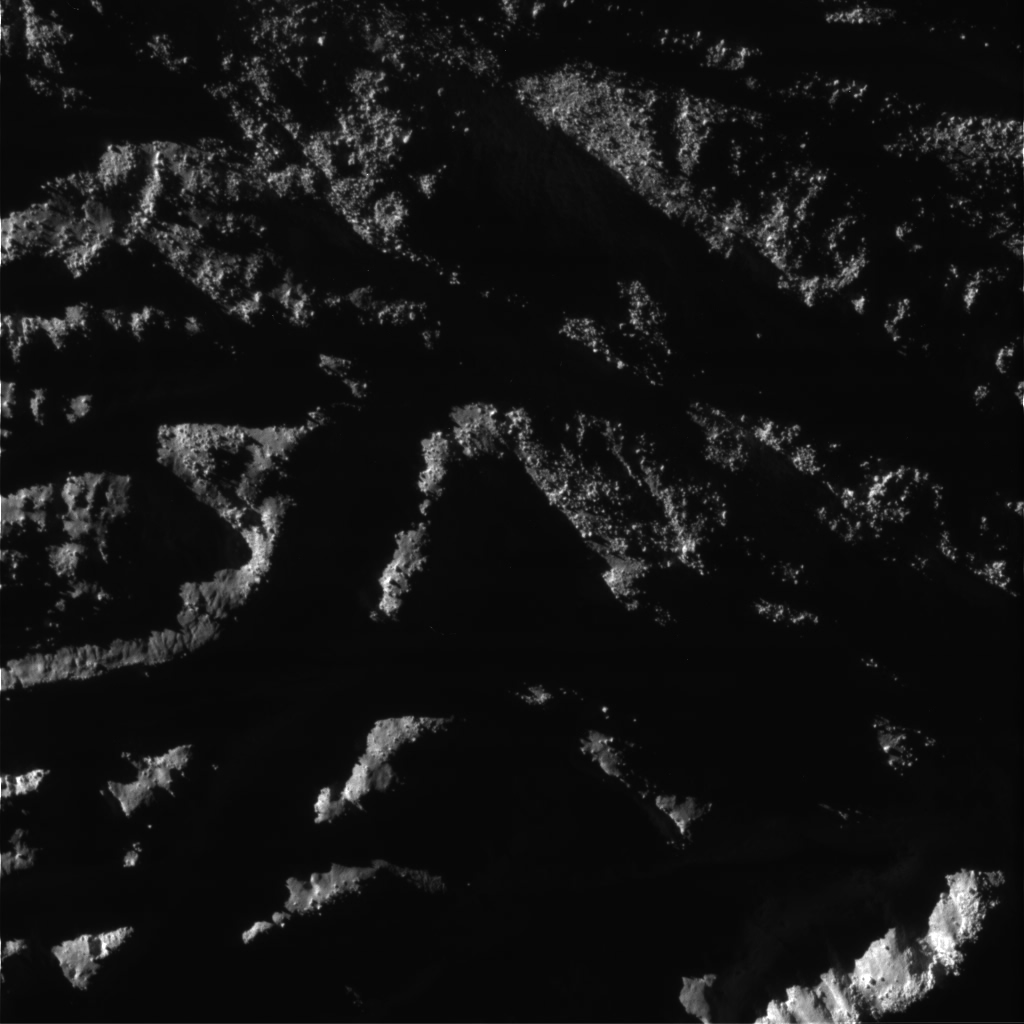
NASA / JPL / SSI
Enceladus 'Skeet Shoot' #1
As Cassini receded from its close flyby of Enceladus on August 11, 2008, it took a series of seven images with its narrow-angle camera while the spacecraft spun to partially compensate for the fast motion of Enceladus across the field of view. This is the first of those, taken from closest range (1,288 kilometers), with a resolution of about 10 meters per pixel. The image is taken close to the terminator (day-night boundary), so sunlight coming from the upper left glances across the folded terrain, hiding most of the valleys in shadow. There are large boulders everywhere. This version has been rotated 180 degrees to match the orientation of the flyby preview map.Next is a lovely overlapping pair, shots numbers 3 and 4. These overlap over one of the large "sulci" that cross Enceladus' south pole, Cairo sulcus.
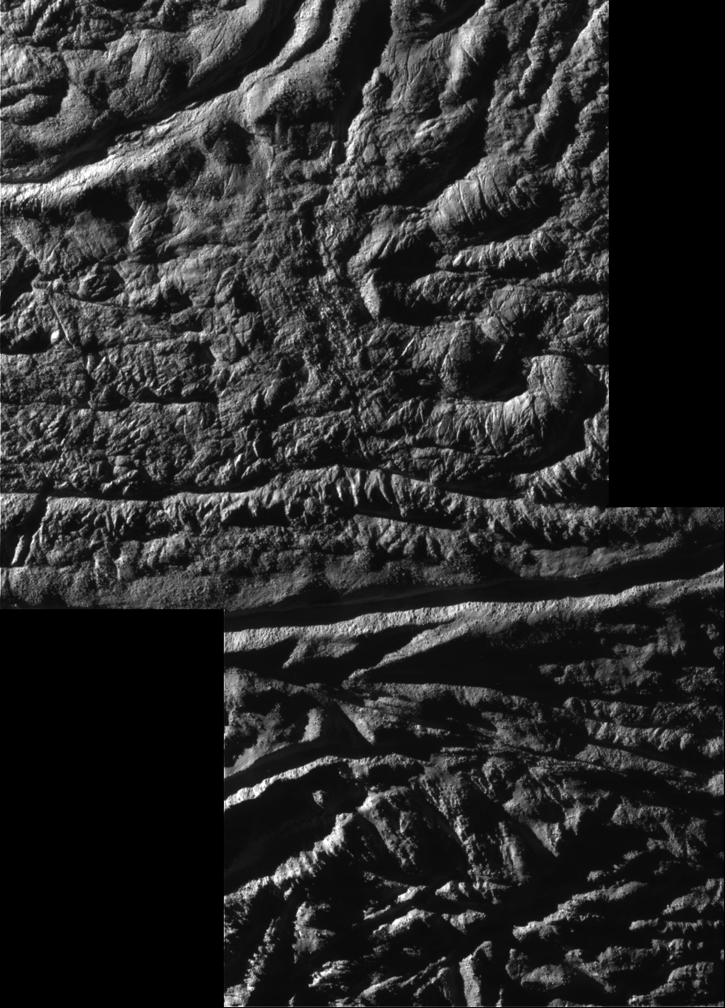
NASA / JPL / SSI / mosaic by Emily Lakdawalla
Enceladus 'Skeet Shoot' #3 and #4
As Cassini receded from its close flyby of Enceladus on August 11, 2008, it took a series of seven images with its narrow-angle camera while the spacecraft spun to partially compensate for the fast motion of Enceladus across the field of view. This is a mosaic of the third and fourth, taken from ranges of 1,567 and 2,621 kilometers. Near where the two images overlap they cross Cairo sulcus, one of four fissures that seam Enceladus' south pole. Near the top of the image, an unnamed sulcus cuts across one corner. This version has been rotated 180 degrees to match the orientation of the flyby preview map.COOOOOOOOL. There will be much more interpretation to come. In the meantime, I am trying to get a handle on the images that have been released so far, and where they fit on the Enceladus pre-flyby image planning maps; I'm posting my notes here for your enjoyment. Now I must tear myself away from Enceladus and go do mommy stuff for a couple of hours.
By the way, I will have a Ustream chat tomorrow at the usual time (1200 PDT / 1900 UTC) where I will show some of these pictures and talk about them and take questions.
Protect Our Shared Future
You help us defend humanity and prevent asteroid impacts. Donate now to become a Planetary Defender!
Donate