
 Explore Worlds
 Find Life
 Defend Earth


More images and data from Chandrayaan-1
Written by
Emily Lakdawalla
January 7, 2009
Chandrayaan-1 has been in orbit at the Moon since November 8, and is steadily returning data from its science instruments. The "Images from Chandrayaan-1" page at the Indian Space Research Organisation has been updated a few times over the last several weeks with new images from its Terrain Mapping Camera and HySI camera, while the headquarters of the Moon Mineralogy Mapper (M3) at Brown University has also posted its first data. The M3 team does a good job of explaining how the M3 instruments builds up "image cubes" as it flies around the Moon -- check it out!
Most of the image releases at ISRO are from the Terrain Mapping Camera, which actually consists of three individual cameras. The three cameras are pointed in different directions: one is pointed directly down, below the spacecraft ("nadir"); one is pointed down and forward along the spacecraft's orbital path ("fore"); and one is pointed down and backward ("aft"). All three cameras capture images of the same places on the Moon, but their different perspectives cause features appear to shift due to parallax. That's nicely illustrated with this example of a small crater from the far side of the Moon, as imaged by the fore, nadir, and aft cameras.
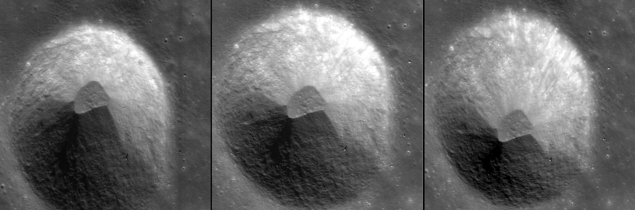
ISRO
Three Chandrayaan-1 Terrain Mapping Camera images of a crater
Representing 3-D images on a flat computer screen is always problematic. ISRO has released two types of images that attempt to show you what the Terrain Mapping Camera can do. One way is to make an "anaglyph," a single flat image that encodes 3-D information some how. Most anaglyphs on computer screens are red-blue anaglyphs, for which you need a pair of red-blue 3D glasses. If you have such a pair of glasses, you'll be able to see lovely topographic detail in the image below, of craters and volcanic channels.

ISRO
Red-blue Terrain Mapping Camera anaglyph of lunar terrain
Wear a pair of red-blue 3-D glasses to see the topography of this cratered and channeled lunar surface.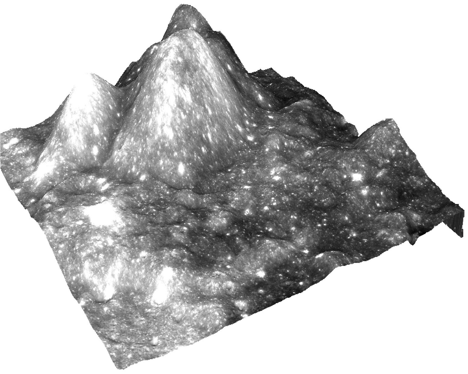
ISRO
Chandrayaan-1 Moon image draped over digital elevation model
Protect Our Shared Future
You help us defend humanity and prevent asteroid impacts. Donate now to become a Planetary Defender!
Donate