Jason Davis • Apr 25, 2018
Pew pew! Lasers will help determine where LightSail 2 is
The main goal of The Planetary Society's LightSail 2 mission is to raise the apogee, or high point, of the spacecraft's orbit around the Earth by solar sailing. When the spacecraft is moving toward the Sun, it turns its sail edge-on to slice through the solar photon stream. When the spacecraft is moving away from the Sun, it turns its sail flat against the photons to get a gentle push. Here's a reminder of what that looks like:
To solar sail effectively, LightSail 2 needs to know exactly where it is as it zips around the Earth. That same information will help the mission team measure what kind of effect solar sailing is having. The more accurately we know where the spacecraft is, the better.
How do we do that? How do we know where any given satellite is, for that matter? I'm glad you asked!
Knowing is half the battle
Space object tracking has traditionally been the domain of governments. In the U.S., an Air Force group called the Joint Space Operations Center, or JSpOC, tracks more than 21,000 objects. The closer to Earth an object is, the smaller it can be and still be detected; JSpOC can see things as small as 5 centimeters in low-Earth orbit and as small as 1 meter out in geosynchronous orbit.
JSpOC does this using radar, optical tracking, and space-based optical and infrared sensors. Just about every day, it issues updated information for each object in the form of TLEs, or Two-Line Element sets. A TLE is two strings of numbers that mathematically represent where an object is and where it's going. You can publicly access TLEs for unclassified objects using a database called Space-Track.
TLEs vary in accuracy. While we can see smaller stuff in low-Earth orbit, it's harder to pinpoint object locations there because of increased atmospheric drag. Solar flares increase the uncertainty further because they heat up and expand the atmosphere. Each object's shape and orientation also affects how much of an impact drag has.
Planet Labs, which operates a fleet of Earth-imaging spacecraft, studied the accuracy of various orbital tracking techniques in 2015. They compared JSpOC TLEs with GPS, which is more accurate. In one instance, they showed that a Planet satellite was up to three-and-a-half kilometers away from its GPS-derived location during the course of a single day after a TLE was issued.
Considering the fact that objects in low-Earth orbit are traveling at roughly 8 kilometers per second, that's still pretty incredible! But there are many instances in which we need more accuracy: avoiding collisions (especially when it comes to something with people aboard, like the ISS) and scientific instruments (NASA's Jason-3 satellite can measure sea level variations within a couple centimeters) are just two examples.
This begs the question: why doesn't every satellite just use GPS? Many do! Space-grade GPS systems are different than the ones used in smartphones. They're rated to handle the rigors of launch, extreme temperature swings, and radiation.
That makes them expensive. I did a few searches for off-the-shelf CubeSat GPS systems, and concluded that you're probably looking at a $10,000 investment for the hardware. Plus you have to work it into your spacecraft design (on a CubeSat, space is precious!), allocate it some of your power budget, add it to your system software, and then test it. That's not trivial! In space, nothing is trivial, really. The basic design of LightSail was completed nine years ago; GPS technology was even less CubeSat-friendly than it is now.
So what's a spacecraft operator to do if you need something more accurate than JSpOC, but you don't have a GPS? Lasers!
Pew-pew!
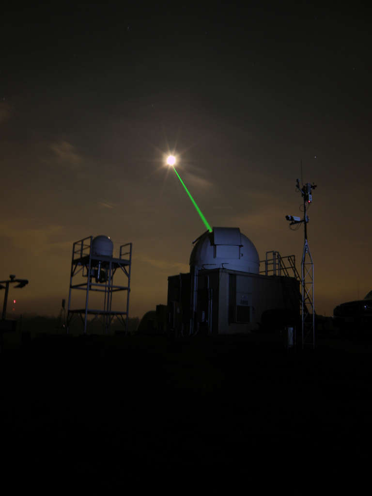
One way to measure the distance between Earth and a space object is called laser ranging. Basically, you put tiny mirrors on your spacecraft and shoot it with a ground-based laser. Since the speed of light is constant (with minor variations between the speed in the atmosphere versus a vacuum), you can measure the round-trip time the laser takes to bounce back to the ground and calculate the distance. We actually still use this technique to measure the distance to the Moon, thanks to retroreflectors left on the surface by the Apollo astronauts!
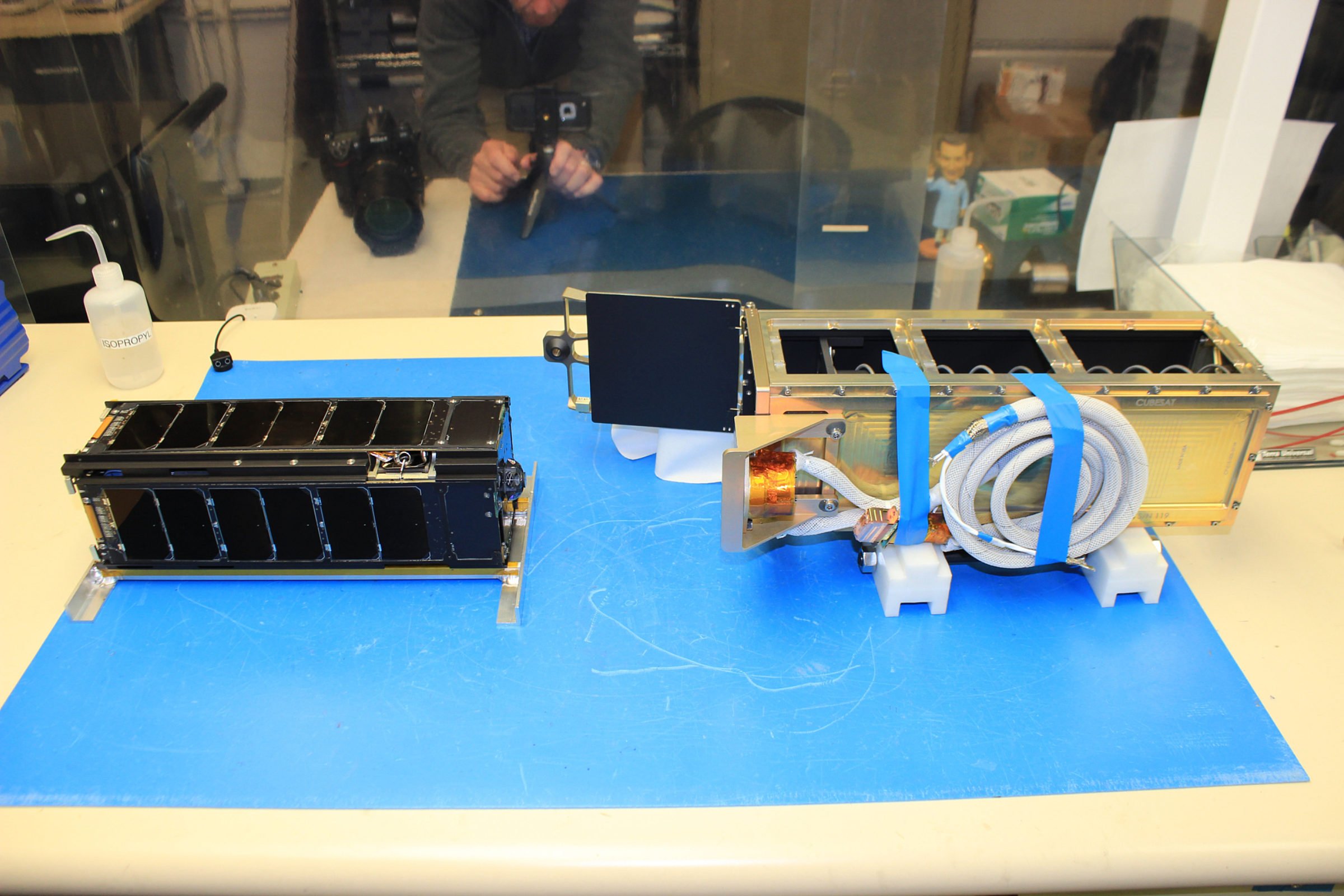
LightSail 2 has a cluster of six retroreflectors on the bottom for laser ranging, and a few more scattered throughout the spacecraft. The bottom cluster actually sticks out from the spacecraft, and nestle inside the big P-POD spring that pushes the CubeSat into space. Here's a closeup shot of the retroreflectors from a previous article, where they are still covered with protective film:
And here's a shot from P-POD integration, where the film has been removed:

So who's going to lase LightSail 2? A group called the International Laser Ranging Service, or ILRS. The ILRS consists of about 40 laser ranging observatories around the world. There's no single overseer or funding body; many government entities contribute to the network for the good of everyone involved. NASA, for instance, helps operate eight observatories and manages a laser ranging data center at Goddard.

Spacecraft operators can apply to have the ILRS range their spacecraft, which is what our mission team did for LightSail 2. An ILRS committee reviews those applications and sets priorities for targets (they said yes to LightSail 2!). Objects in low-Earth orbit generally get higher priority because they move faster and are only visible to certain observatories at certain times; It's easier for the ILRS to find an opportunity to range something in geosynchronous orbit. Additionally, the number of stations that can see a satellite vary depending on each satellite's inclination.
I spoke with NASA Goddard's Carey Noll to learn more. She told me the lasers don't work in clouds or rain; some observatories can range during the day while others can only do it at night. All observatories are equipped with a system to deactivate the lasers when planes are overhead, so they don't accidentally lase pilots (some do this with radar, others get data from a clearinghouse like the FAA).
"These are typically not eye-safe lasers," Noll said. I also asked her if the lasers are powerful enough to give LightSail 2 a push, sort of like the proposed laser-propelled Breakthrough Starshot sails. No such luck.
Noll said it's important to note that laser ranging doesn't supplant the orbital information JSpOC provides; it complements it. Without orbital parameters from an entity like JSpOC, the ILRS wouldn't know where to aim their lasers in the first place! Another interesting complementary use for the technology is GPS satellites; for GPS to be accurate, we have to know precisely where the satellites themselves are, and laser ranging provides a cross-check for that information.
Dave Spencer, the LightSail 2 project manager, said he's hoping the ILRS will be able to laser range the spacecraft both before and after the solar sail is deployed. Before sail deployment, the CubeSat will be tiny. And after deployment, the orbit will be changing rapidly due to the thrust from solar sailing, as well as atmospheric drag acting on the large sail area.
Laser ranging LightSail 2 is definitely doable, but Noll said it won't be easy. "This will be a difficult mission," she said.
Let’s Go Beyond The Horizon
Every success in space exploration is the result of the community of space enthusiasts, like you, who believe it is important. You can help usher in the next great era of space exploration with your gift today.
Donate Today

 Explore Worlds
 Find Life
 Defend Earth


